Last updated: December 13, 2023
Located on the western side of the Sydney CBD, Barangaroo Reserve is a modern Sydney Harbour foreshore park, characterised by open landscaping, large grassy areas, and several walking paths.
The new reserve was constructed as part of the Barangaroo transformation project, which has changed an old industrial site into a thriving business, entertainment, and leisure precinct.
In this article, we’ll share everything you need to know about this beautiful new park in Sydney Harbour, including the Barangaroo Foreshore walk.
Quick navigation:
| Barangaroo Foreshore Walk | |
|---|---|
| Distance: | 1.5 km |
| Duration: | 1 hour |
| Grade: | Easy |
How to Get There
Getting to Barangaroo Reserve is easy. You can catch a train, bus, or ferry, or you can go by car and park underneath the reserve.
1. Train:
The two closest train stations are Circular Quay and Wynyard, both around 1km away from the reserve.
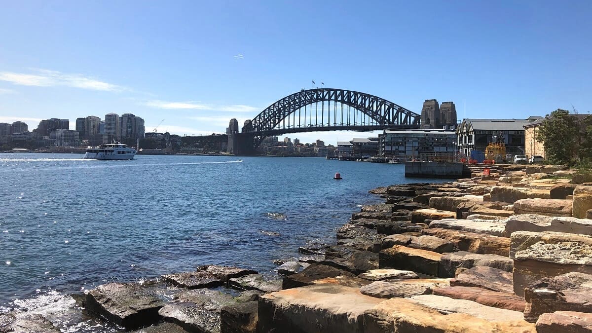
From Circular Quay Station, you can follow the shoreline under the Harbour Bridge and past Walsh Bay to the reserve. Or otherwise, you can walk through The Rocks and Millers Point.
From Wynyard Station, walk through the new underground pedestrian link to the Barangaroo foreshore, and walk to the reserve from there. Read further below for a description of this new walking path.
2. Bus:
There are various bus routes to and from Town Hall, Wynyard and Circular Quay in the city, from where you can walk to Barangaroo.
Bus routes 311, 324 and 325 have a direct connection to Barangaroo Reserve from Town Hall, Walsh Bay and Millers Point.
3. Ferry:
Travelling by ferry is an excellent option, too, with a couple of ferry wharves close by, such as King St Wharf and Barangaroo Wharf.
Check the Transport NSW website to help plan your day with public transport.
4. Car:
Barangaroo Reserve has an underground car park that is open seven days per week from 6 AM until midnight.
However, with so many public transport options available, travelling by car is not recommended.
About Barangaroo Reserve
In the last few years, Barangaroo has become one of the most exciting precincts in the Sydney CBD, and the reserve forms an integral part of it.
Let’s first dive into the history of Barangaroo.
Traditional Custodians
The Gadigal people are the traditional custodians of the land where present-day Barangaroo is. The area was an important hunting and fishing region for the local Aboriginal people.
Port
In the first half of the 19th century, Sydney developed into a major port, with many wharves built along the city shore where Barangaroo is located today.
At the beginning of the 20th century, the NSW Government took control of the area, rebuilding the wharves as trade intensified.
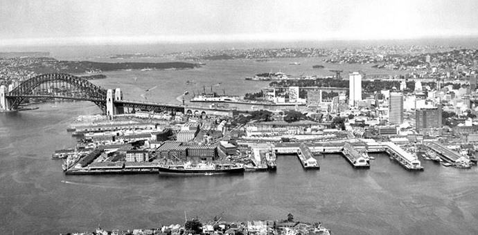
In the second half of the 20th century, Sydney became increasingly less suitable as a modern and sustainable port facility. Ships were getting larger, and Sydney’s freight rail infrastructure could not cope with the increased demand.
With the construction of Port Botany as the new major port in Sydney, the Barangaroo and Darling Harbour precincts became redundant as industrial shipping sites.
Redevelopment
In 2003, the NSW government decided to redevelop Barangaroo and organised an international design competition to generate ideas and concepts.
One of the government’s demands was that Barangaroo had to incorporate the 12 km public foreshore walkway from Woolloomooloo to Anzac Bridge. This walkway officially opened in 2021 as a beautiful continuous walking track.
In 2007, the area was officially named Barangaroo, after a Cammeraygal woman who was an important figure in the Sydney Aboriginal community at the time of early white settlement.
Barangaroo is still expanding, but the Reserve at the northern end of the Barangaroo area has been open to the public since August 2015.
The opening was quite an important event because the area had been closed to the public for more than 100 years.
Today
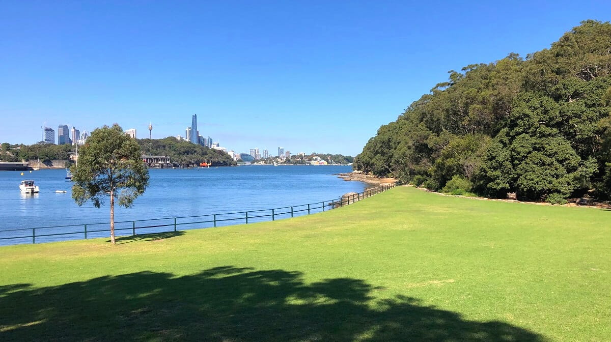
Today, Barangaroo Reserve is widely considered to be a fantastic green addition to the city of Sydney. It is a popular destination for locals as well as for tourists.
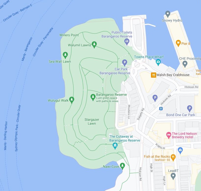
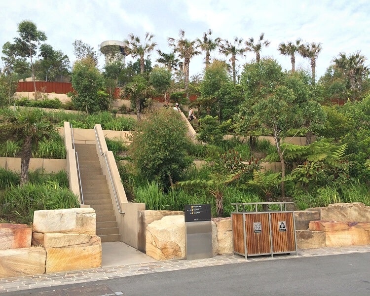
After years of design and development, Barangaroo Reserve is now a 6-hectare waterfront park with a large man-made hill right in the middle.
It is home to over 75,000 planted trees, palms, ferns, shrubs and other plants. Interestingly, all the different species are native to the Sydney region.
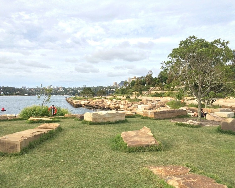
The first impression of the park is quite overwhelming, with so many beautifully designed terraced gardens and various walking paths.
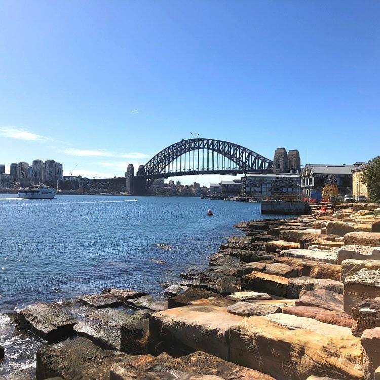
And the abundant use of sandstone fits perfectly in the park’s overall design and architecture.
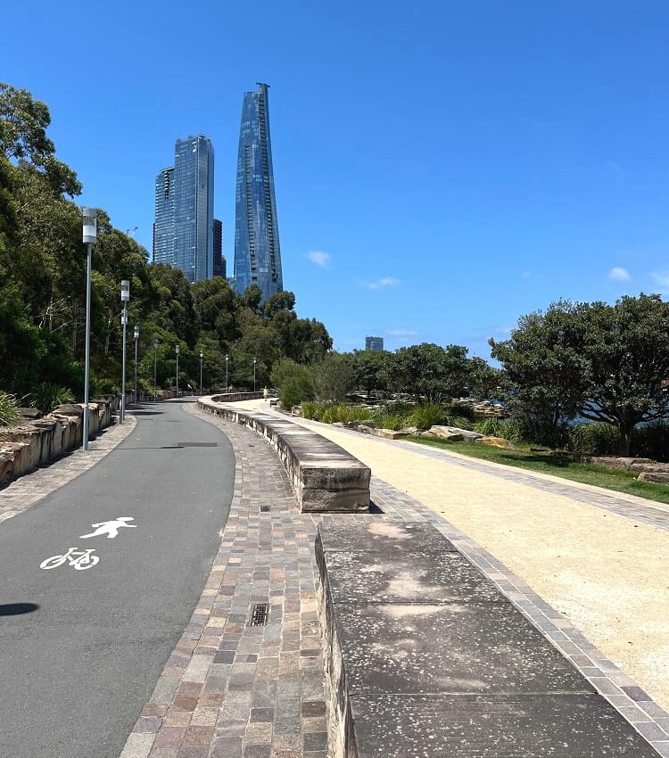
The reserve consists of several walking paths spread over multiple levels. As such, there is no set start and end point, so you can just wander around and enjoy the beautiful surroundings and Harbour views.
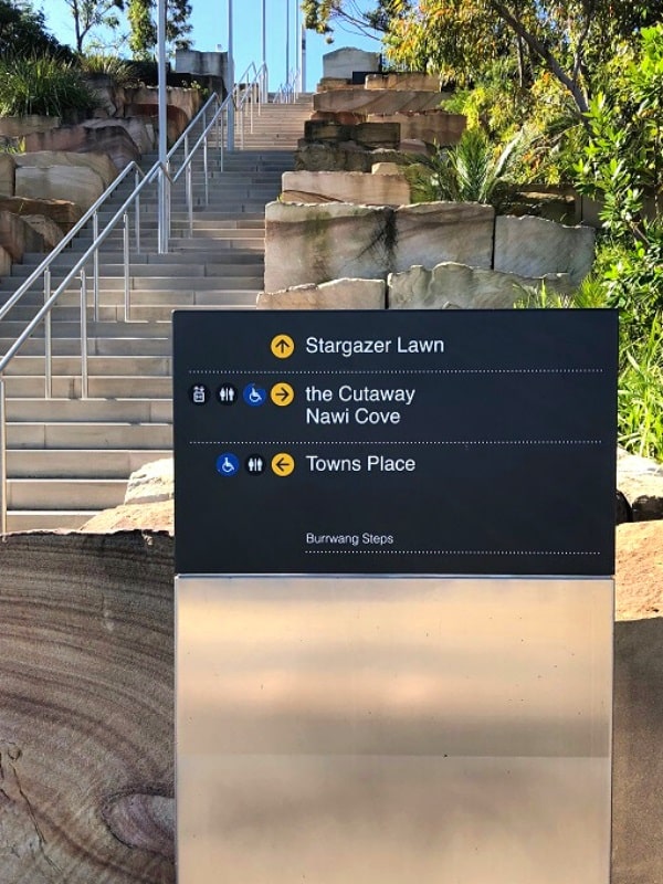
To move between the different levels, you can either use the lift at The Cutaway (see below) or otherwise use the many different sets of stairs at various locations.
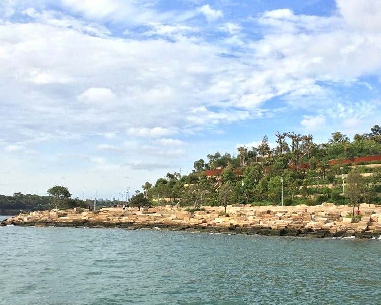
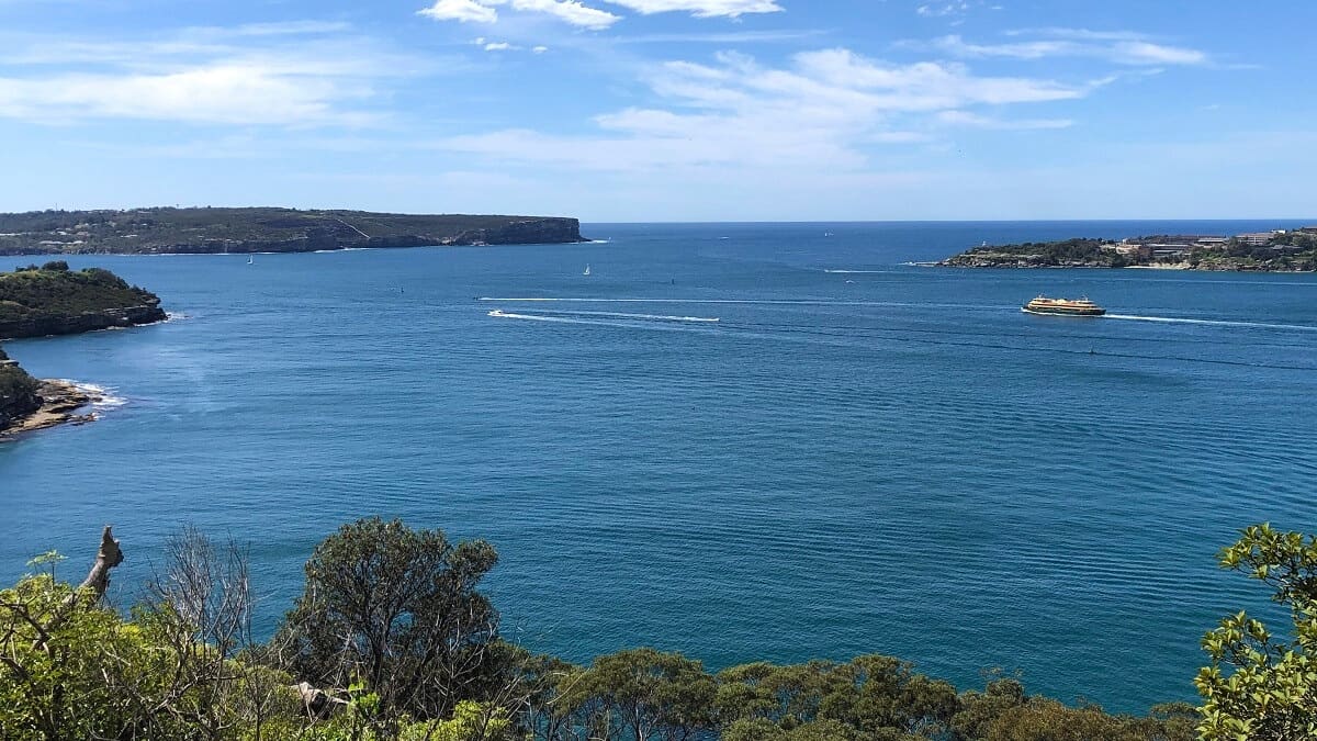
The views from Barangaroo Reserve are fantastic, with Goat Island, the Harbour Bridge, Balls Head Reserve, Pyrmont, and various other landmarks and destinations visible.
What’s great is that Barangaroo Reserve has introduced 18 official new place and road names, with 40% of these names referencing Aboriginal culture or people.
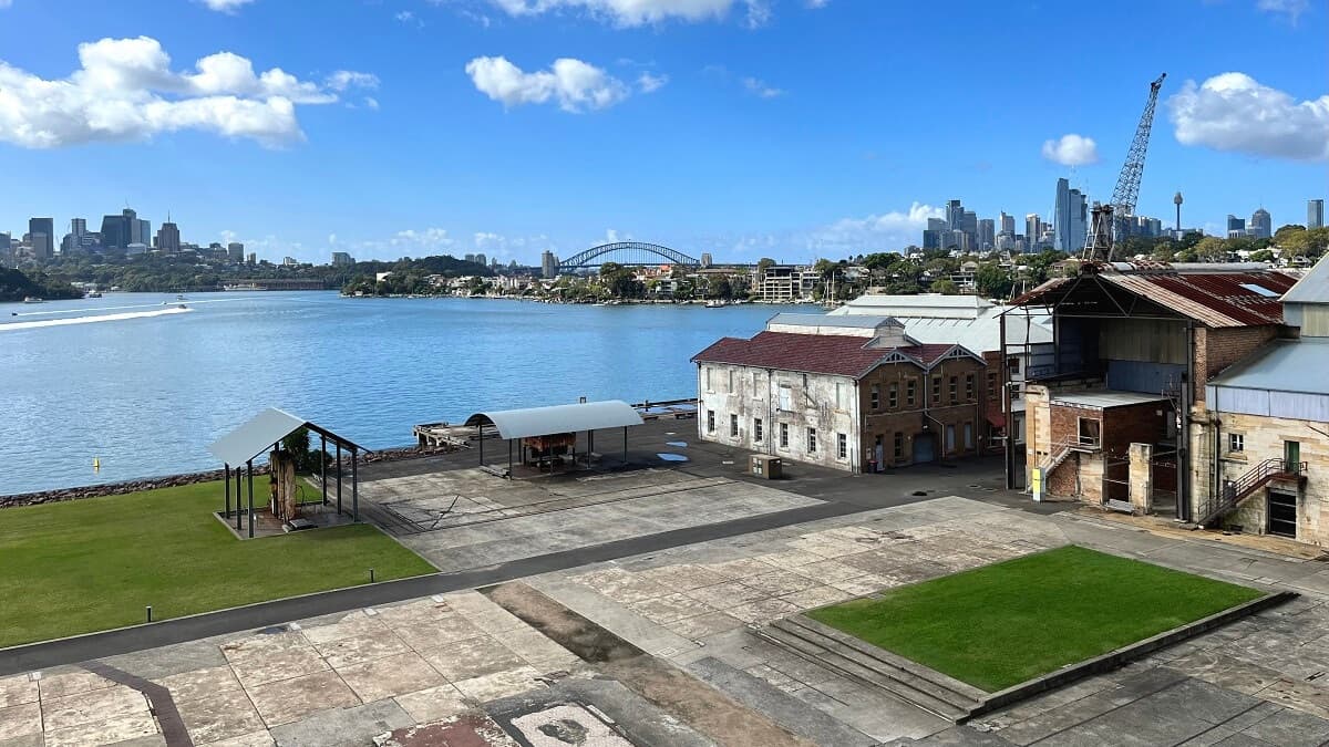
The Cutaway
Beneath the hill that forms Barangaroo Reserve is an interesting venue named “The Cutaway”.
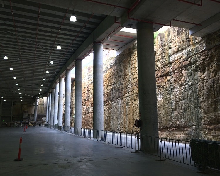
This engineering masterpiece has a roof constructed like a bridge and a massive sandstone wall that opens up to the sky.
The Cutaway is a unique cultural venue hosting all sorts of events throughout the year, such as art exhibitions and food events.
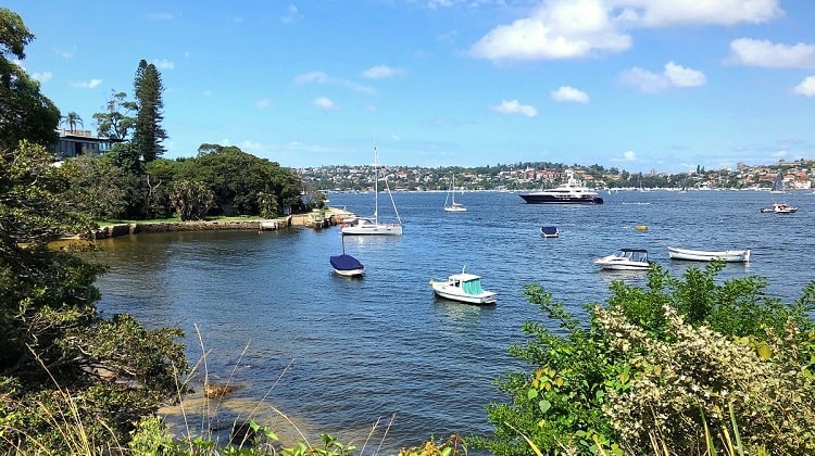
Marrinawi Cove
When visiting Barangaroo Reserve, be sure to visit Marrinawi Cove, which is located at the northern end of the reserve.
Marrinawi Cove is a sheltered, 700-square metre bay and swimming enclosure. This swimming pool opened in 2023 and has proven to be a big success with locals and visitors.
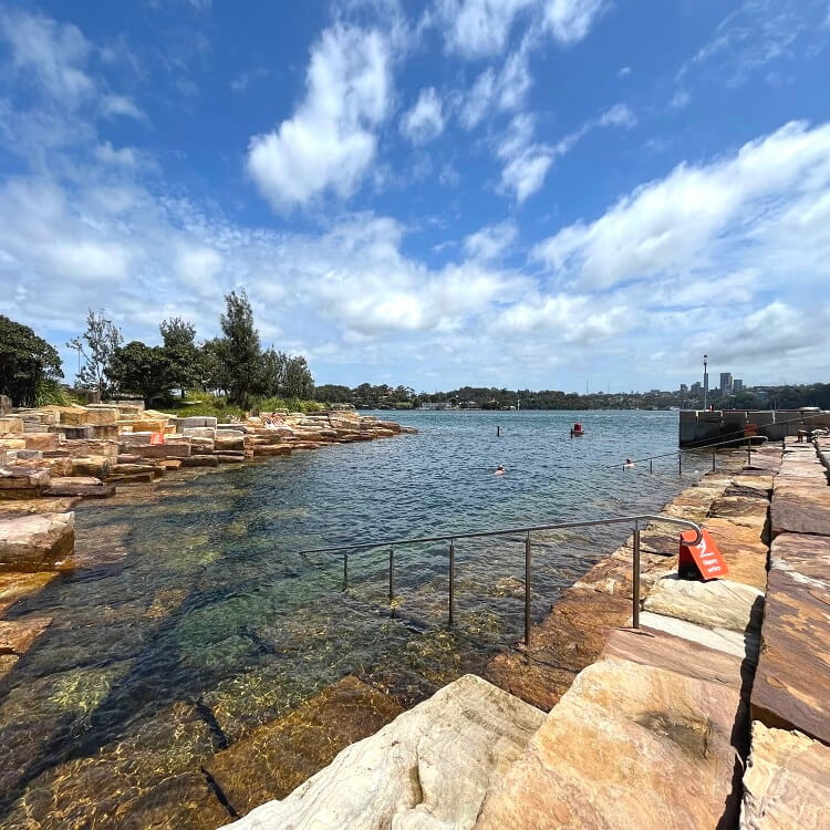
The new swimming enclosure has safety netting to enclose the swimming area, railing, signage, and a shower block.
What’s great is that the pool is surrounded by sandstone blocks where visitors can settle in and relax when not swimming.
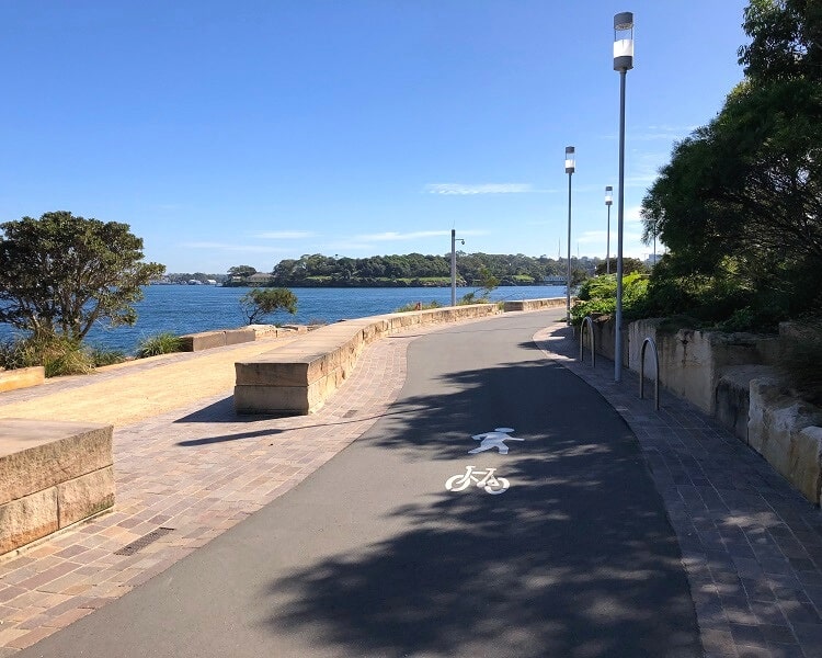
Barangaroo Foreshore Walk
The Barangaroo Foreshore Walk, otherwise simply referred to as the Barangaroo Walk, is a 1.5 km shared walking and cycling path between King Street Wharf and the northeastern tip of Barangaroo Reserve.
Also named the Wulugul Walk, this continuous path follows the reclaimed shoreline from 1836. Wulugul is the local indigenous word for kingfish, a popular catch in this area back in the day.
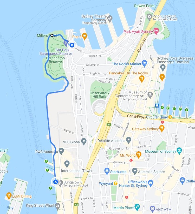
The walk was completed in 2021, when the last remaining section, between the new casino and the southern end of Barangaroo Reserve, was opened.
One thing you will notice when you do this walk the first time is the wide paths, which makes for very comfortable and safe walking.
The best way to get to the starting point of the Barangaroo Walk is by walking from Wynyard Station to Barangaroo via the underground pedestrian link.
With the completion of the Barangaroo Foreshore Walk, it is now also possible to walk from the Anzac Bridge to Woolloomooloo along the shoreline.
This 12 km long adventure is one of Sydney’s best Harbour walks, and is an excellent way to see the best of the Harbour as well as the city.
Places to Visit Nearby
With Barangaroo, Cockle Bay, Darling Harbour, The Rocks and Circular Quay just around the corner, a visit to Barangaroo Reserve can easily be turned into a full day out.
What’s great is that all these destinations are within walking distance and easily accessible via the Harbour foreshore walking path.
- Walsh Bay:
Walsh Bay is a scenic bay just west of the Sydney Harbour Bridge, home to various theatres, restaurants, and bars. It’s also a nice area to wander around. - The Rocks:
The Rocks is one of the oldest neighbourhoods in Sydney and used to be a notorious convict settlement. It is now a top tourist attraction with lots of pubs, cobbled lane-ways, and historic buildings to take in. - Barangaroo South:
Just a short stroll from the reserve is Barangaroo South, Sydney’s newest business, entertainment and leisure precinct, home to a great variety of restaurants, cafes and clubs. - Darling Harbour:
Further south is Darling Harbour, Sydney’s largest recreational and pedestrian precinct, with many waterfront dining options, exciting museums, and large playgrounds.
We certainly appreciate the Barangaroo Park and the maintenance thereof, a wonderful facility!
However, we find the bicycles on the board-walk as part of the Wulugul Walk are quite dangerous as it is narrow. My wife was hit when a bicycle came up fast behind her and I have had a number of close calls.
Please consider banning bicycles on the board-walk at Wulugul Walk and insist they use the bitumen walkway as marked for bicycles and pedestrians.
Many thanks.
Hello Trevor, sorry to hear about your experiences with bicycles on the Wulugul Walk.
You’re making a fair point, and it’s best to write to City of Sydney council so that they can take this matter into consideration.