Last updated: February 29, 2024
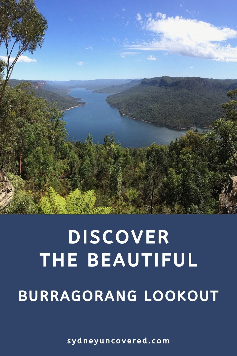
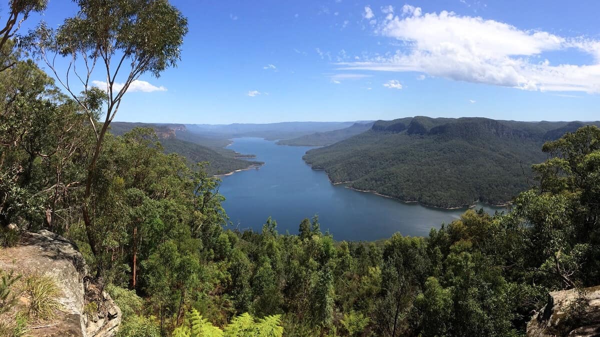
The Burragorang Lookout is a scenic viewing platform overlooking Lake Burragorang, with picnic facilities nearby to make a day of it.
The lookout is the highlight of the Burragorang State Conservation Area, with panoramic views towards the lake and the Blue Mountains to take in.
In this article, we’ll explain everything you need to know about this fantastic lookout, how to get there, and what to do nearby.
How to Get There
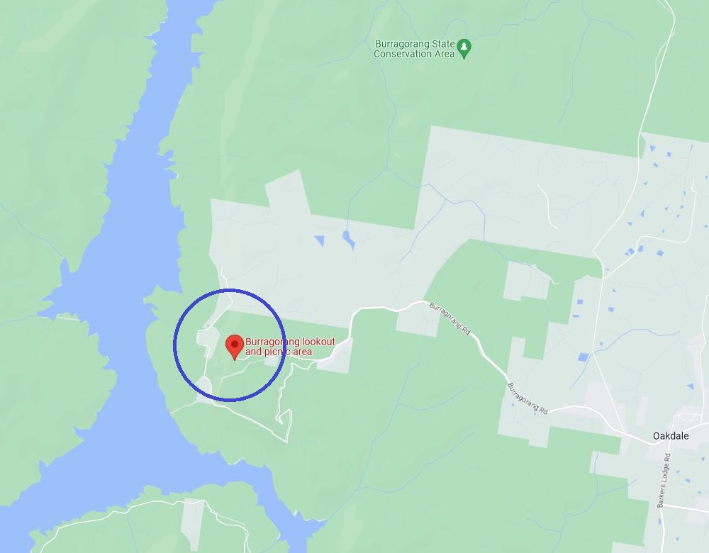
The Burragorang Lookout and Picnic Area is located in the small village of Nattai in the Wollondilly Shire. It forms part of the Burragorang State Conservation Area.
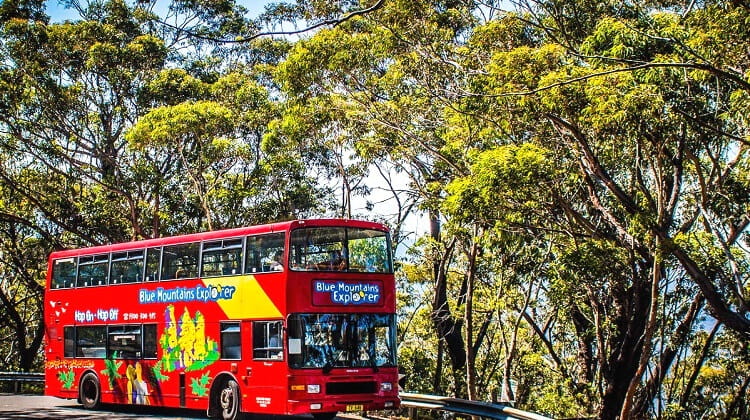
The lookout can be found at the end of Burragorang Road, which can be accessed from the Old Hume Highway in Camden. From Camden, it’s an easy 28 km drive.
If you’re visiting the Burragorang Lookout from Warragamba Dam, it’s a 40 km drive via Silverdale Road and Burragorang Road.
Please note that parking at the lookout will cost $4 per vehicle per day, to be paid at one of the pay machines.
Official address:
Burragorang Road, Nattai NSW 2570 (see map location).
Burragorang Lookout
Once you’ve arrived at the end of Burragorang Rd, park your car in one of the spots in the reasonably sized parking area, and start exploring.
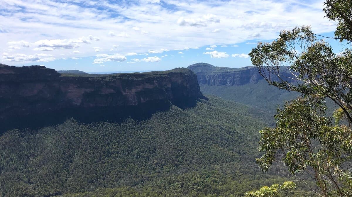
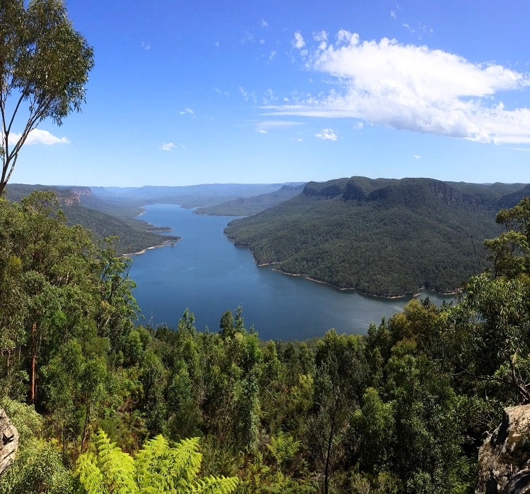
The Burragorang Lookout is right next to the car park and is wheel-friendly. It has a large, fenced platform, with various information boards explaining more about Lake Burragorang and the surrounding area.
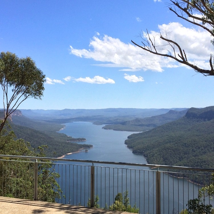
The Burragorang Lookout is widely considered one of the most impressive lookout points in the greater Blue Mountains region.
The views of the lake and the surrounding mountains are stunning, especially on a sunny day with a clear sky or just a few clouds.
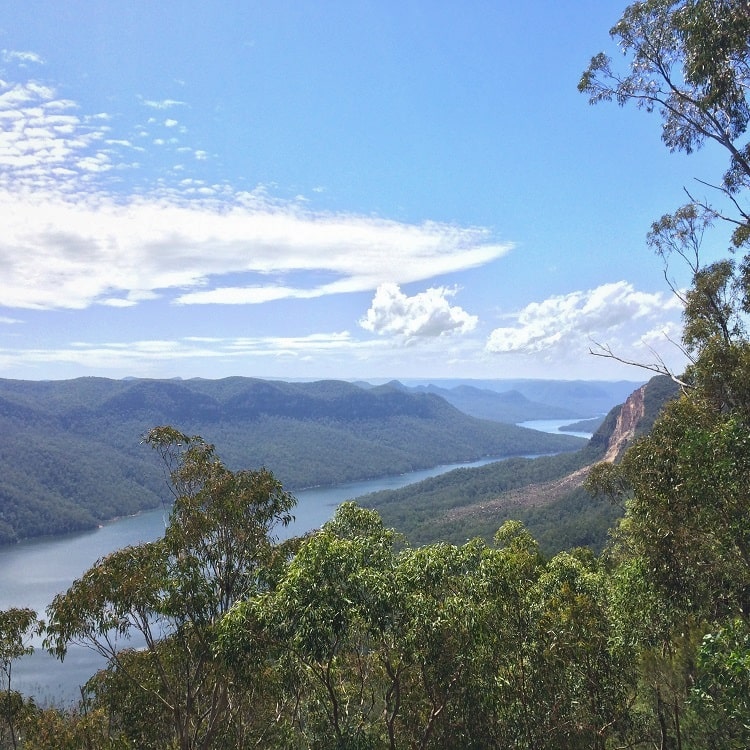
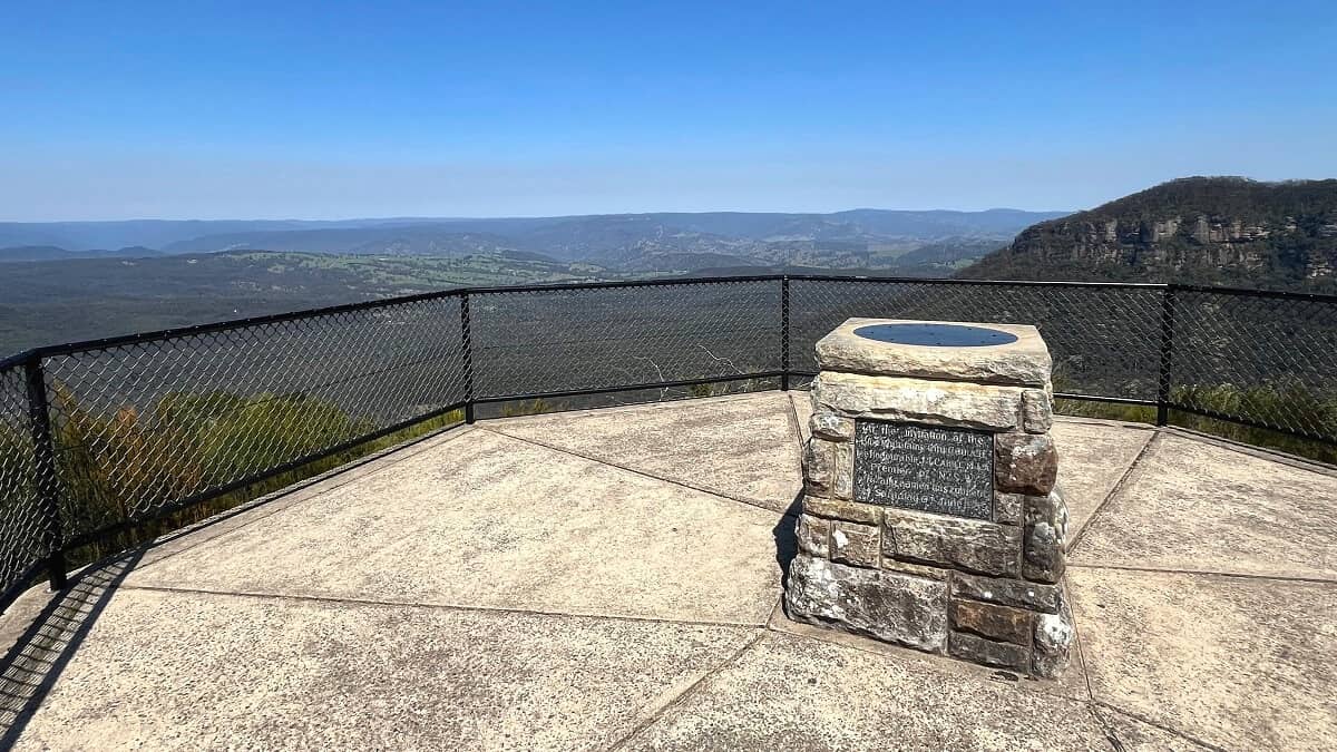
Don’t forget to visit the smaller lookout to the north, which also offers splendid views but from a different angle.
A short, wheel-friendly walking path from the main lookout platform leads to that older lookout, where you’ll also see a monument.
Lake Burragorang
The enormous Lake Burragorang was created as a result of the damming of the Warragamba River. The Warragamba Dam is one of the world’s largest domestic water supply dams and Sydney’s biggest water catchment area.
Construction of this engineering masterpiece started in 1948 and was completed in 1960. Lake Burragorang offers a reservoir capacity of more than 2,000 gigalitres of water, with the surface area of the lake covering 75 square kilometres.
A visit to Burragorang Lookout should ideally be combined with a visit to Warragamba Dam to better understand the importance of the dam and the lake to the people of New South Wales.
Looking at the incredible size of Lake Burragorang from the lookout, it’s interesting to think about what this area would have looked like if it wasn’t for the strong population growth in Greater Sydney.
One can only imagine that this huge water catchment area would have otherwise consisted of large forests, creeks, wildlife, and small townships.
Read more about Warragamba Dam in our guide.
Picnic Area
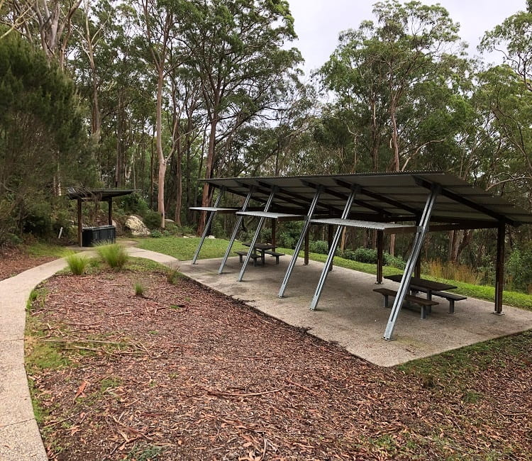
Besides two viewing platforms, the Burragorang Lookout also offers picnic and toilet facilities.
The spacious picnic area is conveniently located next to the car park and consists of a few covered tables and an electric BBQ.
The Burragorang picnic area is also available for non-exclusive hire for weddings or informal events, to be booked through NSW National Parks.
Burragorang State Conservation Area
The Burragorang Lookout and picnic ground are located within the Burragorang State Conservation Area, a nature preserve that covers more than 17,500ha of land and water.
The traditional owners of the land are the Gundungurra and the Dharawal people, and in the 19th century, European settlers used this land for coal-mining purposes.
For many decades, the area was thriving, but the completion of the damming of the Warragamba River in 1960 resulted in these old mining townships vanishing forever.
Read more about the Burragorang State Conservation Area on the NSW National Parks and Wildlife website.
The Rock Lookout in Mulgoa.