Last updated: November 29, 2022
The Jibbon Beach Loop Track is an easy walking trail starting from the Bundeena ferry wharf to Jibbon Head, Port Hacking Point and Shelley Beach.
Enjoy panoramic ocean views and discover well-preserved Aboriginal engravings as you explore this beautiful area in the Royal National Park.
Quick navigation:
| Jibbon Beach Loop Track | |
|---|---|
| Distance: | 5km (circuit) |
| Duration: | 2 hours |
| Grade: | Easy |
| Dogs: | Not allowed |
How to Get There
In the Royal National Park, follow Bundeena Drive all the way to Bundeena, where (limited) street parking is available.
Parking your car anywhere in the centre of town will be close enough to the start of the walk at the western end of Jibbon Beach (see map location).
Parking in the Royal National Park is $12 for the whole day, although parking in Bundeena means you don’t need to pay that entrance fee as it falls outside the national park boundaries.
Alternatively, you can catch a train to Cronulla and then hop on a ferry to Bundeena. Check the ferry timetable for more details and prices.
Note that this is a private ferry service, which means you can’t use the Opal card. Travelling by ferry is fun though, and really adds to the experience.
About Jibbon Beach
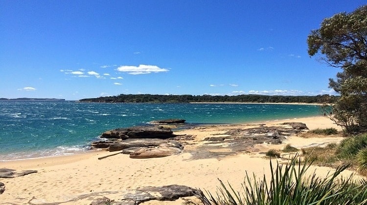
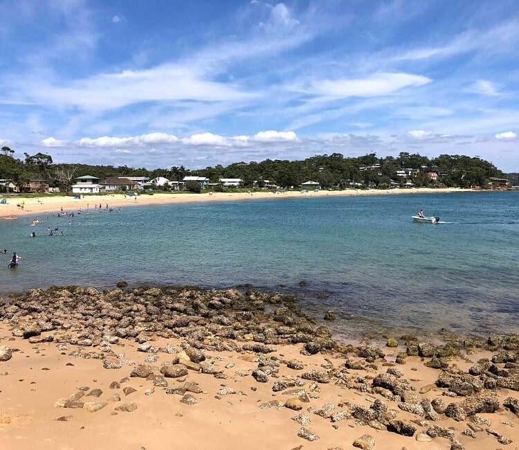
Jibbon Beach is a beautiful 700 metres long, north-facing strip of sand located east of Bundeena village and facing the waters of Port Hacking.
Swimming is great at Jibbon Beach but be mindful that there are no surf life saving services offered there and that it can get quite windy at times.
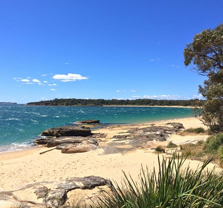
The water is also quite deep a few meters out, which is why you will see a lot of boats anchored there on warm and sunny days. Surfing is virtually impossible at Jibbon Beach.
The name Jibbon is derived from the Aboriginal (Tharawal or Dharawal) word “djeebahn”, which roughly translates to “sandbar at low tide”.
The Tharawal people were the original inhabitants of the southern and south-western Sydney area, from Botany Bay and Port Hacking to the Shoalhaven River in the Nowra area, extending west to Campbelltown and Camden.
Jibbon Loop Track Notes
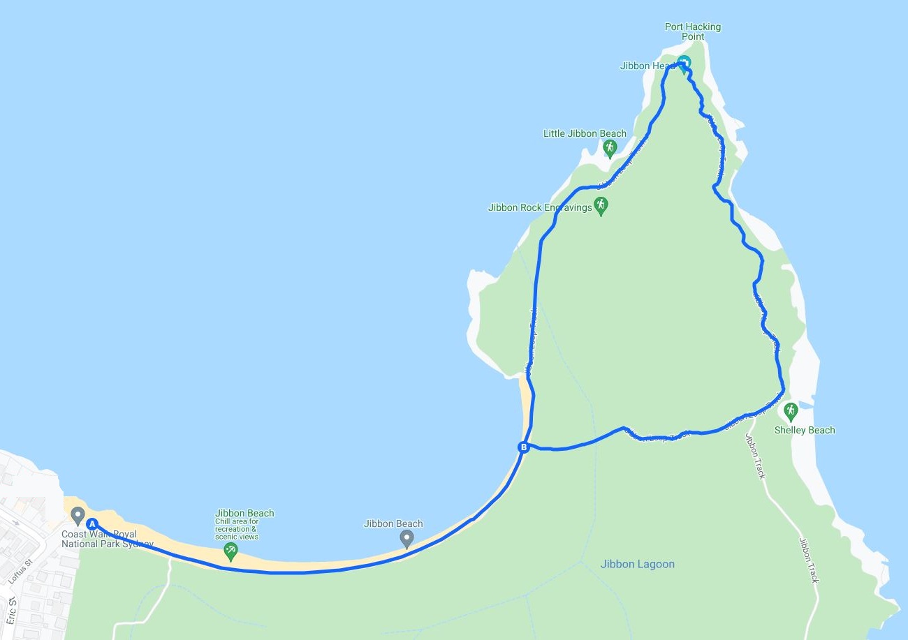
The Jibbon Loop Track officially starts at the western end of Jibbon Beach.
The easiest way to get there is via Loftus Street from the Bundeena ferry wharf. This is a short walk through suburban Bundeena.
Aboriginal Engravings
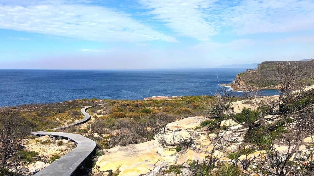
Keep following the shoreline of the beach until you get to Jibbon Head, where you can do a side track to visit an Aboriginal engravings site.
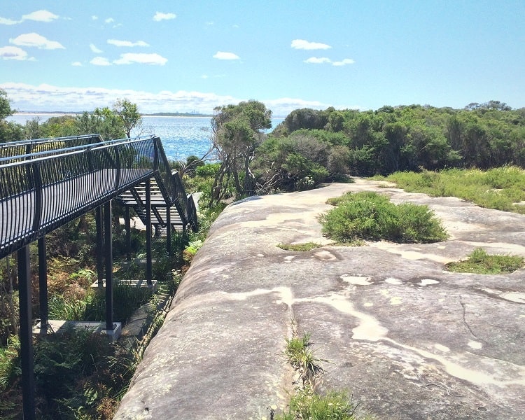
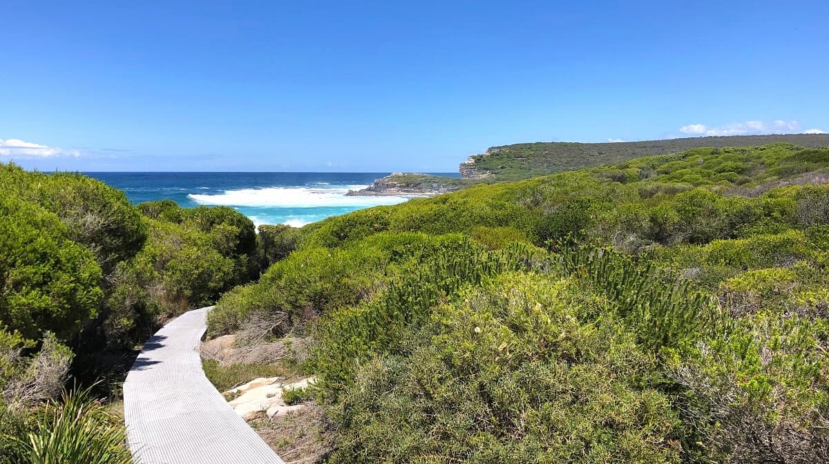
A large boardwalk with a viewing platform has been installed above the engravings, offering visitors an excellent overview of the whole site with all the drawings.
Dating back 2,000 years, the Jibbon engravings are an impressive display of respect the Tharawal people had for the land and the animals they shared the land with.
Little Jibbon Beach
It’s actually quite easy to miss the starting point of that short side track to the engravings.
But not to worry, because that side track reconnects with the main walking trail, and you will definitely notice the end of the boardwalk.
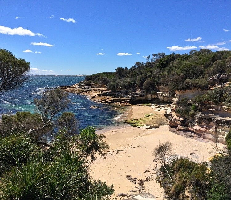
Once you’ve made it to the other side of the boardwalk, you can start seeing the first glimpses of beautiful Little Jibbon Beach below.
Feel free to head down to have a look around, or even go for a swim, but be mindful that this is an unofficial nude beach.
Shelley Beach
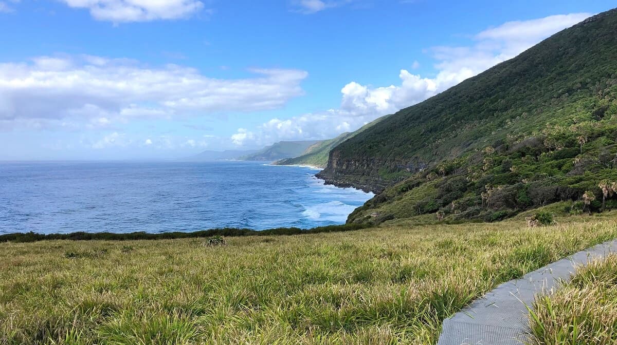
After the boardwalk, continue on the main track to Port Hacking Point, where you can enjoy panoramic views of Cronulla and the city in the north and the Pacific Ocean right in front of you.
The Jibbon Loop Track then follows the shoreline southbound until it arrives at Shelley Beach. This is a great spot to have a break, eat lunch, and enjoy the scenic views over the ocean.
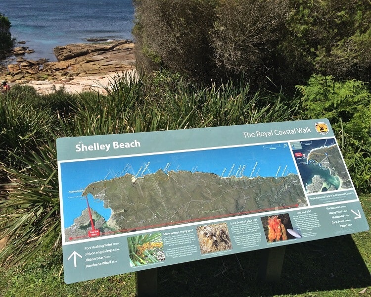
From Shelley Beach, the track takes you back to Jibbon Beach via a short bushwalk. This part of the track is fenced to keep the deer out, which helps to protect the more vulnerable wildlife.
There are two gates to enter the path through this area, one at the Shelley Beach end and the other at the Jibbon Beach end.
Jibbon Track
At Shelley Beach, the Jibbon Beach loop track intersects with the Jibbon Track, and these two walking trails often get mixed up.
The Jibbon Track passes Jibbon Lagoon and leads to Beachcomber Avenue in the southern part of Bundeena.
That is also where you will find the starting point of the Royal National Park Coast Track and the walking trail to Wedding Cake Rock.
About Bundeena
Bundeena is a quiet village at the northern end of the Royal National Park and on the southern side of Port Hacking. It is part of the local government area of the Sutherland Shire.
With a population of around 2,000 people, Bundeena is a healthy mix between a beach holiday destination and a residential suburb. It isn’t officially part of the Royal National Park, though, but it is completely surrounded by it.
It’s a pleasant little town to visit, with several picnic areas, cafes, a supermarket, and two large beaches. Jibbon Beach to the east and Horderns Beach to the west are the two most prominent beaches.
If you’d like to stay overnight, there are a number of B&Bs, campgrounds, and other accommodation options to choose from.
Map and Route
Start the walk at the Bundeena ferry wharf and make your way to Jibbon Beach via Loftus Street. Hike all the way to Jibbon Head, where you can do a side track to see Aboriginal engravings.
Continue around Port Hacking Point to Shelley Beach, where you can return to Jibbon Beach via a short bush track.
Once you’ve completed the Jibbon Beach loop track, have a look at our list of great walks in Royal National Park for more hiking ideas nearby.

Do we need to worry about the tides? How high does the water get, can we always walk on the shore? Thanks.
Hi Agha, no need to worry about the tides for this particular walk.
Thanks for this helpful post. We did the loop and stopped at Little Jibbon for a dip. It is a lovely nudist beach and on the day we were there (in July) there were several others. It’s a bit challenging to get in to the water due to the rocks, but the beach itself is well protected from the wind and warm enough for sunbathing even on a winter’s day.