Last updated: March 5, 2024
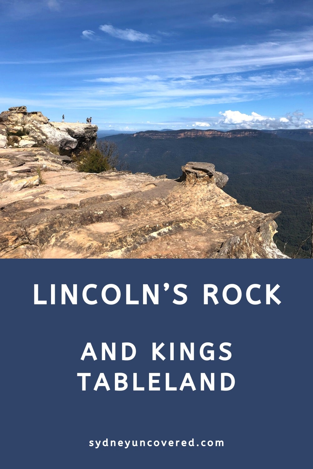
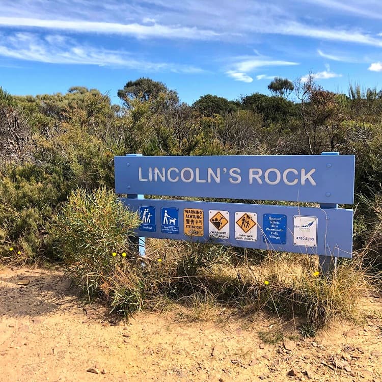
Lincoln’s Rock is one of the most impressive lookouts in the Blue Mountains, located south of Wentworth Falls on the Kings Tableland Plateau.
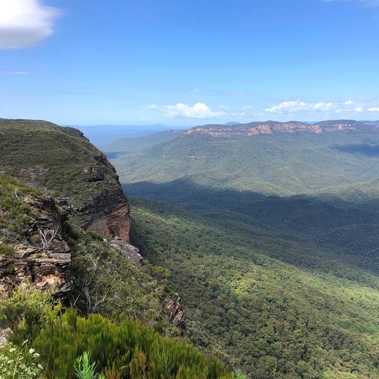
With sweeping views of Jamison Valley and beyond, Lincoln’s Rock is a unique and historically significant sight that is well worth a visit.
In this article, we’ll share everything you need to know about this beautiful spot in the Blue Mountains.
Watch this short video of Lincoln’s Rock:
How to Get There
There are two ways to get to Lincoln’s Rock: driving or walking.
1. Driving
Driving to the Lincoln’s Rock lookout is super easy. It is located on Little Switzerland Drive at the end of Hordern Road in Wentworth Falls.
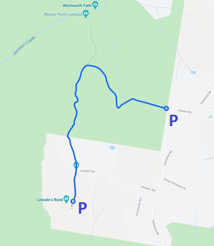
From the Great Western Highway, turn into Tableland Road. After 2 km, turn right into Hordern Road and drive until the end, where it meets Little Switzerland Drive.
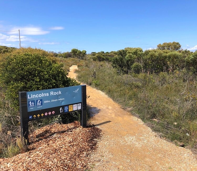
At that junction, turn right, and you will end up at the reasonably sized Lincoln’s Rock car park (see map location).
This new car park, with a large turning circle, was built in 2021 to replace the informal car park closer to the lookout. From this new car park, it’s a short 300m walk to Lincoln’s Rock.
2. Walking
If you feel like a bit of hiking, park your car on Chester Road (off Tableland Road) just north of Hordern Road (see map location).
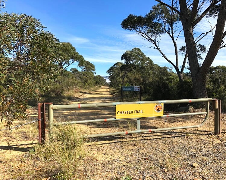
From there, follow the Chester Trail and the Little Switzerland Trail to Lincoln’s Rock. It’s a pleasant and easy 40-minute walk to the lookout.
Map
The official address of the Lincoln’s Rock lookout:
51 Little Switzerland Drive
Wentworth Falls, NSW 2782
The map below shows the two parking areas, one at the actual lookout and the other on Chester Road, where you’ll find the start of the Chester Trail.
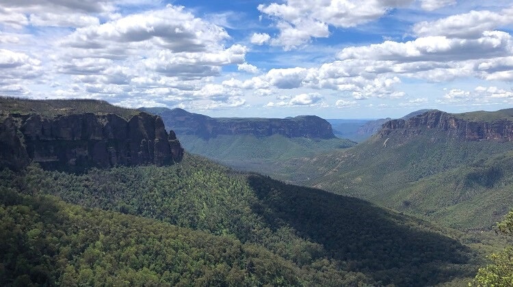
Lincoln’s Rock
The Lincoln’s Rock lookout is the most popular destination on the Kings Tableland plateau.
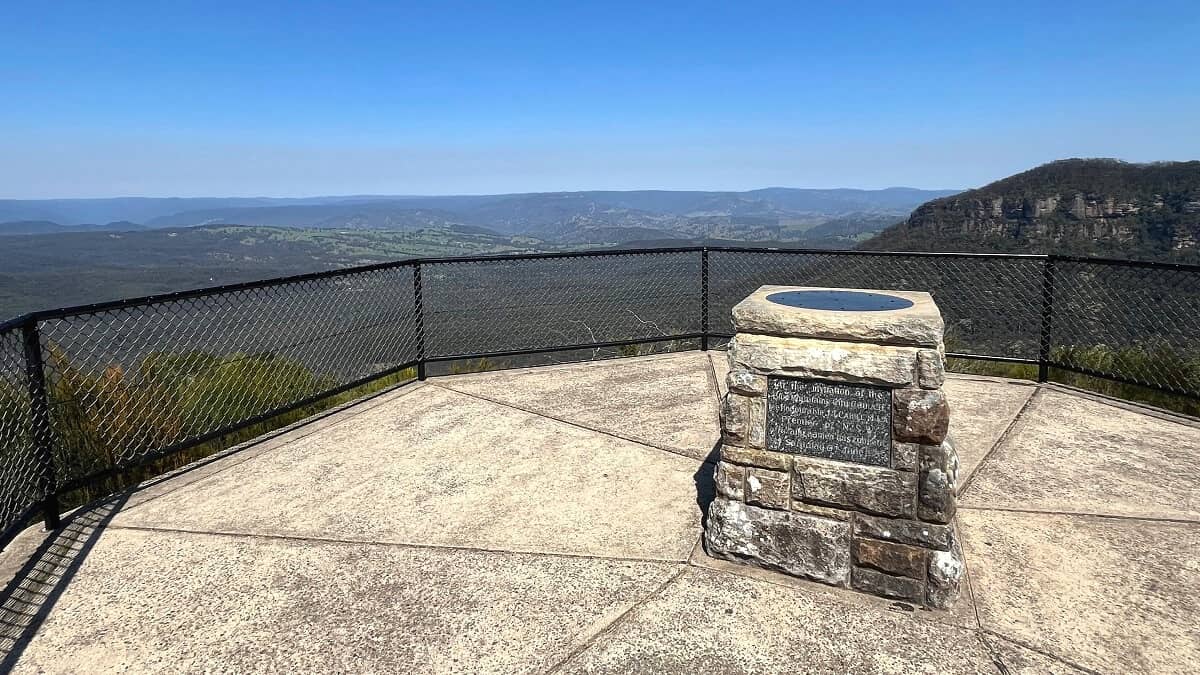
Lincoln Hall
The lookout was named in honour of Lincoln Hall, a mountaineer who lived in Wentworth Falls for decades before his untimely passing in 2012.
On 25 May 2006, Lincoln Hall was left for dead at Mount Everest at an altitude of 8700 metres, as he was descending from the summit.
However, the following day, Hall was found still alive by a team that was making a summit attempt, and he was rescued.
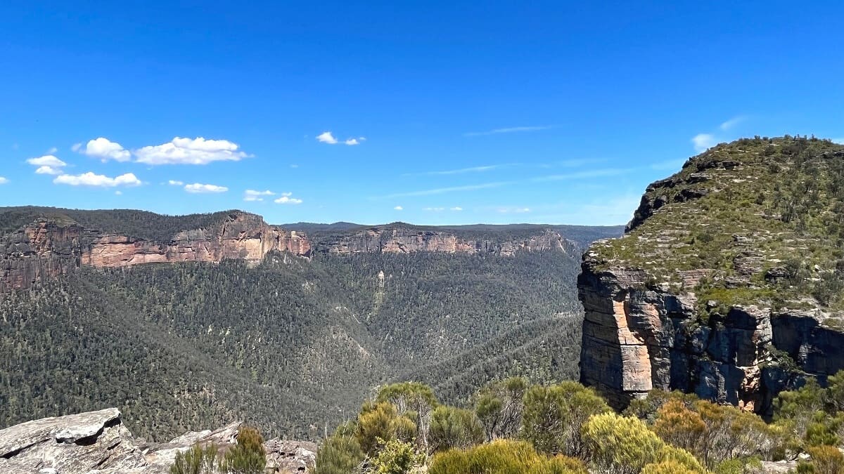
Views
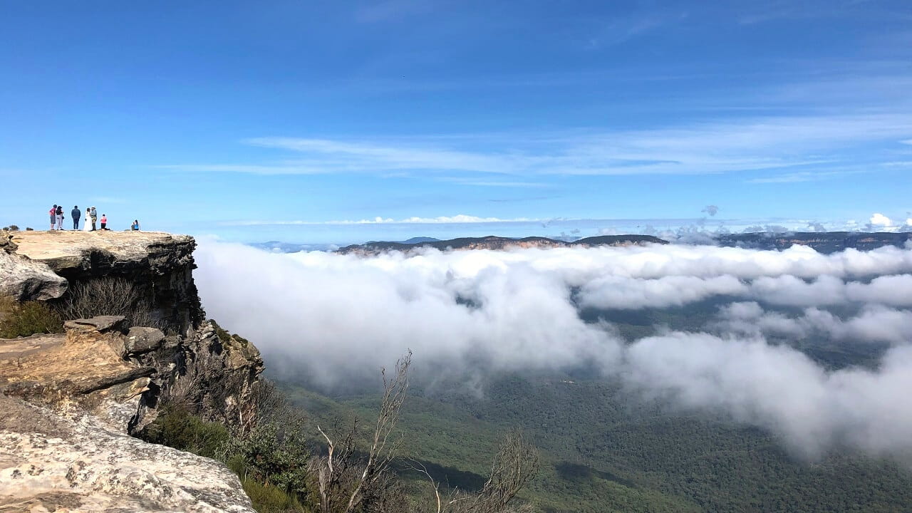
The panoramic views from Lincoln’s Rock overlooking Jamison Valley are unparalleled. But it’s not just the views that attract many visitors to this lookout.
The unique photo opportunity, while sitting on the edge of the cliff, is what makes this spot so popular in the land of Instagram.
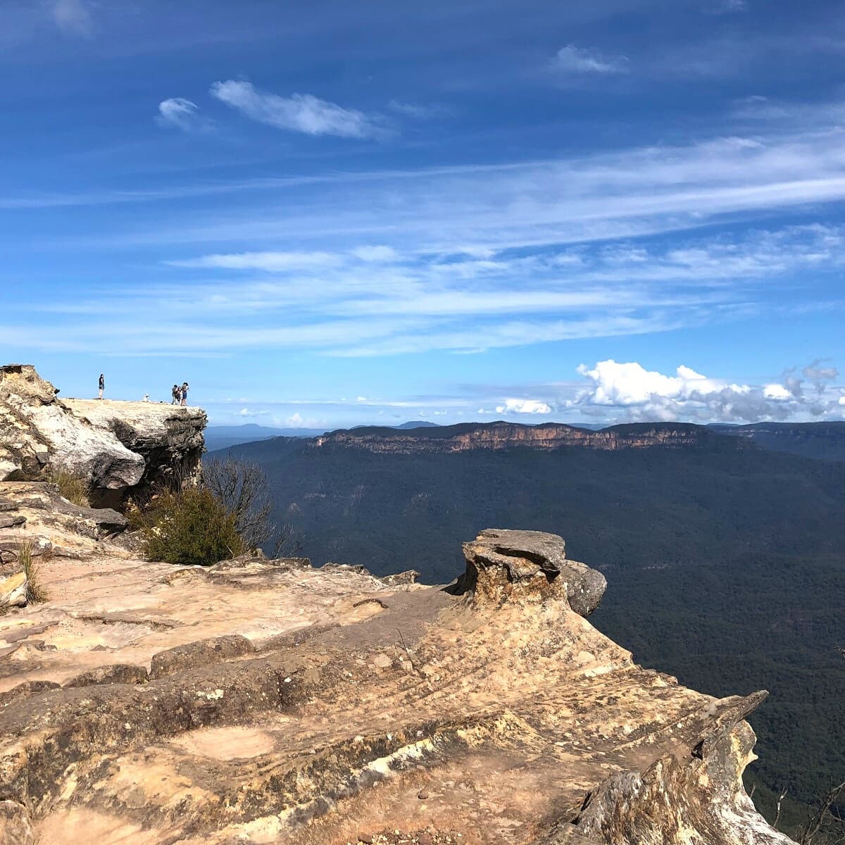
The Lincoln’s Rock lookout is stunning, but it is also unfenced. This adds to the beauty of the area, but it also makes exploring a bit risky. Stay well away from cliff edges at all times, especially when taking photos and selfies.
Make sure to also explore the southern section of the lookout, where you will find a path heading down to a secret vantage point.
Kings Tableland
Kings Tableland is a large plateau immediately south of Wentworth Falls in the Blue Mountains.
The plateau forms the eastern boundary of Jamison Valley and extends south to McMahons Point lookout and beyond, with views over Lake Burragorang.
Kings Tableland is also one of the most historically significant areas in the greater Blue Mountains region.
For many years, long before white settlement, the area that we now know as Kings Tableland was a place of significance to the Gandangara people whose traditional lands include the Wollondilly Shire, the Blue Mountains, and the Southern Highlands. Remnants of Aboriginal engravings and shelters can still be found in the area.
Nearby Sights
There are a few other interesting sights close to Lincoln’s Rock that are worth visiting.
1. McMahons Point lookout
The McMahons Point Lookout is a beautiful vantage point located at the end of Tableland Road, the southernmost point of the Kings Tableland Plateau.
It is located in a remote area of the Blue Mountains with limited to no reception, but it’s pretty easy to drive to, even with a 2WD vehicle.
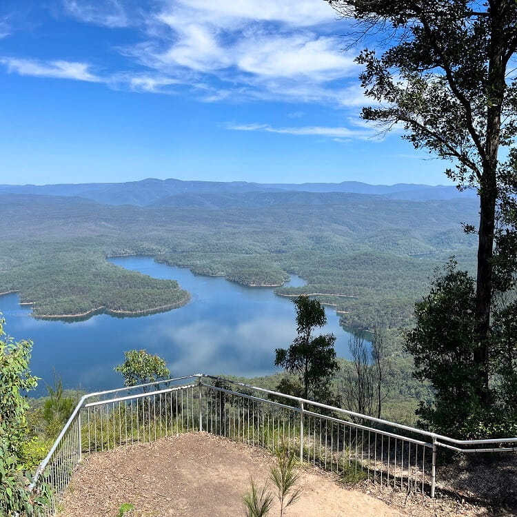
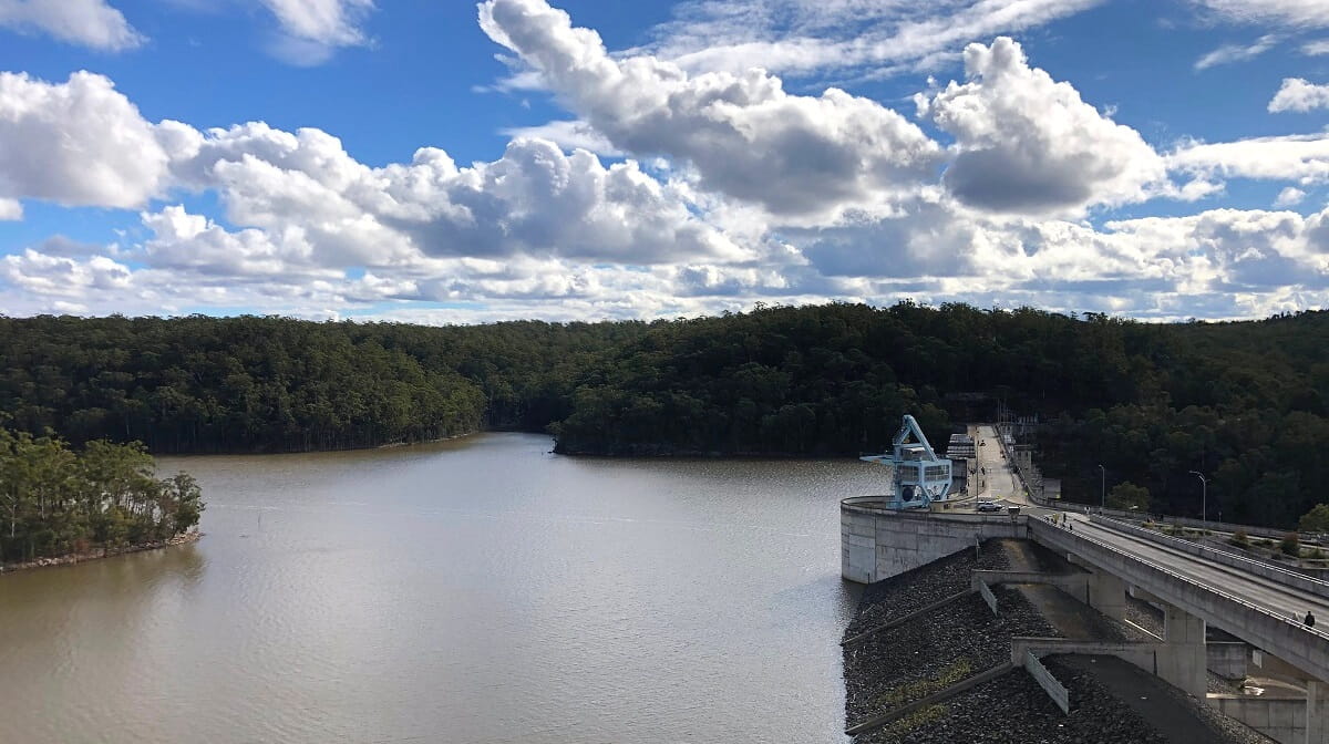
From McMahons Point, you can enjoy sweeping views of Lake Burragorang and the Greater Blue Mountains wilderness.
The lake is formed by the Warragamba Dam, Australia’s largest concrete dam, and is Sydney’s primary reservoir for water supply.
2. Rocket Point Lookout
One of Wentworth Falls’ best-kept secrets is the Rocket Point Lookout, which offers fantastic views of the waterfall and the valley below.
Many visitors to Wentworth Falls skip this lookout because it’s only accessible via a side track away from the regular walking track above the waterfall.
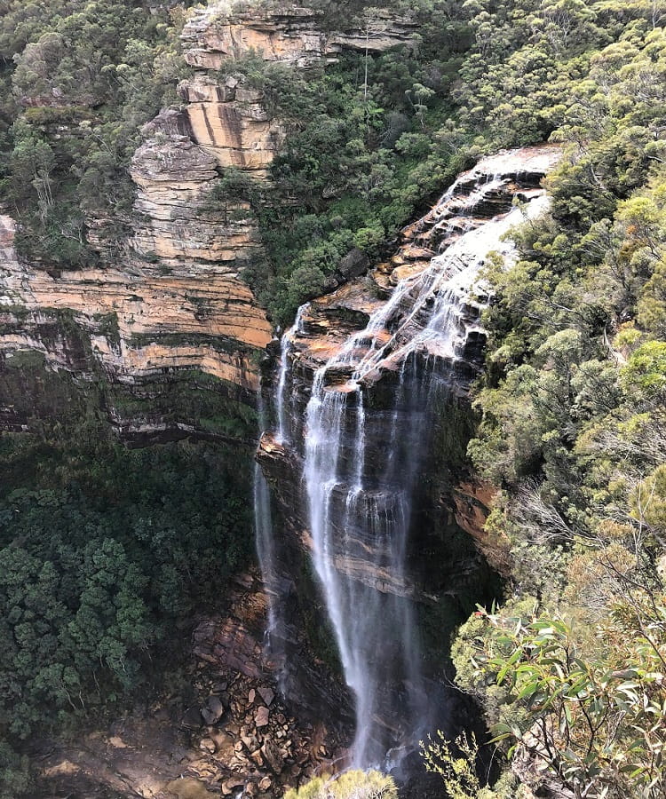
To reach Rocket Point Lookout from Lincoln’s Rock, follow Little Switzerland Trail heading north. It’s an easy walk and takes about 30 minutes to complete.
Once you’re there, you may as well head down to have a closer look at the impressive waterfall that is Wentworth Falls.