Last updated: December 8, 2023
Established in 1894, Ku-ring-gai Chase National Park is Australia’s second oldest national park, 15 years younger than the Royal National Park.
Located only 25 km north of the Sydney CBD, Ku-ring-gai Chase is a popular weekend destination for Sydney residents and tourists.
Measuring a generous 15,000 hectares, the park is characterised by rainforests, cliffs, mangroves, Aboriginal sites, picnic areas, secluded beaches, lookouts, mountain biking trails, and various walking trails.
In this article, we share the eight best walking tracks in Ku-ring-gai Chase NP, ranging from 1 to 10 km in length.
Top 8 Ku-ring-gai Chase Walks:
| Walk | Distance | |
|---|---|---|
| 1 | Resolute Loop Track | 6 km (circuit) |
| 2 | America Bay Track | 2 km (return) |
| 3 | West Head Lookout to Great Mackerel Beach | 5 km (one-way) |
| 4 | West Head Army Track | 1 km (return) |
| 5 | Cowan to Brooklyn via Jerusalem Bay | 13 km (one-way) |
| 6 | Sphinx Memorial to Bobbin Head Loop Track | 10 km (circuit) |
| 7 | Gibberagong Walking Track | 6 km (one-way) |
| 8 | Berowra to Mount Kuring-gai via Apple Tree Bay | 9.5 km (one-way) |
Top 8 Ku-ring-gai Chase Walks
Here is our list of 8 great walks in Ku-ring-gai Chase National Park. Some of these walking walks are long and challenging, and others are much shorter and easier.
1. Resolute Loop Track
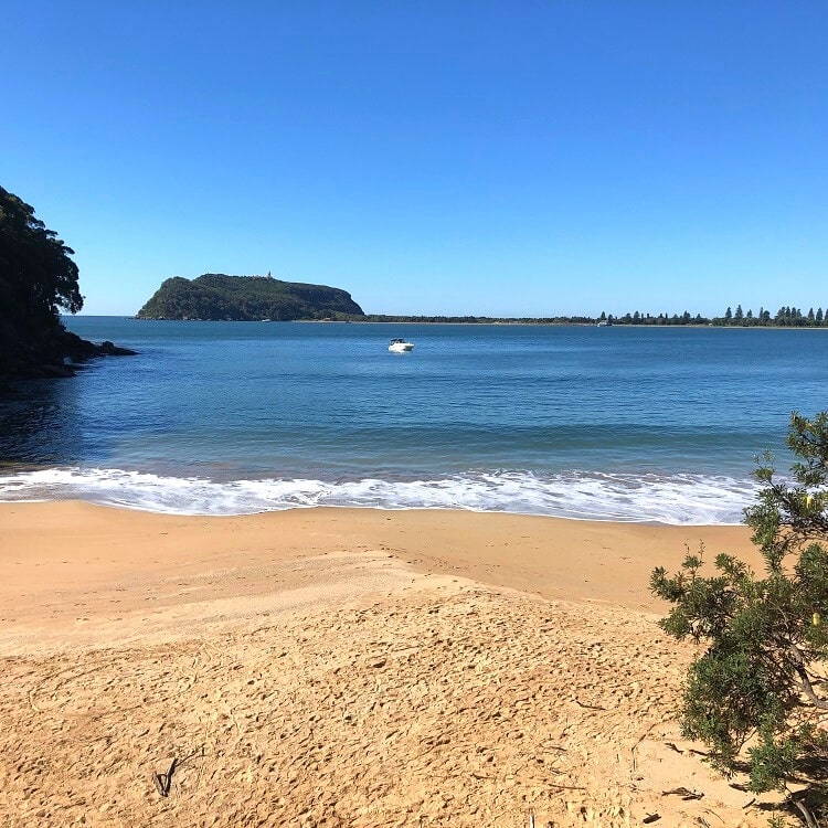
Resolute Beach is one of the prettiest secluded beaches in Sydney, located just south of the West Head lookout. This beach is a 60m strip of sand with calm water and no rocks, making it perfect for a relaxing swim.
The beach is also a popular boat landing area. Many visitors arrive there with their leisure boats from Palm Beach for a quiet afternoon in the sun.
The best way to visit Resolute Beach is by doing the 6 km Resolute Loop Track starting from the picnic ground. The first part of this track is a section with well-preserved Aboriginal engravings, followed by a descent into the bush towards Resolute Beach.
After a refreshing swim, continue the track northbound to West Head Beach and the West Head Lookout, where you can enjoy scenic views of Pittwater and the Barrenjoey Headland.
| Resolute Loop Track | |
|---|---|
| Distance: | 6 km (circuit) |
| Duration: | 2 – 3 hours |
| Grade: | Moderate |
2. America Bay Track
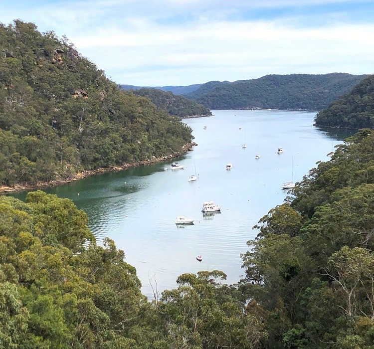
The America Bay Track in the West Head and Basin precincts of Ku-ring-gai Chase National Park may be short, but it’s a fun outdoor adventure offering a lot of bushwalking goodness.
The highlight of this easy 2 km track is the lookout at the end of the walk, which offers panoramic views of America Bay. This lookout is also an excellent spot for a picnic in beautiful surroundings.
Before you arrive at this lookout, you will explore Aboriginal engravings, small waterfalls, creek crossings, and beautiful natural scenery.
| America Bay Track | |
|---|---|
| Distance: | 2 km (return) |
| Duration: | 1 hour |
| Grade: | Easy |
3. West Head Lookout to Great Mackerel Beach
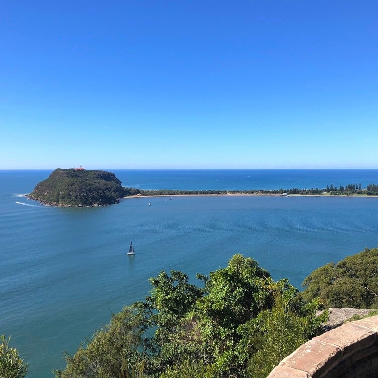
The West Head Lookout in Ku-ring-gai Chase offers breathtaking views of Pittwater, Broken Bay, Barrenjoey Headland, Palm Beach, and the Central Coast.
A 5 km (one way) walking trail from this lookout leads to Great Mackerel Beach, a small suburb that looks a bit like a remote holiday resort, with a population of just over 100 residents.
Go for a wander and admire the fascinating real estate behind the beach, but watch out for the golf carts and wheelbarrows that are used to carry luggage and other things around.
Before arriving at Great Mackerel Beach, the walking track takes in the small and secluded West Head and Resolute beaches, so there are plenty of options for a quiet swim.
You can read more about this beautiful walking track in our West Head Lookout article.
| West Head Lookout to Great Mackerel Beach | |
|---|---|
| Distance: | 5 km (one-way) |
| Duration: | 2 – 3 hours |
| Grade: | Moderate |
4. West Head Army Track
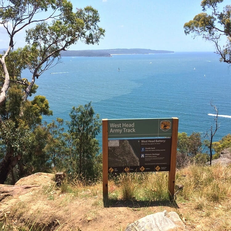
Officially opened in 2016, the short but somewhat challenging West Head Army Track is a unique trail at the West Head Lookout that leads to a historic army battery.
Part of this walk consists of a steep ladder construction required to help navigate hikers down to the old West Head Army Battery.
Once down there, you can wander around and see the gun emplacements and battery observation posts used in the Second World War to protect the country against hostile activities.
You can read more about this unique walk in the West Head Army Track section in our detailed West Head Lookout article.
| West Head Army Track | |
|---|---|
| Distance: | 1 km (return) |
| Duration: | 1 hour |
| Grade: | Moderate (steep sections) |
5. Cowan to Brooklyn via Jerusalem Bay
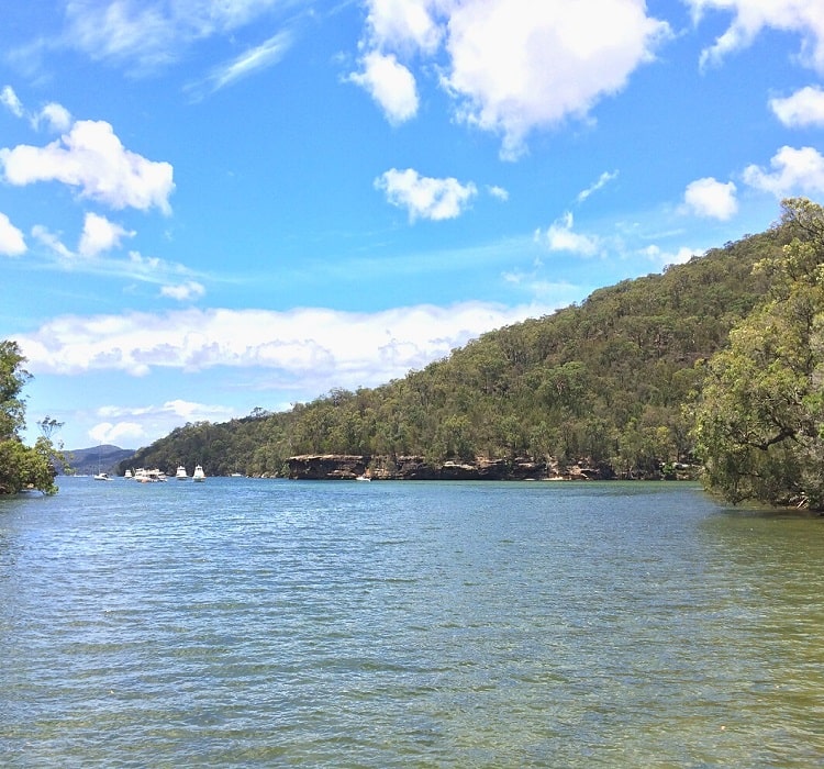
The 13 km challenging walk between Cowan and Brooklyn is part of the Great North Walk, an iconic 250 km track connecting Sydney, Hunter Valley, and Newcastle.
This particular section of that iconic walk is not the easiest but well worth the effort, with fantastic scenery along the way to take in.
When doing the walk from Cowan train station to Brooklyn, try and go for a refreshing swim in Jerusalem Bay. The quiet and peaceful surroundings of the bay and the abundance of trees make swimming there such a unique experience.
The best way to get to Cowan is to use public transport, as the start of the walking track is opposite the train station. Follow the signs for Brooklyn and the Great North Walk to find the trailhead. Once you have reached Brooklyn, you can catch the train back to Cowan.
| Cowan to Brooklyn | |
|---|---|
| Distance: | 13 km (one-way) |
| Duration: | 4 – 5 hours |
| Grade: | Hard |
6. Sphinx Memorial to Bobbin Head Loop Track
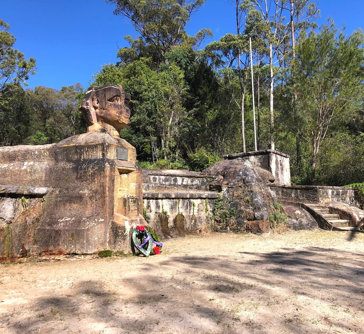
The 10 km Sphinx Memorial to Bobbin Head loop via Warrimoo Track is an exciting bushwalk through various landscapes in Ku-ring-gai Chase NP.
One half of the loop (Warrimoo Track) follows the scenic shoreline of Cowan Creek, while the other half (Bobbin Head trail) is mostly a fire trail through a forest of gum trees.
While this loop track can be started in Bobbin Head, a more logical place to start is the Sphinx Memorial in North Turramurra. The Sphinx Memorial is a unique sandstone monument that was built in the 1920s to commemorate those who died in service during World War I.
The best section of this loop track is the Warrimoo Track, with beautiful forests, rock formations, mangroves, and panoramic water views to explore.
| Sphinx Memorial to Bobbin Head Loop Track | |
|---|---|
| Distance: | 10 km (circuit) |
| Duration: | 3 – 4 hours |
| Grade: | Moderate |
7. Gibberagong Walking Track
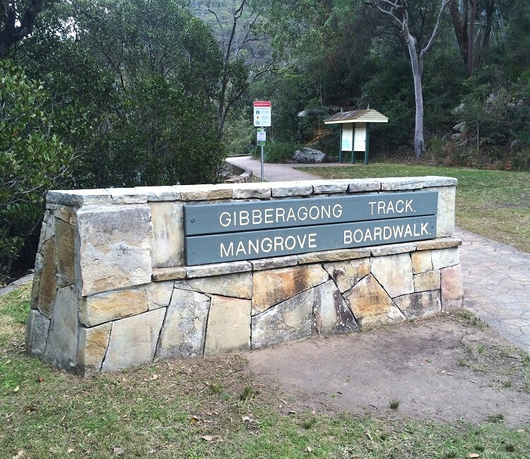
The Gibberagong track is another popular bushwalk that has its starting point in Bobbin Head.
The first section of this walking track is the Bobbin Head mangrove boardwalk that swirls through saltwater mangroves as part of Cockle Creek.
The track then continues all the way to North Wahroonga through a section of thriving bushland with a large waterhole as one of the highlights.
The Gibberagong walking track is perfect for adventurous bushwalkers who enjoy bird-watching and wildlife-spotting.
| Gibberagong Walking Track | |
|---|---|
| Distance: | 6 km (one-way) |
| Duration: | 2 – 3 hours |
| Grade: | Moderate |
8. Berowra to Mount Kuring-gai via Apple Tree Bay
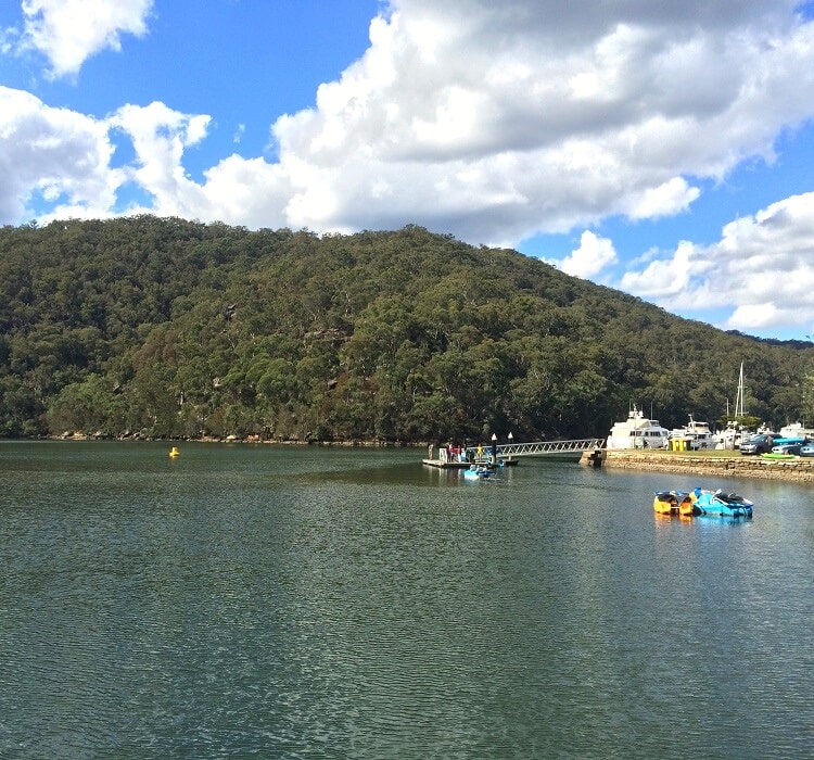
The moderately challenging walking track between Berowra and Mount Kuring-gai makes for a perfect day out for both seasoned bushwalkers as well as casual outdoor enthusiasts.
Berowra and Mount Kuring-gai both have railway stations with regular train services, so you don’t have to walk all the way back once you’ve completed your adventure.
The track mostly follows the shoreline of Cowan Creek, with a few great lookout points along the way. A visit to Apple Tree Bay is optional as a side track but well worth the effort if you’ve never been there before.
Apple Tree Bay is a popular weekend destination with a boat ramp and plenty of parking. The area has large picnic areas with BBQs, a small kiosk, drinking water, toilet facilities and plenty of shade from the trees.
| Berowra to Mount Kuring-gai | |
|---|---|
| Distance: | 9.5 km (one-way) |
| Duration: | 4 hours |
| Grade: | Moderate / hard |
Are there any hike trails in Kuring-gai NP where you can bush camp overnight?
Hello Marshall,
I believe the only spot in Ku-ring-gai Chase where you’re allowed to camp is at the Basin campground, which is accessible via the Basin walking trail or otherwise via ferry, as it’s facing Pittwater.
Hope this helps!
Thank you for the helpful information. How can we join bush walking groups?
Hi Ali, Meetup and Facebook are great resources for bushwalking groups in and around Sydney, including Ku-ring-gai Chase National Park.
These look great, thanks for the info.
Which of these do you think would be best for training for the Kokoda track, or can you recommend others?
Cheers,
Dave
Hello David, the Kokoda track is on a whole different level, very exciting.
From this list, the most challenging hike would be the Cowan to Brooklyn walking track, it’s quite a tough and long bushwalk.
Even better, when you get to Brooklyn, have a rest, then turn around and walk back! Take a head torch.