Last updated: December 16, 2023
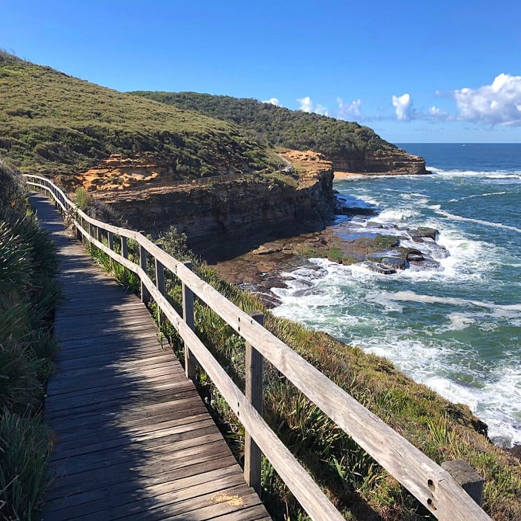
The Maitland Bay Track is a short but steep bush trail in Bouddi National Park between the Information Centre and the isolated beach of Maitland Bay.
The track showcases the beauty of the national park, with beautiful lush rainforest and stunning ocean views to enjoy. Stroll further along the beach to Bouddi Point, and discover some of the remains of an old shipwreck.
In this article, we’ll share the highlights of this enjoyable, family-friendly walking trail, and explain how best to get there and what to do nearby.
| Maitland Bay Track | |
|---|---|
| Distance: | 1.8 km return |
| Distance to Bouddi Point: | 3.6 km return |
| Time: | 1-3 hours (depending on stops) |
| Grade: | Moderate (steep parts) |
| Dogs: | Not allowed |
How to Get There
The Maitland Bay Track is located in the southern part of the Central Coast, approximately 90 minutes driving from the Sydney CBD.
The quickest way to get there from the M1 Motorway is via Woy Woy Road to Woy Woy, followed by Maitland Bay Drive, Empire Bay Drive, Wards Hill Road, and The Scenic Road to the Information Centre.
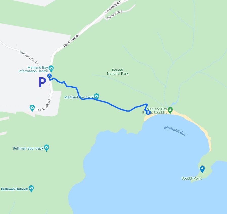
Parking is available near the Information Centre located at the intersection of Maitland Bay Drive and The Scenic Road in Killcare Heights (see map location).
Map
The starting point of this track is about 100 metres south of the information centre, not to be confused with the start of the Stroms Trail right next to it.
Maitland Bay Track Notes
Perhaps not as well-known as Ku-Ring-Gai Chase National Park north of Sydney, or Royal National Park south of Sydney, Bouddi National Park is a great weekend destination for outdoor enthusiasts.
The park is home to various exciting bushwalks, several campgrounds, and some of the most beautiful and most secluded beaches you can find in the state of New South Wales.
One of those bushwalks is the Maitland Bay Track, a popular walking trail that starts from the information centre and leads to the picture-perfect beach of Maitland Bay. This well-maintained track is just under 2 km long (return) and does have a few steep sections.
Maitland Bay Information Centre
Before starting the Maitland Bay walking track, it’s worth visiting the small and charming information centre.
The building was once the Old Maitland Store and residence, one of the earliest homes in the Killcare Heights area.
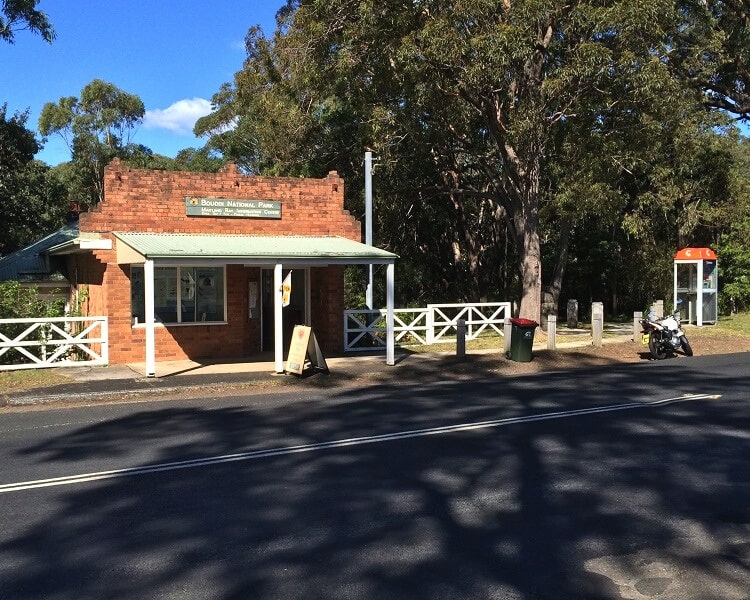
The store was associated with the history of Bouddi National Park and the development of Killcare Heights.
The information centre is open from 11 am until 3 pm on the weekends and public holidays.
Start of the Walk
To start the walk to Maitland Bay, look for the Bouddi National Park sign, which marks the start of both the Maitland Bay Track and the Bullimah Spur Track.
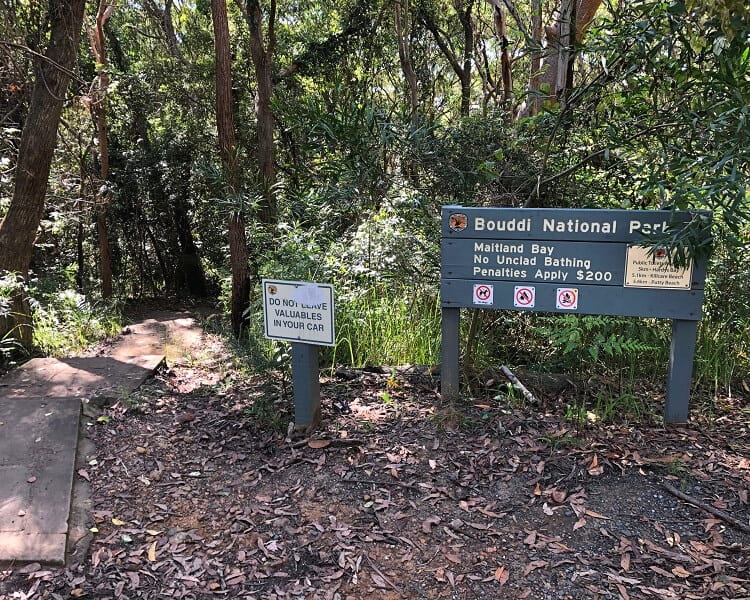
After about 100 metres, the path arrives at a junction where you need to keep going straight ahead, as the path to the right is the Bullimah Spur Track.
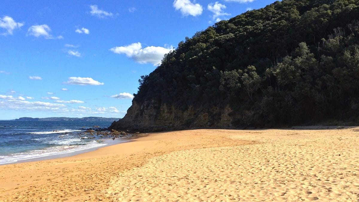
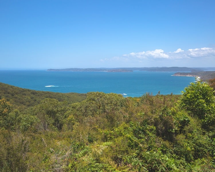
As you make your way down through the forest, you will soon start to see glimpses of Maitland Bay, Bouddi Point, and the ocean.
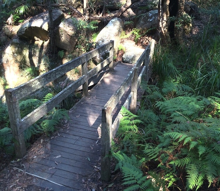
Be mindful that while going down to the beach is very easy, going back up can be a bit of a challenge, especially for young children.
It takes around 20 minutes to get to the beach, but it will take twice as long to get back up to the car park via the steep walking path.
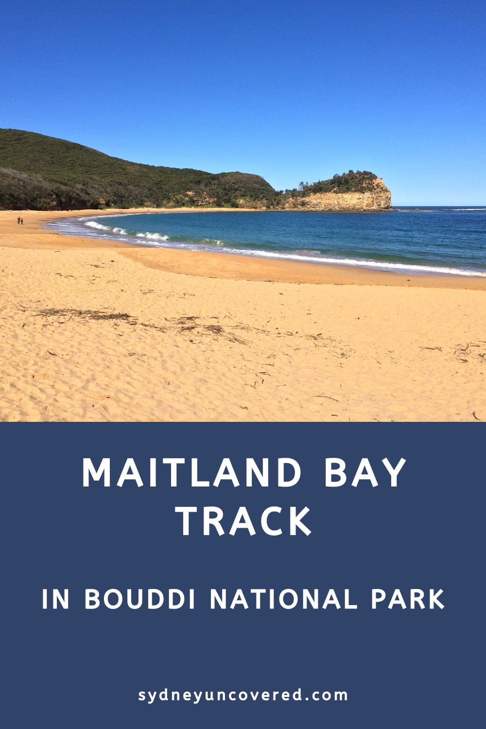
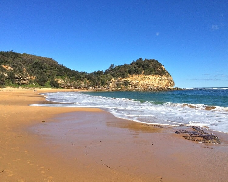
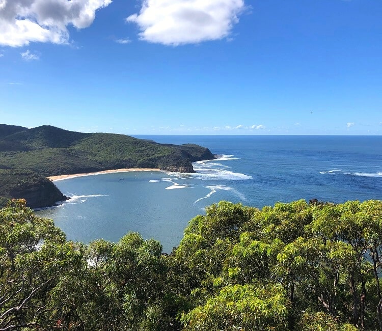
Maitland Bay Beach
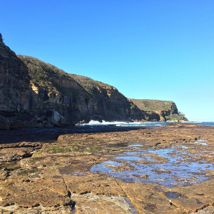
Maitland Bay itself is a beautifully secluded beach in Bouddi National Park.
On a typical Sunday, you won’t easily find more than a handful of people at the beach, which can be quite refreshing if you’re from Sydney.
Keep in mind that Maitland Bay Beach is unpatrolled, so please be careful if you’re planning to go for a swim.
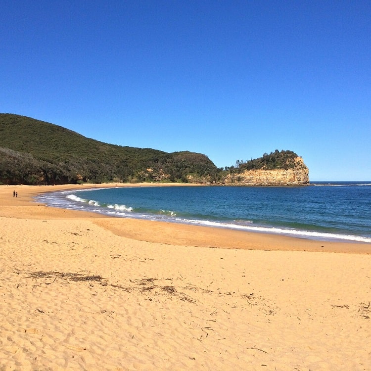
Bouddi Point
From the beach, it’s recommended to continue hiking to Bouddi Point at the eastern end of the beach.
Not only are the views fantastic along the way, but you will also be able to discover some remnants of an old shipwreck.
The S.S. Maitland Shipwreck
In May 1898, the coastal paddle steamer S.S. Maitland ran aground at the eastern end of Maitland Bay during a vicious storm.
Remembered as the “Maitland Gale”, this storm caused the sinking of several other ships along the coast of New South Wales, but the Maitland disaster claimed the most lives.
More than 120 years later, some of the remains of this shipwreck are still visible at low tide.
It’s worth walking the extra stretch from the end of the Maitland Bay Track to Bouddi Point to discover these historical remains.
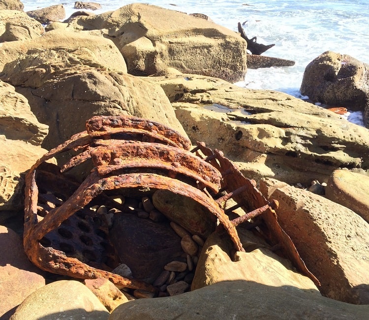
It’s fascinating to see, and makes you think about what the passengers and crew on board the S.S. Maitland must have gone through that fateful night.
On Saturday 14th October 1961, a monument was dedicated to commemorating the sinking of the S.S. Maitland as a maritime disaster.
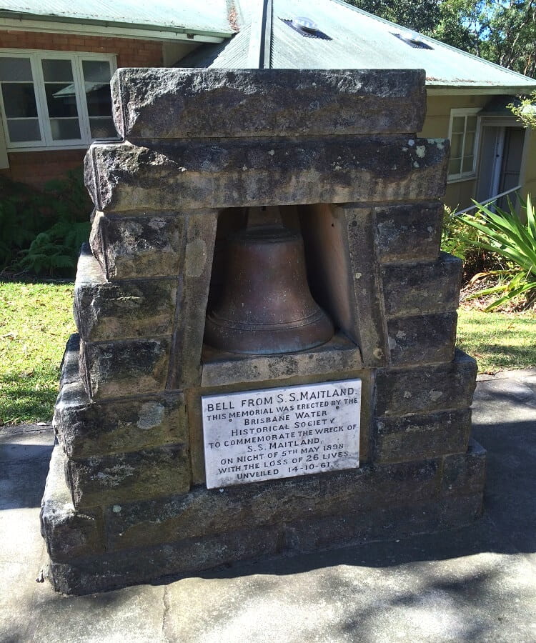
The monument stands next to the information centre, and is a replica of the bell of the ship.
The bay was previously known as Boat Harbour, but was renamed Maitland Bay following the disaster.
Other Tracks Nearby
There are many walking tracks to choose from in Bouddi National Park, with some of them close to and connecting with the Maitland Bay Track.
1. Bouddi Coastal Walk
One of the longest walking tracks in the national park is the scenic 8 km Bouddi Coastal Walk, between MacMasters Beach and Putty Beach, and also includes Maitland Bay.
With panoramic ocean views from start to finish, beautiful beaches, and several lookouts, the Bouddi Coastal Walk is a fantastic adventure.
2. Mount Bouddi Walking Track
The short but scenic Mount Bouddi Walking Track starts from the Mount Bouddi (Dingeldei) picnic area, and meanders through beautiful bushland to the Bouddi Lookout.
The scenic Bouddi lookout point offers beautiful views of Maitland Bay and its surroundings.
3. Bullimah Spur Track
Like the Maitland Bay Track, the Bullimah Spur Track also starts from the Bouddi National Park information centre, heading south towards the Bullimah Outlook.
The views from the Bullimah Outlook to Putty Beach, Box Head, Broken Bay, Lion Island, and Palm Beach are absolutely stunning and very much worth the effort to get there.