Last updated: November 9, 2023
The Malabar Headland circuit walk is a fascinating and enjoyable track exploring the Malabar Headland National Park just south of Maroubra Beach.
This hiking adventure consists of two walking trails: the Boora Point walking track along the beautiful coastline, and the Western Escarpment walking track through scenic bushland.
Keep reading to find out more about the highlights of this popular walking track and how best to get there.
| Malabar Headland Circuit Walk | |
|---|---|
| Distance: | 7 km (circuit) |
| Duration: | 2 hours |
| Grade: | Easy / moderate |
| Dogs: | Not allowed |
How to Get There
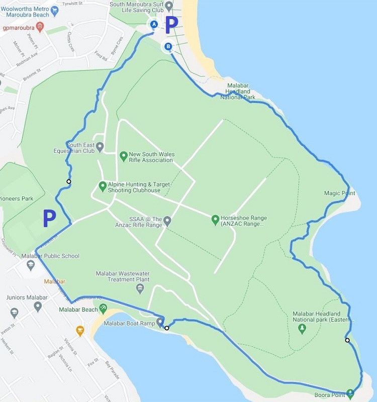
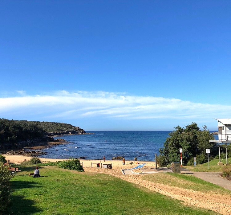
Since this is a circuit walk, you can start and finish at various spots. However, most people start the hike from the car park at Arthur Byrne Reserve at the southern end of Maroubra Beach (see map location).
To get there from the city, turn into Fitzgerald Avenue towards Maroubra Beach from Anzac Parade. At the roundabout, take the third exit into Arthur Byrne Reserve via Bernie Kelly Drive.
This car park is well-sized but fills up quickly on the weekends. If it is indeed full, you can try to find a parking spot closer to the beach or in the suburban streets nearby.
Alternatively, Pioneers Park on the southwestern side of the Malabar Headland also has a car park, and is also a good spot to start and finish the circuit walk (see map location).
Both of these parking areas (Arthur Byrne Reserve and Pioneers Park) are marked on the following map:
Malabar Headland Track Notes
As mentioned, the Malabar Headland Circuit Walk consists of the Western Escarpment walking track in the west and the Boora Point walking track in the east.
The circuit walk navigates around the ANZAC Rifle Range located in the middle of the Malabar Headland. Consequently, the Boora Point walking track is not accessible during rifle range operations.
When shooting practice is scheduled, the park entry gates are closed, and red flags fly above the range. You can find more details about opening times on the NSW National Parks website.
1. Western Escarpment Walking Track
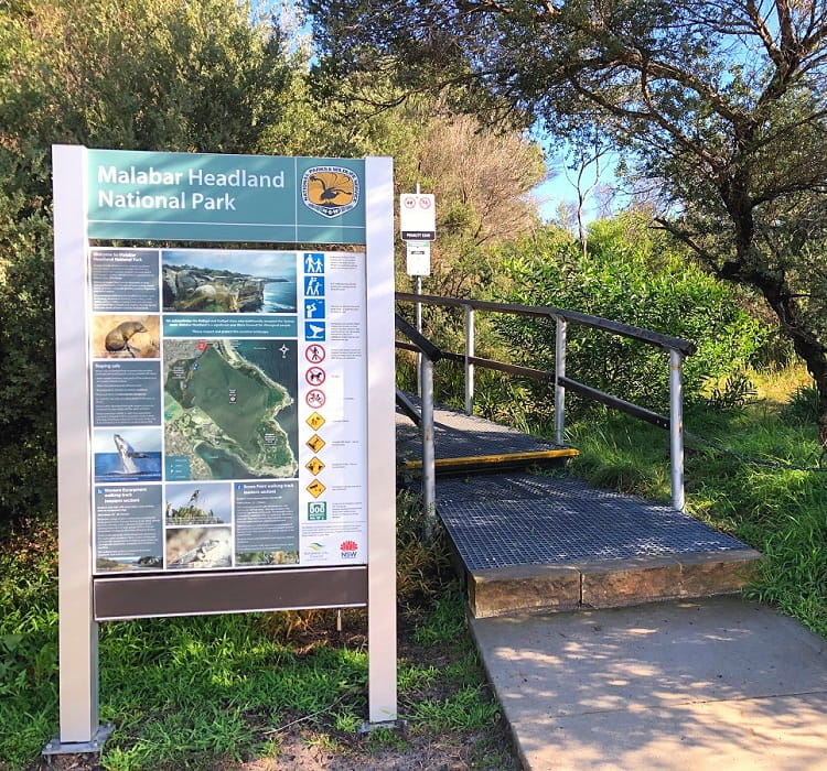
The first part of the Malabar Headland circuit walk starts at the big information board at the Arthur Byrne Reserve car park, which is hard to miss.
It’s good to read through all the information provided on that board to learn more about the Malabar Headland, the local flora and fauna, the walking tracks, and the traditional owners of the land.
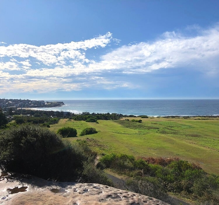
The Western Escarpment walking track connects Maroubra Beach and Malabar, navigating through unspoiled bushland with fantastic panoramic views.
There are various natural and man-made vantage points along the way, in addition to benches from where you can soak in the beautiful surroundings.
Once you reach the end of the Western Escarpment walking track at Pioneers Park, follow the trail towards Malabar Beach.
To get there, make a right turn into Franklin Street, followed by a left turn into Dacre Street, and another left turn into Fishermans Road which runs right behind Malabar Beach.
2. Boora Point Walking Track
From Malabar Beach, follow the trail past the boat ramp car park, continuing on to Boora Point.
This is where the Boora Point walking track officially starts.
Opened in April 2017, the Boora Point walking track is a 3.7 km long coastal adventure that connects the southern end of the Malabar Headland with the beach at South Maroubra.
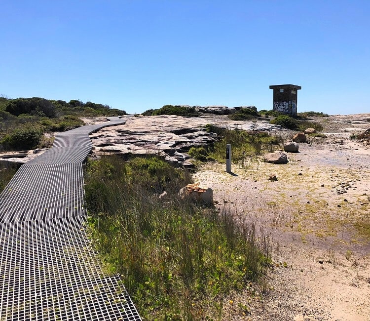
Not only does this walking track offer superb views of the unique Sydney coastline, but it is also home to various old heritage structures from the Second World War.
Malabar Battery
The Malabar Battery was built in 1943 as a coastal defence battery, along with other batteries in the Botany Bay area.
The Battery consisted of gun emplacements, an underground facility, and even a tramway that was used to transport weaponry.
It’s worth exploring the area, with lots of remnants that are still accessible.
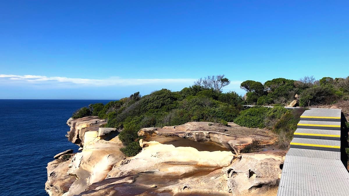
From the former battery, the walking track continues along the coastline and is almost entirely on metal boardwalks up until South Maroubra Beach.
Coastline
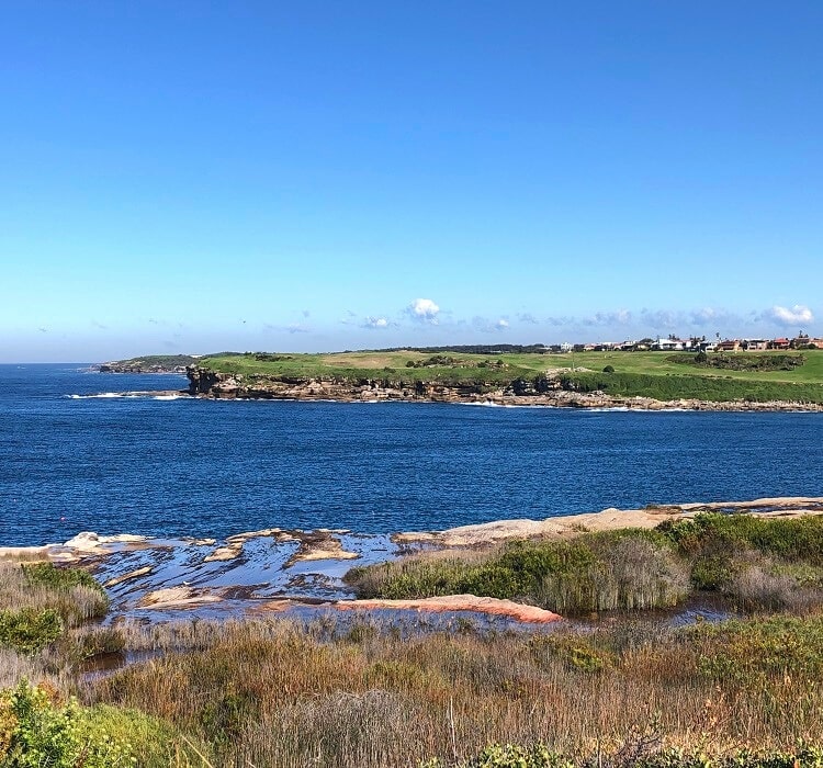
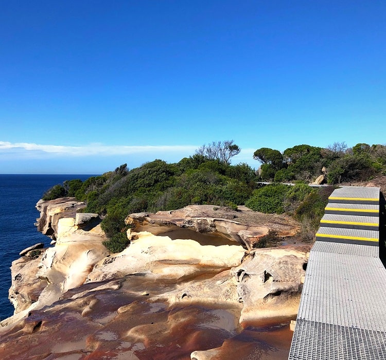
The stunning coastline at Malabar Headland is characterised by high cliffs and impressive sandstone escarpments, with numerous lookouts and rest areas to enjoy along the way.
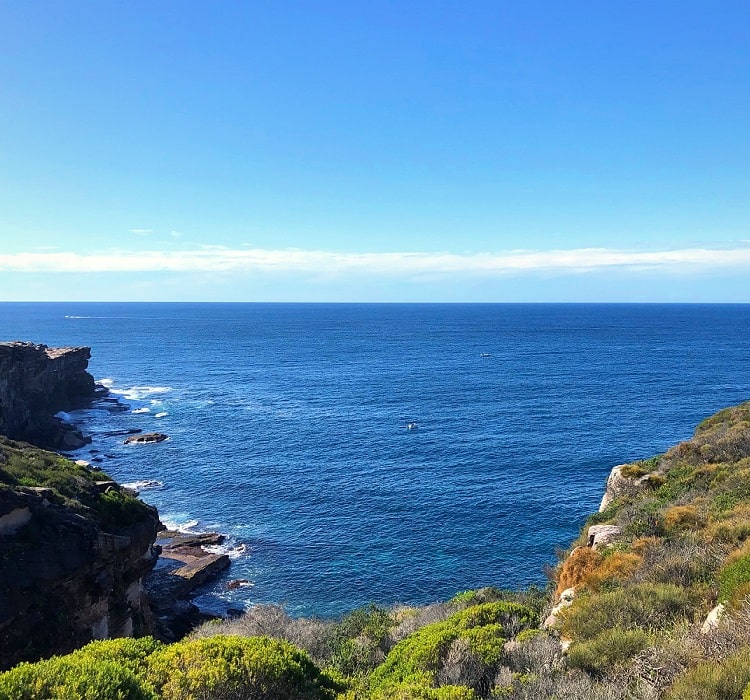
The views on a clear day are breathtaking, with Bondi and the city skyline in the north, and La Perouse and Kamay Botany Bay National Park in the south.
Magic Point
One of the highlights along the Boora Point walking track is Magic Point, a small peninsula with rock platforms that provide fantastic views out to the ocean.
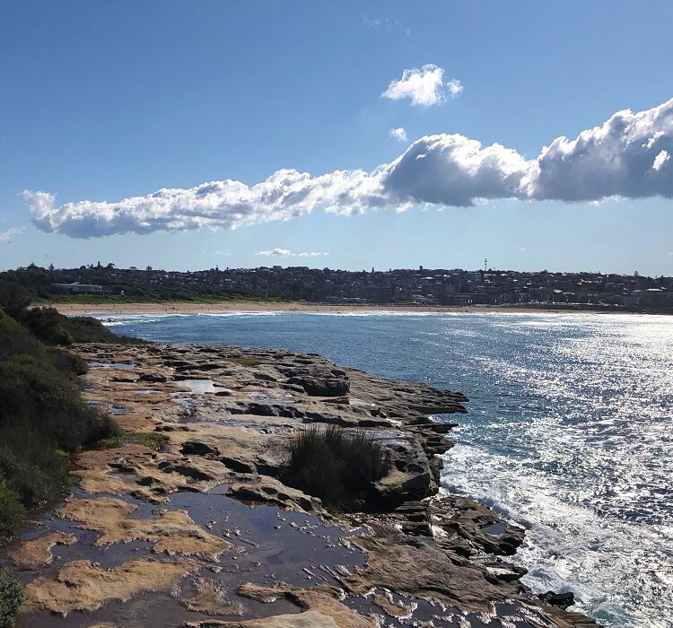
From Magic Point, it’s only a short hike back to either Maroubra Beach or Arthur Byrne Reserve.
There are many places to eat and drink at the beach, so if you’re feeling hungry after completing the Malabar Headland circuit walk, you will have plenty of choices!

One of my favourite walks, love the Western escarpment with its panoramic views, and thank you to Parks and wildlife for doing up the track and making it safe to walk in any weather.
Are any of these tracks fully wheelchair accessible?
Hi Linda, the first boardwalk section up until Magic Point is meant to be wheel friendly, but then the path from the car park to the start of the boardwalk is on uneven ground, so unfortunately we can’t call it wheel friendly.
Sydney could certainly do with more wheel friendly trails, and we’re planning on collecting them here on this website.
I love this walk, at 7km it’s just 1-1/2 hours, bright sun, and fresh sea air. Lots of friendly people on busy days.
Absolutely, it’s one of the best hikes in Sydney.