Last updated: April 15, 2024
Mount Banks, with its distinctive rounded peak, is one of the most recognisable landmarks in the Blue Mountains.
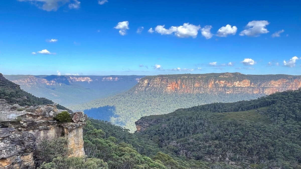
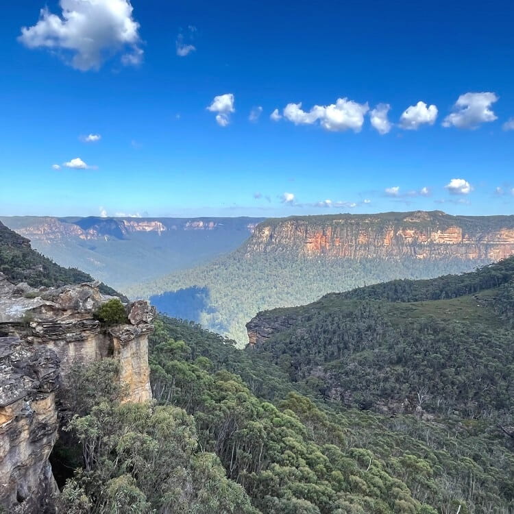
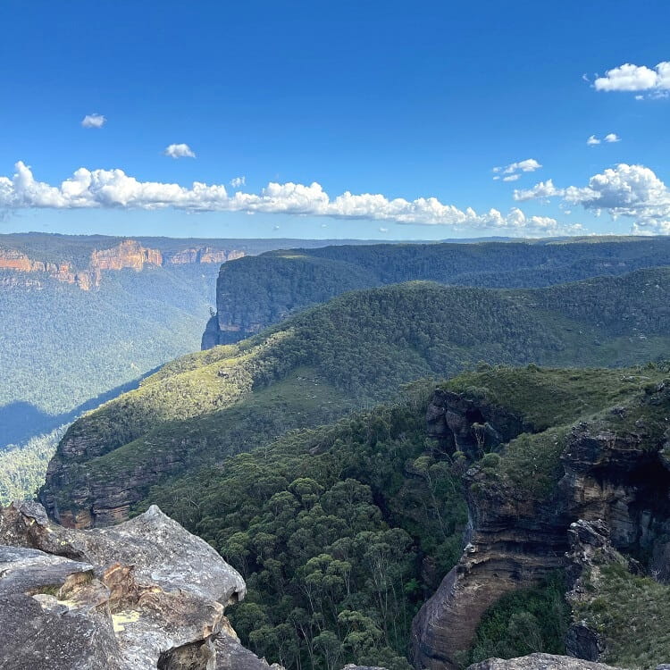
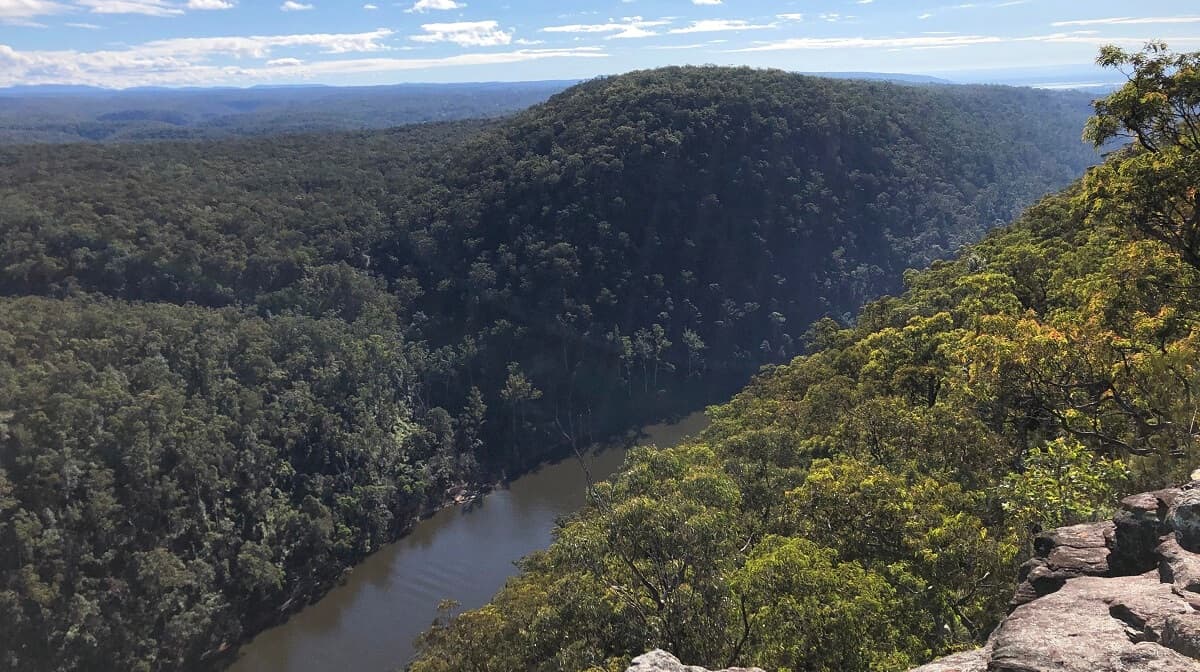
Mostly overlooked by tourists, the hike to the summit of Mt Banks offers beautiful views of the Grose Valley and surrounding wilderness.
In this article, we will discuss the two trails that lead to the summit of this mountain peak along with highlights and photos.
| Mt Banks Summit Walk | |
|---|---|
| Distance: | 2.5 km (return) / 5 km (circuit) |
| Duration: | 1-3 hours |
| Grade: | Moderate (short but steep) |
| Elevation: | 1,049 m |
| Dogs: | Not allowed |
How to Get There
The Mount Banks Summit Walk starts at the Mount Banks picnic area, which has a small car park and toilet facilities (see map location).
From Bells Line of Road, turn into Mount Banks Road at the big signpost. Note that this is a 1 km unsealed road, but can be driven with a 2WD vehicle. Just be cautious, especially after a period of rainfall.
Mount Banks Rd is located 10 km west of the Blue Mountains Botanic Garden in Mount Tomah and 28 km east of Lithgow.
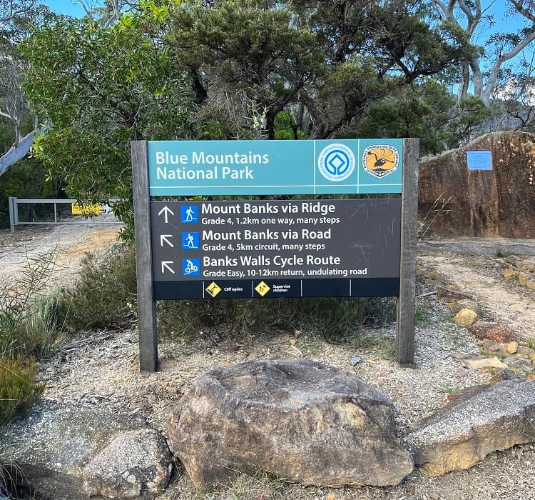
Once you’ve parked your car, look for the National Park signpost that marks the starting point of the hike up to Mount Banks.
Mount Banks Track Notes
The hike to the summit of Mount Banks is a moderately challenging bushwalking trail with steep sections and steps. The track is well-maintained but is overgrown in some parts.
We recommend wearing good hiking shoes and bringing a bottle of water, especially on warmer days. Dogs are not allowed because the walk is located in the national park.
Two Walking Trails
Hiking to the summit of Mount Banks can be done in two ways:
- Via the ridge
- Via the road
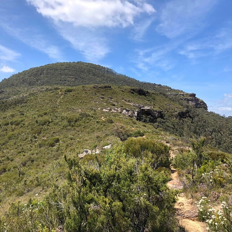
The first track follows the cliff edge to the summit, while the second walking track follows the extension of Mount Banks Road.
This map shows those two walking trails:
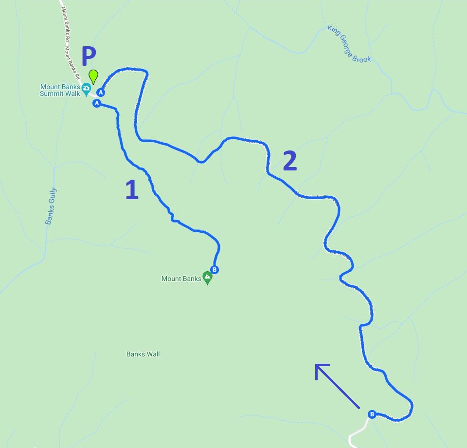
The first option is the shortest and most scenic walking track, but it is also quite steep. The views of the valley and the nearby mountain peaks are breathtaking.
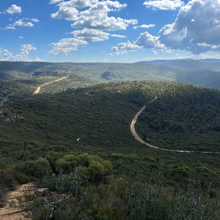
The second option is significantly longer and not as steep, but it doesn’t offer the best views. It’s mainly just the fire trail without the valley views.
We recommend doing the shorter walk because the views are phenomenal. Another, perhaps even better option is to combine the two trails and turn them into a (5 km) circuit walk.
The intersection of the two walking tracks is signposted just before the top of the mountain (see photo further below).
Also, note that the signpost at the car park may be a bit confusing.
If you’re going to do the shorter walking track to the summit, you will need to look for the path that starts behind the big rock with the plaque.
About Mt Banks
With an elevation of 1,049 metres, Mount Banks is an iconic mountain peak located within the Explorers Range of the Blue Mountains region along the northern escarpment of the Grose Valley.
Millions of years ago, large parts of what is now the Blue Mountains region were covered with volcanic lava flows, resulting in layers of basalt.
While erosion has removed most of these basalt layers, in some places, the basalt has remained.
Mount Banks is one of those peaks where the basalt is still present, creating a fertile soil that supports a rich vegetation different from other parts of the Blue Mountains. And that is why the mountain is populated with so many trees.
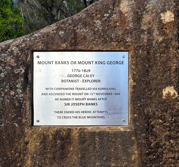
The mountain was named after Sir Joseph Banks by George Caley, an English botanist and explorer and the first European settler to reach the Mt Banks summit in 1804.
Joseph Banks was an English naturalist and botanist who employed George Caley as a botanical collector in New South Wales at the end of the 18th century.
The Summit
Reaching the top of Mount Banks may be a bit of a disillusion.
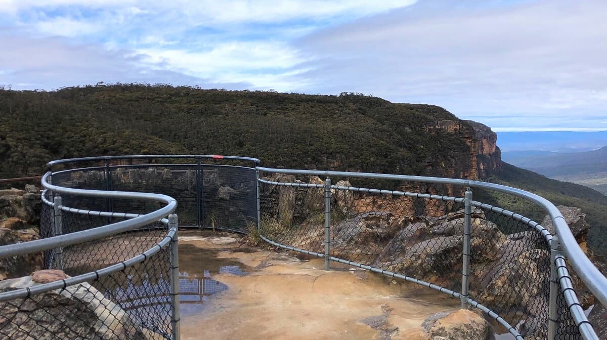
There are no 360-degree views as one would typically expect to enjoy on top of a mountain, such as at the Mount Kosciuszko summit.
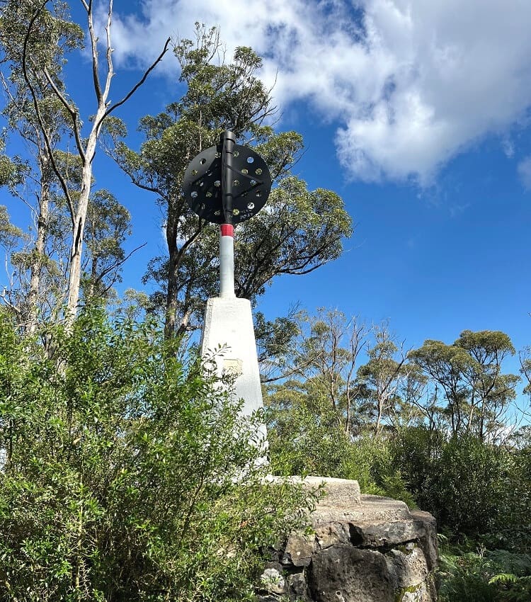
The top of Mt Banks is very different. It is covered with a tall, thriving forest of gum trees, with a triangulation station erected in the centre.
In other words, hiking to the summit of Mt Banks is about the achievement, not so much about any views from the top.
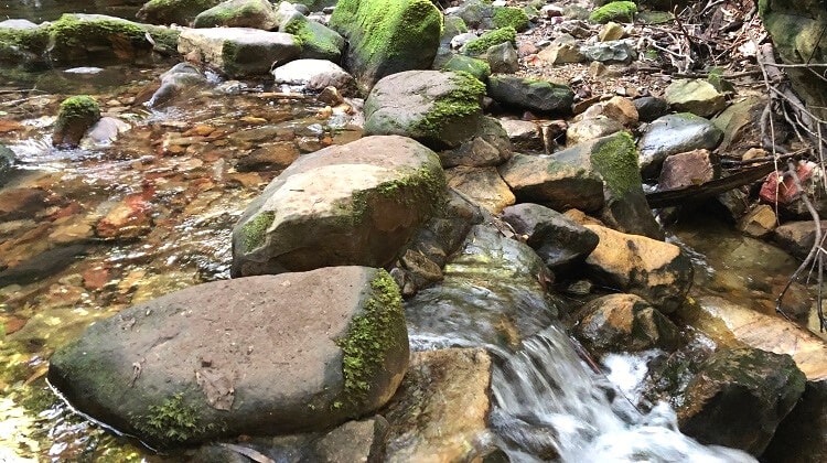
That said, the views from the path to the summit are stunning and show a side of the Blue Mountains where not many tourists go.
Wildlife also thrives at Mount Banks, with wombats, mountain goats and many different types of birds claiming this area as their home.
Once you’ve reached the summit, you can either retrace your steps to the car park via the same trail or make it a circuit walking track by returning via the second trail.
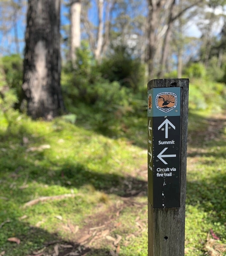
Look for the junction, like in the photo above, and follow the other trail back to the car park at the picnic area.
The hike to the summit of Mt Banks is one of the many things to do in this part of the Blue Mountains. Check out our guide to the Bells Line of Road for a complete list of hikes and sights nearby.
I walked the whole way.
Good effort!
Thanks for this article, it was very handy for my visit today. Yeah the summit of Mt Banks as such is not so amazing, but the walk is very challenging closer to the peak.
Thanks for sharing, Srini, and good to know you enjoyed the walk to the summit.