Last updated: February 26, 2024
The walk from Narrow Neck to Castle Head is a short bush trail that leads to a beautiful lookout with panoramic district views towards Mount Solitary.
This reasonably easy 4.5 km return walk starts from the Narrow Neck Plateau trail, which extends from Glenraphael Drive in the Katoomba area of the Blue Mountains.
| Narrow Neck to Castle Head Lookout | |
|---|---|
| Distance: | 4.5 km (return) |
| Time: | 2 hours |
| Grade: | Easy / moderate (mildly steep sections) |
| Dogs: | Not allowed |
Short video of the Castle Head Lookout:
How to Get There
Narrow Neck and Castle Head are located in the Katoomba area of the Blue Mountains, not too far away from Scenic World and Echo Point.
To get there, turn into Glenraphael Drive from Scenic Drive, and stay on this road until it arrives at a gate with a car park (see map location).
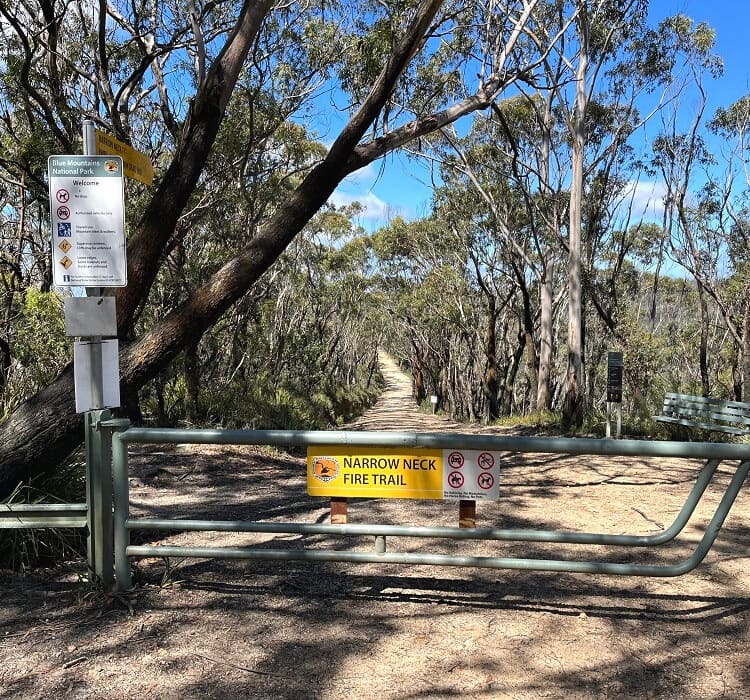
Note that this car park is located beyond the car park for the Golden Stairs and the walking track to Ruined Castle.
Glenraphael Drive is an unsealed road but is in good condition. The road is manageable by 2WD vehicles, but a 4WD vehicle is recommended after rainfall.
Map
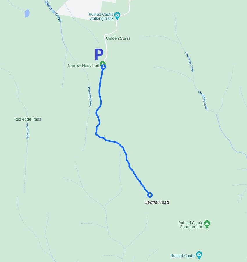
Below is a map of the walking track starting from the car parking area.
A: Narrow Neck Fire Trail car park
B: Castle Head Lookout
About the Narrow Neck Plateau
The Narrow Neck Plateau, also known as the Narrow Neck Peninsula, is a plateau southwest of Katoomba that divides the Megalong Valley and the Jamison Valley.
Glenraphael Drive runs on top of the Plateau and evolves into the Narrow Neck Plateau Trail, a management trail that leads all the way to the southernmost point of the peninsula.
This management trail is a popular hiking and cycle trail and offers beautiful views of an area of the Blue Mountains that is not so high-trafficked.
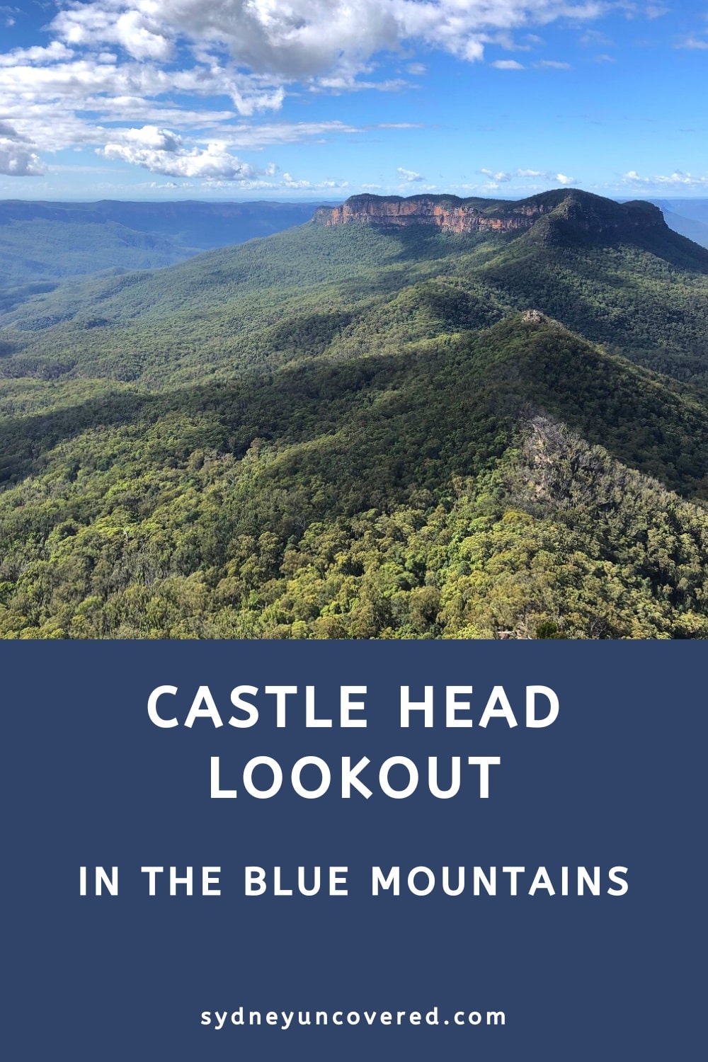
Castle Head is a small headland on the eastern side of the Narrow Neck Plateau, with a scenic lookout facing Mount Solitary and Ruined Castle.
And it’s that scenic lookout we’re going to explore below!
Castle Head Lookout Track Notes
The track to the Castle Head Lookout is relatively short (4.5 km return from the gate on the road), but there are a few mildly steep sections and various sections with a rough surface to conquer.
But overall, it’s not a challenging walk, and anyone with a reasonable fitness level should not have any issues completing the track.
Start of the Walk
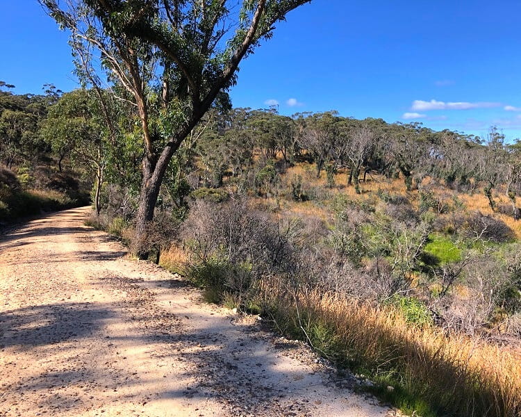
Once you’ve parked your car, make your way to the gate and start hiking southbound on the management trail, the Narrow Neck Plateau Trail.
After approximately 15 minutes, the trail arrives at an intersection with the Castle Head Track, where you need to turn left into the bush.
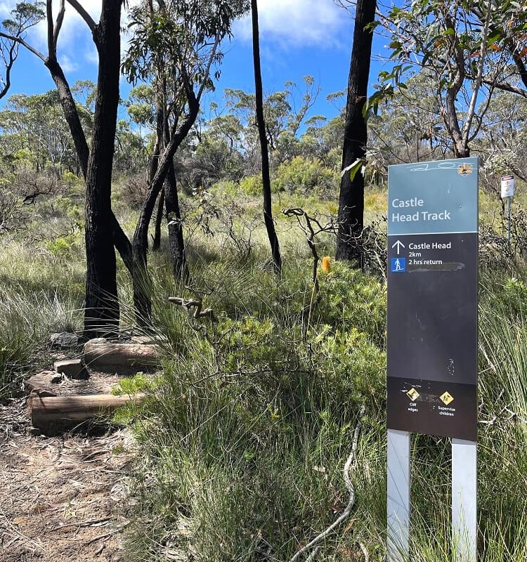
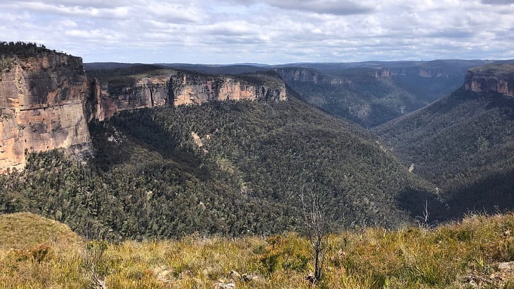
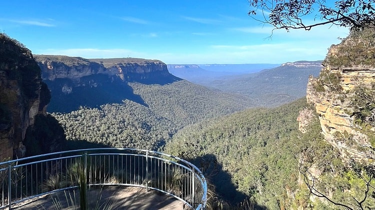
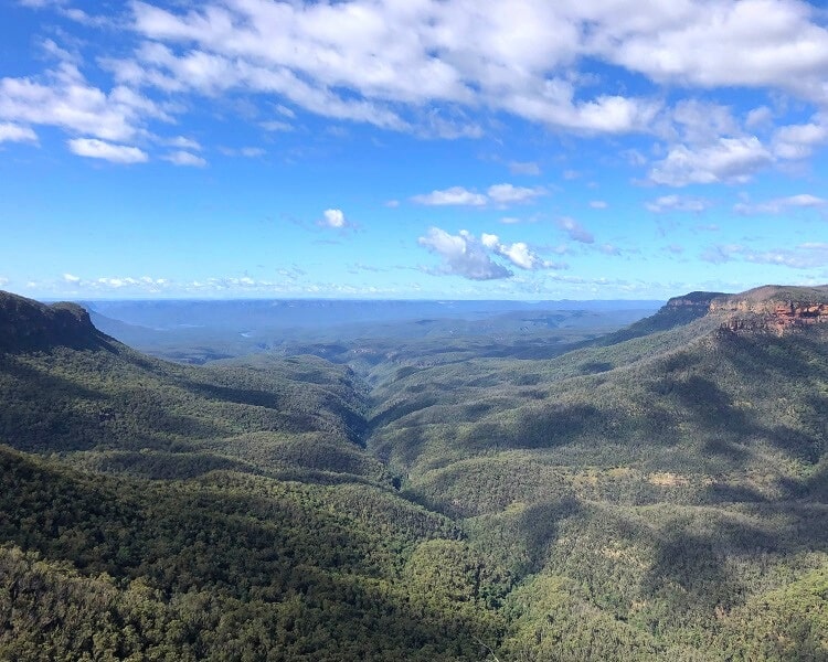
After a bit of climbing and descending, the track passes an unofficial lookout that offers superb views of the Jamison Valley.
On a clear day, you should be able to identify the Three Sisters and perhaps even the Kings Tableland plateau further east.
Trig Station
Just before the track arrives at the final destination, the Castle Head Lookout, it passes an old trig station, which marks the highest point of the headland.
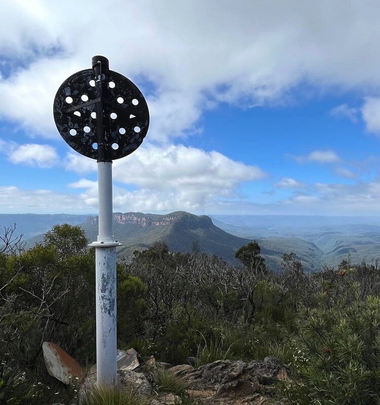
From this trig station, it’s only a short walk through a section of low-growing vegetation to reach the lookout.
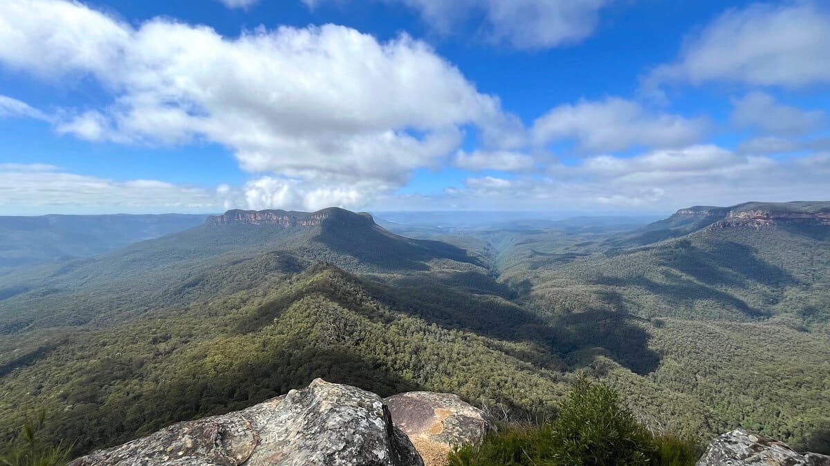
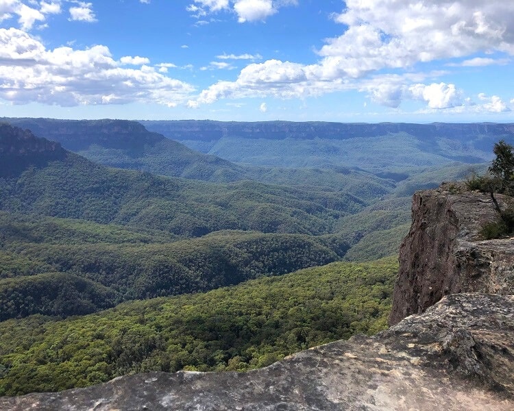
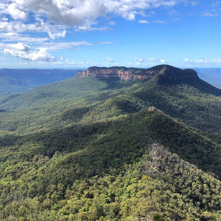
Castle Head Lookout
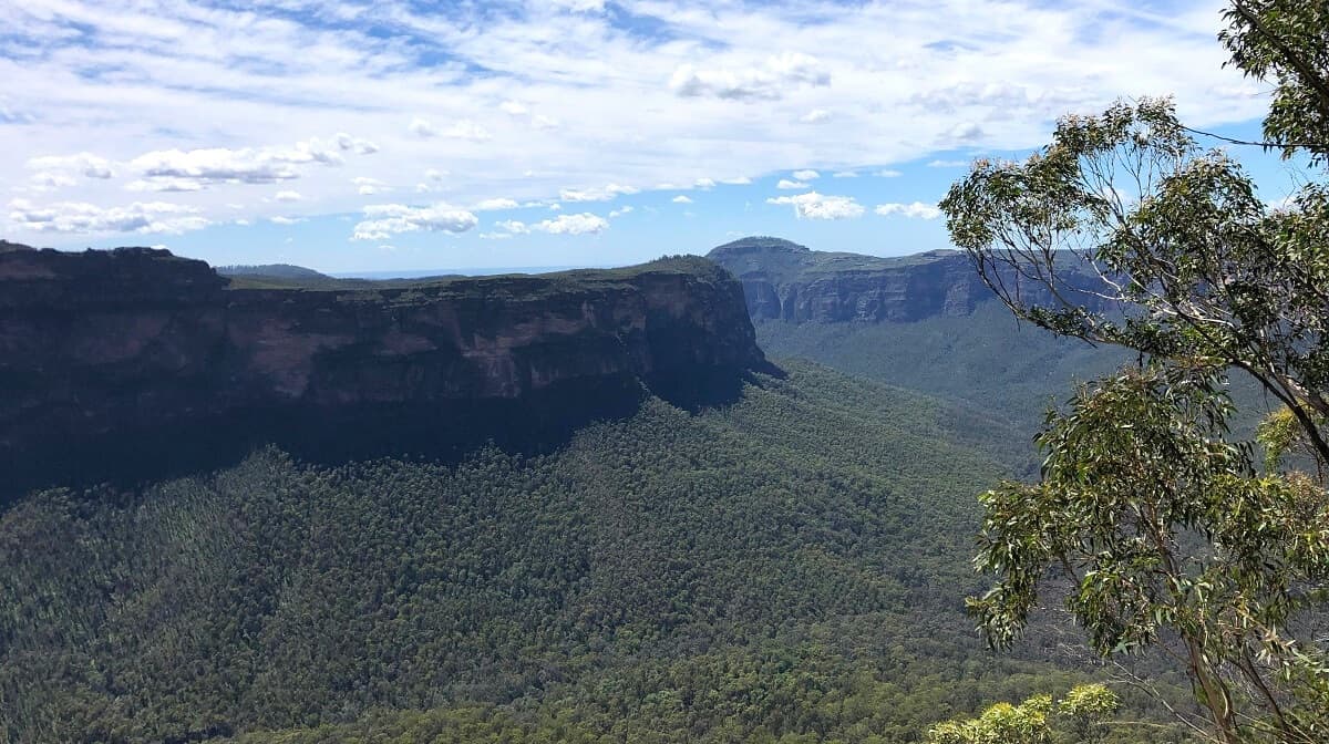
The views from the lookout are breathtaking, with various landmarks, mountains, and valleys visible on a clear day.
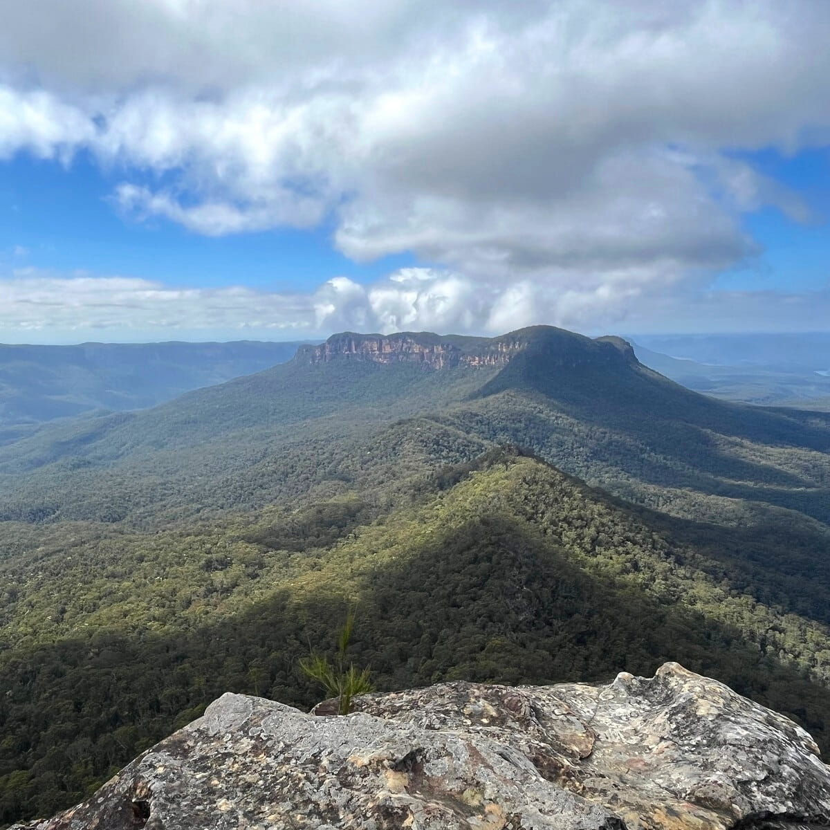
Straight ahead, you should be able to identify the Ruined Castle, with the imposing Mount Solitary behind it.
The valley on the left (east) is the Jamison Valley, and the Cedar Creek Valley (west) is located on the opposite side.
The Cedar Creek Valley is essentially located between Castle Head and the southern part of the Narrow Neck Peninsula.
On the other side of Narrow Neck is the Megalong Valley, which you can’t actually see from the Castle Head lookout.
Once you’ve finished admiring the views from Castle Head, retrace your steps to the management trail and the parking area.
More Hiking
If you have time and energy left, you could continue on the Narrow Neck management trail to the peninsula’s southernmost point. This isn’t a hard walk by any means, but with almost 10 km, it is quite long.
You can read more about this Narrow Neck walking trail on the NSW National Parks website.