Last updated: August 28, 2023
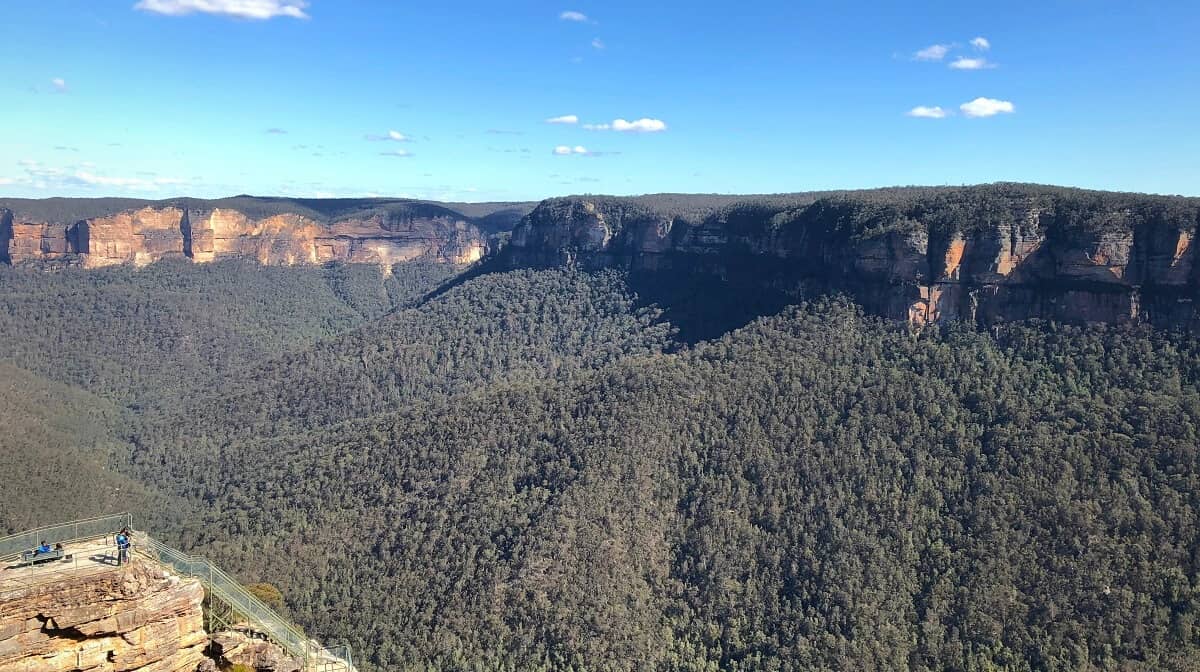
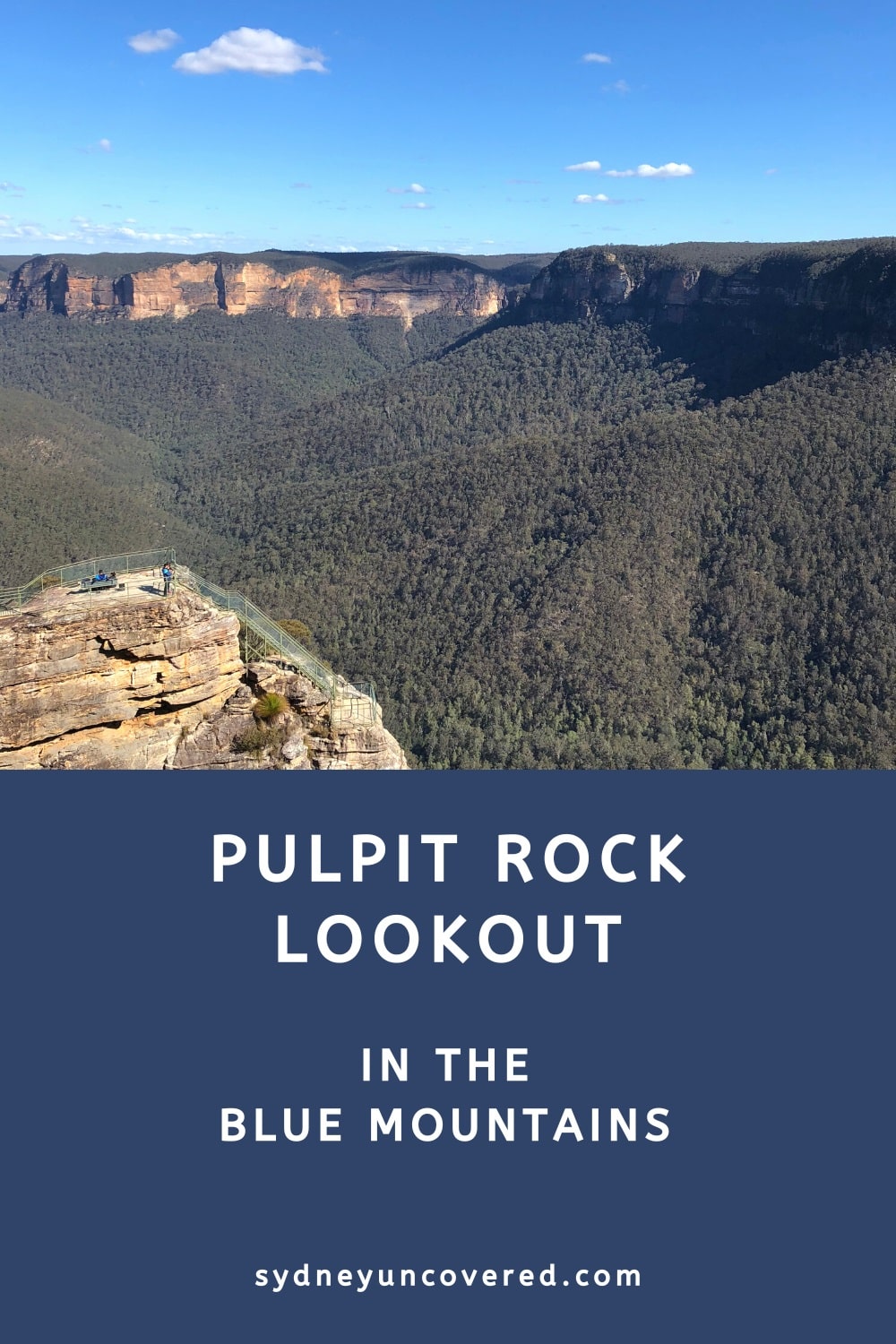
Pulpit Rock near Blackheath in the Blue Mountains is a large cliff edge with three lookout points spread across different levels. The lookouts are connected via a path with several sets of stairs.
An unsealed road and a short walking path will get you to the Pulpit Rock Lookout, offering panoramic views of the Grose Valley and beyond.
Keen to do some hiking nearby? The Pulpit Rock Track is an exciting bushwalk between the lookout and Govetts Leap. Read on to find out more!
Please note that Pulpit Rock Lookout is closed until further notice. The Pulpit Rock Track can be accessed from Govetts Leap but is only partly open. Check the NSW National Parks website for the latest updates.
A good alternative is Anvil Rock Lookout, which is only a short drive away from Pulpit Rock. It’s a quiet spot with fantastic valley views.
How to Get There
The Pulpit Rock Lookout is located near Blackheath in the Blue Mountains. From the Great Western Highway, turn into Hat Hill Road and follow the signs to the lookout.
Keep in mind that the last stretch is an unsealed road with a few challenging bumps, but it can easily be conquered with a regular 2WD vehicle.
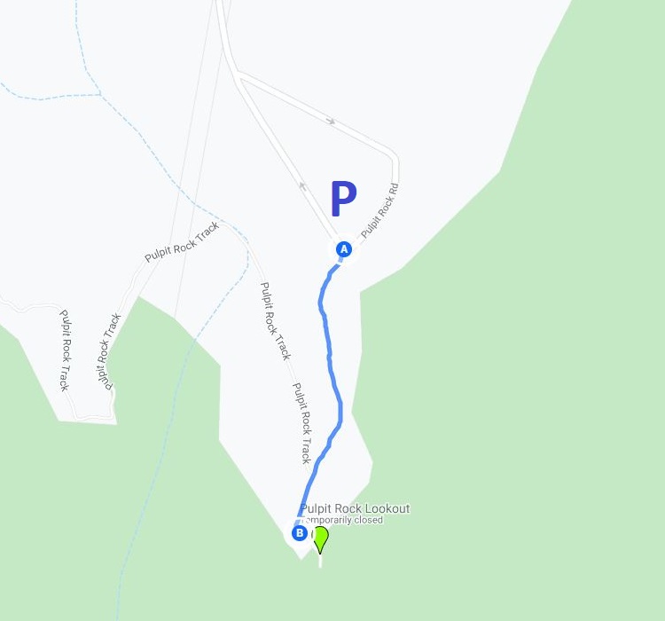
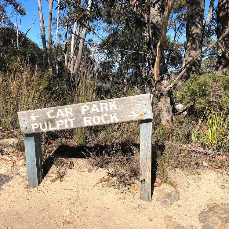
There is a small car park at the end of the road, but it does fill up quickly on busy days. From the car park, it’s an easy 15-minute walk to the lookout.
The official address of the Pulpit Rock Lookout (see map location):
Pulpit Rock Track
Blue Mountains NP NSW 2570
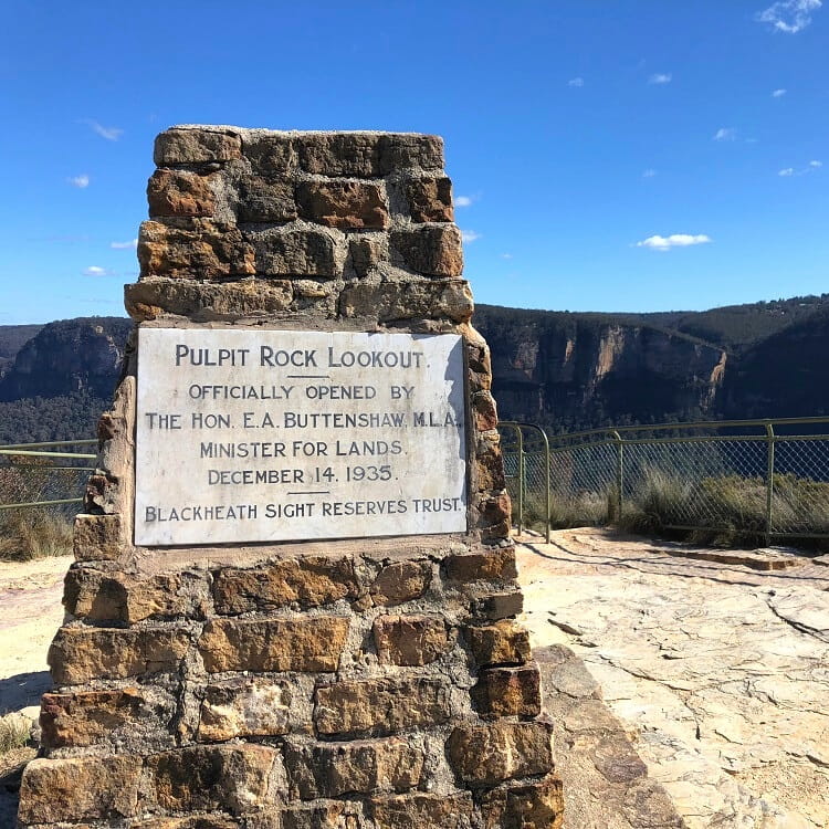
Pulpit Rock Lookout
The Pulpit Rock lookout was first opened to the public in 1935 by Ernest Buttenshaw, the Minister for Lands in the New South Wales government.
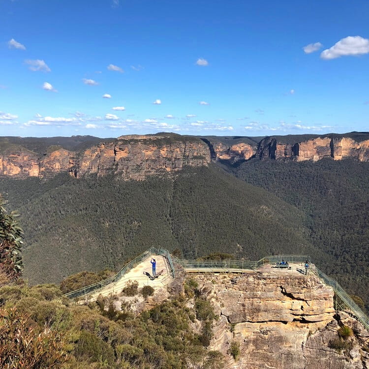
What’s great about Pulpit Rock is its multi-tiered lookout with several platforms on different levels.
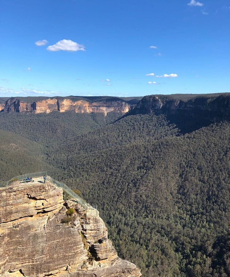
A walking path with stairs connects the platforms, so there is lots of space to move around and explore this beautiful spot.
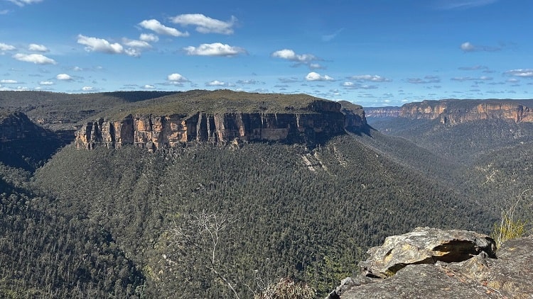
Each platform offers a different perspective of the Grose Valley, and all of them combined result in near 360-degree views of the surrounding scenery.
It’s not difficult to spend a few hours at Pulpit Rock to take in the panoramic views of the valley and mountain tops on the other side.
And without the big crowds, there is more opportunity to take in the views and practise those photography skills, especially at sunset or sunrise.
The best lookouts in the Blue Mountains.
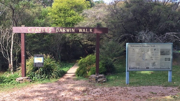
Pulpit Rock Track
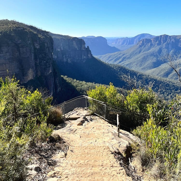
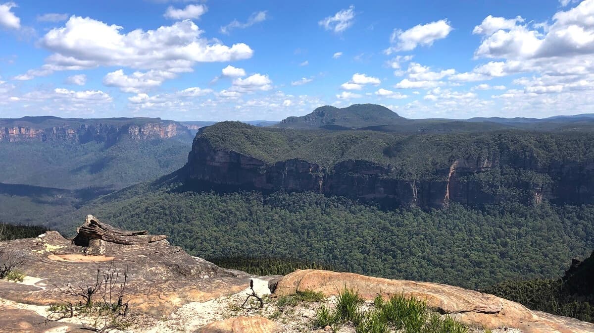
The Pulpit Rock walking track is a spectacular 3.5 km bushwalk between Pulpit Rock and Govetts Leap, following the edge of the cliff facing Grose Valley.
This track passes several lookout points, with each lookout offering different views of the valley and waterfalls in this part of the Blue Mountains.
Here is a map of this fantastic walk:
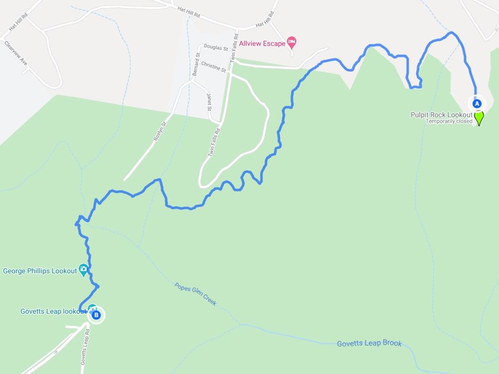
Closer towards Govetts Leap, the track intersects with the Popes Glen Track, which follows the Popes Glen Creek back into Blackheath.
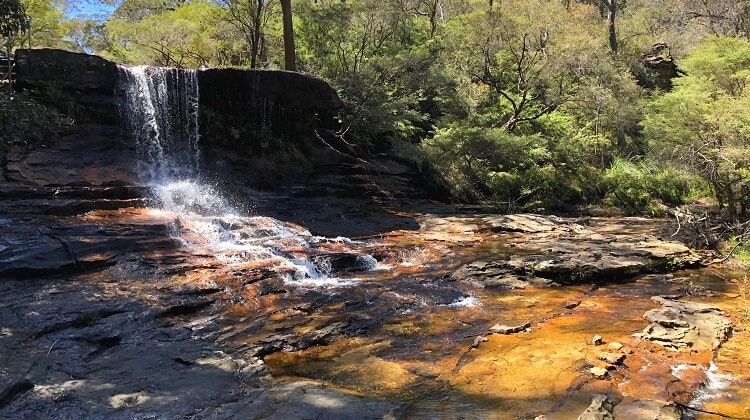
From Govetts Leap, it’s possible to extend this bushwalk adventure by heading to the Evans Lookout via the Cliff Top walking track.
This walking track passes the top of the Govetts Leap waterfall and the Barrow Lookout, from where you can see the waterfall from close by.
| Pulpit Rock Track | |
|---|---|
| Distance: | 3.5 km (one way) |
| Time: | 2 hours |
| Grade: | Moderate (some steep sections) |
| Dogs: | Not allowed |
Hi, was wondering if you know if pulpit rock lookout is accessible, says online that the lookout is closed due to bushfire damage?
Hi Ari, yes that is correct, Pulpit Rock Lookout is still closed. We’re about to update this article.
Govetts Leap Lookout, Anvil Rock, and Perrys Lookdown, which are all nearby, are open, if you haven’t been there yet.