Last updated: February 3, 2024
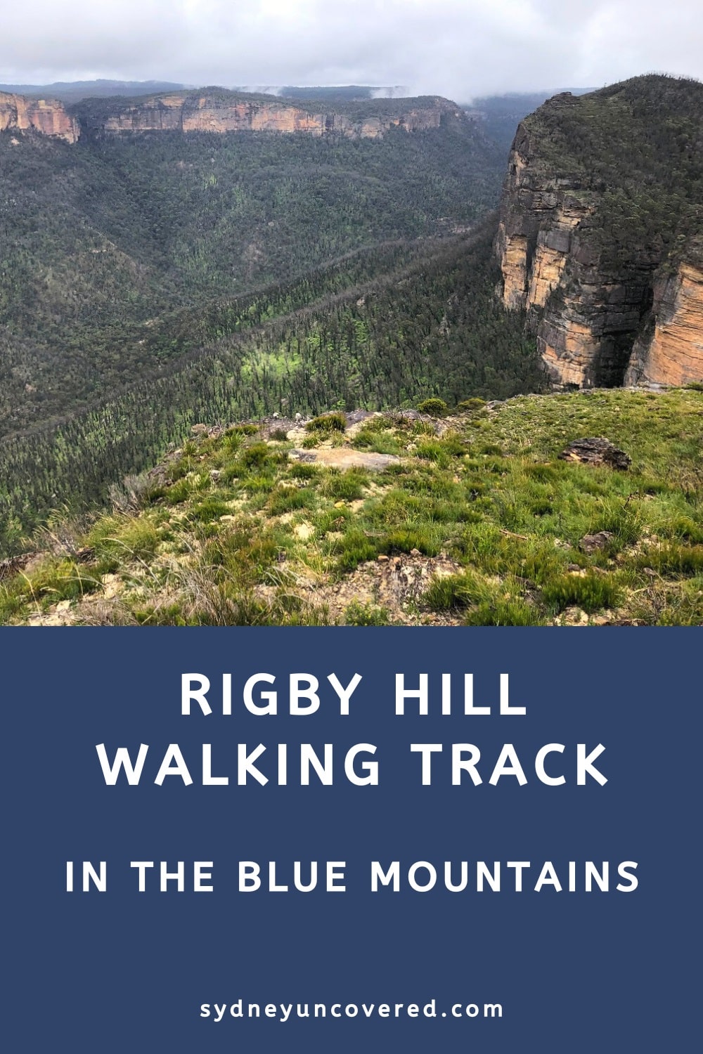
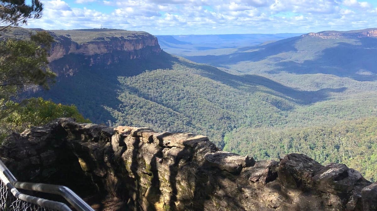
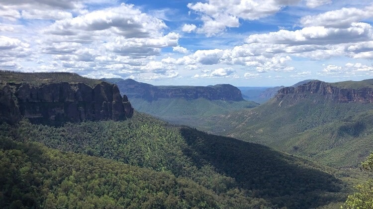
The Rigby Hill Track is a short but scenic trail in the Bells Line of Rd area of the Blue Mountains, offering beautiful Grose Valley views.
This 1.2 km return trail leads to a hill on top of a sandstone escarpment from where visitors can soak in panoramic views of the valley and the surrounding cliff walls.
| Rigby Hill Walking Track | |
|---|---|
| Distance: | 1.2 km (return) |
| Duration: | 1 hour (including stops) |
| Grade: | Easy / moderate (uneven surfaces) |
| Dogs: | Not allowed |
How to Get There
From the Bells Line of Road, turn into Pierces Pass Road at the large “Pierces Pass Picnic Area” signpost.
Pierces Pass Rd is located approximately 1.5 km west of Mount Banks Road and 2.5 km southeast of Mount Wilson Road (see map location).
Stay on Pierces Pass Rd until the very end, where you will find a small car parking area. This is an unsealed road, but driving with a 2WD vehicle is manageable. However, after rain, it’s recommended to use a 4WD vehicle.
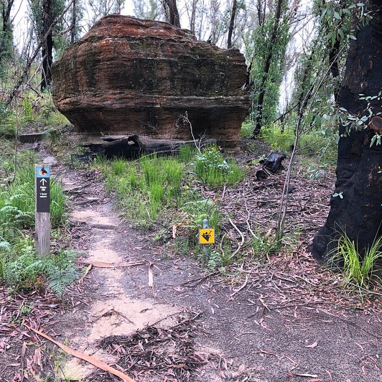
You will find the starting point of the walking track to Rigby Hill at the parking area. This is also the starting point of the challenging Pierces Pass, which descends into the Grose Valley.
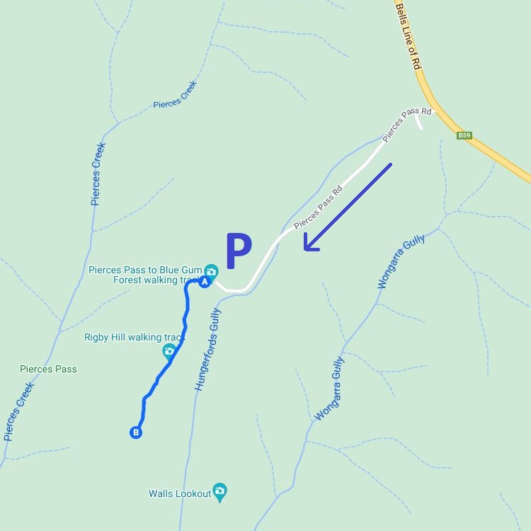
Map
Here is a map of the Rigby Hill Walking Track, including Bells Line of Rd, Pierces Pass Rd, and the parking area:
Rigby Hill Track Notes
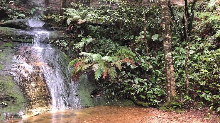
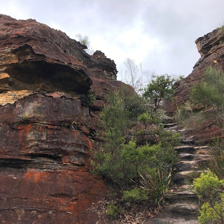
The short hike up to Rigby Hill is a fun walk through fantastic scenery. The track is a bit rough at times, with a few steep sections, but overall, it’s a relatively easy walk.
Good walking shoes are recommended, as the walking path can be a bit challenging in certain sections. The return walk can easily be completed within one hour, including time spent enjoying the views.
You will find the starting point of the Rigby Hill walking track at the parking area at the end of Pierces Pass Rd.
It’s a small parking area that fills up quickly on the weekends because the popular Pierces Pass also starts from there. You can try parking a bit further up the road if the parking area is at capacity.
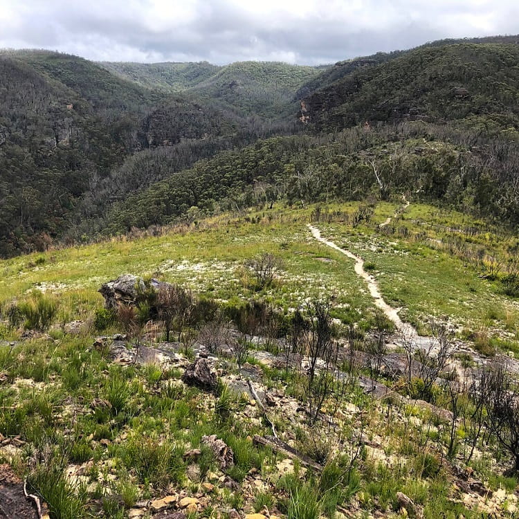
The walking track is very easy to follow, from start to finish.
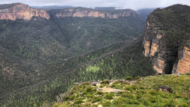
The first part of the walk is mostly uphill through bushland, followed by a section through open scenery with beautiful district views.
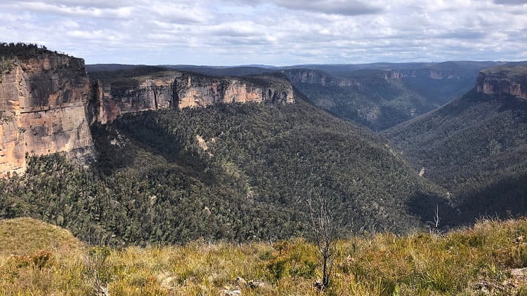
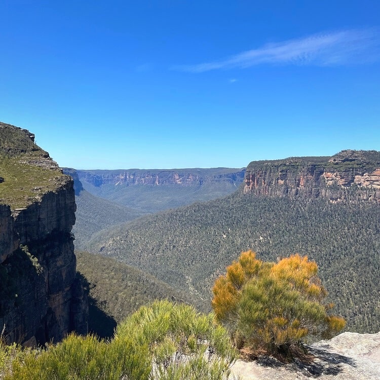
Once you reach the end of the walk, on top of Rigby Hill, the views of the Grose Valley are absolutely breathtaking.
This is still a bit of an undiscovered area in the Blue Mountains, where you won’t find too many tourists around.
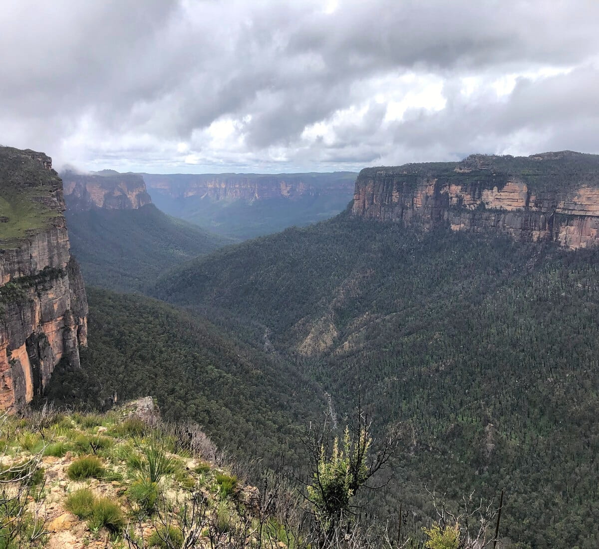
Please be mindful though that this is not a paved walking track, nor is there any fencing around the cliff edges.
This means visitors must be careful when exploring the escarpment, especially when walking closer to the cliff edges facing the valley.
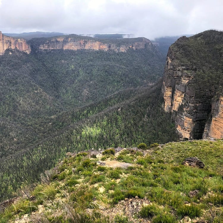
For a bit of perspective, the Blackheath area is located on the opposite side of the Grose Valley, with Perrys Lookdown towards the left (east), and the Baltzer Lookout and Hanging Rock towards the right (west).
Further away, looking towards the east, you might be able to identify Mount Banks and Du Faur Head.
Nearby Walks and Lookouts
If you’d like to do more exploring in this beautiful part of the Blue Mountains, there are a few great walking tracks nearby to consider.
1. Pierces Pass
The Pierces Pass is a challenging walking track along the Grose River to the Blue Gum Forest in the Grose Valley. The start of this track is the same as the start of the Rigby Hill walking track, so you can’t miss it.
Read more about the Pierces Pass.
2. Walls Lookout Walking Track
The walking track to the Walls Lookout is located next door to the Rigby Hill walking track, a similar walk with fantastic views, but slightly longer.
You can find the starting point of this enjoyable walking track at the parking area located at the start of Pierces Pass Rd.
Read more about the Walls Lookout walking track.
3. Mount Banks Summit Walk
The hike up to Mount Banks is a moderately challenging walking track to the summit of one of the most iconic mountain peaks in the Blue Mountains.
The summit walk starts at the Mount Banks picnic area, which can be accessed via Mount Banks Rd, approximately 1.5 km east of Pierces Pass Rd.
Read more about the Mount Banks summit walk.
The best hikes in the Blue Mountains.