Last updated: February 16, 2024
The 5.5 km return walk from Seaforth Oval to Bluff Lookout is a challenging bush trail in Garigal National Park with fantastic views of Bantry Bay.
It’s an exciting hike with a few climbs and sections with a rough surface to conquer, but the views from the lookout make it a worthwhile adventure.
Check out our guide to the best bushwalks in Sydney for more exciting walking tracks like this one.
| Seaforth Oval to Bluff Lookout | |
|---|---|
| Distance: | 5.5 km (return) |
| Duration: | 3 hours |
| Grade: | Moderate / hard (steep sections, rough surface) |
| Dogs: | Not allowed |
How to Get There
The walking track to the Bluff Lookout starts from the Seaforth Oval, which has a reasonably sized car park (see map location).
The oval is located at the southern end of Wakehurst Parkway in Seaforth. If you’re driving via Spit Rd, turn left into Sydney Rd after crossing the Spit Bridge, and follow Frenchs Forest Rd until you reach Wakehurst Pkwy.
There is also a bus stop on Wakehurst Parkway next to the oval, which makes public transport a good option. Check the NSW trip planner website for current bus timetables.
Shorter Access Trail
If you only want to visit the Bluff Lookout and aren’t interested in doing the walk from the Seaforth Oval, you can also get there very quickly from Ararat Reserve in Frenchs Forest (see map location).
Park your car on Bantry Bay Road and follow the very short and easy Bluff Trail to the lookout.
Map
Here is a map of the walk from Seaforth Oval to Bluff Lookout:
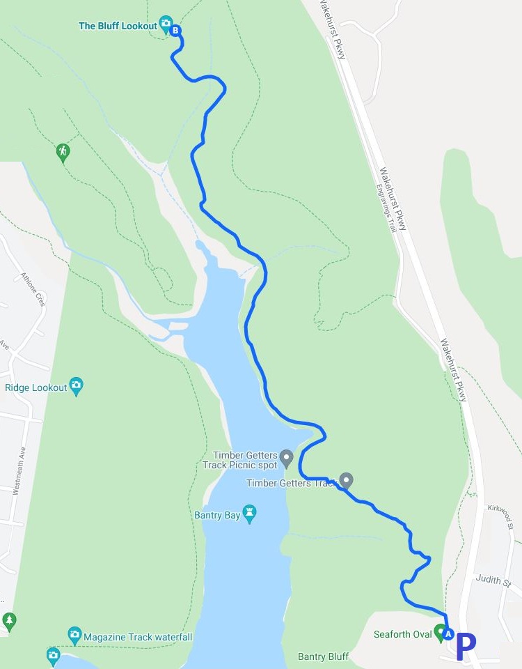
Seaforth Oval to Bluff Lookout Track Notes
We rate the walking track from Seaforth Oval to Bluff Lookout as moderate to hard. Even though it’s reasonably short, there are steep sections, and the surface can sometimes be rough and muddy.
It’s recommended to wear proper hiking shoes and to bring a bottle of water and perhaps a snack with you.
1. Timber Getters Track
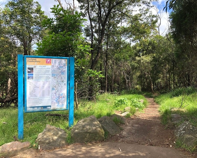
The start of the walking track can be found next to the information boards at the northern end of the Seaforth Oval car park.
From there, the trail heads straight into the bush and soon arrives at the Timber Getters Track and Engraving Track intersection.
This is where you need to turn left to continue the main walking trail via the Timber Getters Track through pleasant bushland scenery.
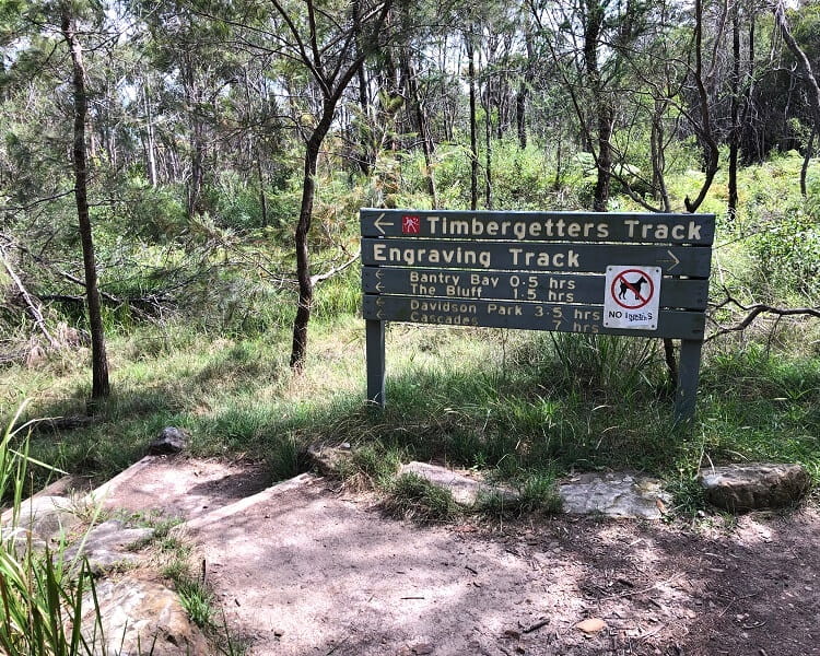
This section of the walk is quite easy as it goes downhill for the most part, heading towards Bantry Bay.
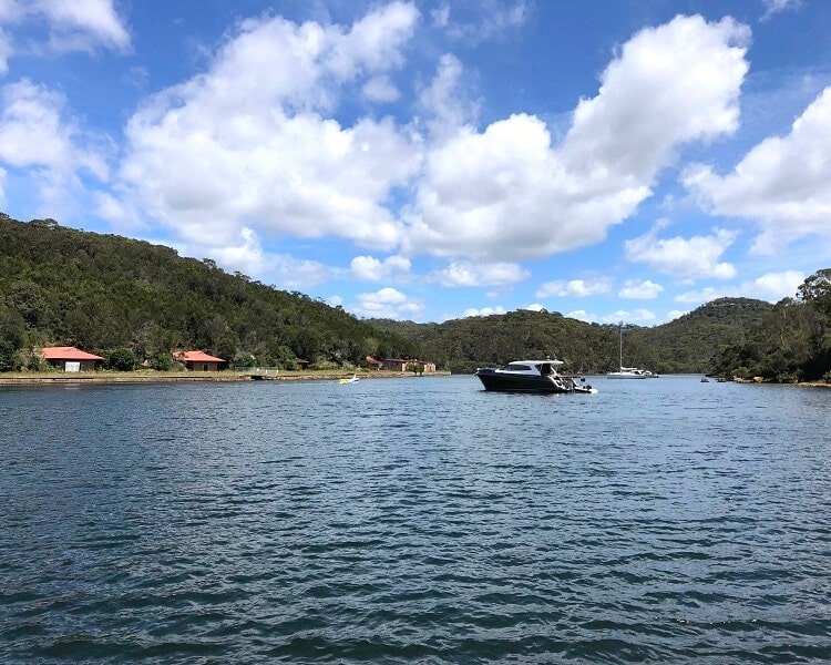
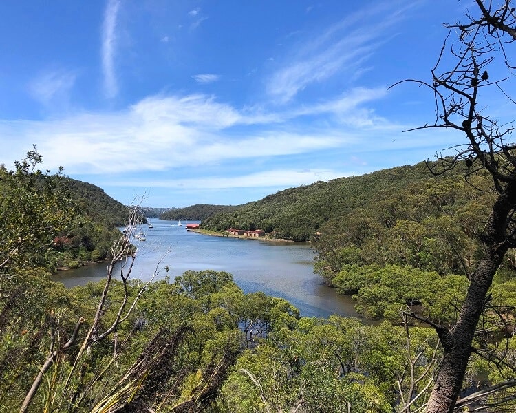
2. Bantry Bay
The Timber Getters Track arrives at the Bantry Bay Picnic Area, which is home to a picnic table, an open grassy area, lots of trees, and a public wharf.
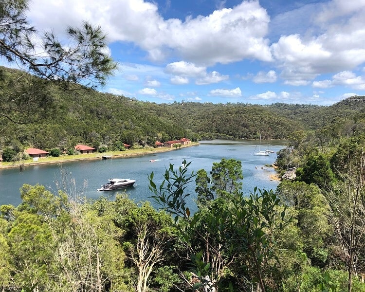
It’s worth walking onto the wharf because the views of Bantry Bay from there are very pretty.
The buildings on the opposite side of the bay were once part of the Bantry Bay Explosives Depot, and were used to store military explosives until 1974.
3. The Bay Track
From the picnic area, continue on the main walking trail via the Bay Track, which follows the eastern shoreline of the bay.
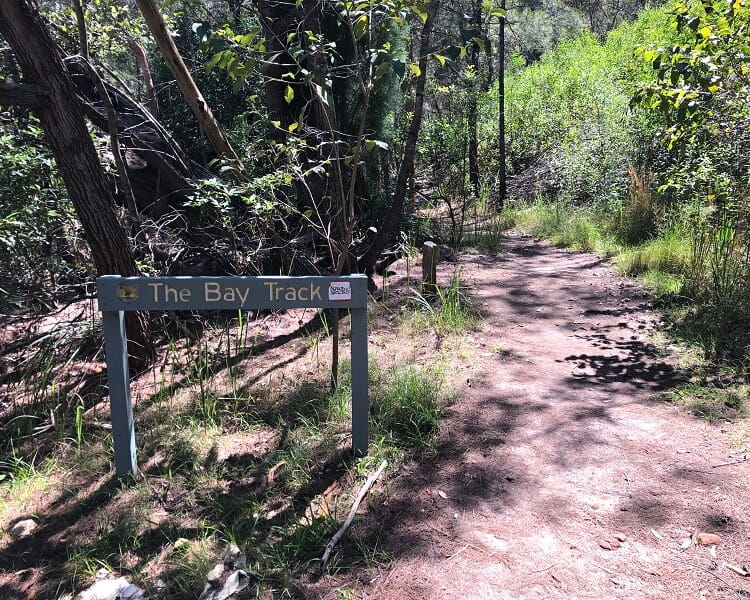
This is the most enjoyable part of the walk, as you get to take in beautiful views of the bay from different angles.
Towards the northern end of the bay, the track gets a lot more challenging with steep sections, a bit of rock scrambling, and a couple of creek crossings.
4. The Bluff Lookout
The last section of the walk to the Bluff Lookout is the steepest part and feels much longer than it is.
As you make your way up to the official lookout, take a few moments of rest to allow yourself to soak in the bay views that keep getting better the higher up you get.
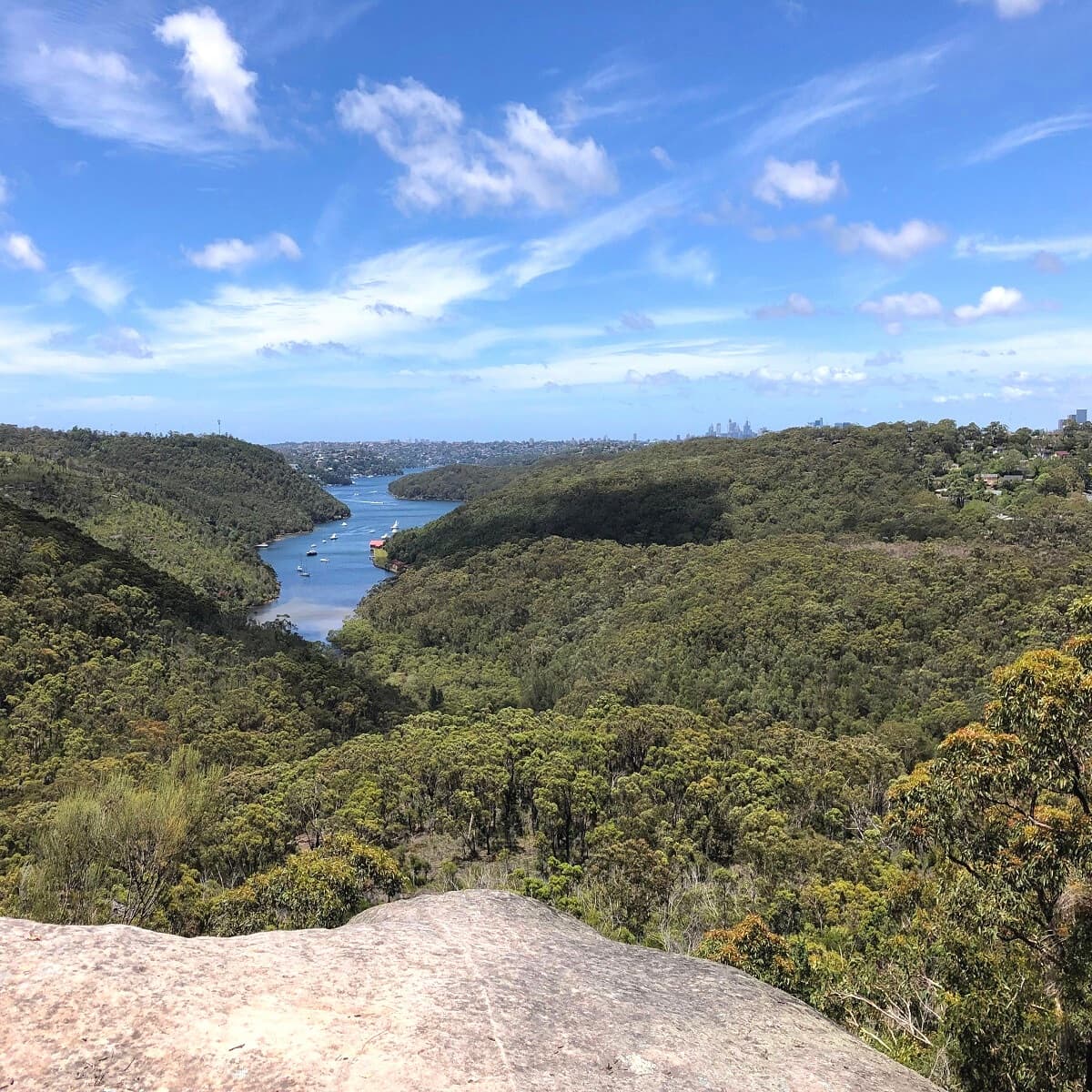
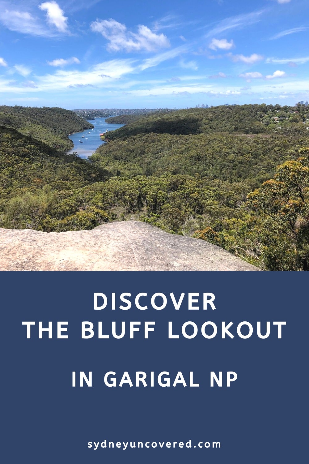
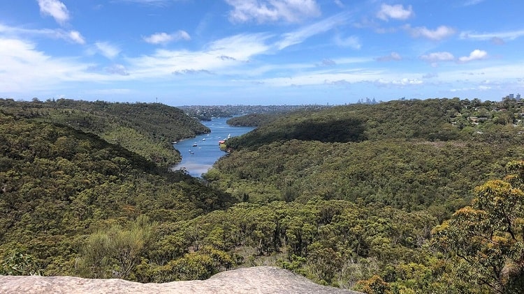
The Bluff Lookout is an unfenced rocky area that offers fantastic views towards Middle Harbour and the city skyline. On a clear day, you may even be able to identify some of Sydney’s iconic skyscrapers.
There is lots of space at the lookout to settle in and take in the views or to even have a picnic.
Back to Seaforth Oval
Once you’ve finished exploring the Bluff Lookout, you have three options to get back to the Seaforth Oval.
1. Return the same way:
The most obvious thing to do is to simply retrace your steps via the same walking track.
2. Return via the Engravings Track:
The Engravings Track is an easy trail that runs parallel to Wakehurst Pkwy. The distance is about the same, but it’s much easier with no climbing.
To get there, follow the Bluff Trail to Ararat Reserve, and make your way to the start of the Engravings Track via Bantry Bay Rd.
3. Return via the Gahnia Mountain Bike Track:
The third option is to return via the Gahnia Mountain Bike Track, which connects with the Engravings Track.
The start of this track is just beyond the Bluff Lookout and is very clearly signposted.