Last updated: October 31, 2023
One of the most beautiful National Parks in the Greater Sydney area is located in the city’s backyard: the famous Sydney Harbour.
Many Sydney-siders as well as tourists visiting Australia’s most beautiful city, don’t always realise that the magnificent Harbour, including its islands, bays and foreshore, is officially a National Park.
Sydney Harbour National Park was established in 1975 to protect islands, landforms and foreshore areas that exist in the harbour, primarily east of the Harbour Bridge.
Home to a great variety of bushwalking tracks, picnic areas, secluded beaches, vantage points and historic sites, Sydney Harbour has something for everyone. Keep reading, as we reveal the eight best Sydney Harbour walks.
Top 8 Sydney Harbour Walks:
| Walk | Distance | |
|---|---|---|
| 1 | Rushcutters Bay to Rose Bay | 5.5 km (one way) |
| 2 | Rose Bay to Watsons Bay | 8 km (one way) |
| 3 | Watsons Bay Circuit Walk | 4.5 km (circuit) |
| 4 | Anzac Bridge to Woolloomooloo | 12 km (one way) |
| 5 | Spit Bridge to Manly | 10 km (one way) |
| 6 | North Head Walk | 9.5 km (circuit) |
| 7 | Taronga Zoo to Balmoral Beach | 6.5 km (one way) |
| 8 | Cremorne Point Circuit Walk | 3 km (circuit) |
Top 8 Sydney Harbour Walks
Some of the following walking tracks are quite challenging, while others are much easier and suitable for all ages and fitness levels.
1. Rushcutters Bay to Rose Bay
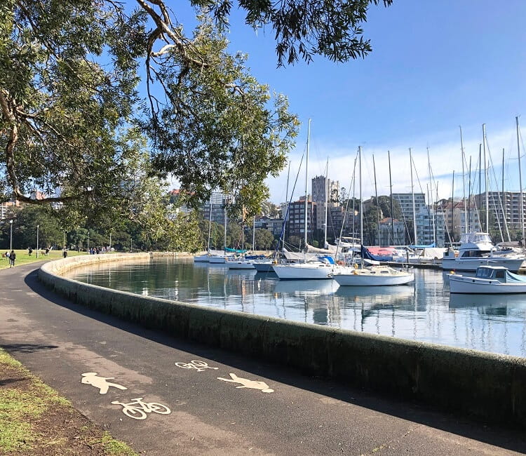
The scenic Harbour foreshore trail between Rushcutters Bay and Rose Bay is a 5.5 km long adventure with endless photo opportunities.
This walk includes various beautiful parks and marinas, offering incredible views of the Harbour as well as the city skyline.
The track officially starts at Rushcutters Bay Park and continues to Double Bay via Yarranabbe Park and McKell Park. The second part of the walk explores Point Piper, before finishing at Rose Bay.
There are various cafes and restaurants to find along the way, which makes this walking track an enjoyable day out and about in Sydney.
| Rushcutters Bay to Rose Bay | |
|---|---|
| Distance: | 5.5 km (one way) |
| Duration: | 3 hours (depending on stops) |
| Grade: | Easy |
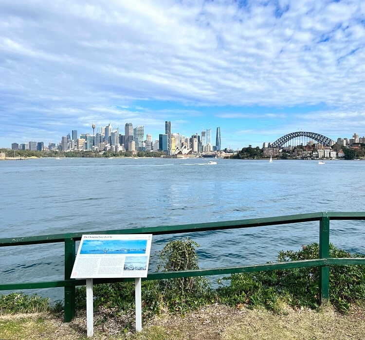
2. Rose Bay to Watsons Bay
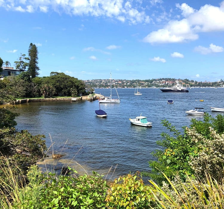
One of the most scenic walking trails in Sydney is the 8 km coastal track that guides hikers from Rose Bay to Watsons Bay in Sydney’s eastern suburbs.
This relatively easy walk takes in some of Sydney’s finest secluded beaches, in addition to beautiful parks and picturesque bays. The panoramic views of the city skyline and the Sydney Harbour will make you want to do this walking track more than once.
Part of this walking trail is the shorter Hermitage Foreshore track between Bayview Hill Rd just north of Rose Bay and Nielsen Park in Vaucluse.
| Rose Bay to Watsons Bay | |
|---|---|
| Distance: | 8 km (one way) |
| Duration: | 3 – 4 hours |
| Grade: | Easy / moderate |
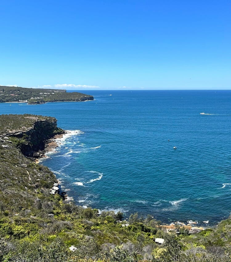
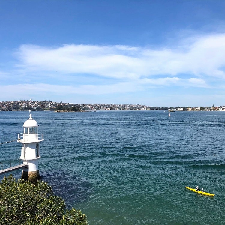
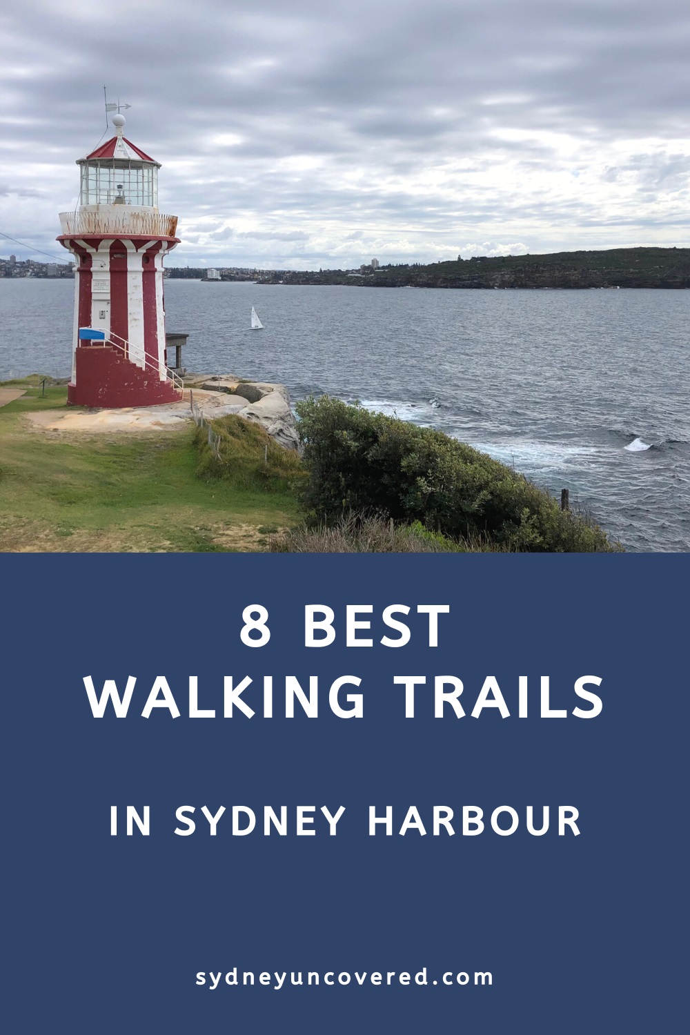
3. Watsons Bay Circuit Walk
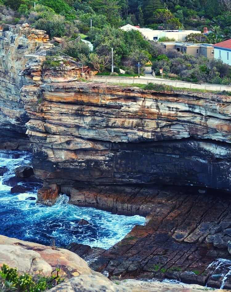
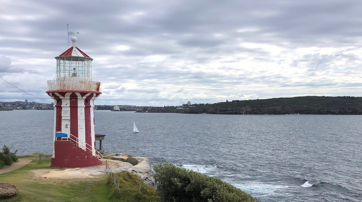
The Watsons Bay circuit walk is a scenic hike around South Head, featuring beautiful views of Sydney Harbour, the city skyline, North Head and the historic Hornby Lighthouse.
One of the highlights is Camp Cove, the location where Governor Arthur Phillip first set foot in Port Jackson (the old name for Sydney Harbour) in 1788. It is now a sheltered bay with a quiet north-facing beach.
Another must-see highlight is the Hornby Lighthouse, a characteristic red and white striped tower built in 1858. The views from this spot are excellent, with the Pacific Ocean to the east, Sydney Harbour to the west and North Head right in front of you.
Parking in Watsons Bay is challenging during weekends, so it’s best to use public transport. The best way to get to Watsons Bay is by ferry departing from Circular Quay, which is one of Sydney’s best ferry trips.
| Watsons Bay Circuit Walk | |
|---|---|
| Distance: | 4.5 km (circuit) |
| Duration: | 2 hours |
| Grade: | Easy |
4. Anzac Bridge to Woolloomooloo
The fantastic walking trail between the Anzac Bridge in Pyrmont and Woolloomooloo on the other side of the CBD is one of Sydney’s newest Harbour walks.
This walk was officially opened in 2021 as a continuous walking path, following the completion of the Barangaroo foreshore walk, which runs between South Barangaroo and the northern tip of Barangaroo Reserve.
The trail between Anzac Bridge and Woolloomooloo is a great way to see the best of Sydney Harbour and the city, passing many famous Sydney landmarks with beautiful Harbour views as a bonus.
| Anzac Bridge to Woolloomooloo | |
|---|---|
| Distance: | 12 km (one way) |
| Duration: | 4 – 5 hours |
| Grade: | Moderate |
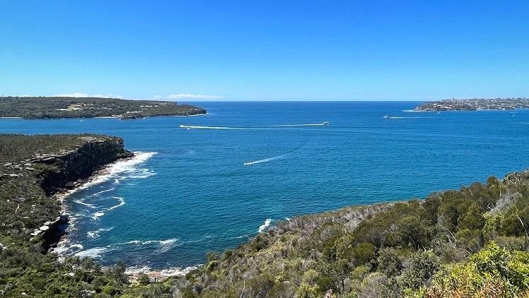
5. Spit Bridge to Manly
The Spit Bridge to Manly walk is a beautiful 10 km hiking trail, featuring scenic bushland, quiet inner harbour beaches, picturesque bays and panoramic ocean views.
The walk forms part of the 20 km long Manly Scenic Walkway that runs from the Spit Bridge to Manly North Head (see below).
The official starting point of the Spit to Manly walk is at the northern end of the historic Spit Bridge, which carries Spit Road across Sydney’s Middle Harbour. From there, the track follows the shoreline of Clontarf Reserve, Dobroyd Head and North Harbour Reserve to Manly Cove.
With beautiful scenery from start to finish, the Spit to Manly walk is one of Sydney’s finest and most popular Harbour walking tracks.
| Spit Bridge to Manly | |
|---|---|
| Distance: | 10 km (one way) |
| Duration: | 4 – 5 hours |
| Grade: | Moderate |
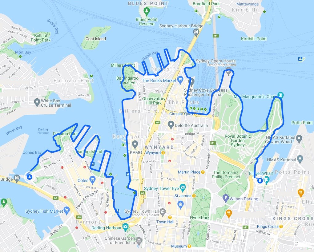
6. North Head Walk
The North Head Walk in Manly is one of Sydney’s most enjoyable hikes, with lots of history, panoramic views, and scenic beaches to take in.
What’s great about this outdoor adventure is that it is both a coastal and bush walk. And while it may be quite a long walking track, it is suitable for all ages and fitness levels.
This circuit walk will take you past Shelly Beach, Spring Cove and Little Manly Reserve while enjoying impressive views from North Head. Not only will you be going through an area with diverse wildlife and flora, but you can also experience some of Sydney’s rich military history.
| North Head Walk | |
|---|---|
| Distance: | 9.5 km (circuit) |
| Duration: | 3-5 hours |
| Grade: | Moderate |
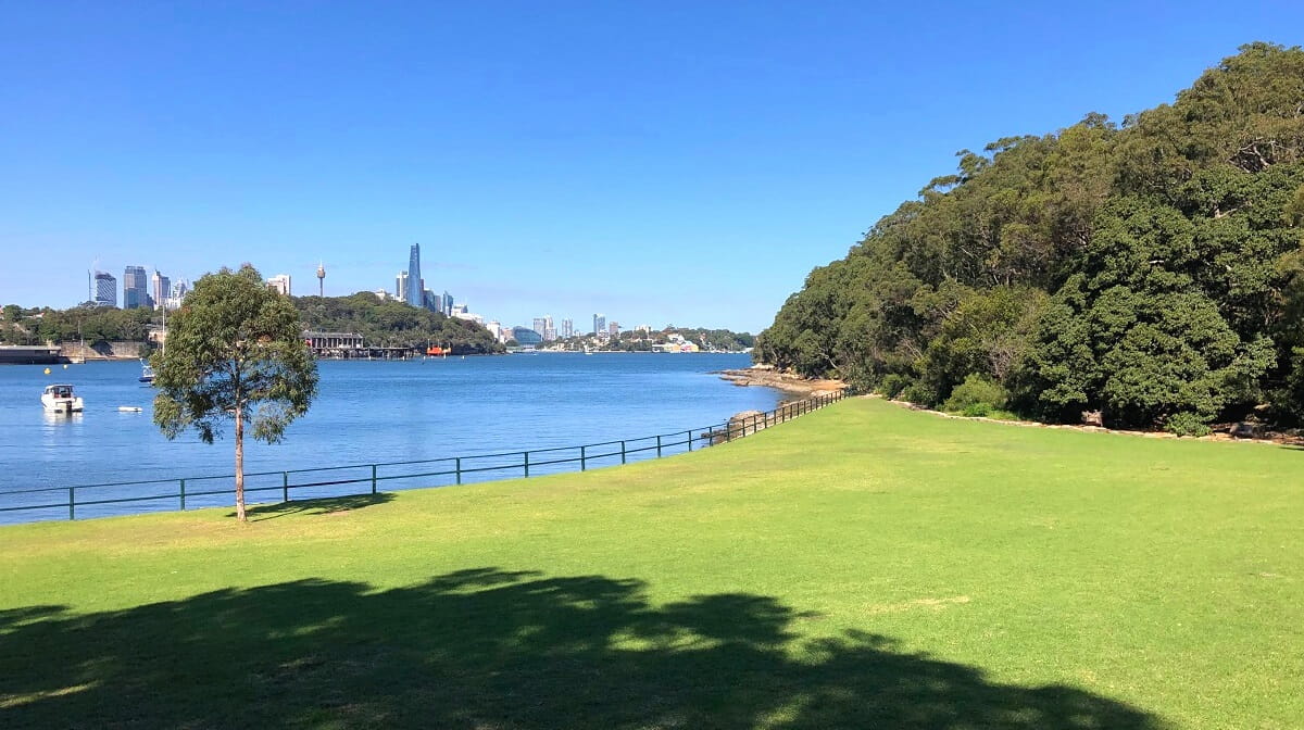
7. Taronga Zoo to Balmoral Beach
The 6.5 km long trail between Taronga Zoo and Balmoral Beach swirls its way past secluded beaches, picturesque bays, impressive lookouts and historic sites.
The track can roughly be divided into three sections, with Bradleys Head, Chowder Bay and Balmoral Beach as the key milestones. The starting point of the track is on Athol Road, moments away from the Taronga Zoo ferry wharf.
One of the many highlights along this walking track is the Georges Head Lookout, which offers amazing views of Sydney Harbour, with North Head and South Head right in front of you and the Sydney skyline in the west.
The track ends at the playing fields and large car park behind Balmoral Beach, one of Sydney’s most popular family-oriented beaches. Balmoral usually has calm waters, which makes it perfect for swimming.
| Taronga Zoo to Balmoral Beach | |
|---|---|
| Distance: | 6.5 km (one way) |
| Duration: | 2 – 3 hours |
| Grade: | Easy / moderate |
8. Cremorne Point Circuit Walk
The Cremorne Point walk is an easy 3 km foreshore circuit trail in Sydney Harbour National Park with beautiful views across Mosman Bay, Sydney Harbour and the city skyline.
Discover Robertsons Point Lighthouse, Cremorne Reserve and the MacCallum swimming pool, as you wander past picturesque gardens and impressive old mansions, only a short ferry trip away from Circular Quay.
Cremorne Point is a leafy harbourside suburb on the lower north shore, only 6 km from the Sydney CBD. It was named after Cremorne Gardens, a large amusement park where, in the 19th century, visitors could enjoy activities such as live music, archery, gymnastics and fireworks.
The circuit walk officially starts and ends at the Cremorne Point wharf, with a detour to the Robertons Point Lookout. Follow the 3 km trail clockwise (or anti-clockwise), and within 90 minutes, you’ll be back at the ferry wharf.
| Cremorne Point Circuit Walk | |
|---|---|
| Distance: | 3 km (circuit) |
| Duration: | 1 hour |
| Grade: | Easy |
One Sydney Harbour hike that doesn’t seem to get much publicity is Wollstonecraft Station to Milsons Point via Berry Island and Balls Head. Good track and signposting with spectacular inner harbour and bridge views. One of my favourite Sydney hikes.
Owen Ma
Thanks for sharing, Owen. You’re right, that is a beautiful walk indeed, and not so well-known. We’ve written about Berry Island and Balls Head here, but it’s good to know that there is an uninterrupted walking track from Wollsoncraft to Milsons Point!
Guys, I remember seeing you will be able to hike the harbor, 50k combined trails. I read the article in the SMH. Do you have any information of that proposal, which trails will be combined. Thanks much, love your trails links.
Bill Hansen, USA
Hi Bill, you’re most likely referring to the Bondi to Manly walk, which links existing Sydney coastal and harbourside tracks, a whopping 80km in total.
The walk is open for business right now, and is a fantastic adventure. We’ve linked to that walk further up in this article. Hope this helps!
Just want to send a thank you from myself and my Air Canada crew members who often frequent Sydney. The city is one of our favourite layovers – great weather, fantastic hikes, good food and the odd beer thrown in. Your website has provided fantastic motivation to get out and enjoy all of the surrounding hikes in the area. I must admit, the Spit Bridge to Manly hike is our fave – with a certain reward across from Manly Beach at the end of the grind. The perfect way to spend our time before the long trip home to Vancouver. Appreciate your website – thanks again!
Captain Gary Dean
Thanks so much for the kind words Gary! You’re right, the Spit to Manly walk is amazing and nothing beats a cold beer at the beach after all that hiking.