Last updated: November 5, 2022
The Valley of the Waters walking track is a moderately challenging hike in the Wentworth Falls area of the Blue Mountains that follows a creek into the valley.
This rather steep track is an absolute treat, taking in several beautiful waterfalls and cascades, including Empress Falls, Sylvia Falls and Lodore Falls.
For more fantastic hikes like this one, have a look at our list of best walks in the Blue Mountains for some great options.
| Valley of the Waters Track | |
|---|---|
| Distance: | 2.5 km (return) |
| Duration: | 1.5 hours |
| Grade: | Moderate / hard (steep) |
| Dogs: | Not allowed |
How to Get There
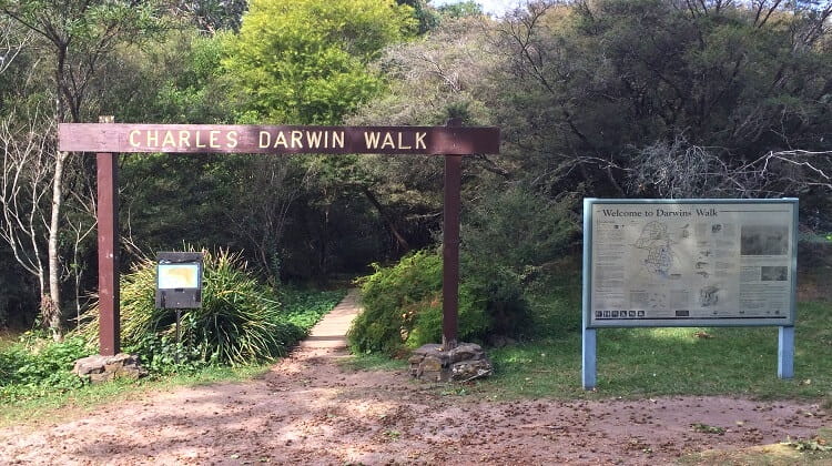
The Valley of the Waters track is a return walking trail that starts from the old Conservation Hut in Wentworth Falls.
Driving there is easy. Turn into Falls Road from the Great Western Highway, followed by a right turn into Fletcher Street, which leads to the car parking area (see map location).
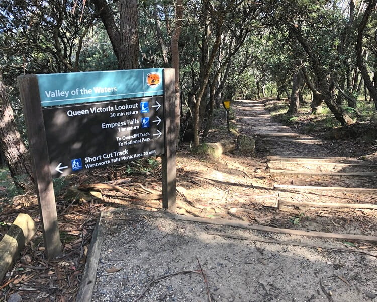
Once you’ve parked your car, look for the Valley of the Waters, Queen Victoria Lookout and Empress Falls signpost where the walk starts.
Also note that you could extend this walk by including the Nature Track, which also starts from the Conservation Hut. This walk enters the valley via a different route and eventually meets Empress Falls.
Valley of the Waters Track Notes
The Valley of the Waters walking track is relatively short, but also quite steep as it descends into the valley along the creek. The trail itself is well-maintained and signposted, and is very easy to follow.
It’s strongly recommended to wear good shoes as the path can get a bit slippery, and also bring enough water with you on warmer days.
Note that the Valley of the Waters track is essentially a section of the challenging Wentworth Pass circuit walk, which leads to the Wentworth Falls waterfall.
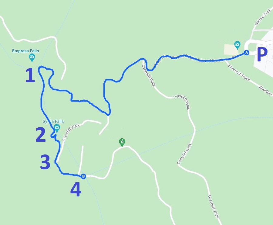
Below is a map of the Valley of the Waters track with the following waterfalls marked from one to four:
- Empress Falls
- Sylvia Falls
- Lodore Falls
- Flat Rock Falls
Start of the Walk
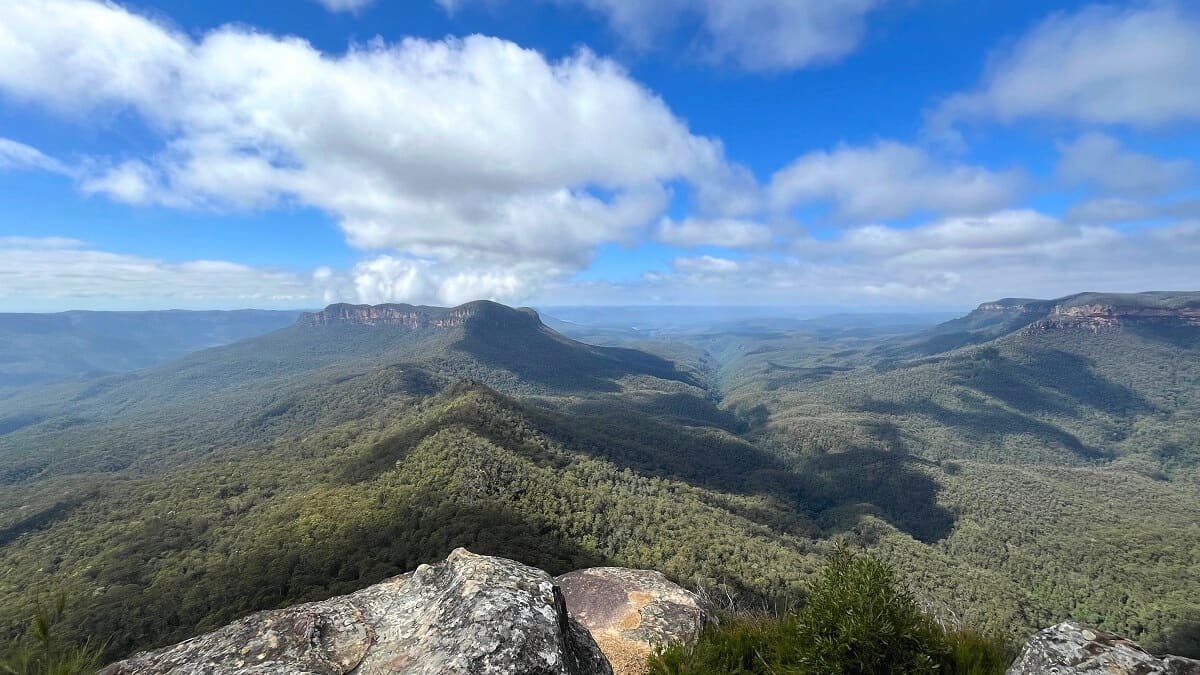
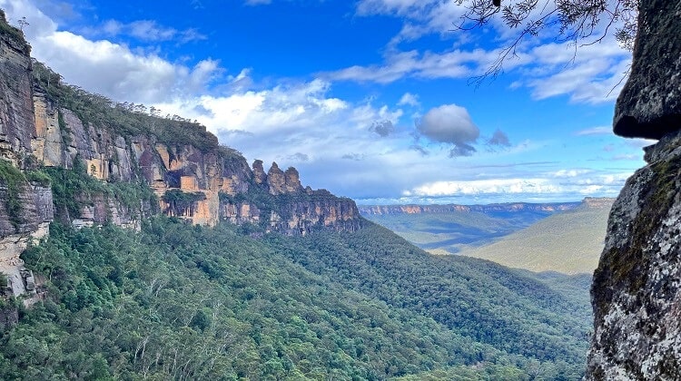
The first section of the walk is an easy-to-follow path on wooden steps, before it arrives at the Queen Victoria Lookout, which offers fantastic views of the Jamison Valley.
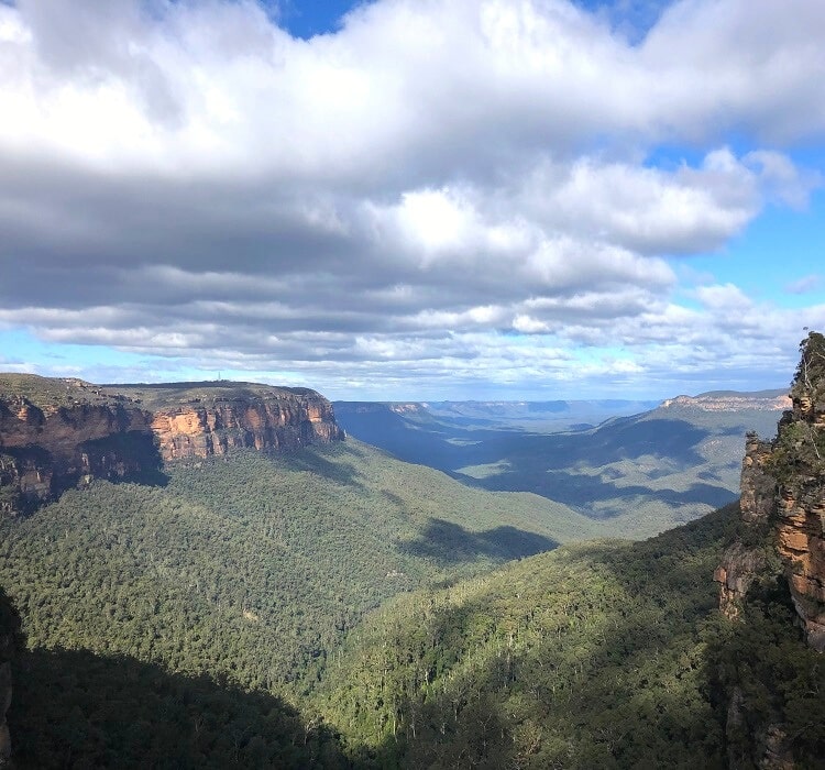
This lookout is soon followed by the Empress Lookout, from where you can see the top of Empress Falls if you look closely.
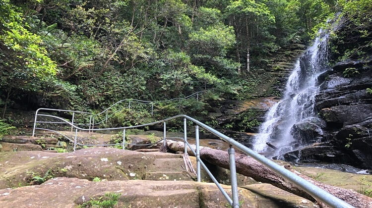
From Empress Lookout, the walking track quickly descends into the valley via sets of metal stairs and steps cut into the rocks.
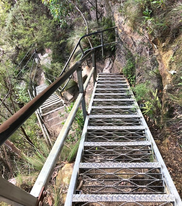
While this section of the track is quite steep, the various handrails and the stairs make it very easy and safe to navigate.
The track then soon arrives at an intersection with the Nature Track, where you will make a left turn to continue on the main track to Empress Falls.
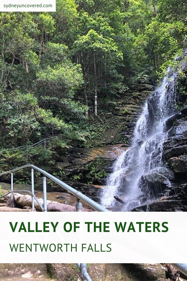
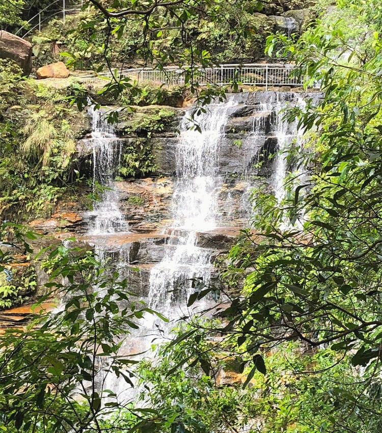
1. Empress Falls
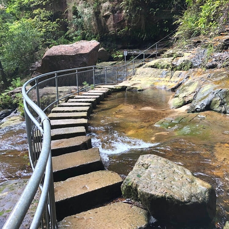
Before arriving at Empress Falls, the track crosses Isobel Creek via a set of stepping stones, entering a more lush rainforest-type environment.
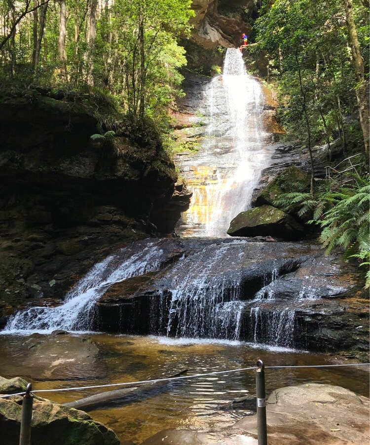
Just past this creek crossing is where Empress Falls becomes visible between the trees, with the track going around the waterfall and continuing via a set of stepping stones in front of the water spectacle.
The views from that spot of the waterfall are spectacular, and if you’re lucky, you might even spot some canyoners abseiling down the falls into the pool.
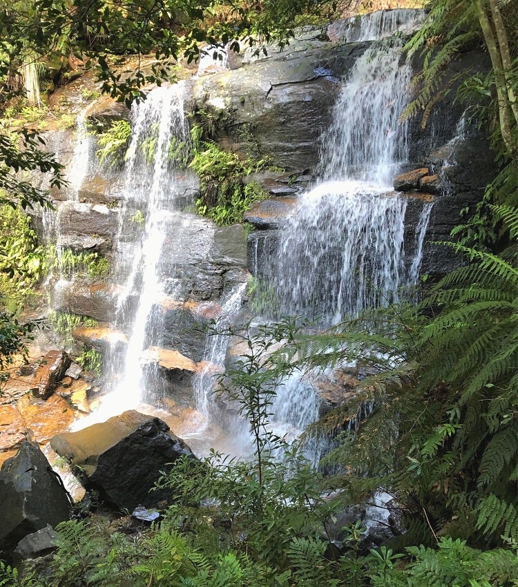
2. Sylvia Falls
The stepping stones in front of Empress Falls are where the walking track crosses the Valley of the Waters Creek.
To continue the walk to Sylvia Falls, keep following the path after crossing the creek, and the next waterfall will soon appear on your left.
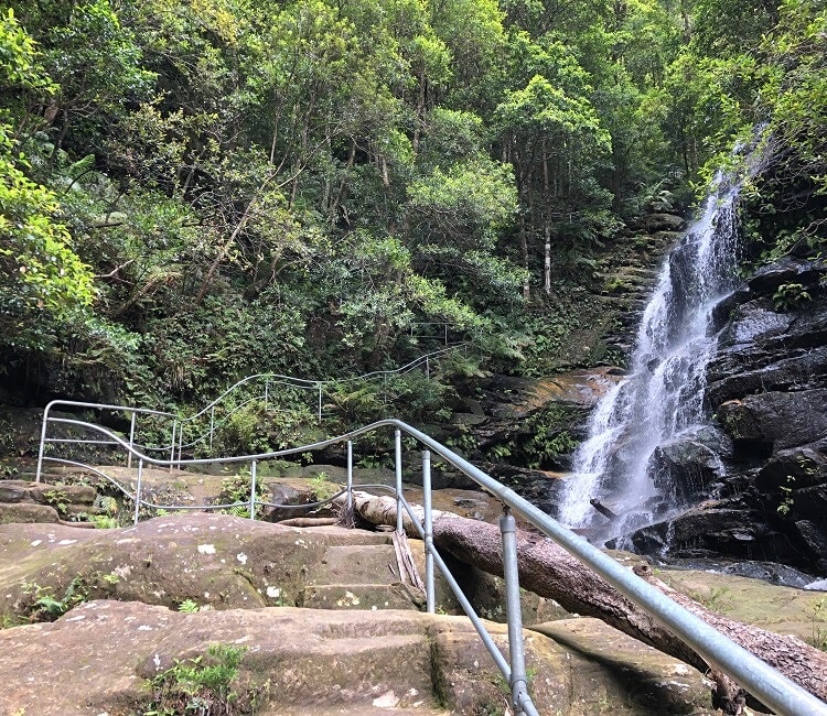
The track descends further into the valley via a staircase alongside Sylvia Falls, before arriving at another set of stepping stones right in front of the waterfall.
The views into the other direction are fantastic too, with the valley below and the cliff walls surrounding the valley.
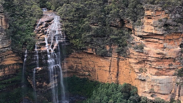
3. Lodore Falls
After crossing the creek once again via the stepping stones, the track descends further via a set of stairs, keeping the valley and the creek to the right.
This is where the Valley of the Waters Creek makes a big drop in the form of Lodore Falls, a rather large waterfall spectacle.
Sadly though, as spectacular as Lodore Falls is, the views are obscured by the trees along the walking path, although there are a few spots where you can still see bits of the waterfall.
4. Flat Rock Falls
The track soon passes an intersection with the National Pass walking track (which is closed until further notice) and continues in a zig-zag style to Flat Rock Falls.
This waterfall might be a bit smaller than the previous ones, but it’s just as pretty in its own right.
Keen to see even more waterfalls?
The trail continues beyond Flat Rock Falls with more waterfalls to discover, in the following order:
- Brittania Falls
- Red Rock Falls
- Vera Falls
Brittania Falls and Red Rock Falls are not too far from Flat Rock Falls, but Vera Falls is a bit further away into the valley, and the track there is generally considered hard.
Also note that Brittania Falls and Red Rock Falls are still part of the Wentworth Pass circuit walk, whereas Vera Falls is located well beyond the intersection with Wentworth Pass.