Last updated: February 12, 2024
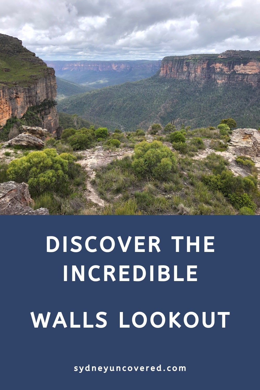
The walking track to Walls Lookout in the Blue Mountains is a short trail to one of the most impressive vantage points in the region.
This trail is located in the Bells Line of Road area of the Blue Mountains, which is typically much quieter than the Katoomba, Leura, Wentworth Falls, and Blackheath areas.
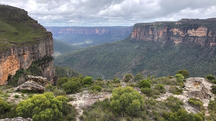
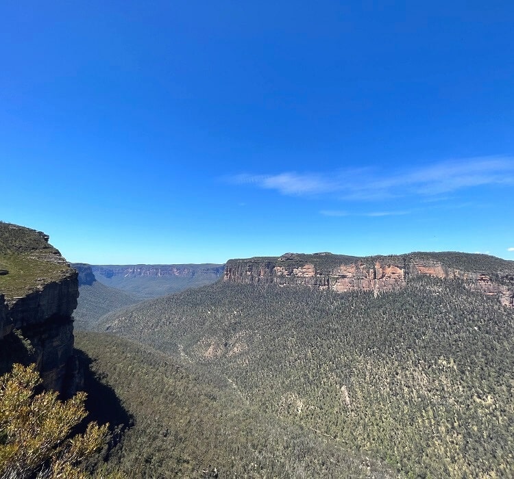
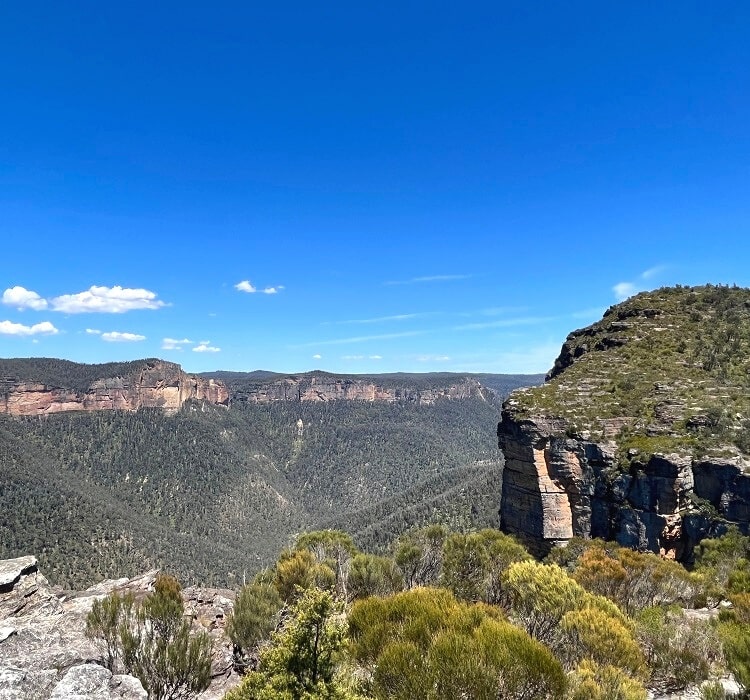
The views from Walls Lookout over the Grose Valley and its surrounding cliffs are stunning, with lots of space to explore and wander around.
| Walls Lookout Walking Track | |
|---|---|
| Distance: | 2 km (return) |
| Time: | 1.5 hours (including stops) |
| Grade: | Easy / moderate (rough surface) |
| Dogs: | Not allowed |
Short video of the Walls Lookout Walk:
How to Get There
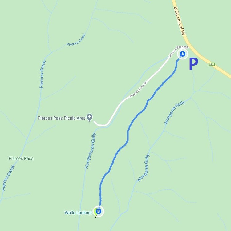
The start of the walking track to Walls Lookout is located on Bells Line of Road. Turn into Pierces Pass Road at the large “Pierces Pass Picnic Area” sign.
Pierces Pass Rd is approximately 1.5 km west of Mount Banks Rd and 2.5 km southeast of Mount Wilson Rd. Refer to this link for the exact location on Google Maps.
Immediately after turning into Pierces Pass Rd, turn left into the little parking area for the walking track to Walls Lookout.
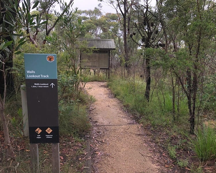
The start of the walking track to Walls Lookout is directly accessible from the car park. A large information board contains more details about this beautiful part of the Blue Mountains, which is worth reading before starting the hike.
Walls Lookout Walking Track
The Walls Lookout walking track is a relatively easy 2 km return hike, suitable for all skill and fitness levels. It’s essential to wear proper shoes, as the path is often quite uneven.
Also note that there are a few steep sections, but overall, this hike isn’t hard at all and can be completed within one hour.
The first section of the walking track is through scenic bushland on an easy-to-follow and reasonably well-maintained path.
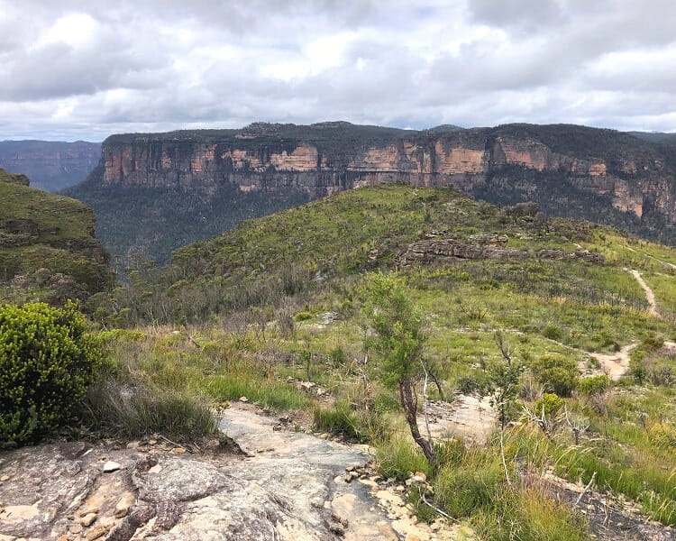
As soon as you come out of that patch of bushland, you will see glimpses of the lookout and the massive cliff walls surrounding the valley.
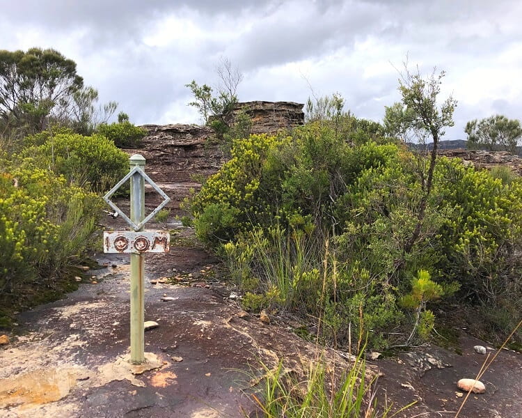
At some point, the walking track arrives at a small 100m marker (see picture), which means there is only a short stretch left before arriving at the cliff edge.
Incredible Views
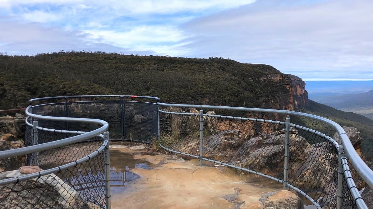
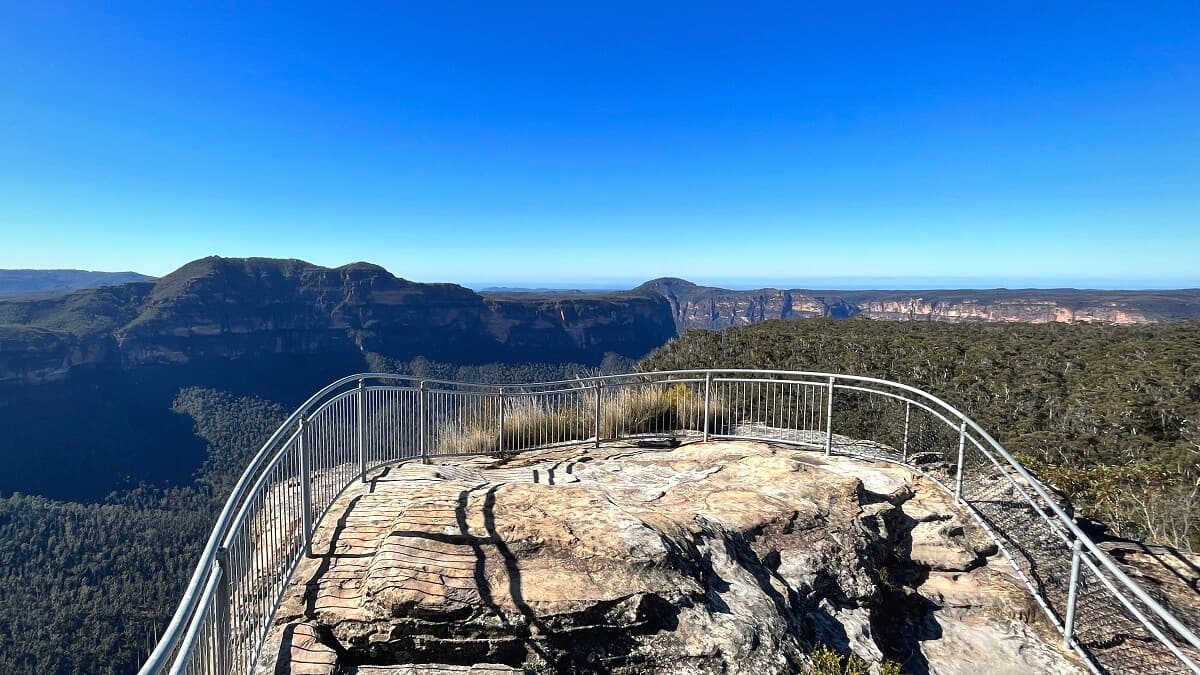
Note that Walls Lookout is not a purpose-built lookout platform. It’s essentially a large area on top of a cliff where you can wander around and enjoy the views.
This also means that there is no fencing, and visitors should always be careful when walking close to the cliff edges. If you bring children with you, keep an eye on them when exploring this beautiful area.
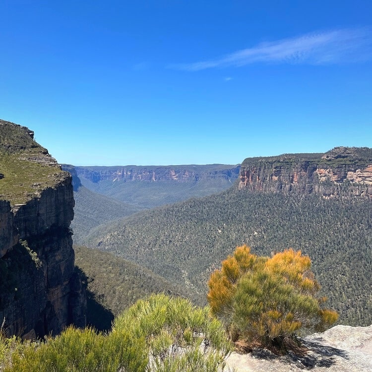
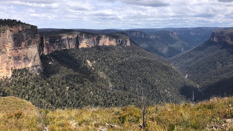
What’s good about the Walls Lookout is that the views are literally 360 degrees. One could spend hours here and not get tired of those views.
To give you some perspective, the massive cliff wall right in front of the Walls Lookout is an area that is often referred to as the Blackheath Walls.
The Anvil Rock Lookout and Perrys Lookdown are located towards the left of that wall, and the Baltzer Lookout and Hanging Rock towards the right.
Further away, looking towards the east, you might be able to see Mount Banks, the cliff wall of Du Faur Head, and Lockleys Pylon right behind it.
Before visiting Walls Lookout, it’s a good idea to do some research on Google Maps (in satellite view) and identify those spots in the Blue Mountains.
That makes it easier to understand where Walls Lookout is located in relation to other landmarks in this beautiful part of the world.
Waterfall on Hungerfords Gully
Depending on recent rainfall, you may be able to spot a rather tall but narrow waterfall, if you look carefully.
This is a waterfall on the Hungerfords Gully, which eventually flows into the Grose River in the valley below.
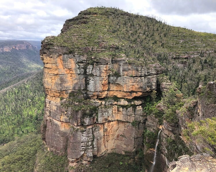
As far as we know, this waterfall does not have an official name, which shows that this area of the Blue Mountains is still a bit off the beaten track.
You can find this waterfall on the western side of Walls Lookout. Be careful, though, because there is no fencing, and the surface is uneven.
Nearby Walks and Lookouts
If you’d like to do more exploring in this area, there are more hikes you can do that are close to the Walls Lookout.
1. Rigby Hill Track
The Rigby Hill walking track is similar to the Walls Lookout walking track, albeit slightly shorter and a bit easier. Rigby Hill is essentially located next to Walls Lookout, and the views are also quite similar.
The starting point of this 1.5 km track is at the picnic area on Pierces Pass Rd, the same road you turn into to get to the Walls Lookout walking track.
Read more about the Rigby Hill walking track.
2. Pierces Pass
The Pierces Pass is a challenging walking track into the Grose Valley to Blue Gum Forest along the Grose River.
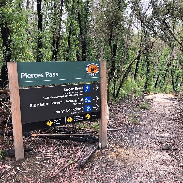
The start of this track is also at the picnic area on Pierces Pass Rd. This is quite a steep dirt road, but it can be done with a 2WD vehicle.
Read more about the Pierces Pass.
3. Mount Banks Summit Walk
The hike up to Mount Banks is a moderately challenging walking track to the summit of one of the most iconic mountain peaks in the Blue Mountains.
The summit walk starts at the Mount Banks picnic area, which can be accessed via Mount Banks Rd, approximately 1.5 km east of Pierces Pass Rd.
Read more about the Mount Banks summit walk.
The best lookouts in the Blue Mountains.