Last updated: March 13, 2024
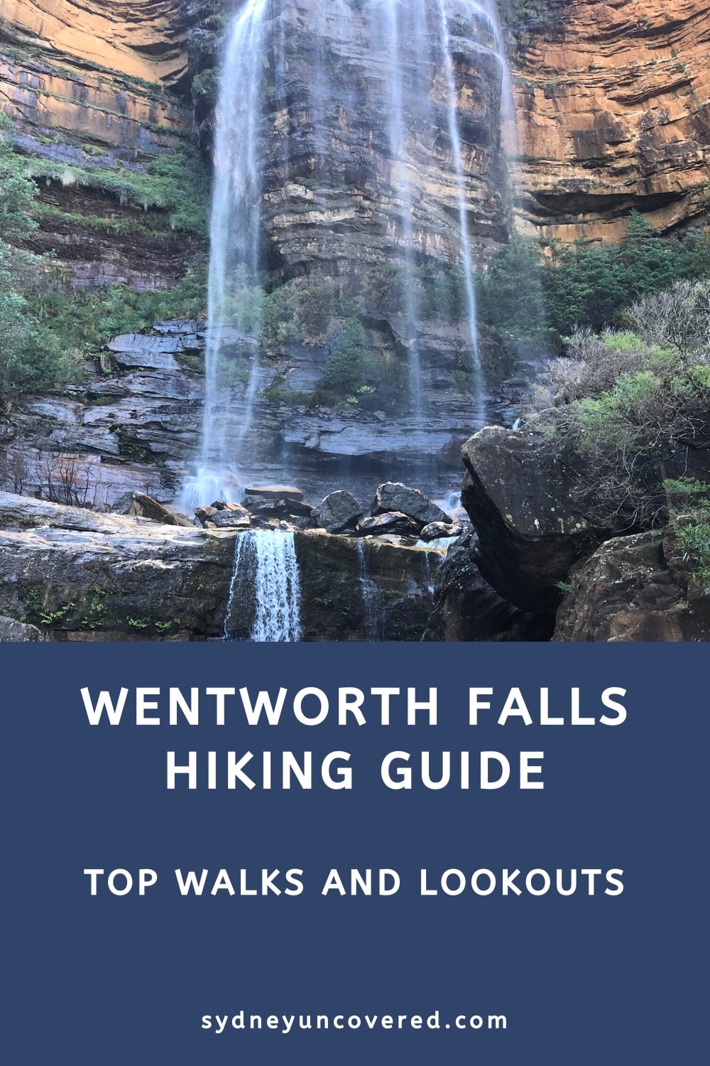
This Wentworth Falls guide explores the best walks and lookouts in one of the most popular hiking destinations in the Blue Mountains.
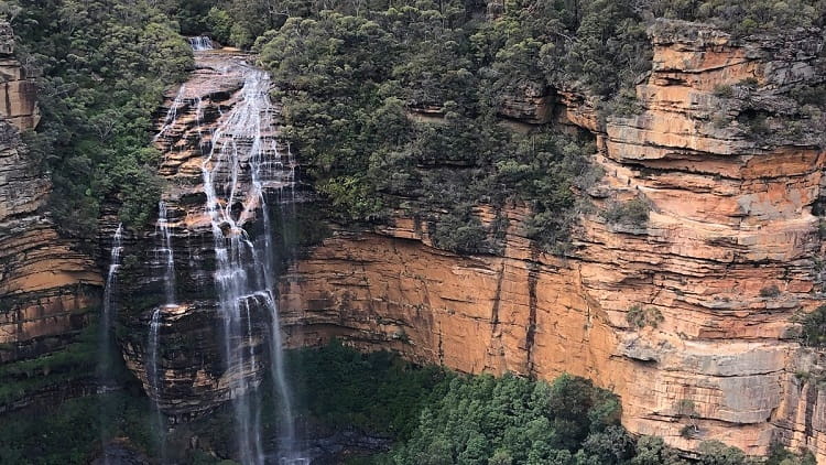
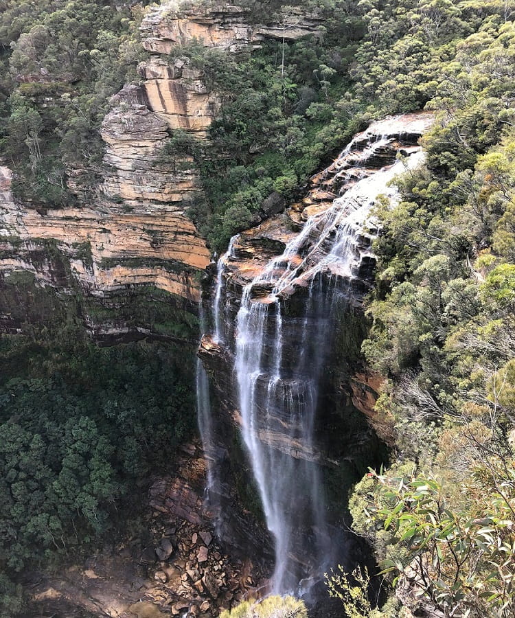
The town of Wentworth Falls is home to one of the most beautiful waterfalls in New South Walls, visited by thousands of tourists each year.
Various walking tracks and lookouts exist close to this incredible waterfall, and this guide will help you plan your day out in the Wentworth Falls area.
Quick navigation:
Before travelling to Wentworth Falls, check for the latest updates on closed walks and lookouts on the National Parks website.
How to Get There
Most walks in the Wentworth Falls area start and end at the Wentworth Falls Picnic Area or the old Conservation Hut.
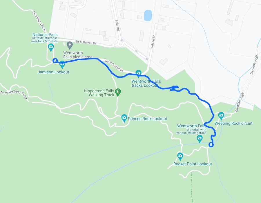
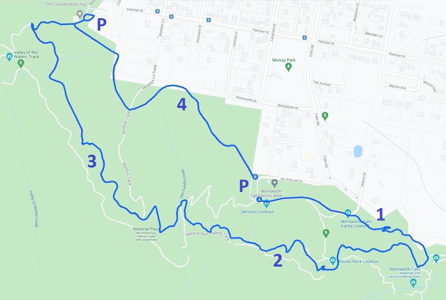
1. Wentworth Falls Picnic Area
Take the Falls Road exit from the Great Western Highway and drive to the car park at the end of the road (see map location).
This is where Falls Road flows into Sir H Burrell Drive that loops around the car park and the picnic area.
Choose the Wentworth Falls Picnic Area for the following walks:
- Den Fenella Track
- Princes Rock Walking Track
- Wentworth Falls Track
- Overcliff Undercliff Track (also passes Conservation Hut)
- Wentworth Pass (also passes Conservation Hut)
If you’re travelling to Wentworth Falls by public transport, catch a train to Wentworth Falls station, and from there, walk south along Falls Road to the waterfall. This is an easy 30-minute walk.
The Charles Darwin Walk connects the train station with the waterfall but is currently closed until further notice.
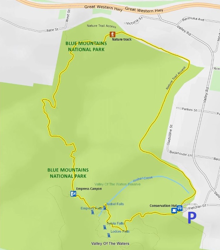
2. Conservation Hut
Take the Falls Road exit from the Great Western Highway and then turn into Fletcher Street (see map location).
The Conservation Hut has a reasonably sized car park that quickly fills up during weekends, but suburban street parking is available nearby.
Choose the Conservation Hut for the following walks:
- Empress Falls Track
- Nature Track
- Valley of the Waters Track
- Overcliff Undercliff Track (also passes Picnic Area)
- Wentworth Pass (also passes Picnic Area)
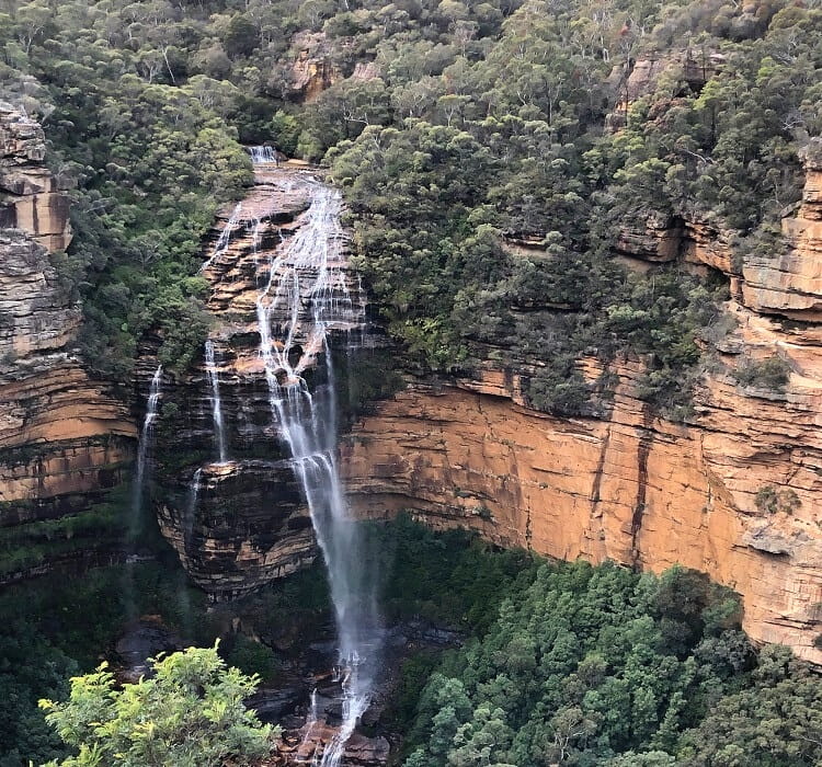
The best waterfalls in the Blue Mountains.
8 Best Walks in Wentworth Falls
Below are the eight most popular walking tracks in the Wentworth Falls area, ordered by distance.
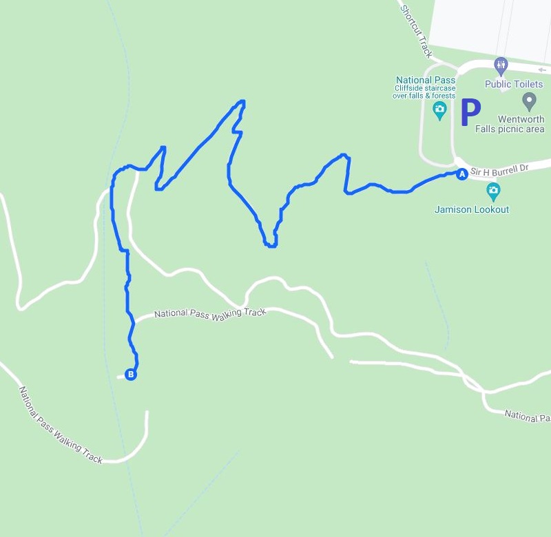
The National Pass is not included on this list because it has been closed for many years, and some believe this may be permanent.
If you’re in a hurry and want to see the best highlights in a relatively short time, do the Princes Rock Walking Track, followed by the Wentworth Falls Track.
- Den Fenella Track
- Empress Falls Track
- Princes Rock Walking Track
- Wentworth Falls Track
- Valley of the Waters Track
- Nature Track
- Overcliff Undercliff Track
- Wentworth Pass
1. Den Fenella Track
The Den Fenella Track is a short but enjoyable bushwalk between the picnic area and a scenic lookout point facing the Jamison Valley.
Even though it’s only a 1 km return walk, it’s a real treat, with creek crossings, cascade waterfalls, lush rainforest, and panoramic views. The highlight of this walk is the Den Fenella Lookout at the very end, from where you can enjoy sensational valley views.
Since this is only a short walk, it is often combined with one or more other walks, such as the Overcliff Undercliff Track.
| Den Fenella Track | |
|---|---|
| Distance: | 1 km (return) |
| Duration: | 1 hour |
| Grade: | Easy |
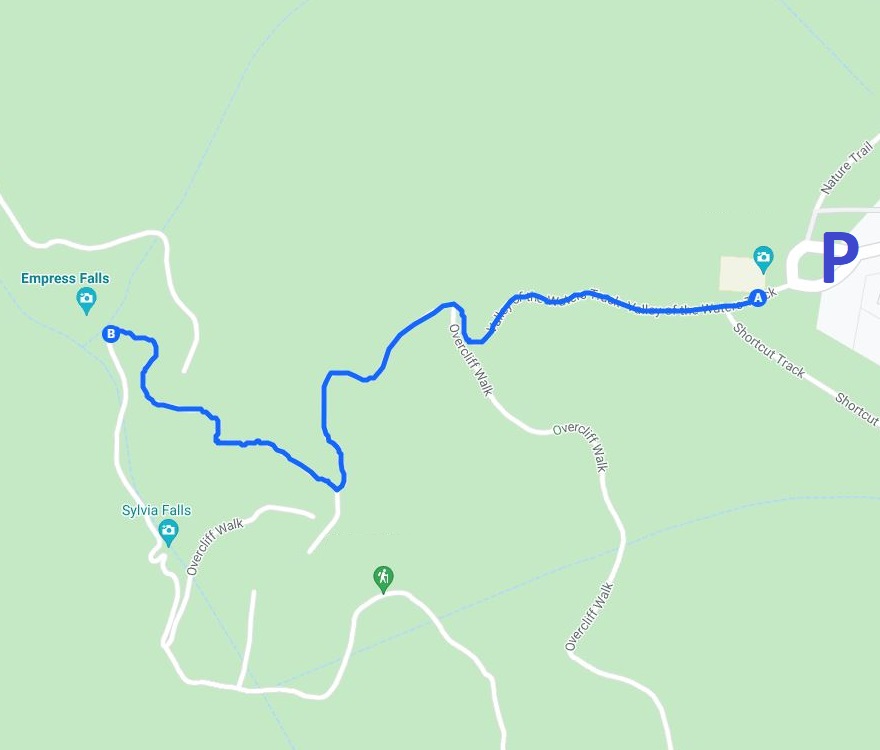
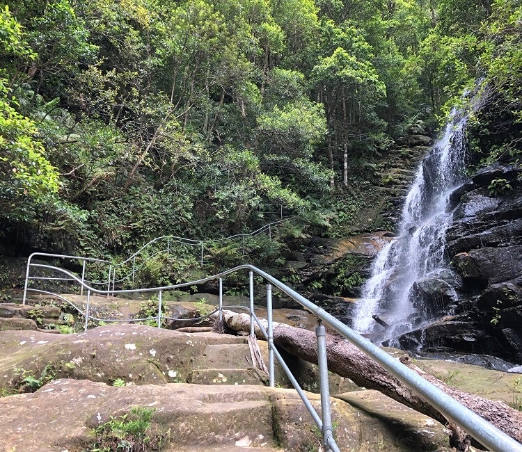
2. Empress Falls Track
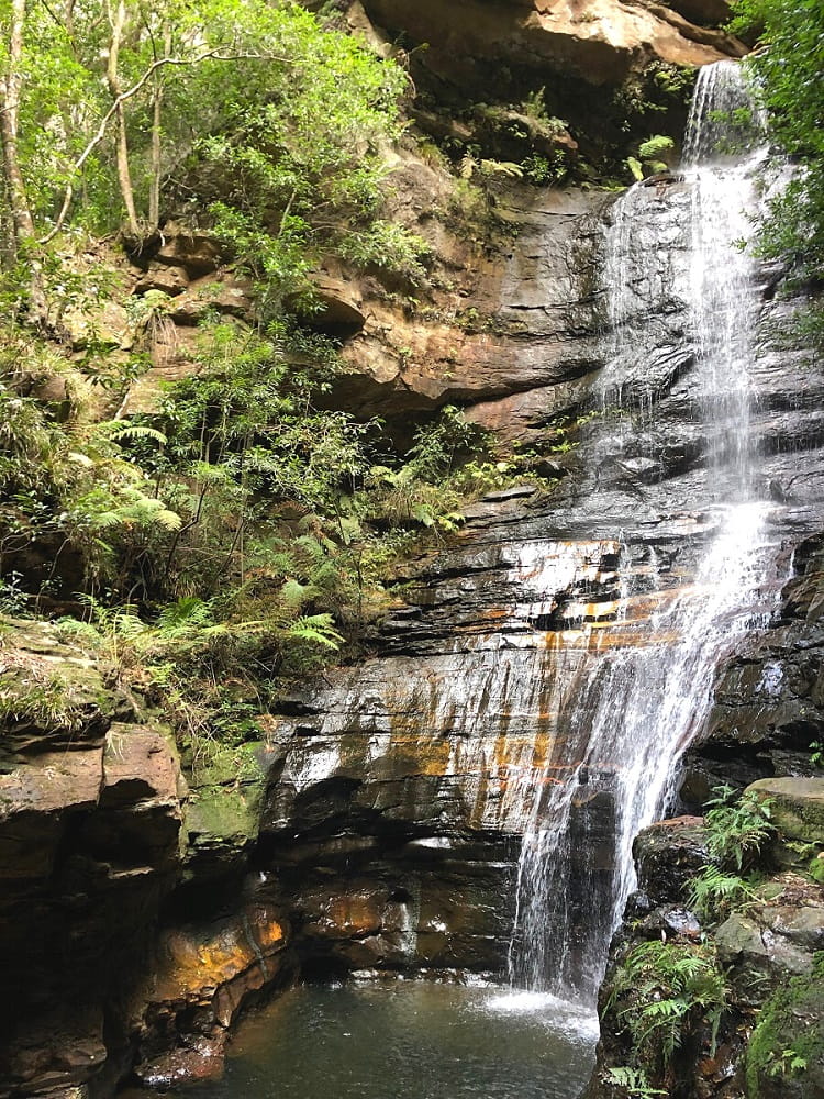
The second most beautiful waterfall in the Wentworth Falls area is Empress Falls. A short walking trail from the Conservation Hut leads to this waterfall.
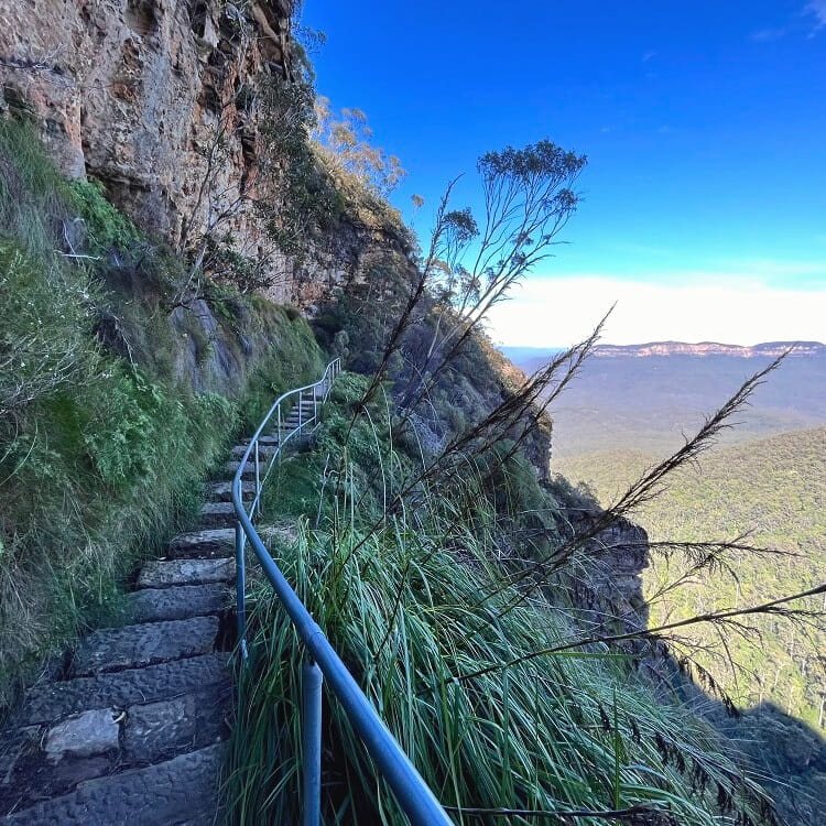
While this walking track is short (only 1 km), it is also quite steep. Before reaching the waterfall, the track passes the Queen Victoria Lookout, which offers panoramic views over the Jamison Valley.
From that lookout, it’s only a short stretch to the waterfall via several staircases, with a walking path navigating closely around it.
The Valley of the Waters Track (see below) continues from there, with a couple more waterfalls to explore.
| Empress Falls Track | |
|---|---|
| Distance: | 1 km (return) |
| Duration: | 1 hour |
| Grade: | Moderate (short but steep) |
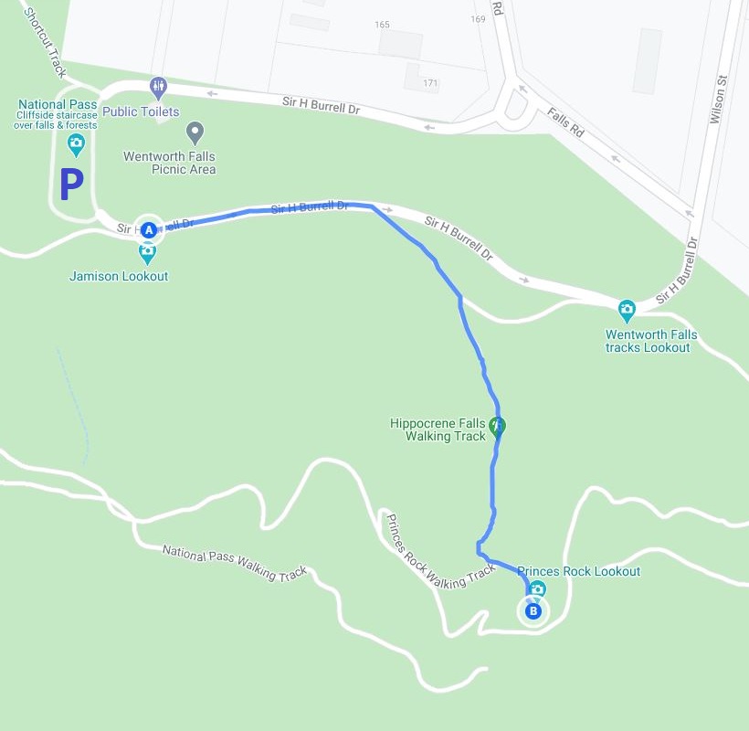
3. Princes Rock Walking Track
The walking track to the Princes Rock Lookout is often overlooked by visitors, but the lookout at the end of the trail is one of the best in Wentworth Falls.
The walk officially starts at the picnic area and makes a right turn into the bush between the Jamison and Wentworth Falls lookout points.
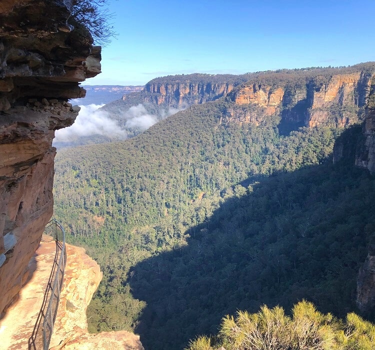
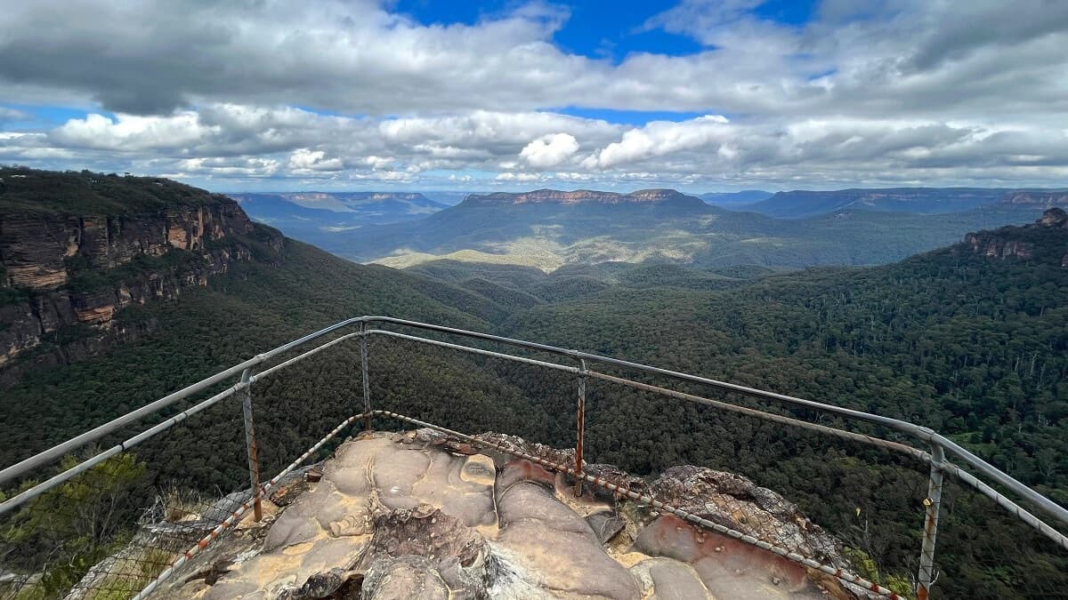
The destination, the Princes Rock Lookout, offers excellent views of the waterfall and the surrounding cliff walls and valley.
| Princes Rock Walking Track | |
|---|---|
| Distance: | 1.5 km (return) |
| Duration: | 1 hour |
| Grade: | Easy |
4. Wentworth Falls Track
Starting at the picnic area, the Wentworth Falls track is a short walking trail to the top of Wentworth Falls.
This track is perfect if you don’t have much time or if you’re simply not up for a longer, more challenging hike.
The Wentworth Falls track includes the lookouts along Sir H Burrell Drive, so you get to enjoy great views of the valley before arriving at the waterfall.
Once you’ve reached the waterfall, you can extend this walk by taking the Grand Stairway to the mid-section of the waterfall, or you can visit the Rocket Point Lookout, which is signposted.
| Wentworth Falls Track | |
|---|---|
| Distance: | 2 km (return) |
| Duration: | 1 hour |
| Grade: | Easy |
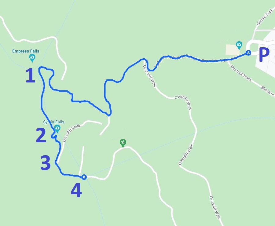
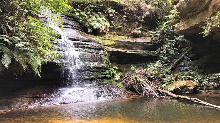
5. Valley of the Waters Track
The Valley of the Waters Track is an extension to the Empress Falls Track, with several more waterfalls to explore.
The Valley of the Waters Track is approximately 2.5 km long (return) and takes in the following waterfalls:
- Empress Falls
- Sylvia Falls
- Lodore Falls
- Flat Rock Falls
| Valley of the Waters Track | |
|---|---|
| Distance: | 2.5 km (return) |
| Duration: | 1.5 hours |
| Grade: | Moderate / hard |
6. Nature Track
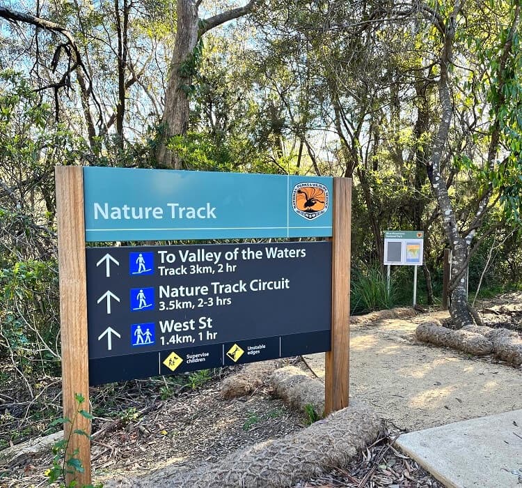
The Nature Track is the only walk in this list of Wentworth Falls walks that doesn’t get close to the famous waterfall.
With start and finish at the Conservation Hut, the moderately challenging 3.5 km Nature Track is a true bushwalker’s delight.
With dense rainforest, small waterfalls, and lookout points, this fascinating walking trail is named Nature Track for good reasons.
Follow the signs from the Conservation Hut and enjoy this two-hour adventure in absolutely stunning natural surroundings.
| Nature Track | |
|---|---|
| Distance: | 3.2 km (circuit) |
| Duration: | 2 hours |
| Grade: | Moderate / hard |
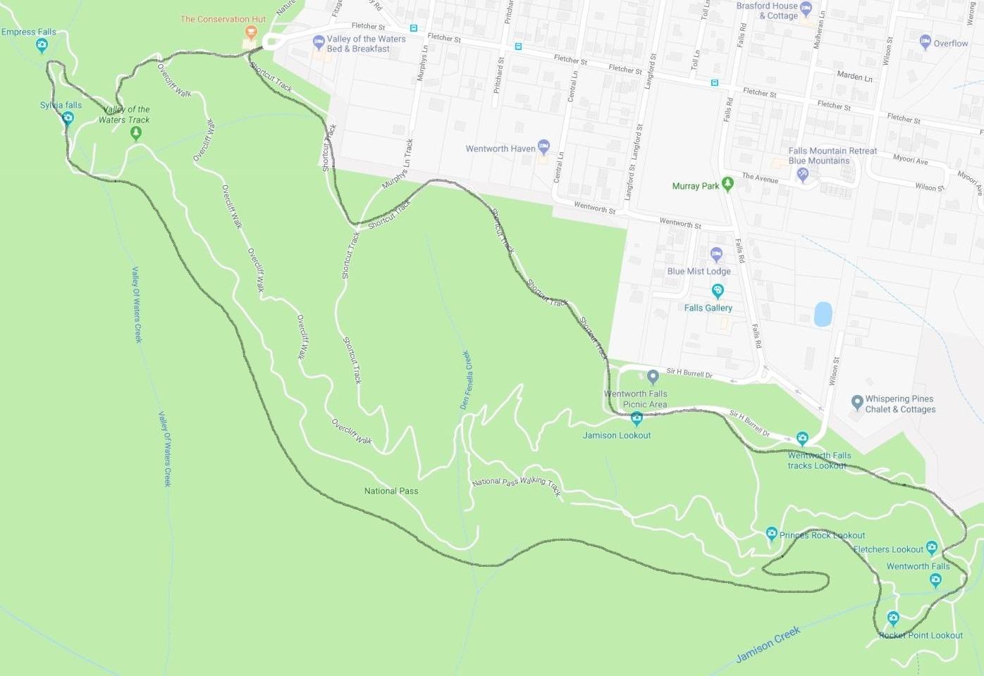
7. Overcliff Undercliff Track
The Overcliff Undercliff Track follows the edge of the cliff rather than going into the valley as the Wentworth Pass does.
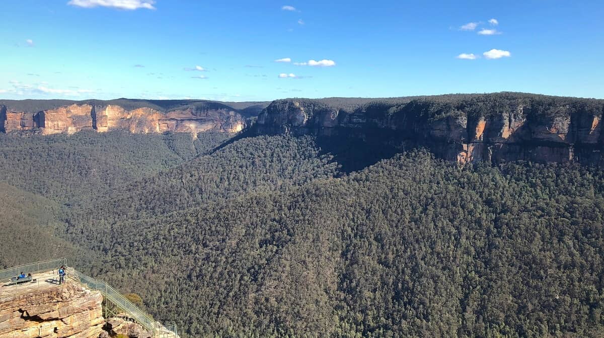
Several small lookout points along the way, such as the Lyrebird and Breakfast Point lookouts, offer great views of the Jamison Valley and beyond.
The Overcliff Undercliff Track is approximately 4 km in length and consists of four sections (in clockwise order, starting from the picnic area):
- Wentworth Falls Track
- Undercliff Track
- Overcliff Track
- Shortcut Track
| Overcliff Undercliff Track | |
|---|---|
| Distance: | 4 km (circuit) |
| Duration: | 2.5 hours |
| Grade: | Moderate |
8. Wentworth Pass

The Wentworth Pass is a 5 km adventurous hike that can be started from the old Conservation Hut or the picnic area.
From the Conservation Hut, the Wentworth Pass makes its way through the upper section of the Valley of the Waters and descends into the dense rainforest of the Jamison Valley.
The Slack Stairs brings hikers to higher ground before the Grand Stairway leads to the top of Wentworth Falls.
From the waterfall, the track continues past the Wentworth Falls and Jamison lookout points, before returning to the Conservation Hut via the Shortcut Track.
| Wentworth Pass | |
|---|---|
| Distance: | 5 km (circuit) |
| Duration: | 4 hours |
| Grade: | Hard |
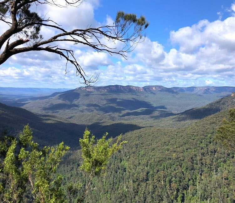
5 Best Lookouts in Wentworth Falls
There are several great lookouts in the Wentworth Falls area where you can enjoy amazing views of the waterfall and the nearby cliff walls and valleys.
These are the five most popular lookouts in Wentworth Falls, all accessible from the picnic area:
- Jamison Lookout
- Wentworth Falls Lookout
- Fletchers Lookout
- Rocket Point Lookout
- Princes Rock Lookout
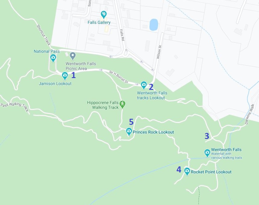
1. Jamison Lookout
Conveniently located right next to the car park along the footpath beside the Sir H Burrell Drive loop, the Jamison Lookout offers scenic views of the Jamison Valley towards Mount Solitary and beyond.
While you can’t see the waterfall from this viewing point, the views are amazing enough to get you excited about what’s to come.
2. Wentworth Falls Lookout
Like the Jamison Lookout, the official Wentworth Falls Lookout also offers Jamison Valley views, but from a slightly different angle.
Located along the eastern side of the Sir H Burrell Drive loop, the Wentworth Falls Lookout is the first major lookout that provides glimpses of the waterfall. But despite its name, this is not the best place to see the waterfall in its entirety.
From the Wentworth Falls Lookout, the main walking track goes into the bush towards the Fletchers Lookout and the waterfall.
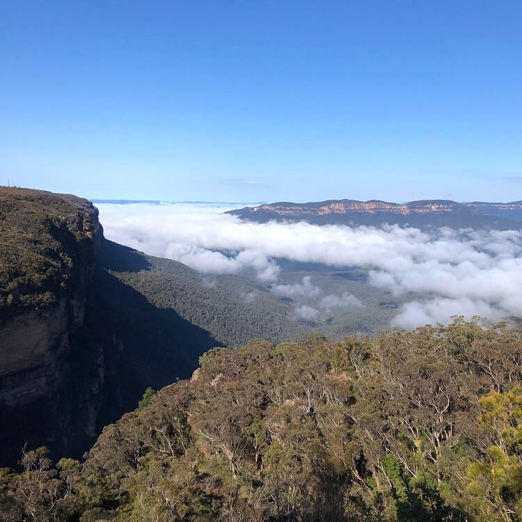
3. Fletchers Lookout
The small Fletchers Lookout offers a close-up view of the top of the waterfall in addition to panoramic views over Jamison Valley and the surrounding escarpments.
The Fletchers Lookout is signposted as a small side track off the main Wentworth Falls walking track.
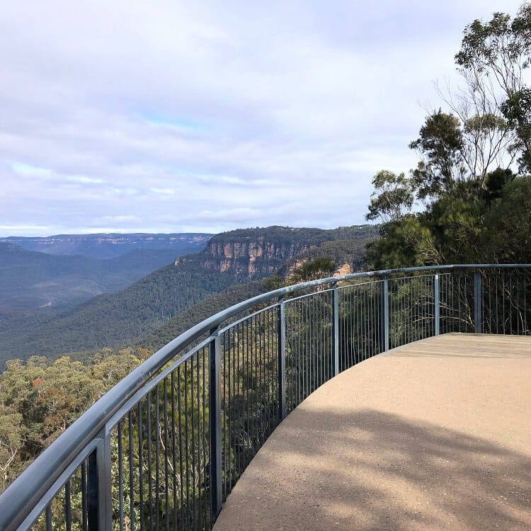
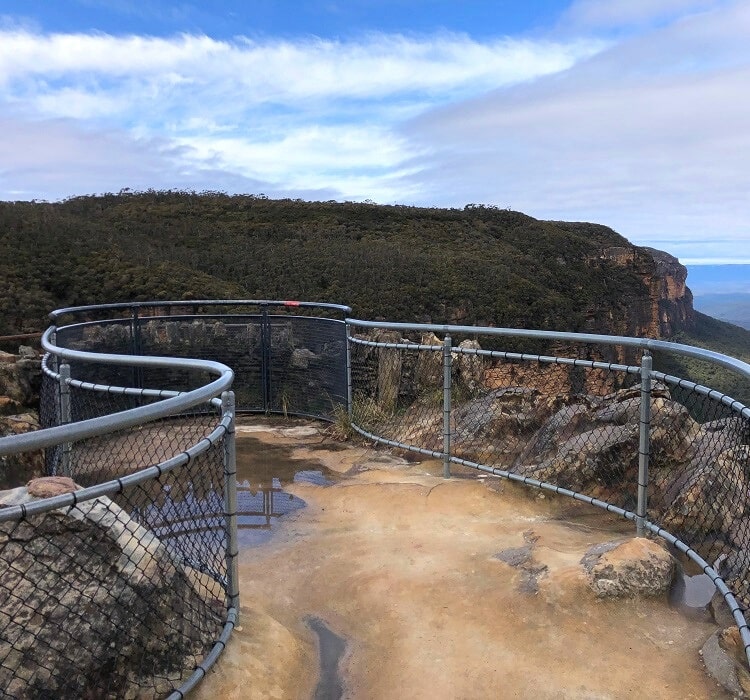
4. Rocket Point Lookout
The Rocket Point Lookout is located on the other side of the waterfall and can be accessed via a short loop walking track.
The start of this loop is close to the top of the waterfall, but many visitors to Wentworth Falls tend to skip this lookout because this walk isn’t very obvious. That’s a pity because the views from Rocket Point are fantastic.
After crossing Jamison Creek above the waterfall, look out for the small Rocket Point Circuit signpost to find the walk to the lookout. The fenced lookout sits high on a cliff and offers panoramic views of the waterfall.
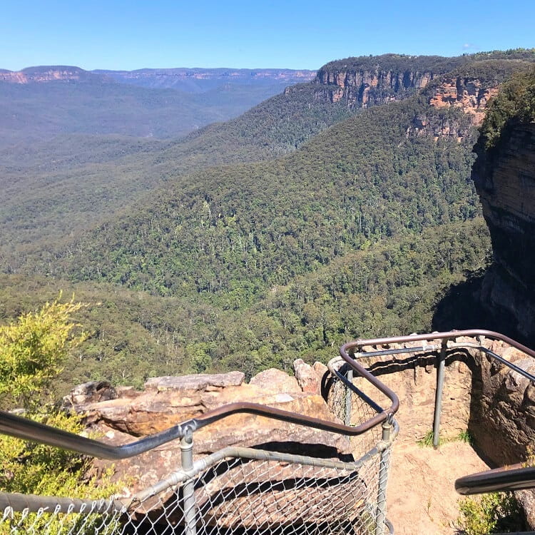
5. Princes Rock Lookout
The Princes Rock Lookout is perhaps the best viewing point in the area to see the entire waterfall.
There are two ways to get to this lookout. The easiest and quickest way is via the Princes Rock Walking Track that starts from Sir H Burrell Drive, close to the Wentworth Falls Lookout. It’s an easy 1 km descending walking path from there.
The other way to get to this lookout is via a section of the Overcliff Undercliff Track (see above).
The best lookouts in the Blue Mountains.
Can you combine the Wentworth Falls walk with the Princes Rock walk, and if so, how long would it take?
Hello Lindsey, you certainly can combine those two walks.
It’s best to first walk to the Princes Rock Lookout from the car park, and then continue on to the top of the Wentworth Falls waterfall. In total, this would take between 60 and 90 minutes, depending on how much time you’re going to spend at the lookouts.
Hope this helps!