Last updated: April 12, 2024
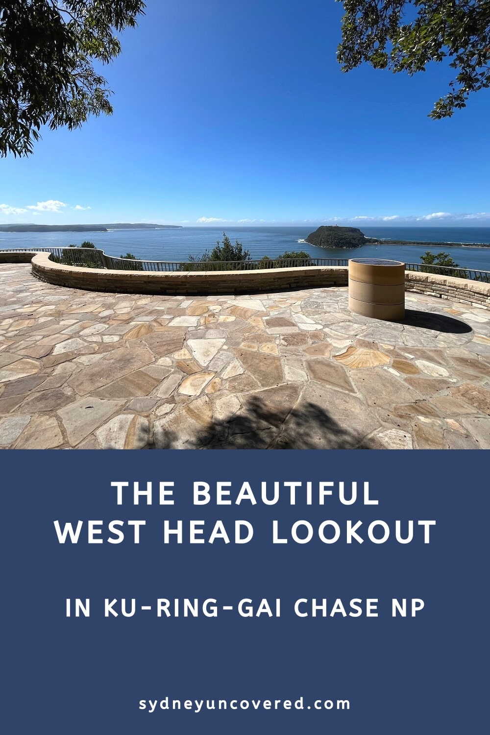
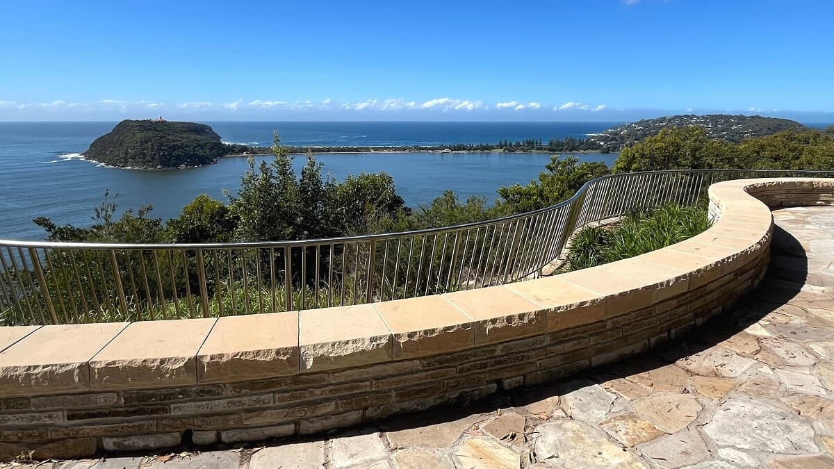
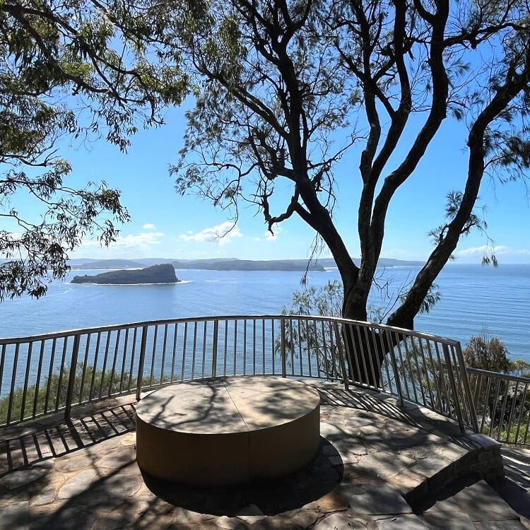
The West Head Lookout in Ku-ring-gai Chase National Park offers fantastic views, with various walks and beaches nearby to make a day of it.
Widely regarded as one of the best lookouts in Sydney, the West Head Lookout is one of the most popular destinations in Ku-ring-gai Chase NP.
In this article, we’ll share everything you need to know about West Head, including nearby beaches and walking trails.
| West Head Lookout | |
|---|---|
| Where: | Ku-ring-gai Chase National Park |
| Parking: | Car park close to lookout |
| Road quality: | Sealed roads |
| Wheel-friendly: | No |
| Dog-friendly: | No |
How to Get There
The West Head Lookout is located at the end of West Head Road in Ku-ring-gai Chase National Park. This road is accessible via McCarrs Creek Road.
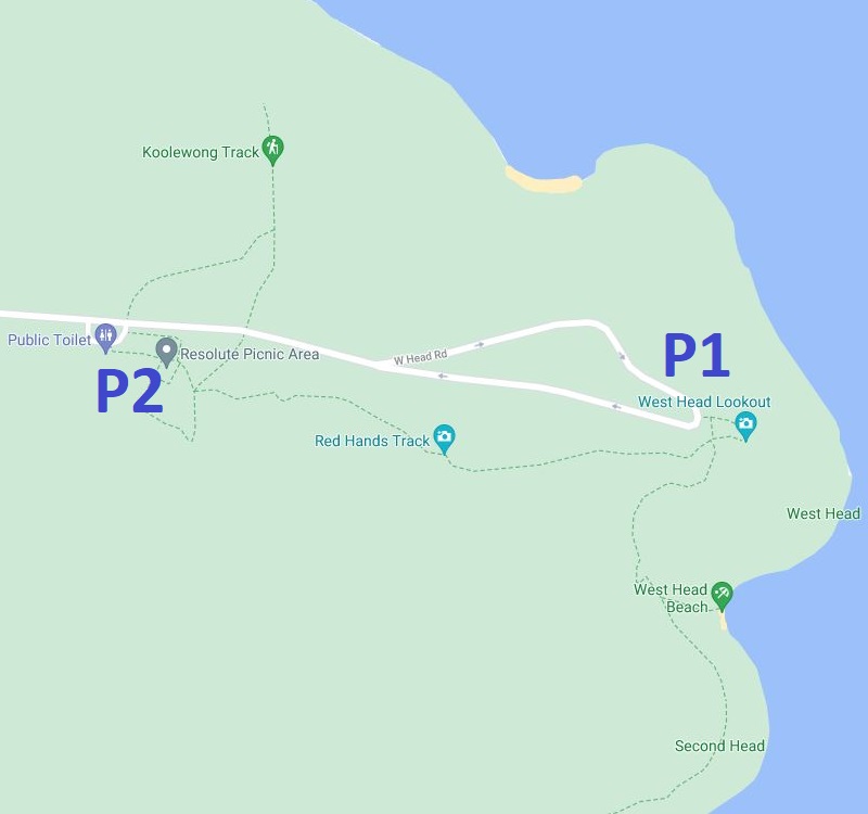
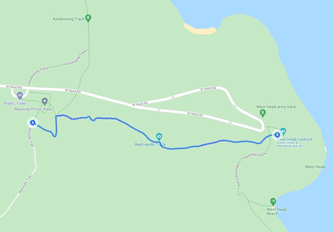
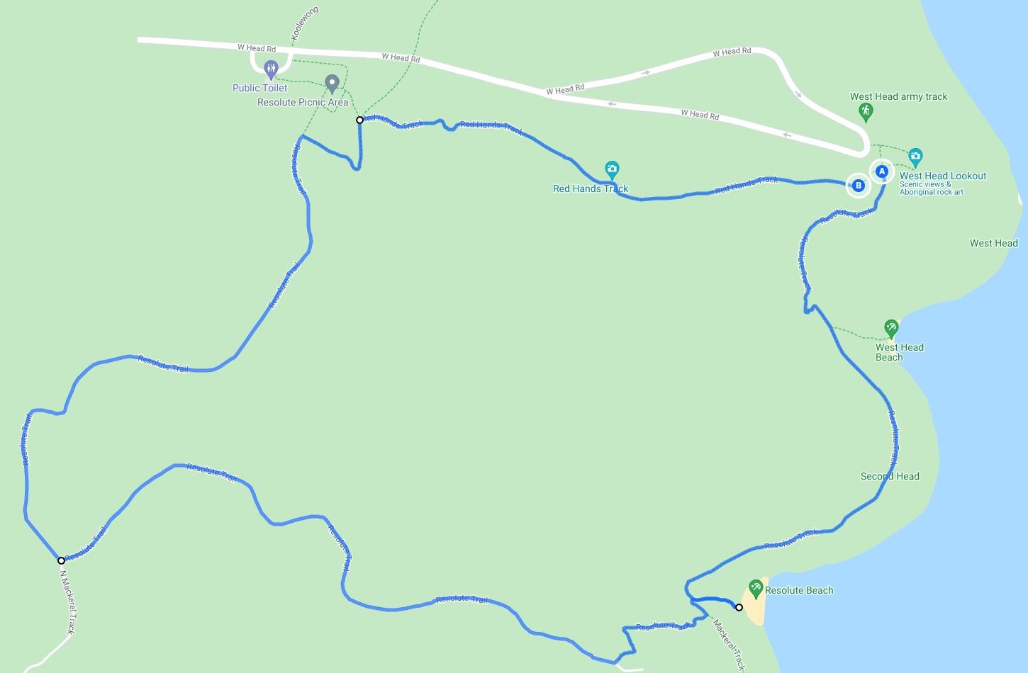
Parking is available at the lookout and at the Resolute Picnic Area. From the picnic area, you can walk to the lookout via the Red Hands Track (more on that further below).
There is a $12 entrance fee to the national park, to be paid at the booth on West Head Rd or at one of the pay machines at the lookout.
Best time to visit? All year, but we recommend going on a sunny day for the best experience and views. We also recommend going early in the day to avoid the crowds.
Map
The map below shows the two car parks:
- P1: West Head Lookout car park
- P2: Resolute Picnic Area car park
About the West Head Lookout
Once you’ve parked your car, it’s time to start exploring this beautiful area.
But West Head is not just a beautiful lookout point; it also has a rich history.
Military History
The northeastern tip of Ku-ring-gai Chase National Park was the perfect location for the army to protect Sydney against foreign invasion via Broken Bay.
During the Second World War, West Head was home to two large guns, an observation post, and two searchlight posts (the West Head Battery).
The guns were located at the bottom of the headland, and the administrative area, including large sleeping areas, was located at the top. An inclined railway was built to transfer goods between these two locations.
At the time, West Head was a full-scale military site.
This was quite an impressive achievement, especially because West Head was so hard to reach, let alone build such a crucial military fortress.
Recreational Site
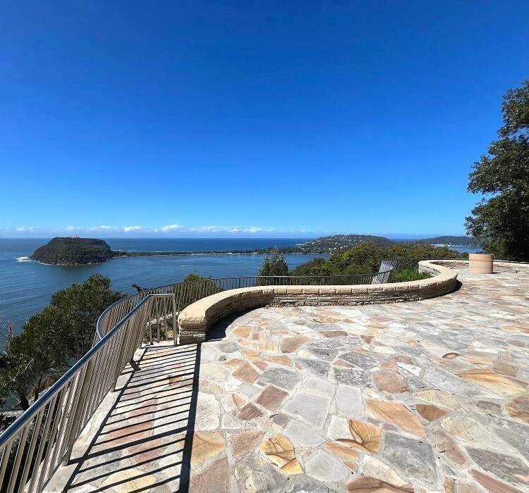
In the 1960s, the West Head Lookout was created, with a large sandstone viewing area and several information boards.
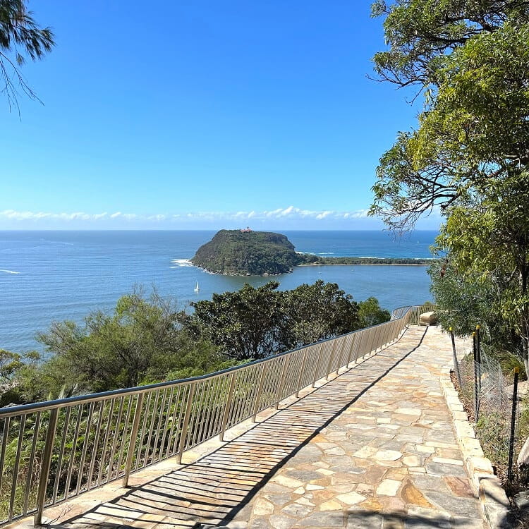
From the car park, a short walking path leads to this viewing area, with several benches conveniently scattered throughout the area.
The views are so impressive that you could easily sit on one of the benches for a few hours and absorb the beautiful scenery around you.
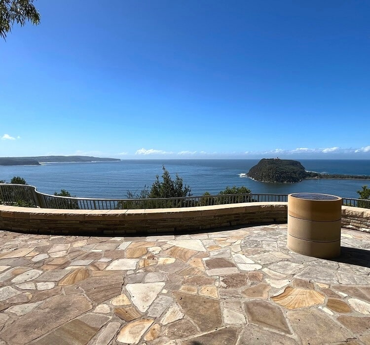
West Head is now widely considered one of the most impressive lookouts in Sydney and New South Wales.
Walks and Beaches Nearby
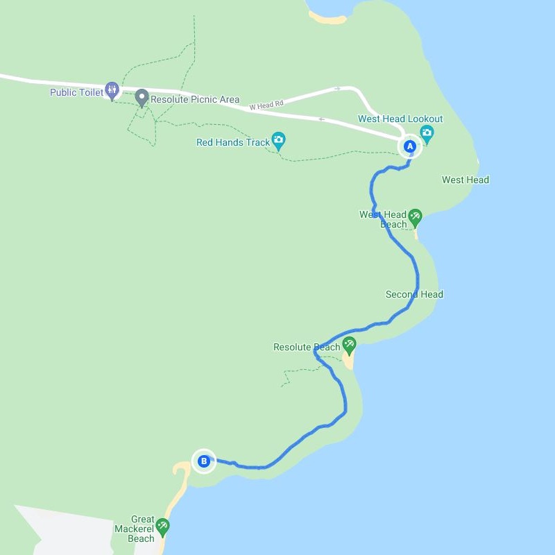
A visit to the lookout is not complete without doing at least one of the nearby bushwalks. Some of these walks lead to beautiful beaches, such as West Head Beach, Resolute Beach, and Great Mackerel Beach.
There are five exciting walks near the West Head Lookout:
- Red Hands Track
- West Head Army Track
- West Head Beach Walk
- Resolute Beach Loop Trail
- Great Mackerel Beach Walk
1. Red Hands Track
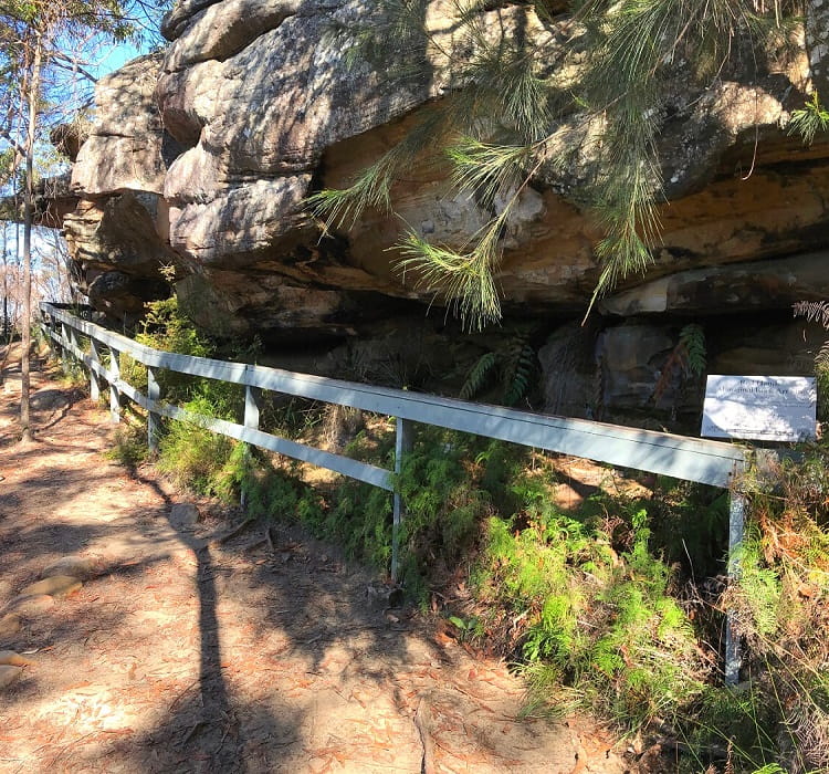
The Red Hands Track is an easy bushwalk between the Resolute Picnic area and the West Head Lookout.
It’s called Red Hands because it passes a large rock overhang that was used as a cave by Aboriginals thousands of years ago.
If you look closely, you may be able to identify an Aboriginal artwork in the shape of two hands in the cave.
| Red Hands Track | |
|---|---|
| Distance: | 1 km (one way) |
| Duration: | 0.5 hours |
| Grade: | Easy (sections with rough surface) |
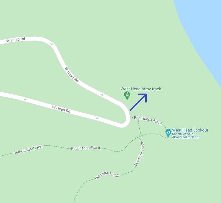
2. West Head Army Track
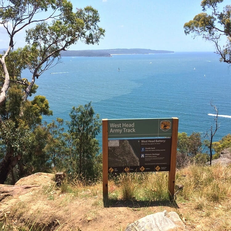
The West Head Army Track was officially opened on May 14th, 2016. It gives visitors a taste of what it must have been like to protect the country against a potential invasion during WWII.
The track is short but quite challenging, marked with a grade 4. Part of the track is so steep that a ladder structure was installed to help descend to the old West Head army battery.
Once there, you can wander around and see the gun emplacements and battery observation posts from close by.
| West Head Army Track | |
|---|---|
| Distance: | 1 km (return) |
| Duration: | 1 hour |
| Grade: | Moderate / hard (steep) |
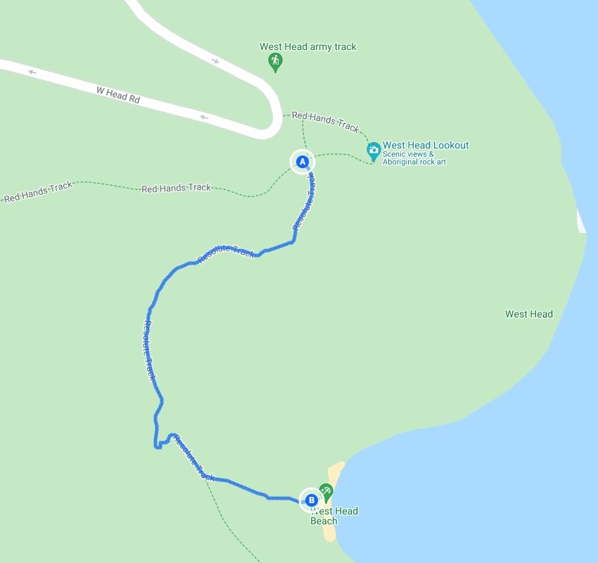
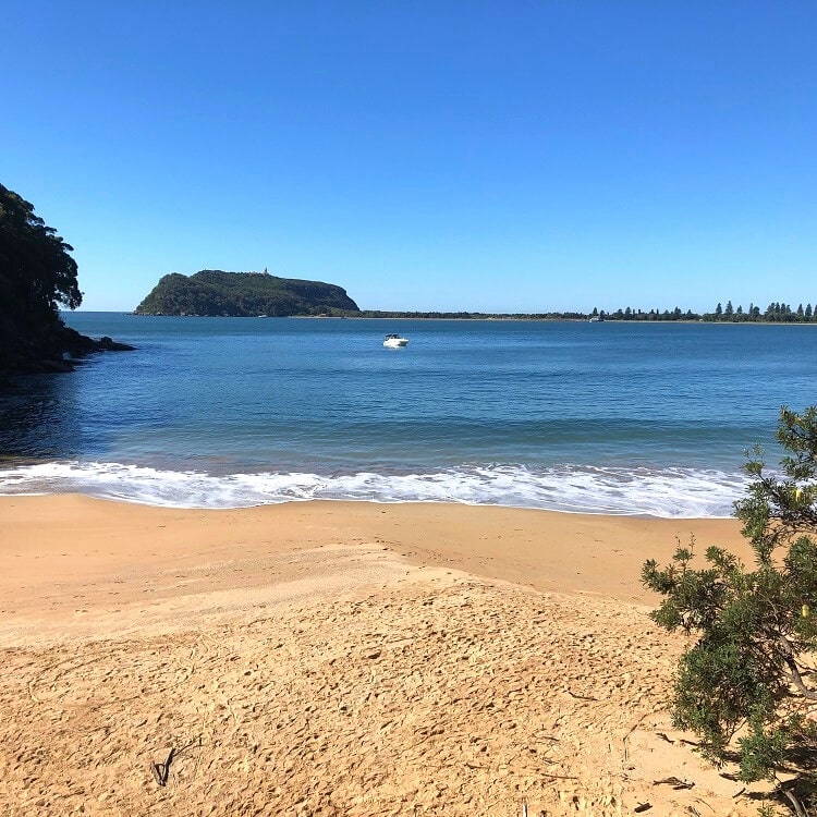
3. West Head Beach Walk
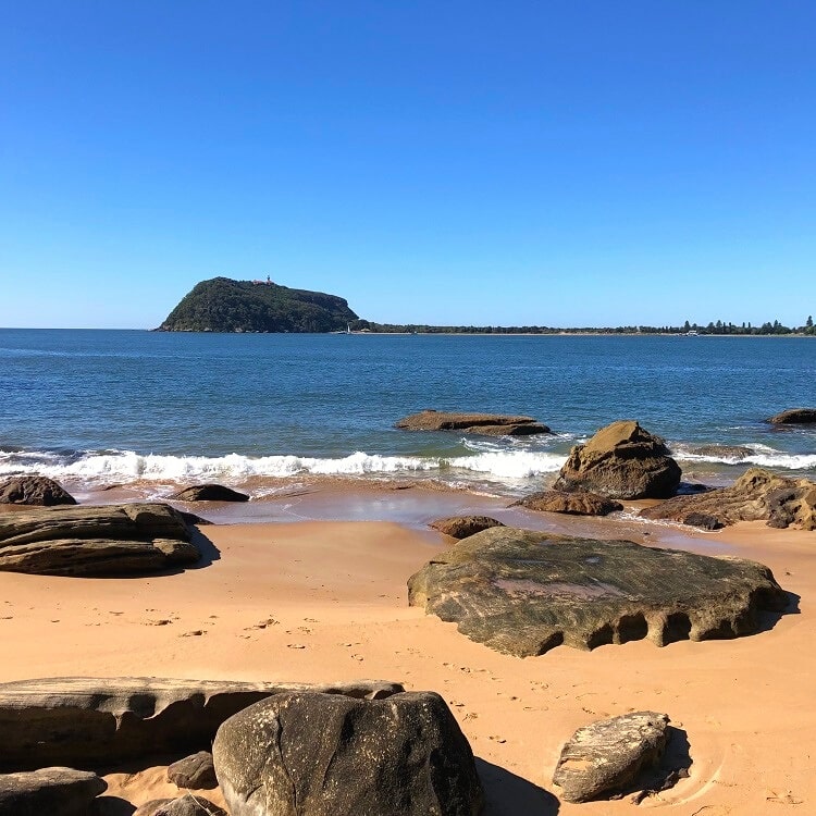
If you’re keen to visit a beautifully secluded beach, the walk to West Head Beach is a must. It’s only a short walk through the bush, with steep stairs leading down to the beach.
West Head Beach is only a small strip of sand, facing the Barrenjoey Headland on the other side of Pittwater. And with the fantastic views and clear water, the beach feels like a small paradise.
| West Head Beach Walk | |
|---|---|
| Distance: | 1 km (return) |
| Duration: | 1 hour |
| Grade: | Easy / moderate (some steep sections) |
4. Resolute Beach Loop Trail
From West Head Beach, the trail continues to Resolute Beach, another beautifully secluded strip of sand with stunning views.
From Resolute Beach, you have a few options. You can retrace your steps to the West Head Lookout, continue hiking to Great Mackeral Beach, or complete the Resolute Beach Loop Trail to the Resolute Picnic Area.
To do the loop trail, look for the walking track going up the hill, not too far away from the beach. This track connects with a fire trail that leads back to the picnic area.
| Resolute Beach Loop Trail | |
|---|---|
| Distance: | 6 km (circuit) |
| Duration: | 3 hours |
| Grade: | Moderate / hard (some steep sections) |
5. Great Mackerel Beach Walk
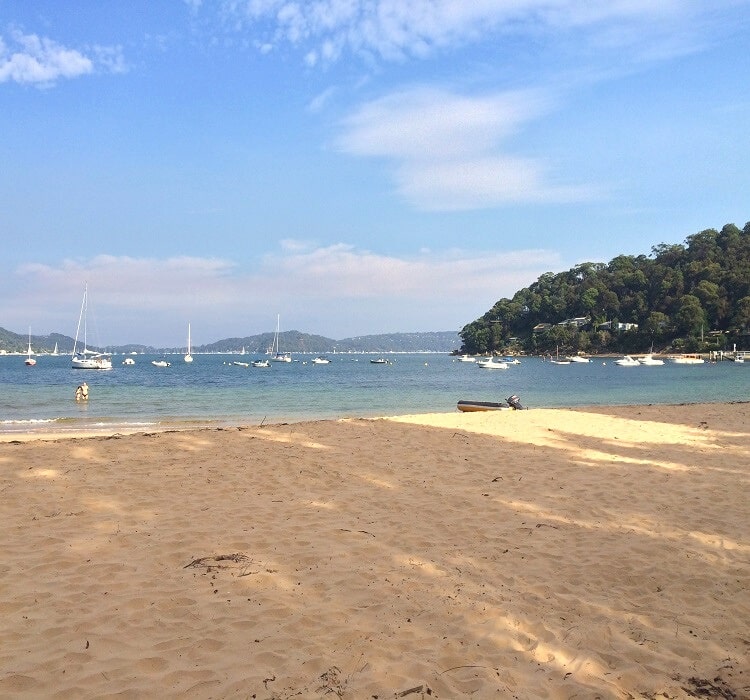
As mentioned, from Resolute Beach, you have the option to visit a third beach, Great Mackerel Beach, which is another 600 metres further south.
Great Mackerel Beach is also the name of the small suburb right behind the beach. It has a wharf, with ferries travelling between Great Mackerel and Palm Beach.
Once you’ve finished exploring this fascinating suburb, retrace your steps to either the West Head Lookout or the Resolute Picnic Area.
| Great Mackerel Beach Walk | |
|---|---|
| Distance: | 3.2 km (return) |
| Duration: | 2 hours |
| Grade: | Moderate / hard (some steep sections) |