Last updated: December 12, 2022
The Harold Reid Foreshore Track is a family-friendly bushwalk in the small suburb of Middle Cove, with scenic Middle Harbour views to take in.
This walk explores the Harold Reid Reserve, a beautiful pocket of natural waterfront bushland on a Hawkesbury sandstone landform.
Keep reading, as we share the highlights of this walk, how best to get there, and where to park your car.
| Harold Reid Reserve Track | |
|---|---|
| Distance: | 4 km (loop) |
| Duration: | 1.5 hours |
| Grade: | Easy (unsealed and slippery surfaces) |
| Dogs: | On a lead |
How to Get There
Harold Reid Reserve in Middle Cove is a bit of a hidden gem, but it is relatively easy to find.
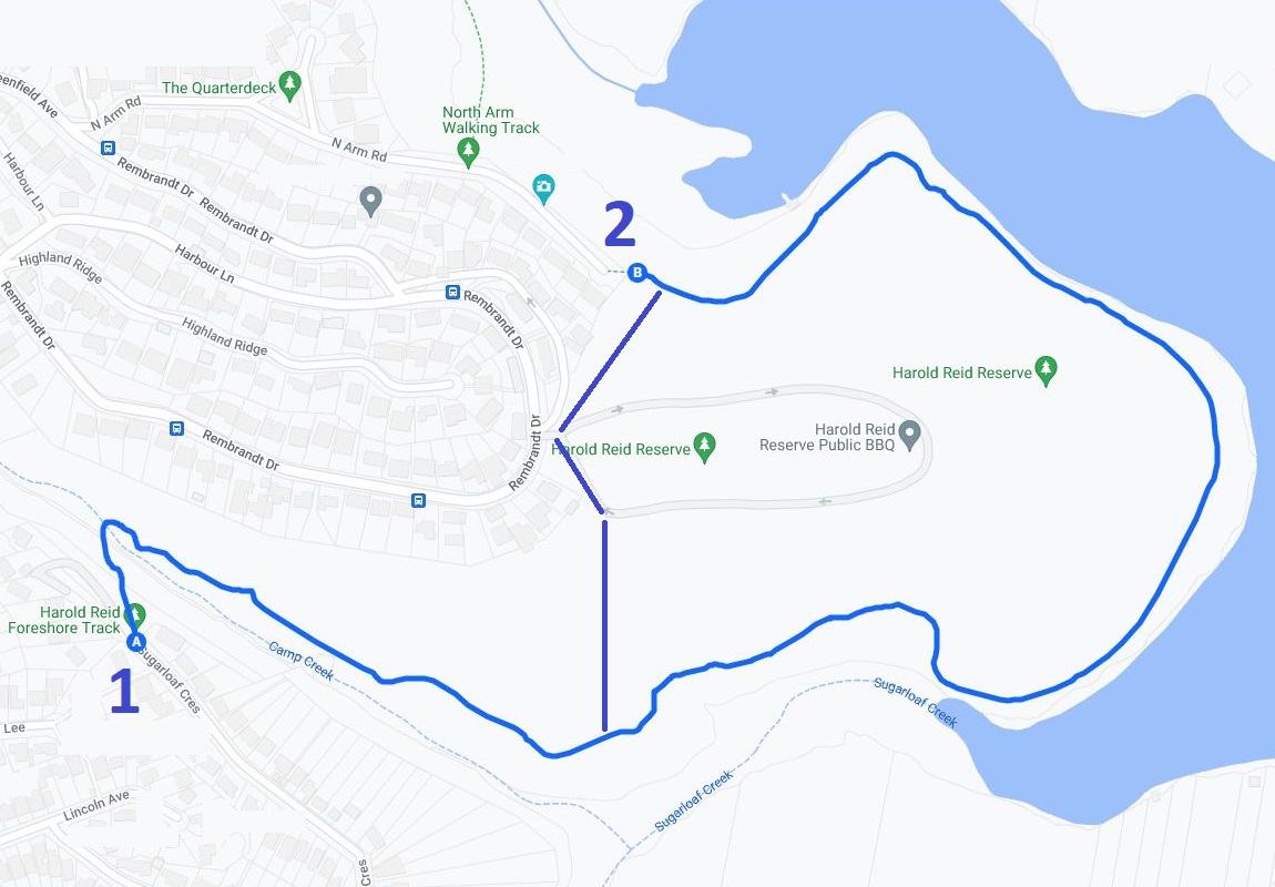
There are two locations to start this walk:
- From Sugarloaf Crescent in Castle Crag (see Google Maps).
- From North Arm Road in Middle Cove (see Google Maps).
We recommend starting from the Sugarloaf Crescent end so that you can include the 1 km trail along Camp Creek towards the loop, a section that is quite scenic and interesting.
Here is a map of the walk:
Track Notes
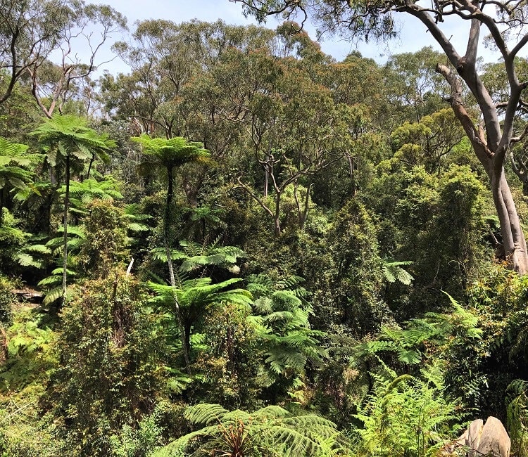
The Harold Reid Foreshore Track is an easy-to-navigate, family-friendly walking trail. It’s a real bushwalk, though, with an unsealed path and sections with uneven and slippery surfaces.
After a period of rainfall, the path can get a bit muddy, especially along the waterfront on the eastern side of the reserve.
Start of the Walk
Once you’ve parked your car, head straight into the bush at the signpost. It’s worth reading the information boards to learn more about the history of the reserve, the wildlife, and the plant communities.
The reserve was named after Harold James Reid, a local resident and Willoughby Council town clerk in the 1950s and 1960s, in recognition of his contribution to the community.
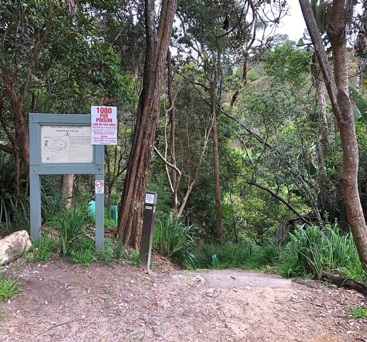
The path quickly descends into a thriving forest environment, crossing Camp Creek, and then heading east towards Sugarloaf Creek and Fig Tree Cove.
You will soon arrive at a junction where you can either climb up and head north to the other side of the reserve, or continue going straight along the creek.
We recommend turning left at this junction so that you can complete the entire loop in a clockwise manner.
Crossing the Reserve
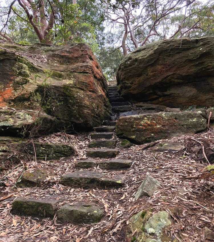
From that junction, the path ascends to higher ground via multiple sets of stairs, away from the creek.
After approximately 10 minutes, the trail ends up on a small road, which is the one-way road that leads to the Harold Reid Reserve picnic area and lookout (more on that further below).
At this road, turn left and keep walking on the side of the road for only a few moments until you see the continuation of the bushwalking trail on your right.
From there, the path continues towards the second entry point to the Harold Reid Reserve walking track, at the end of North Arm Road.
Water Views
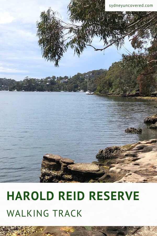
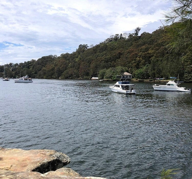
This is where the best part of the walking track starts, the section closely following the foreshore of the reserve.
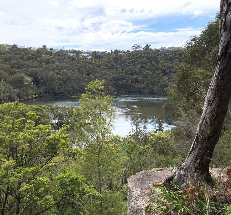
The path slowly descends towards the shoreline on the northern side of the reserve, while catching the first glimpses of the water.
After a few hundred metres of walking along the shoreline, the path arrives at a junction where you can go straight ahead to continue hiking along the water, or turn right for a shortcut through the bush.
We recommend going straight at this junction, as this is the most scenic part of the walk, which includes a nice lookout right at the water at Sugarloaf Creek.
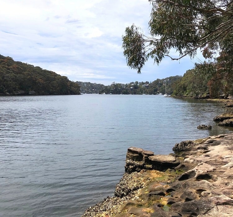
Sugarloaf Creek
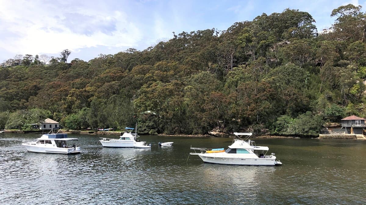
The water views from this lookout are lovely, and the lookout itself, a small rocky platform, lends itself well to a picnic at the water.
From the lookout, the path soon arrives at the very first junction of the walk, from where you can retrace your steps back up to Sugarloaf Crescent.
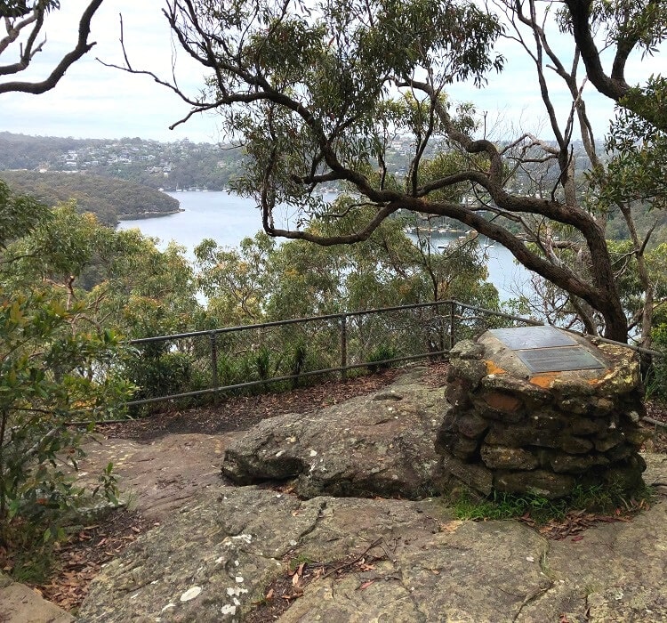
Picnic Area and Lookout
Once you’ve completed the entire walking track and made it back to where you started, it’s worth driving to the Harold Reid Reserve BBQ area and lookout point.
You could also walk there (the road starts from Rembrandt Drive), but since the road itself is quite narrow and not very exciting, driving there might be the better option.
To get there, make your way to Rembrandt Drive east of the reserve, and then turn into this one-way road that goes into the reserve.
Keep driving until you see picnic tables and BBQs, where you can park your car. From there, it’s a short walk to the lookout, where you can enjoy scenic Middle Harbour views.