Last updated: January 12, 2022
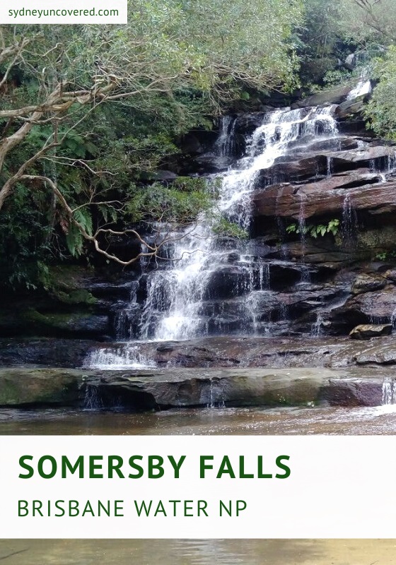
A visit to Somersby Falls in Brisbane Water National Park is a geat day trip from Sydney, with beautiful scenery and great picnic facilities to enjoy.
Follow a short walking track along Floods Creek from the picnic area that goes all the way to the base of Somersby Falls.
A series of small but pretty waterfalls will greet you, as you make your way down along this easy and picturesque walking trail.
| Somersby Falls Walking Track | |
|---|---|
| Distance: | 500 m (return) |
| Duration: | 30 minutes (depending on stops) |
| Grade: | Easy (some steep sections) |
| Dogs: | Not allowed |
How to Get There
Somersby Falls and the picnic area are located within Brisbane Water National Park, and are very easily accessible.
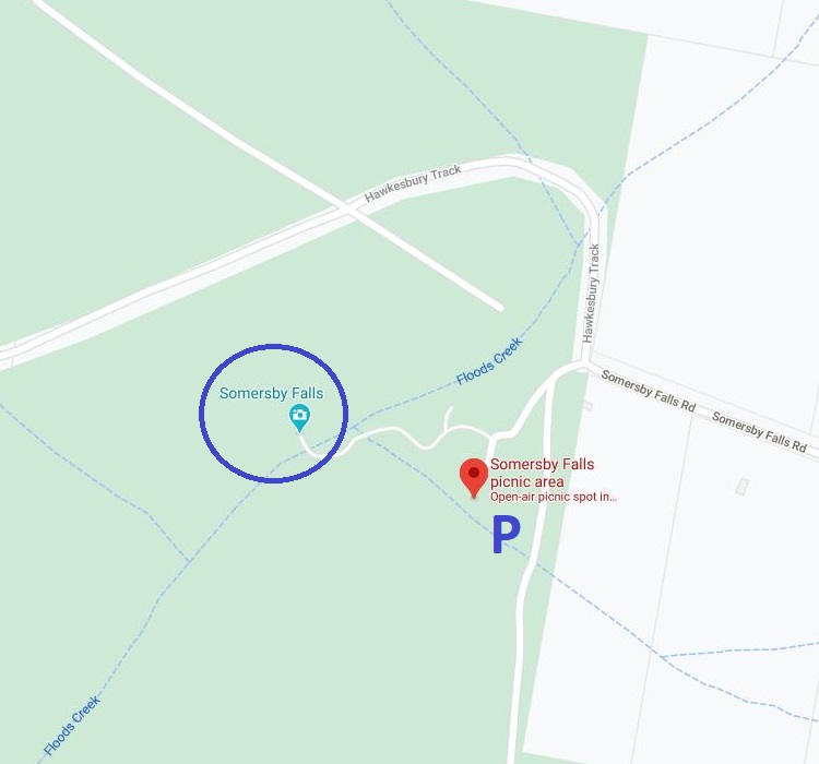
To get there, turn into Wisemans Ferry Road from the M1 Pacific Motorway. At the first roundabout turn left into Somersby Falls Road. Keep following this road until you reach the car park at the picnic area (see map location).
An $8 parking fee applies per vehicle for the whole day, which you can pay at one of the ticket machines at the carpark.
Somersby Falls Picnic Area
The picnic area at Somersby Falls is located at the end of Somersby Falls Road, right next to the carpark.
It has excellent facilities, such as barbeques, picnic tables, toilets, garbage bins, and various information boards where you can read more about the national park.
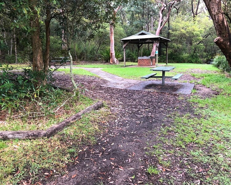
Conveniently located close to the motorway, the Somersby Falls picnic area is also a popular rest stop along the NSW Central Coast route.
What’s great about this picnic site, and the entire Somersby Falls area, is that it is located right in the middle of thick rainforest.
The fresh air, the giant trees, the wildlife (birds, lizards, brush turkeys, etc.), it makes for a great day out in beautiful natural surroundings.
Before you head out to Brisbane Water National Park, it’s recommended to check online for any potential park closures or weather warnings.
Opening hours of the picnic area are from 8am to 8pm during daylight savings, and otherwise from 8am to 5pm during the rest of the year.
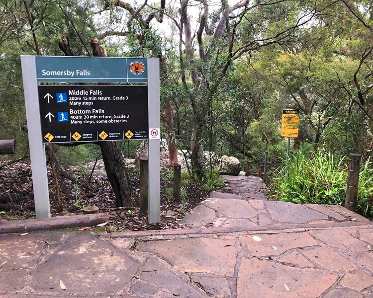
Somersby Falls Walking Track
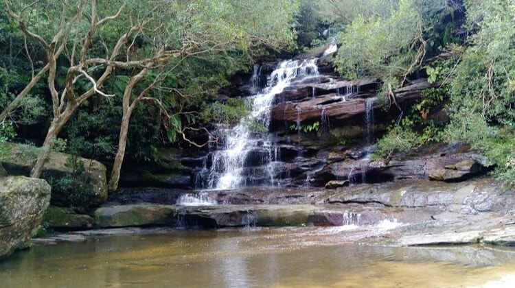
The 500 metres return walk through lush rainforest offers views of the top, middle and bottom falls, with several lookout points to enjoy along the way.
There are three parts to Somersby Falls:
- Upper Falls
- Middle Falls
- Bottom Falls
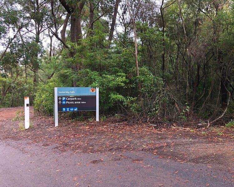
The start of this walking track is next to the picnic area, and goes all the way down to the bottom of Somersby Falls.
Start the walking trail at the information board, and follow the path until it arrives at the first intersection.
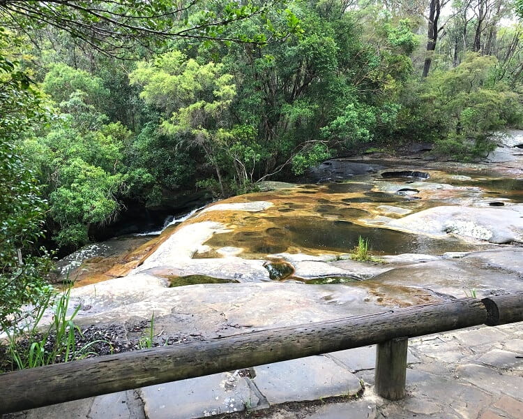
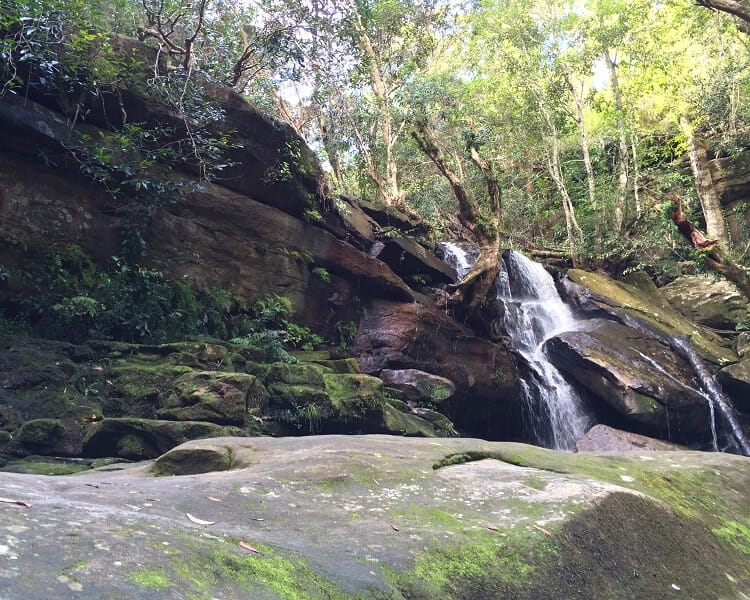
Turn right to pay a quick visit at the first lookout on the walking track, which offers scenic views of the top of Somersby Falls.
Back on the main trail, after a few minutes you can turn left to have a look at a small waterfall on a tributary of Floods Creek.
This small waterfall is certainly not as impressive as the main Somersby Falls waterfalls, but it is still worth checking out while you’re there.
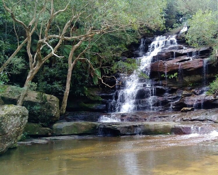
Keep following the main track and make your way to the next stop, the middle part of Somersby Falls (middle falls). It’s possible to get very close to the waterfall, and the surrounding scenery is absolutely stunning.
There is a rather large and flat area in front of the waterfall, where you can wander around and enjoy the fantastic views.
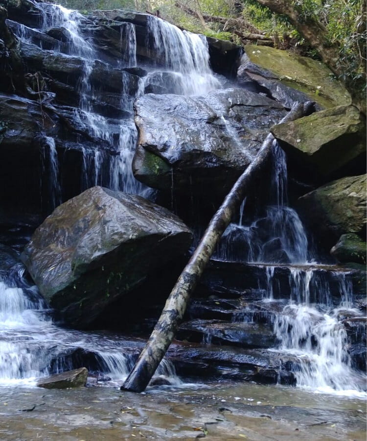
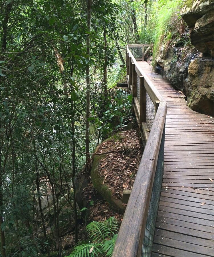
The rest of the trail brings visitors all the way down to the bottom of Somersby Falls. Be careful though, because there are some steep parts and various sets of stairs to conquer here.
Once you see the “No track beyond this point” sign, you’ve made it to the very end of the walking track.
Have a look around and enjoy the beauty of this area. The return trip back up to the picnic area is a bit harder, so by all means take your time.
The Somersby Falls walking track is a great walk at any time of year, but the waterfalls are at their best after a few days of rain. It’s also a great spot to go for a little dip if the weather is warm.
Although it’s an easy walk, it is recommended to bring appropriate shoes with you, as the track can be quite steep and slippery at times.
If you’re not planning to stay at Somersby Falls for too long, perhaps visit the Australian Reptile Park, which is only a short drive away from the waterfall.