Last updated: March 28, 2024
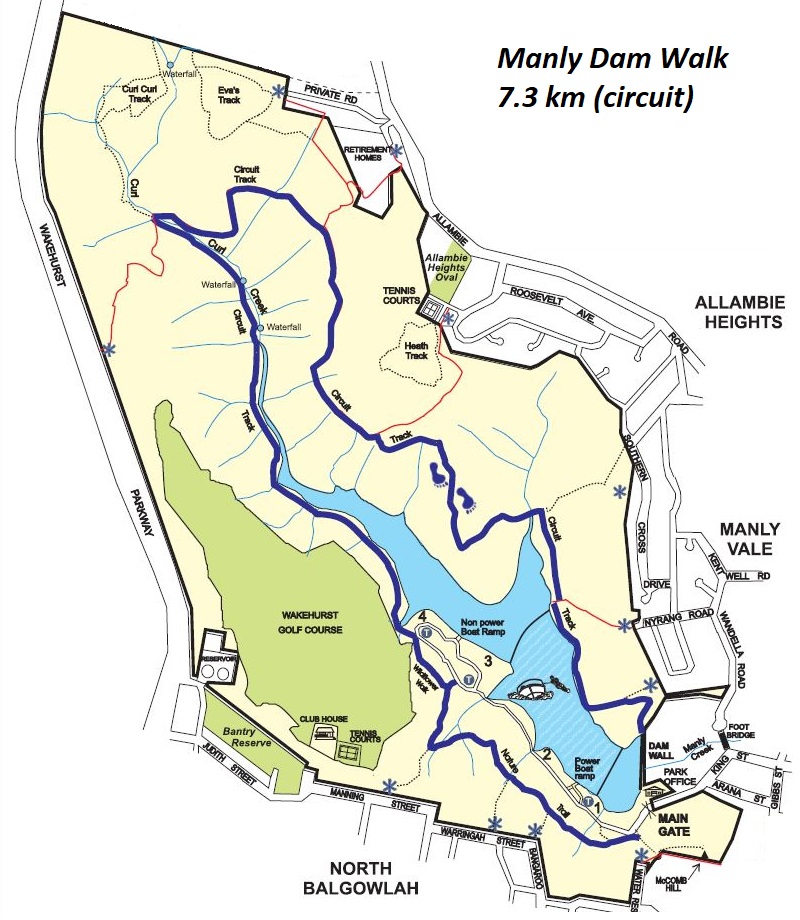
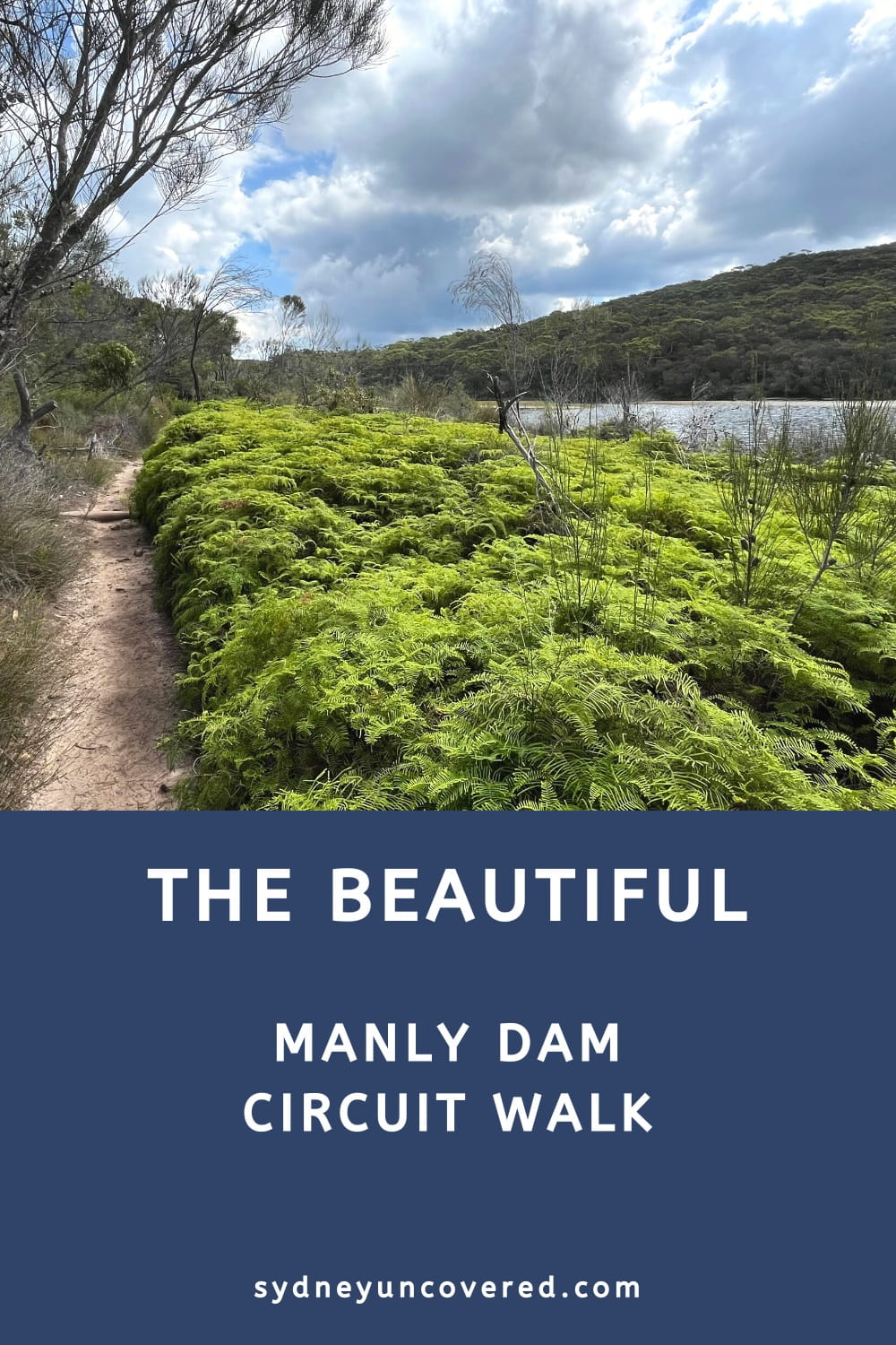
The Manly Dam Walk is a scenic 7.3 km circuit trail in Manly Warringah War Memorial State Park, consisting of the Nature Trail, the Wildflower Walk, and the Park Circuit Track.
The walk navigates through various types of landscapes, with spectacular views of the lake and the surrounding bushland scenery.
In this article, we’ll share everything you need to know about this exciting bushwalk, including how to get there, where to park, and a handy map.
| Manly Dam Walk | |
|---|---|
| Distance: | 7.3 km (circuit) |
| Duration: | 3 hours |
| Grade: | Moderate |
| Dogs: | On a lead |
How to Get There
The Manly Dam Walk is located within the Manly Warringah War Memorial State Park, also known as Manly Dam Reserve, or simply Manly Dam.
In Manly Vale, drive to the end of King Street (off Condamine Street), where you will see a small paid parking area (see map location).
If this car park is full or you find it a bit too expensive, try parking just outside the reserve along the suburban streets nearby.
Public transport is also an option. Buses travel regularly between the city and Manly Vale, with various bus stops within walking distance from the reserve.
Map
Below is a map of the 7.3 km Manly Dam Walk in Manly Warringah War Memorial State Park.
If you’d like to print a map and take it with you on the walk, click on this link where you’ll find a map on the Northern Beaches Council website.
Manly Dam Circuit Track Notes
The official 7.3 km long Manly Dam Walk starts at the car park at the end of King Street and consists of the following three sections:
- Nature Trail
- Wildflower Walk
- Park Circuit Track
There are various intersections (and shortcuts) along the way, but if you want to do the entire 7.3 km loop, follow the signs for Nature Trail, Wildflower Walk, and Park Circuit Track, in that order.
We grade this walk as moderate as there are a few steep sections and some sections where the path can be uneven and rough. Overall, though, the walk is well-maintained and easy to follow.
1. Nature Trail
To start the Manly Dam Circuit Walk, look for the big signpost opposite the War Memorial at the car park. From there, the path goes uphill via a set of steps.
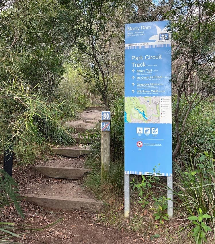
The first section of the circuit walk is the Nature Trail, a peaceful walking track through beautiful bushland with various staircases to negotiate. To stay on the right path, keep following signs for Nature Trail.
The Nature Trail is considered the most challenging part of the circuit walk, so perhaps it’s good to get that out of the way first.
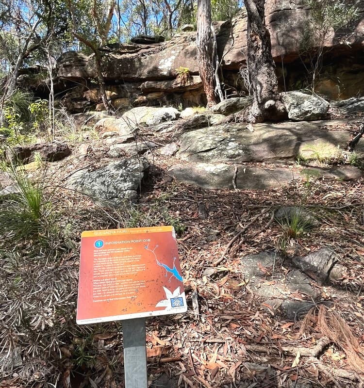
You will also find various interesting information boards along the path that explain more about the local flora and fauna and Aboriginal heritage.
2. Wildflower Walk
After approximately 1.5 km of hiking, the walk arrives at a junction signposted as the Nature Trail and Wildflower Walk.
This is where the Nature Trail ends and the Wildflower Walk begins, heading up the steps.
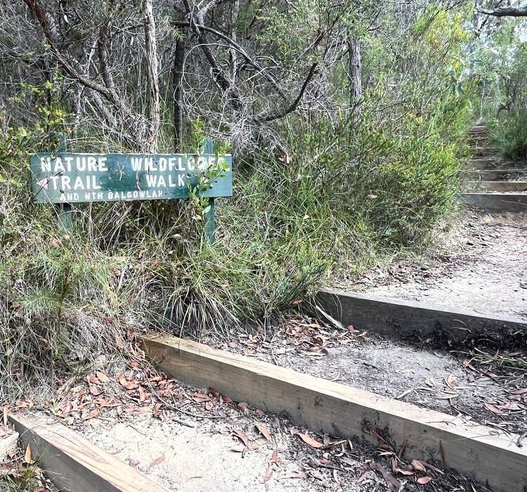
The Wildflower Walk is less than 500 metres long and runs behind the northernmost car park. It’s an easy walk that connects the Nature Trail and the Park Circuit Track.
The Park Circuit Track starts just past the picnic area and is signposted. Follow the red markers to stay on the right trail.
3. Park Circuit Track
The third section of the walk, the Park Circuit Track, is the longest and most enjoyable section, navigating through beautiful scenery.
Parts of this walk are on boardwalks, and some parts are on a fire trail. To stay on the right path, follow the red markers and signs for Park Circuit Track.
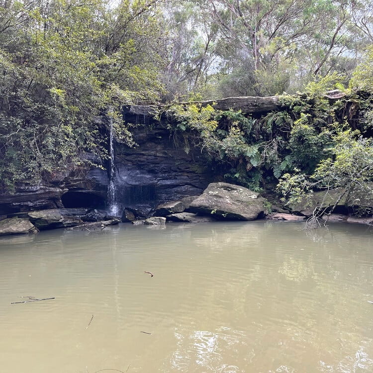
Manly Creek Waterfall
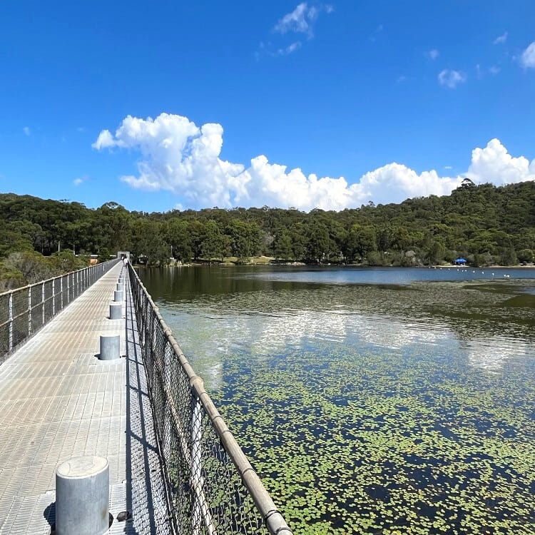
The walking track navigates through an area of wetlands that were artificially created by the damming of the creek. They now form part of a vital local ecosystem.
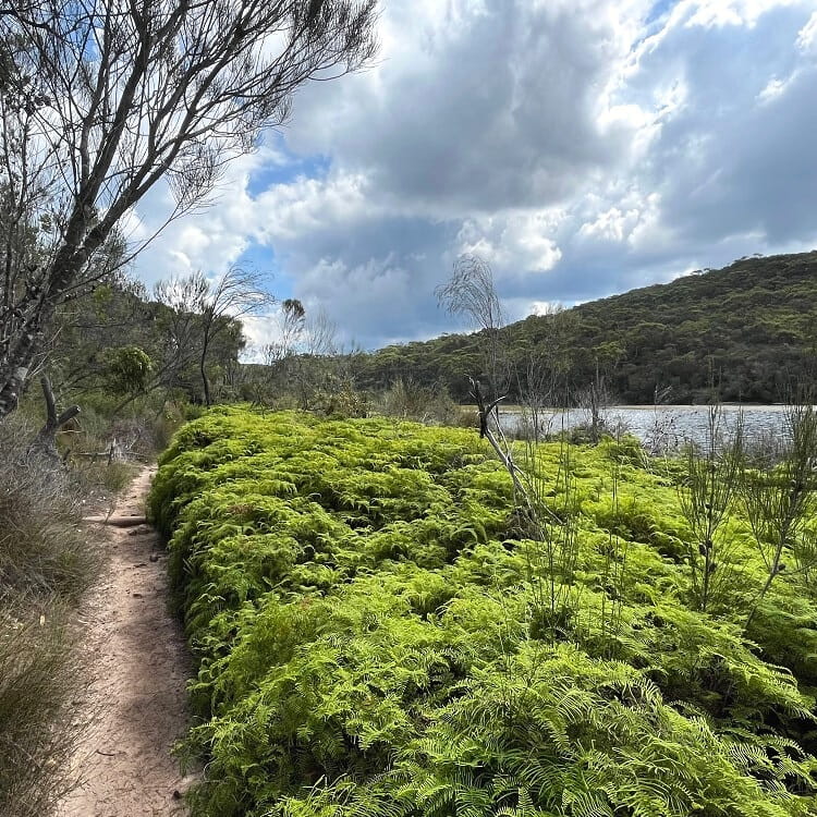
It’s a beautiful area with various boardwalks and small footbridges. You may even spot some of the local residents, such as black swans, swamphens, and freshwater fish.
Before the turning point, the track passes a small waterfall on Manly Creek. It’s a lovely spot with a pool where kids can go for a splash on a warm day.
At the northernmost point of the circuit track, the trail crosses Manly Creek, and from there, it continues southbound towards the dam.
Manly Dam MTB Trail
This turning point is where the circuit walk merges with the Manly Dam MTB Trail. Look for the sign as in the photo below, where you need to turn right.
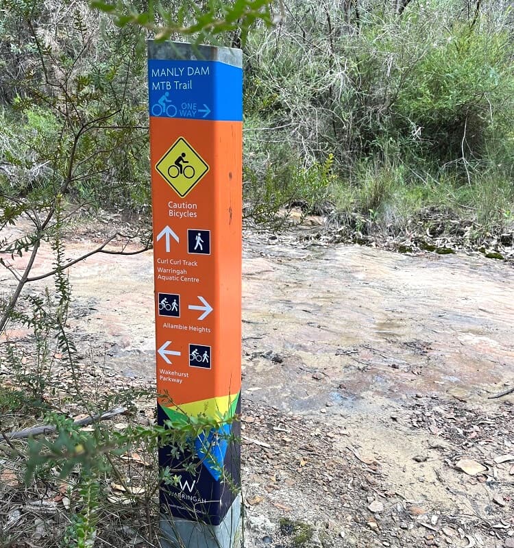
For the next 1.5 km, you will be sharing the trail with mountain bikers, so it’s recommended to be careful and stick to the side of the trail.
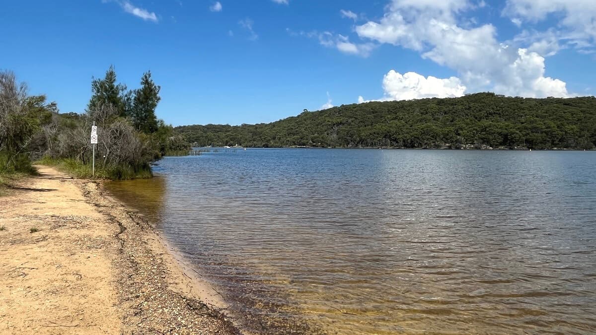
The Lake
Leaving the MTB trail behind, the walking track heads back into the bush. It then follows a long section along the lake’s shoreline before arriving at the dam.
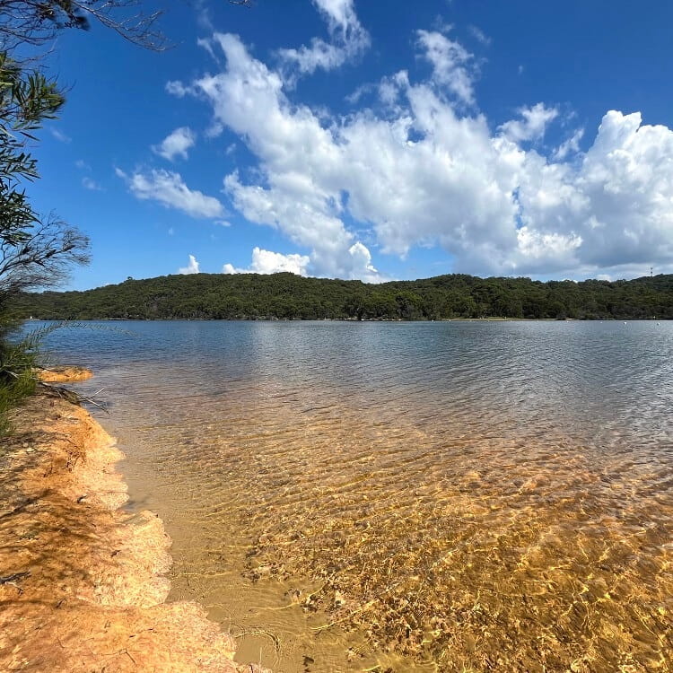
There are various spots along this part of the trail where you can get very close to the water and perhaps take a break with some food.
The views over the lake are beautiful, and you may even be able to watch the water skiers going past.
Crossing the Dam
The Manly Dam was constructed in 1892 and had an initial height of 11 metres. After several increases, the dam wall reached its current height of 35 meters.
Surrounded by 377 hectares of native bushland, the lake created by the dam is known as the largest freshwater lake in Sydney.
In the first half of the 20th century, Manly Dam slowly reached its limits of capacity, and pumping from the dam officially stopped in the 1930s.
The views over the lake from the top of the dam wall are very pretty. The circuit track officially ends at the other side of the Manly Dam wall.
If you’re interested in learning more about dams and the history behind them, read our article about dams in Greater Sydney that you can visit.
Hi!
Is Manly Dam walk a national park?
Can dogs go on the walk?
Hi Kate, dogs are allowed on the tracks and in the bushland, but not in the water or the picnic areas. Enjoy!
Just completed the walk around Manly Dam, minus the wildflower track. Brilliant walk. However it is NOT level and requires some fitness. There are quite a few long inclines and lots of places where one is stepping up or down rocks. The creek crossing at the turn round point furthest from the dam wall is a bit tricky and would not be possible with more rain than we had last night (9mm). I would grade the track as medium. Many of our group really enjoyed it, but it was not suitable for a few with knee/foot problems.
Also on the north side of the dam, towards the end, more signs are needed as there are 2 ways to go. We made it ok, but it would have been nice to have a sign. Highly recommend this walk.
Hi Anne, these are all valid points you’re making, thanks for your input and glad you enjoyed the walk!