Last updated: March 19, 2024
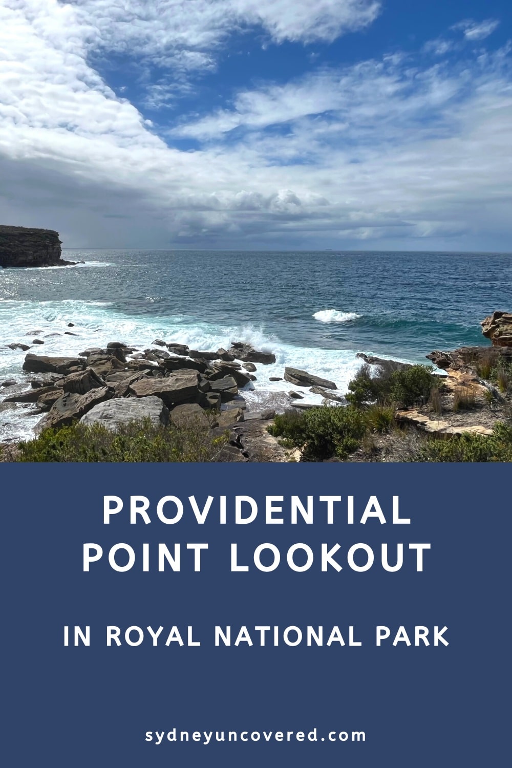
The Providential Point Lookout is a stunning viewing point in the Wattamolla area of Royal National Park, offering beautiful coastal views.
A short walking trail from the Wattamolla car park will get you to this lookout, with various other walks and things to do nearby to make a day of it.
| Providential Point Walk | |
|---|---|
| Distance: | 1 km (return) |
| Time: | 0.5 hours |
| Grade: | Easy |
| Wheel-friendly: | No |
| Dogs: | Not allowed |
How to Get There
To do the walking trail to Providential Point Lookout, you will need to park your car at Wattamolla Beach, which is easy to drive to.
To get there, turn into Wattamolla Road from Sir Bertram Stevens Drive and drive to the end. There is ample parking at Wattamolla, but the car park can fill up quickly on sunny weekends.
To park anywhere in the Royal National Park, you must pay the $12 parking fee. You can pay this at one of the booths (if they’re open) or use one of the pay machines.
Map
Below is a map with the walking trail to the Providential Point Lookout and the car parking area:
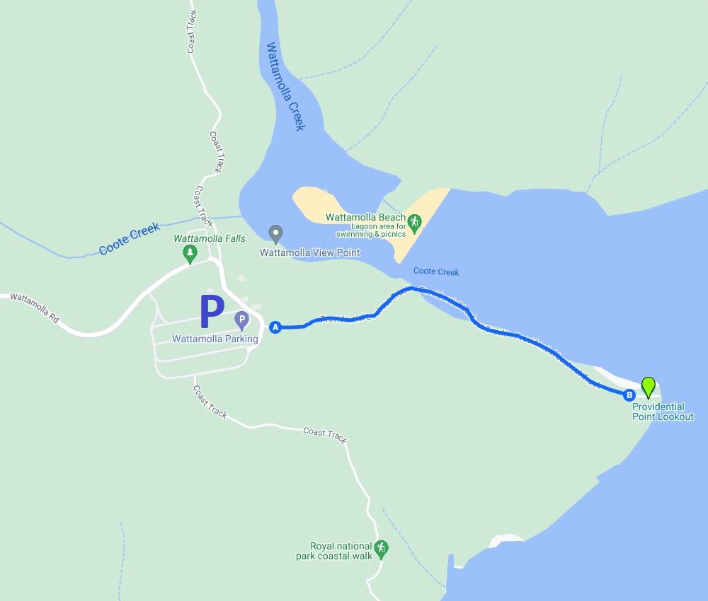
Walk to the Providential Point Lookout
Access to the walking trail to Providential Point Lookout can be found along the eastern side of the car parking area.
Look for signs that say Wattamolla Lagoon, Providential Point Loop, and Royal Coastal Track South. Walk past the large toilet block and follow the path until you see the sign, as in the photo below.
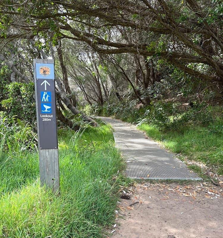
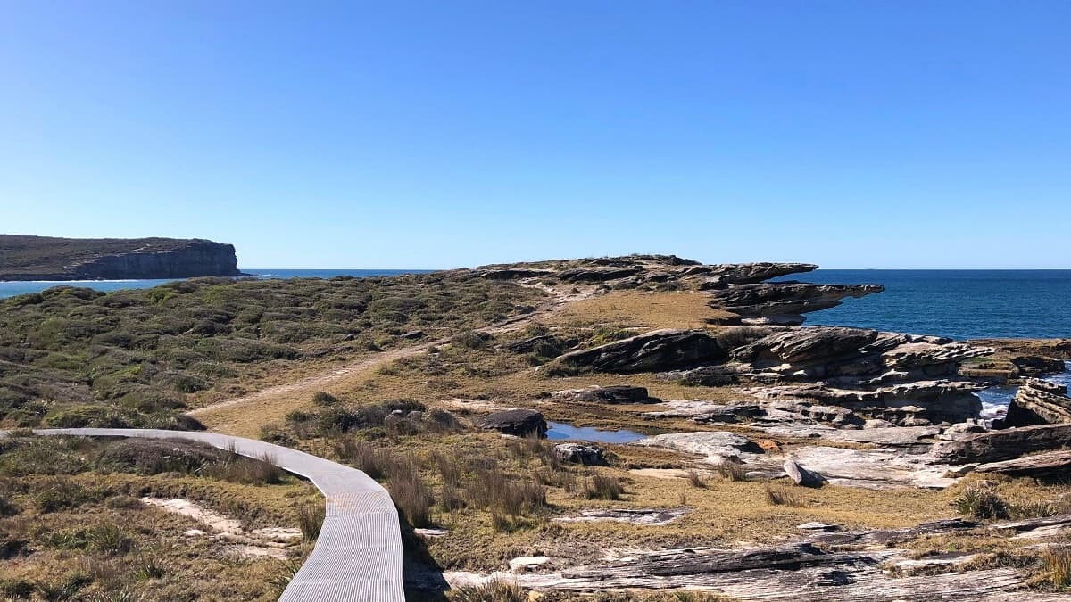
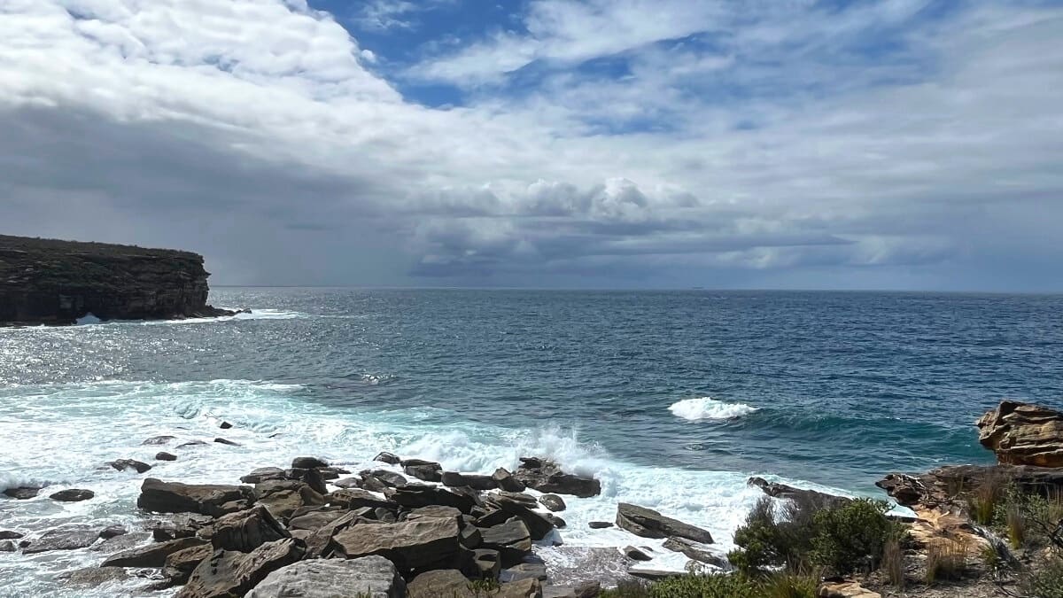
That’s where the walking trail to the Providential Point Lookout officially starts. The trail is almost entirely on a boardwalk, with views of the beach and the ocean to take in on your left.
It’s only a few hundred metres before the trail arrives at a fenced area with viewing platforms on multiple levels.
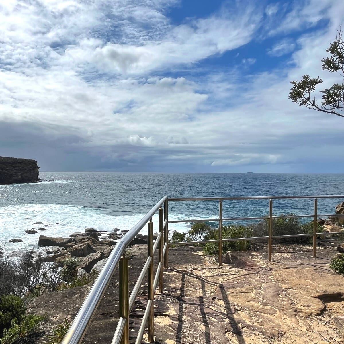
The views towards the ocean and Martin Head on the other side of the bay are phenomenal, but Wattamolla Beach can’t be seen from the lookout.
Once you’ve finished exploring the lookout, go ahead and spend a few hours at Wattamolla Beach, or continue hiking!
Continue Hiking
From the Providential Point Lookout, the Coast Track continues southbound to Eagle Rock and Curracurrong Falls.
Interestingly, Google Maps doesn’t recognise the connecting trail from the Providential Point Lookout to the Coast Track going southbound, but that connecting trail does exist.
Simply go up the stairs from the lookout and continue hiking from there. It’s about 3.5 km one way on a mostly flat walking path to reach Eagle Rock.
Read more about the walk to Eagle Rock and Curracurrong Falls.
Alternatively, you can do a section of the Coast Track going northbound to Little Marley Beach, Marley Beach, and even Wedding Cake Rock.
To do that, retrace your steps from the lookout back to the car park and look for the Coast Track signpost at the northern end of the picnic area.
Read more about the walk to Little Marley Beach.