Last updated: April 26, 2024
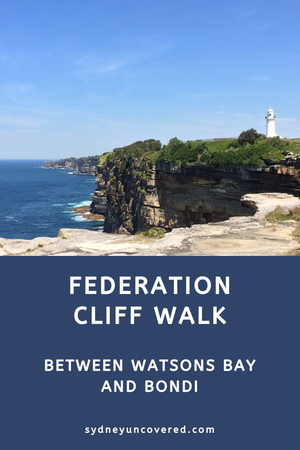
The Federation Cliff Walk is a 5 km trail from Watsons Bay to Dover Heights north of Bondi, offering panoramic coastal views.
This coastal walk meanders through various parklands and open green spaces and includes an exciting timber walkway with viewing platforms on the cliffs.
While this walk is not as pretty as the coastal walks south of Bondi, we still recommend doing the Federation Cliff Walk, as it offers unique views.
| Federation Cliff Walk | |
|---|---|
| Distance: | 5 km (one way) |
| Duration: | 1.5 hours |
| Grade: | Easy |
| Dogs: | On a lead |
How to Get There
The best way to get to Watsons Bay is by ferry from Circular Quay. From the ferry wharf in Watsons Bay, walk across Robertson Park to The Gap and follow the walking trail heading south.
Travelling by bus is also a good option, with buses departing regularly from the city to Watsons Bay. Check the timetables on the Transport NSW website.
If you’re driving in by car, the best location to park your vehicle in Watsons Bay is on Old South Head Road. At the other end of the walk, ample street parking is available in Dover Heights.
Another way to get to Watsons Bay is via the walking trail from Rose Bay. Doing that walk plus the Federation Cliff Walk will end up being 13 km long.
Highlights and Map
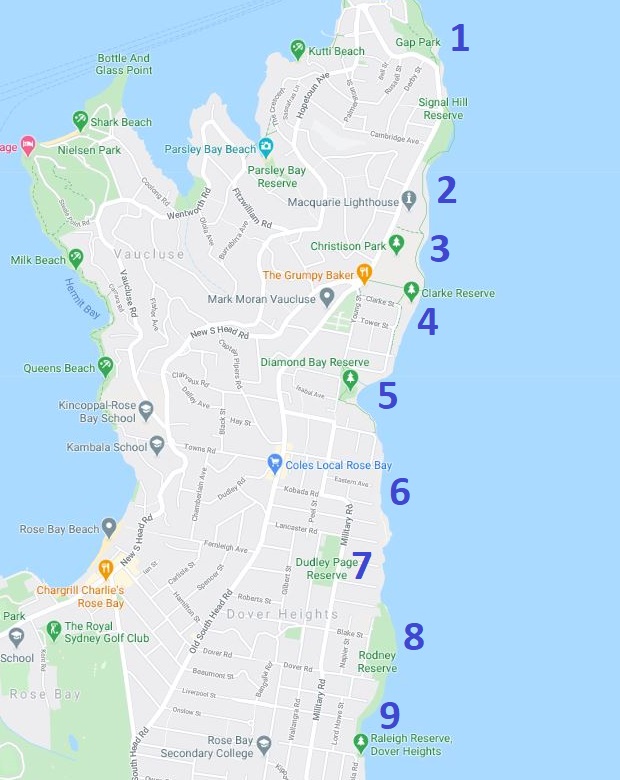
In this guide to the Federation Cliff Walk, we are going to focus on the following nine landmarks and highlights:
- Gap Park
- Macquarie Lighthouse
- Christison Park
- Clarke Reserve
- Diamond Bay Reserve
- Eastern Reserve
- Dudley Page Reserve
- Rodney Reserve
- Raleigh Reserve
In the track notes below, we’re diving deeper into each of these highlights, as we navigate the trail from north to south.
Here is a handy map for your reference, with the highlights marked from 1 to 9, starting at Gap Park in Watsons Bay:
Track Notes
The Federation Cliff Walk can be commenced either from Gap Park in Watsons Bay, or from Rodney Reserve or Raleigh Reserve in Dover Heights.
In the following track notes, we are starting at The Gap in Watsons Bay, walking southbound to Dover Heights.
1. Gap Park
The Gap is one of Sydney’s most famous ocean cliff lookouts with breathtaking views, located on the eastern side of Watsons Bay.
The Gap is part of Gap Park, a designated area designed around this unique cliff structure. A short walking trail includes a few vantage points from where you can enjoy some pretty impressive views.
Check out our Watsons Bay hiking guide for more information about The Gap and the walking trail around South Head.
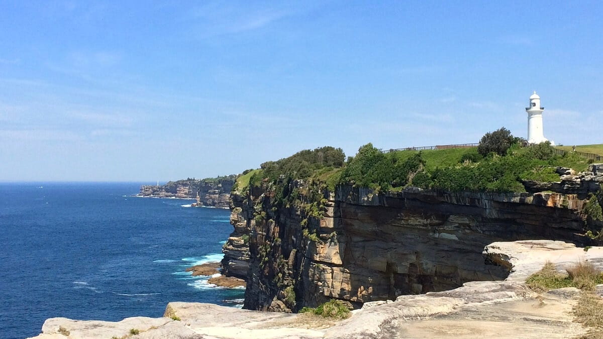
2. Macquarie Lighthouse
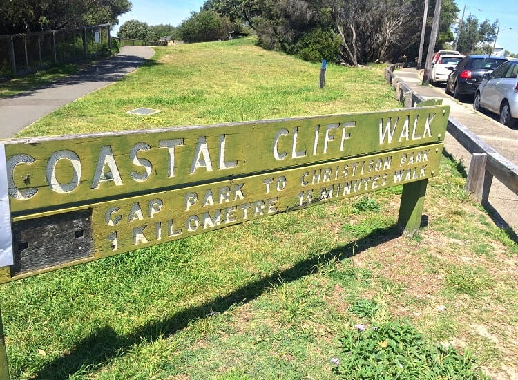
From The Gap, follow the cliff-side path towards the south through Gap Park, connecting with Old South Head Road.
The track stays on the road’s footpath for a short while until it turns into the Coastal Cliff Walk path (see the big sign), which runs parallel to Old South Head Road.
Continue on this path and enjoy the views of the ocean on your left, as you walk past the Signal Station and Signal Hill Fort (est. 1893), part of the Signal Hill Reserve.
The gun at the fort was removed in the 1930s, and the underlying fort has since been locked up. The site of the current signal station has been used since 1790 to signal incoming ships.
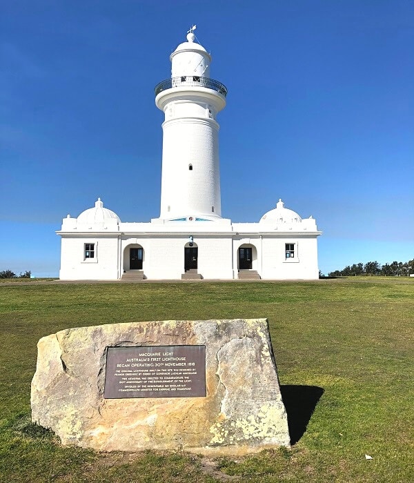
As you continue, you will be walking through the Lighthouse Reserve, past the historic Macquarie Lighthouse.
First constructed in 1818 and rebuilt in 1883, the Macquarie Lighthouse is the oldest lighthouse in Australia, and is open for guided tours.
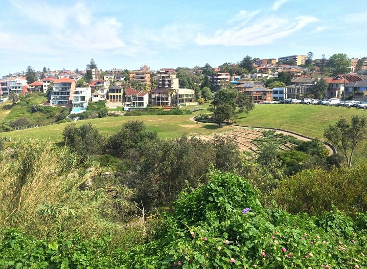
3. Christison Park
The path continues south past Christison Park, with its extensive open sports grounds and various fitness stations.
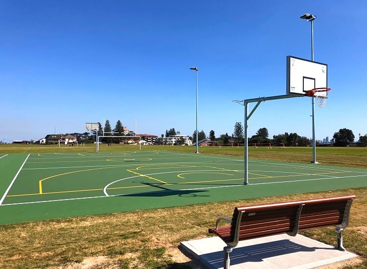
Christison Park is an excellent picnic spot with toilet and playground facilities available.
There is very little natural shade in the park, though, so on a warm and sunny day, Christison Park may not be the best location for a break.
4. Clarke Reserve
The walking path continues to Clarke Reserve, where you will see the first glimpses of the sandstone cliffs at Diamond Bay, further south.
At Clarke Reserve, walk into Jensen Avenue via Clarke Street.
Then turn into Marine Street and Chris Bang Crescent, which will lead to the steps going down into Diamond Bay Reserve.
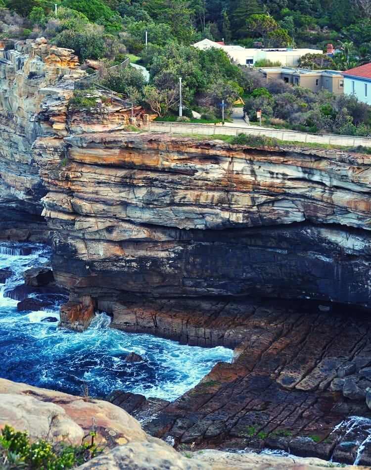
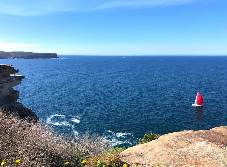
5. Diamond Bay Reserve
As you walk down the steps into Diamond Bay, it’s almost like you’re stepping into a rainforest with beautiful thick vegetation.
The track continues around Rosa Gully, an inlet between the cliffs, a popular place for rock climbing and abseiling.
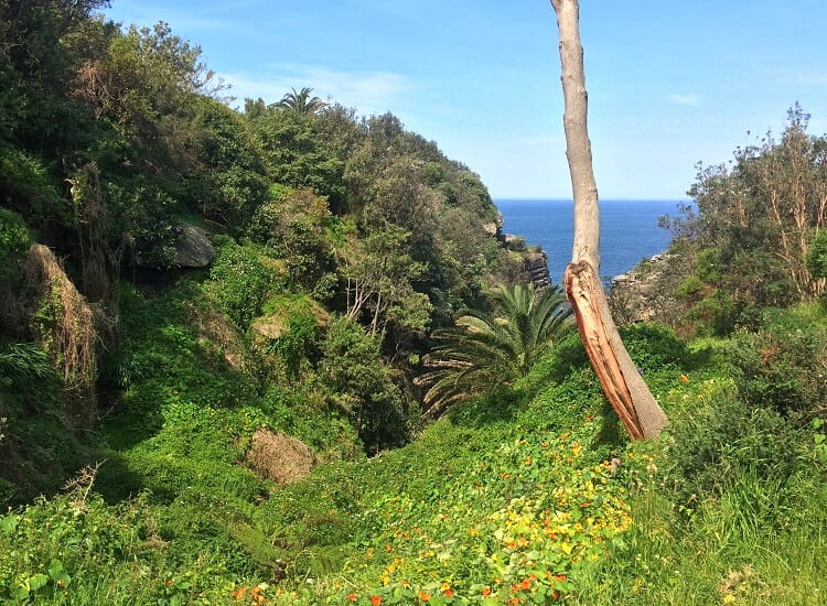
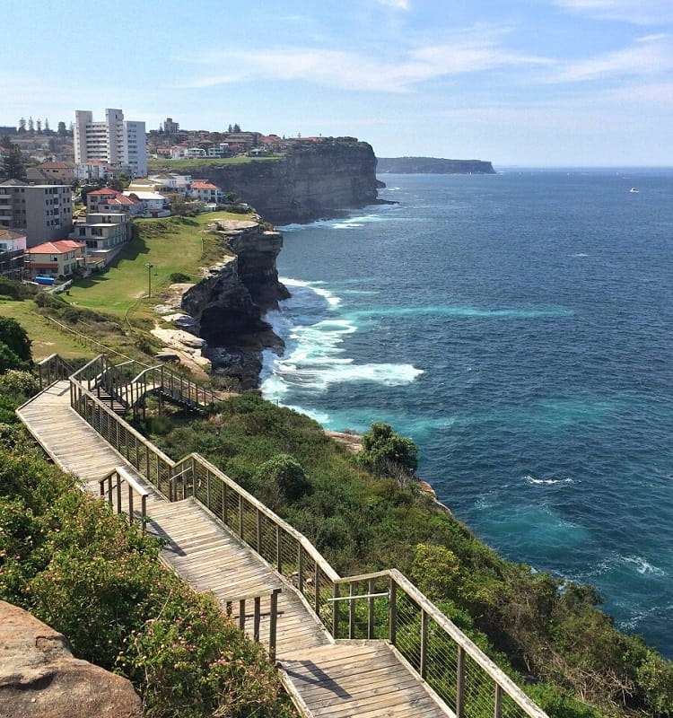
A beautifully constructed wooden walkway with viewing platforms, built by Waverley Council, provides a safe and scenic route around the cliffs.
This walkway will make you feel like you’re walking above the ocean, which makes this walking track even more special.
It starts at Diamond Bay Reserve and continues, with a few interruptions, all the way to Dover Heights.
6. Eastern Reserve
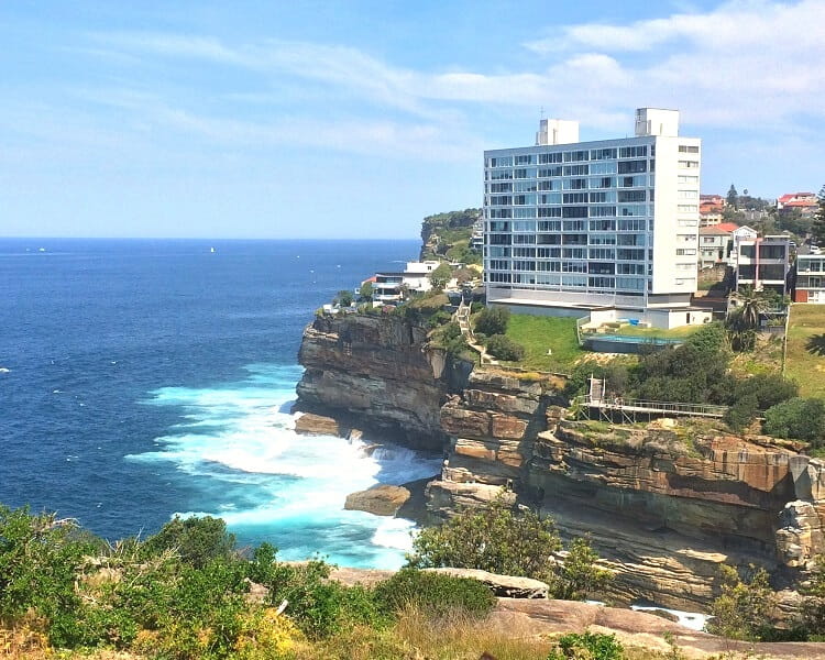
Follow the timber walkway heading south, around the enormous white apartment block with million-dollar views, to Ray Street.
The cliff walk continues a few hundred metres south at Oceanview Avenue, from where you can access Eastern Reserve, also known as Dover Heights Reserve.
Eastern Reserve is a cliffside park located at the end of Eastern Avenue. It’s a beautiful park where you can take your dog for a walk while enjoying the scenic coastal views.
It’s also a great location to spot whales during the migration seasons, as the ocean views are far-stretching and uninterrupted.
7. Dudley Page Reserve
From Eastern Reserve, keep walking south and turn into Lancaster Road, followed by a left turn into Military Road.
This is where Dudley Page Reserve is located, a large grassy area offering fantastic views towards the Sydney CBD skyline.
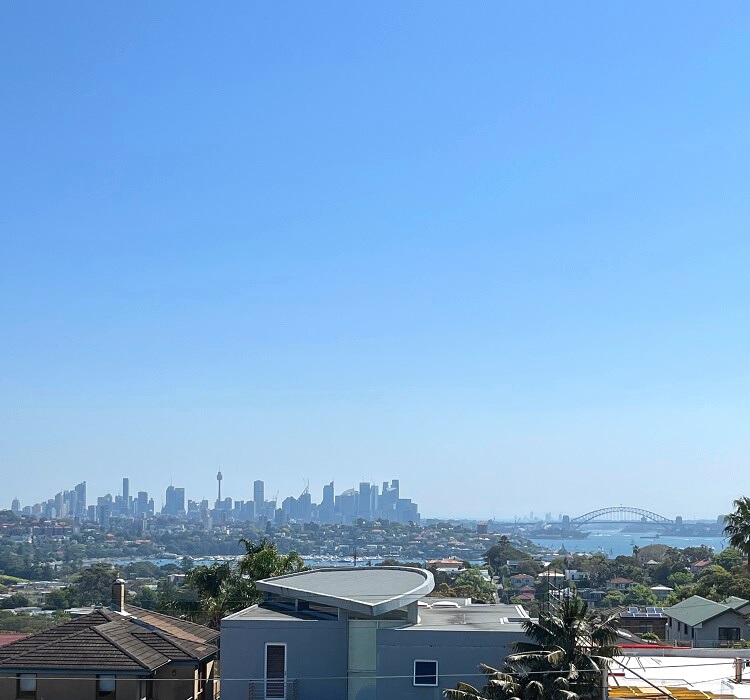
Take a moment to enjoy the spectacular city and Harbour views from this park area, which is also a popular vantage point for the Sydney New Year’s Eve fireworks.
It’s easy to understand why this park is such a popular spot with tourist buses that often stop there for unique photo opportunities.
8. Rodney Reserve
From Military Road, turn left into Weonga Road or Blake Street to return to the Federation Cliff walking track.
This is the northern point of Rodney Reserve, which flows into Raleigh Reserve towards the south.
Near the cliffs in Rodney Reserve, you can find a full-size replica of an eight-element radio antenna that was built in 1951. It has an informative plaque in front of it explaining its interesting history.
9. Raleigh Reserve
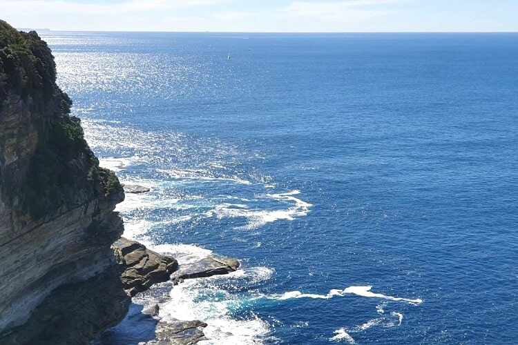
Continue walking through the park heading south, and check out the 80-metre high sandstone cliffs at Raleigh Reserve, revealing millions of years of earth’s geological history.
And that’s it! You have made it to the end of the Federation Cliff Walk.
You now have the option to walk back to Watsons Bay, catch a bus back to where you started, or continue the walk south to North Bondi and Bondi Beach.
Continue to Bondi
The Watsons Bay to Bondi Walk is the Federation Cliff Walk with the extra bit between Dover Heights and Bondi Beach.
This walk is 7 km in total and is worth it if you have the energy. It’s also easier to catch public transport in Bondi than in Dover Heights, so that could be a reason to extend the hike to Bondi Beach.
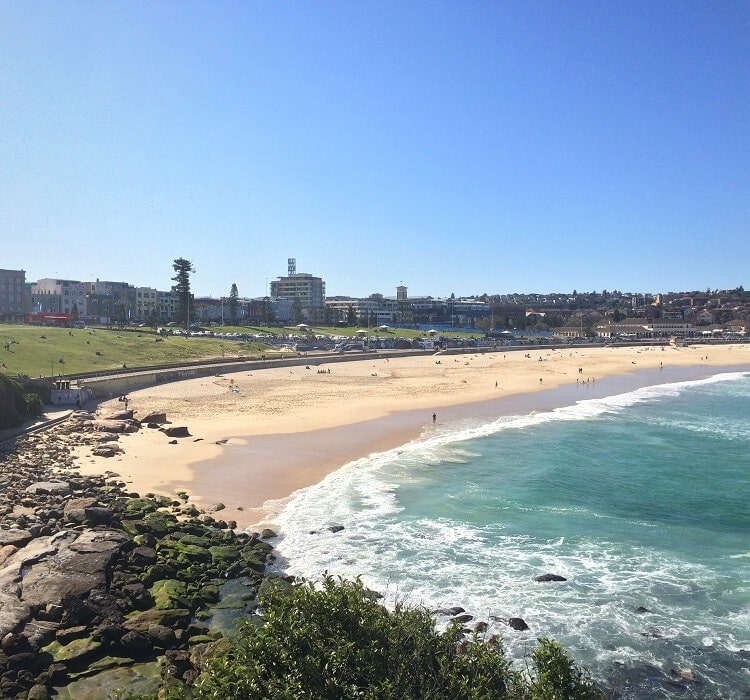
Getting to Bondi Beach from the end of the Federation Cliff walk in Dover Heights is pretty easy, but it’s also not very exciting as it’s mainly via the streets.
From Dover Heights (Raleigh Reserve or Rodney Reserve), follow Military Road onto Wentworth Street through Hugh Bamford Reserve. Go back onto Military Road past the Bondi Golf Course and continue to Bondi Beach.
From Bondi, you can continue hiking southbound to Bronte, Coogee, Maroubra, and Malabar, as the coastal scenery is beautiful.