Last updated: March 9, 2024
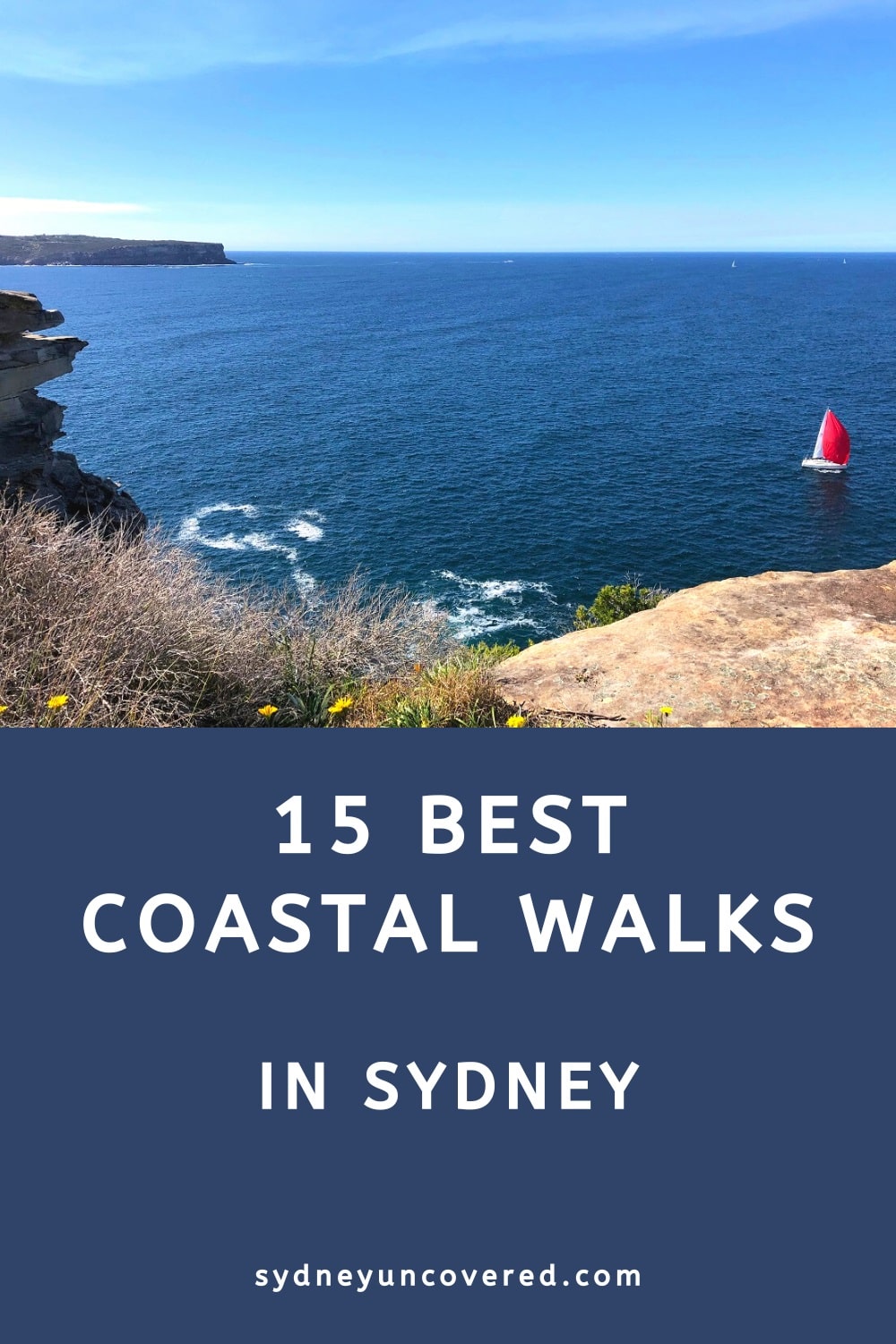
This guide explores 15 of the best coastal walks in Sydney, from short, family-friendly trails to challenging half-day walking tracks.
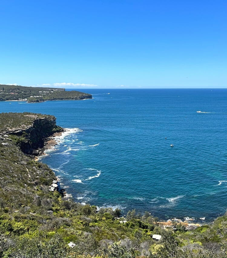
What makes Sydney such a unique city is its amazing coastline and unique Harbour. Beaches, cliffs, rock pools, parks, Sydney’s coastline has it all.
Additionally, the magnificent Sydney Harbour is home to secluded beaches, beautiful bays, historic sites and the iconic headlands.
From Palm Beach in the north to the Royal National Park in the south, Sydney’s coastline includes some of the most scenic coastal walks in Australia.
Top 15 Sydney Coastal Walks:
| Coastal Walk | Distance | |
|---|---|---|
| 1 | Bondi to Bronte Coastal Walk | 2.5 km (one way) |
| 2 | Long Reef Headland Walk | 3.5 km (circuit) |
| 3 | Watsons Bay Circuit Walk | 4.5 km (circuit) |
| 4 | Coogee Beach to Maroubra Beach | 5 km (one way) |
| 5 | Jibbon Beach Loop Track | 5 km (circuit) |
| 6 | Federation Cliff Walk | 5 km (one way) |
| 7 | Bondi to Coogee Coastal Walk | 6 km (one way) |
| 8 | Cape Baily Track | 6 km (return) |
| 8 | Cronulla Beach Coastal Walk | 6 km (part circuit) |
| 10 | Taronga Zoo to Balmoral Beach | 6.5 km (one way) |
| 11 | Bundeena to Wedding Cake Rock | 7 km (return) |
| 12 | La Perouse Circuit Walk | 7.5 km (circuit) |
| 13 | Rose Bay to Watsons Bay Coastal Walk | 8 km (one way) |
| 14 | Wattamolla to Eagle Rock | 8 km (return) |
| 15 | Spit Bridge to Manly Coastal Walk | 10 km (one way) |
Top 15 Sydney Coastal Walks
Ordered from short to long, pick your favourite from the following list of 15 amazing Sydney coastal walks.
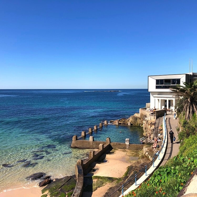
1. Bondi to Bronte Coastal Walk
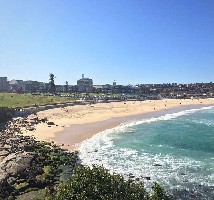
If the classic hike between Bondi and Coogee is a bit too long, you can cut it short by only doing the section between Bondi and Bronte.
This is a relatively easy and short coastal walk but long enough to give you a great impression of Sydney’s stunning coastline.
As you follow the walking track on top of the cliffs between two of Sydney’s most popular beaches, you can explore various viewpoints from where you can soak in the fantastic views.
Tamarama Beach is at the halfway mark and is a great location to have a coffee and perhaps a snack at the cafe in Tamarama Beach Park overlooking the beach.
More information: Bondi to Bronte Coastal Walk.
| Walk stats: | |
|---|---|
| Distance: | 2.5 km (one way) |
| Duration: | 1 hour (depending on stops) |
| Grade: | Easy |
2. Long Reef Headland Walk
The Long Reef Headland in Collaroy on Sydney’s northern beaches is a popular recreational destination. The headland is home to a golf course, a walking trail, a paragliding spot, several beaches, and a fantastic lookout point.
The best way to explore the beauty of this headland is by doing the 3.5 km Long Reef Headland Walk that takes in Fishermans Beach, Long Reef Point Lookout, and Long Reef Beach.
The highlight of this easy, family-friendly circuit walk is the Long Reef Point Lookout, which offers impressive ocean and district views.
Just beyond this lookout is a long staircase that leads to the easternmost tip of the headland, a large rock platform that is a popular fishing spot.
More information: Long Reef Headland Walk.
| Walk stats: | |
|---|---|
| Distance: | 3.5 km (circuit) |
| Duration: | 1.5 hours |
| Grade: | Easy |
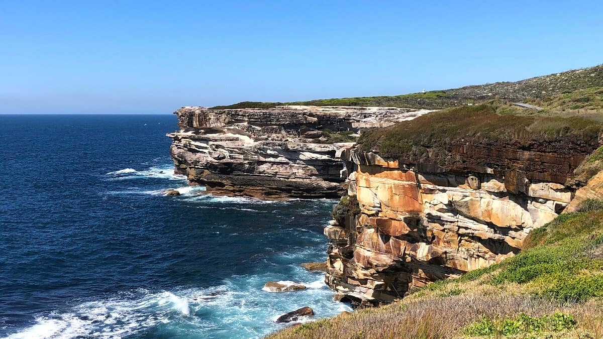
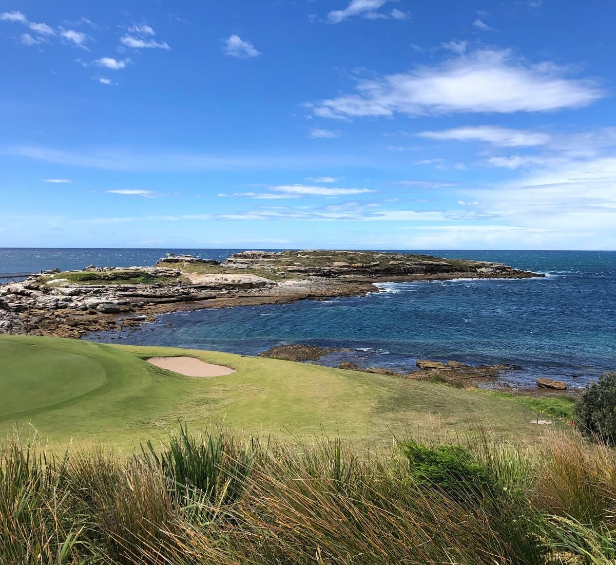
3. Watsons Bay Circuit Walk
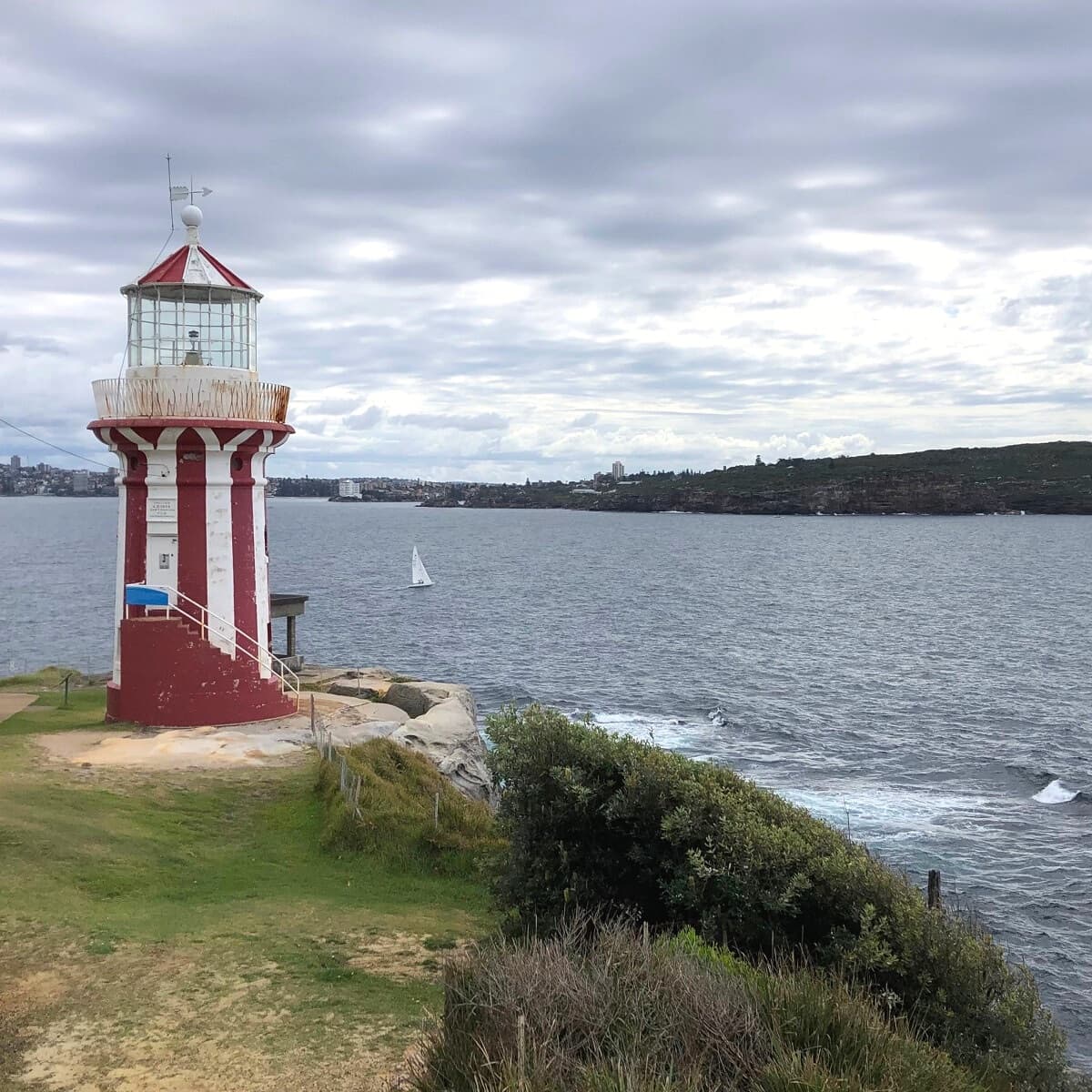
The Watsons Bay Walk is a scenic coastal trail exploring South Head, featuring panoramic views of Sydney Harbour, the city skyline, the Tasman Sea, North Head, and the historic Hornby Lighthouse.
The Watsons Bay Walk connects with the Federation Cliff Walk at the Gap. From the southern end of that walk, you can continue hiking to Coogee and even further south to Maroubra, Malabar and La Perouse, following Sydney’s coastline.
Parking is hard to find in Watsons Bay during weekends, so the best way to travel to this Sydney hot spot is to catch a ferry from Circular Quay.
More information: Watsons Bay Circuit Walk.
| Walk stats: | |
|---|---|
| Distance: | 4.5 km (circuit) |
| Duration: | 2 hours |
| Grade: | Easy |
4. Coogee Beach to Maroubra Beach
The 5 km walking track between Coogee and Maroubra may not be as popular or as well-known as the Bondi to Coogee Walk, but the scenery is just as impressive.
This walk has plenty of highlights, such as the South Coogee Wetlands, the low tide trail in Maroubra, Mistral Point, and several lovely ocean pools.
Because this is a one-way walk, you can start from either end. Coogee and Maroubra are serviced by buses, and both suburbs offer plenty of parking options.
It’s best to do this walk when it’s not high tide because otherwise, the low tide trail section in Maroubra may not be accessible.
More information: Coogee Beach to Maroubra Beach.
| Walk stats: | |
|---|---|
| Distance: | 5 km (one way) |
| Duration: | 1.5 hours |
| Grade: | Easy / moderate |
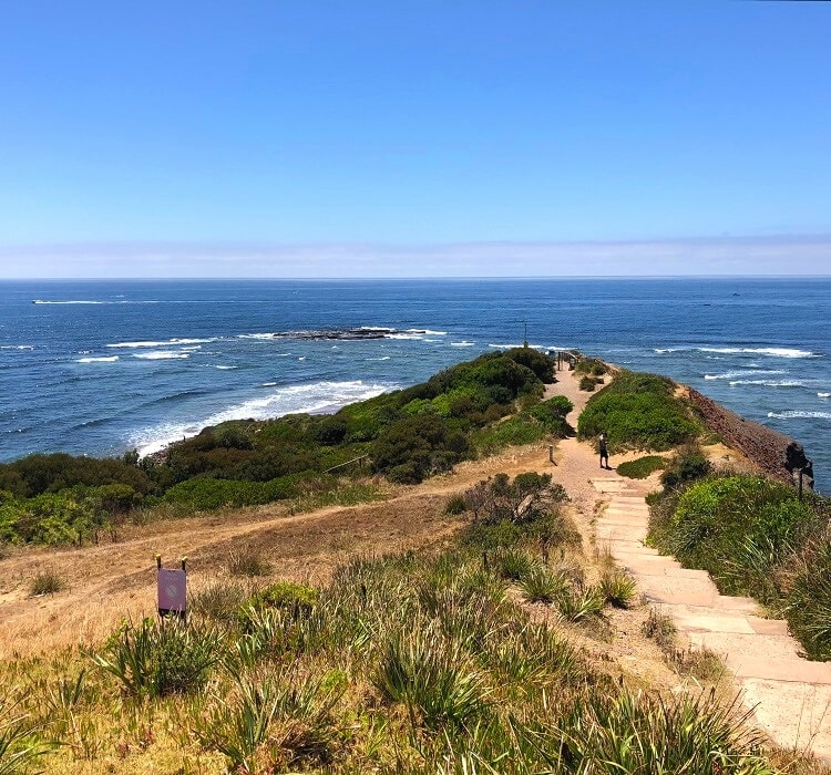
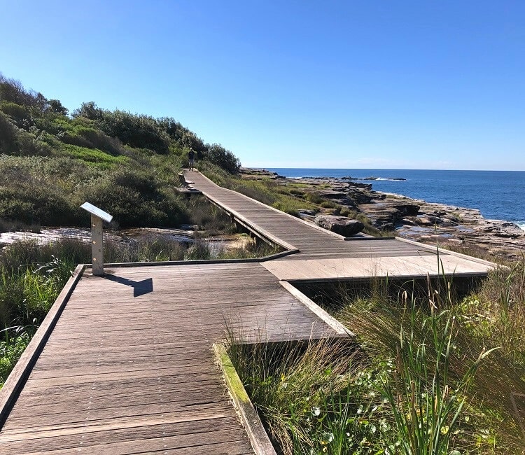
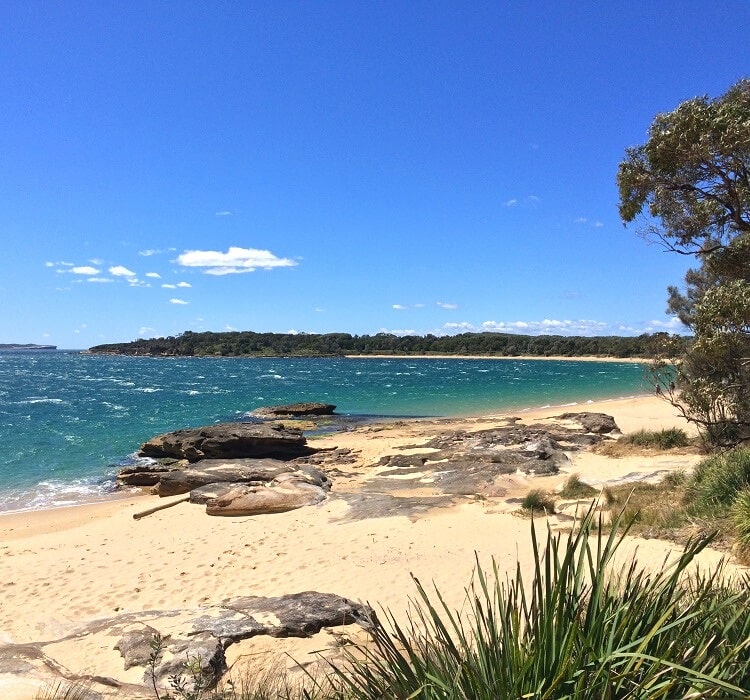
5. Jibbon Beach Loop Track
The Jibbon Beach Loop Track is a bit of a hidden gem in the Royal National Park, with panoramic ocean views and well-preserved Aboriginal engravings to soak in.
This coastal walk starts at the Bundeena wharf and loops around Jibbon Head, Port Hacking Point, and Shelley Beach before returning to Bundeena through scenic bushland.
If you’d like to go for a swim or do a bit of sunbathing, Jibbon Beach is a beautiful 700-metre long, north-facing strip of sand. Just be mindful that this is an unpatrolled beach.
Once you’ve completed the walk, head into the Bundeena town centre for some great food options and a nice coffee.
More information: Jibbon Beach Loop Track.
| Walk stats: | |
|---|---|
| Distance: | 5 km (circuit) |
| Duration: | 2 hours |
| Grade: | Easy |
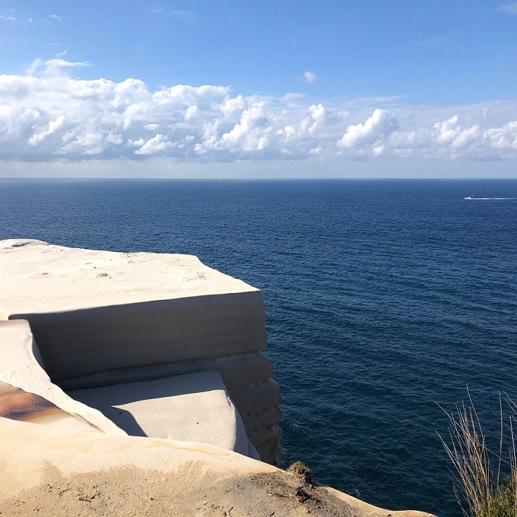
6. Federation Cliff Walk
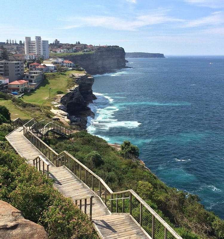
Not as well-known as the Bondi to Coogee walk, but just as spectacular, is the Federation Cliff Walk, a 5 km walking trail between Watsons Bay and Dover Heights north of Bondi Beach.
This scenic track follows the coastline above high sandstone cliffs, offering panoramic views of the Tasman Sea.
One of the highlights along the Federation Cliff Walk is Diamond Bay Reserve, which has a wooden walkway built right on top of the cliffs.
The views of the surrounding area from there are breathtaking. What makes this experience even more enjoyable is that this track north of Bondi never really gets busy.
More information: Federation Cliff Walk.
| Walk stats: | |
|---|---|
| Distance: | 5 km (one way) |
| Duration: | 1.5 hours |
| Grade: | Easy |
7. Bondi to Coogee Coastal Walk
The Bondi to Coogee Walk is perhaps Sydney’s most popular coastal walk, and for good reasons. Australia’s best beaches, stunning ocean views, beautiful parks, and lots of cafes and restaurants; this iconic walking trail has it all.
The first section of Sydney’s most popular coastal trail is the scenic walk from Bondi to Bronte, past Bondi Icebergs, Mackenzies Bay and Tamarama Beach.
From Bronte Beach, follow the track south that leads to Waverley past Calga Reserve, which marks the start of a spectacular boardwalk that swings around the historic Waverley Cemetery.
The boardwalk feeds into Clovelly, a vibrant and charming beachside suburb with a lawn bowls club, a swim-friendly beach and bay, and a large parking area. From there, the trail continues past Gordons Bay to Coogee Beach.
More information: Bondi to Coogee Coastal Walk.
| Walk stats: | |
|---|---|
| Distance: | 6 km (one way) |
| Duration: | 2.5 hours |
| Grade: | Easy |
8. Cape Baily Track
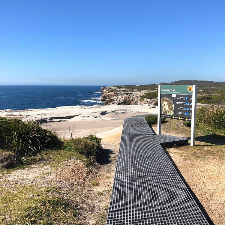
One of Sydney’s best-kept secrets is the scenic coastal walk from Cape Solander to the Cape Baily Lighthouse in Kamay Botany Bay National Park just north of Cronulla.
The Cape Baily Track is a 6 km return coastal adventure, with incredible ocean views, impressive sea cliffs, and a classic lighthouse to take in.
What’s great about this hike is that it doesn’t attract the crowds that other popular coastal walks in Sydney do, such as the Bondi to Coogee walk, even though the scenery is just as impressive.
The track is 6 km long, but you can extend this fantastic walk around the Kurnell peninsula to Cronulla Beach.
More information: Cape Baily Track.
| Walk stats: | |
|---|---|
| Distance: | 6 km (return) |
| Duration: | 2-3 hours |
| Grade: | Easy |
9. Cronulla Beach Coastal Walk
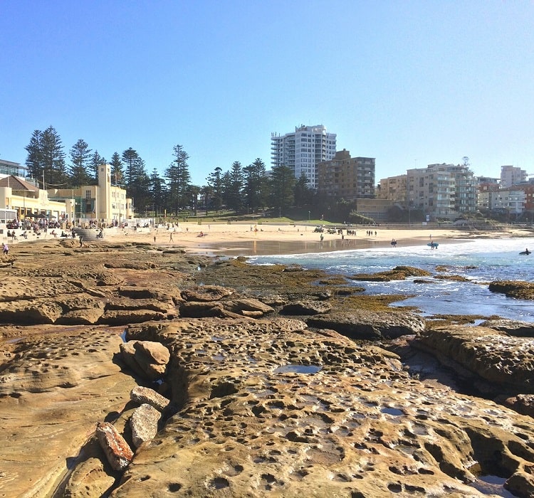
While most visitors to Cronulla go to one of the various beaches or otherwise to its lively town centre, this beachside suburb is also home to one of Sydney’s finest coastal walks.
The coastal walking track following the shoreline of the Cronulla Peninsula is an absolute delight. It’s almost as pretty as the much more popular Bondi to Coogee Walk, but without the crowds.
Starting at Wanda Beach, the track heads south past North Cronulla Beach and South Cronulla Beach, followed by The Esplanade to the southernmost tip of the peninsula.
From there, the track heads north and back into town via Darook Park, Gunnamatta Bay, and the Cronulla Sailing Club.
More information: Cronulla Beach Coastal Walk.
| Walk stats: | |
|---|---|
| Distance: | 6 km (part circuit) |
| Duration: | 2 hours (including stops) |
| Grade: | Easy |
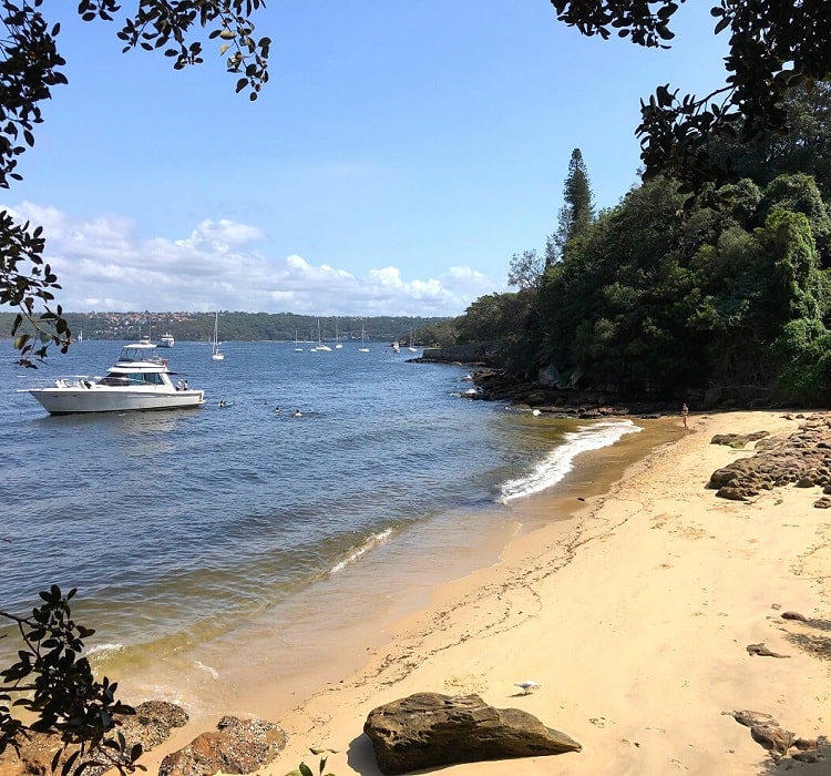
10. Taronga Zoo to Balmoral Beach
One of the most enjoyable Sydney Harbour walking tracks is the trail between Taronga Zoo and Balmoral Beach.
This 6.5 km track meanders past secluded beaches, picturesque bays, impressive lookouts, and various historical sights.
The best way to get to Taronga Zoo is by ferry from Circular Quay. The ferry trip crossing Sydney Harbour is a great experience, and on the weekends, you can take advantage of the daily travel cap on all public transport.
More information: Taronga Zoo to Balmoral Beach.
| Walk stats: | |
|---|---|
| Distance: | 6.5 km (one way) |
| Duration: | 2.5 hours |
| Grade: | Easy / moderate |
11. Bundeena to Wedding Cake Rock
The Wedding Cake Rock is one of the most iconic landmarks in the Royal National Park. And while it may be fenced off, it is still a unique sight to visit.
Even better, the coastal walking track from Bundeena to Wedding Cake Rock is an absolute delight, with fantastic ocean and cliff views to take in from start to finish.
This 7 km return walk starts from Beachcomber Avenue in Bundeena (free street parking), and includes several highlights, such as the Balconies, the Waterrun, and, of course, Wedding Cake Rock.
More information: Bundeena to Wedding Cake Rock.
| Walk stats: | |
|---|---|
| Distance: | 7 km (return) |
| Duration: | 2.5 hours |
| Grade: | Easy / moderate |
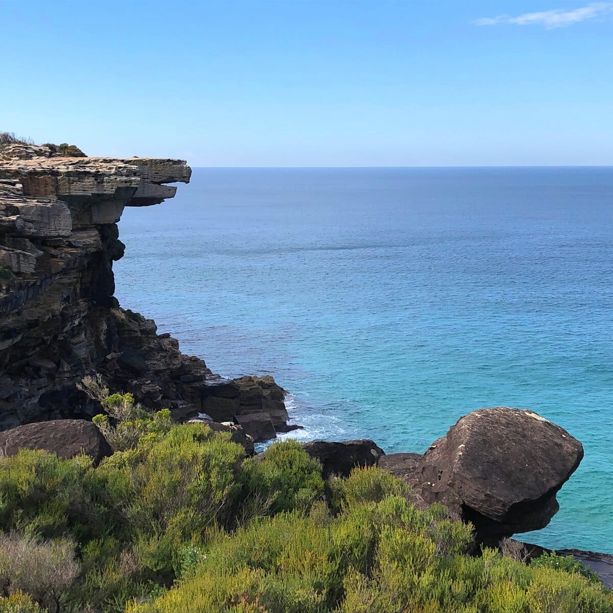
12. La Perouse Circuit Walk
The La Perouse Circuit Walk is an easy to moderately challenging trail through beautiful scenery with several beaches, coastal cliffs, and thriving bushland.
That beautiful natural scenery is complemented by a few historical sites that make this walking track even more unique and enjoyable.
One of the highlights of the La Perouse Circuit Walk is Cape Banks, a largely untouched headland with a rocky landscape.
More information: La Perouse Circuit Walk.
| Walk stats: | |
|---|---|
| Distance: | 7.5 km (circuit) |
| Duration: | 3 hours |
| Grade: | Easy / moderate |
13. Rose Bay to Watsons Bay Coastal Walk
The walking track from Rose Bay to Watsons Bay is one of the most scenic coastal walks in Sydney Harbour National Park.
The walk takes in secluded beaches, beautiful parks and picturesque bays, with amazing panoramic views of the city and the harbour to enjoy along the way.
The beauty of this walk is that you can park your car at Rose Bay or Watsons Bay and catch a ferry back to where you started. Ferry services run between Watsons Bay and Rose Bay.
Part of the Rose Bay to Watsons Bay Walk is the Hermitage Foreshore track, between Rose Bay and Nielsen Park in Vaucluse. This is a much shorter walk but is perhaps the prettiest section.
More information: Rose Bay to Watsons Bay Coastal Walk.
| Walk stats: | |
|---|---|
| Distance: | 8 km (one way) |
| Duration: | 3.5 hours |
| Grade: | Easy / moderate |
14. Wattamolla to Eagle Rock
This is both a coastal walk and a bushwalk, so you get to enjoy different types of scenery along this fantastic hike in the Royal National Park.
Starting at Wattamolla Beach, this 4 km walking track navigates to Eagle Head Rock, an iconic landmark resembling an eagle’s beak.
Eagle Rock is not the only unique sight you can explore at the end of the walk. Right next to Eagle Rock is Curracurrong Falls, one of the very few waterfalls in the world that flows directly into the ocean.
When the winds are strong, the water at Curracurrong Falls is often pushed back up, making for a pretty spectacular sight.
More information: Wattamolla to Eagle Rock.
| Walk stats: | |
|---|---|
| Distance: | 8 km (return) |
| Duration: | 3 hours |
| Grade: | Easy / moderate |
15. Spit Bridge to Manly Coastal Walk
The Spit to Manly Coastal Walk is a beautiful 10 km walking trail, featuring secluded Sydney Harbour beaches, scenic bushland, picturesque bays, and panoramic lookout points.
The track forms part of the iconic 20 km Manly Scenic Walkway, which goes from the Spit Bridge to Manly Beach, followed by the Manly North Head circuit walk.
For the best views along the Spit to Manly Walk, head to the Crater Cove and Arabanoo lookout points at Dobroyd Head, offering incredible views of Sydney Harbour, North Head, and South Head.
More information: Spit Bridge to Manly Coastal Walk.
| Walk stats: | |
|---|---|
| Distance: | 10 km (one way) |
| Duration: | 4 hours |
| Grade: | Moderate |