Last updated: December 12, 2023
The Rose Bay to Watsons Bay walk is one of the most scenic coastal walking tracks in Sydney Harbour National Park.
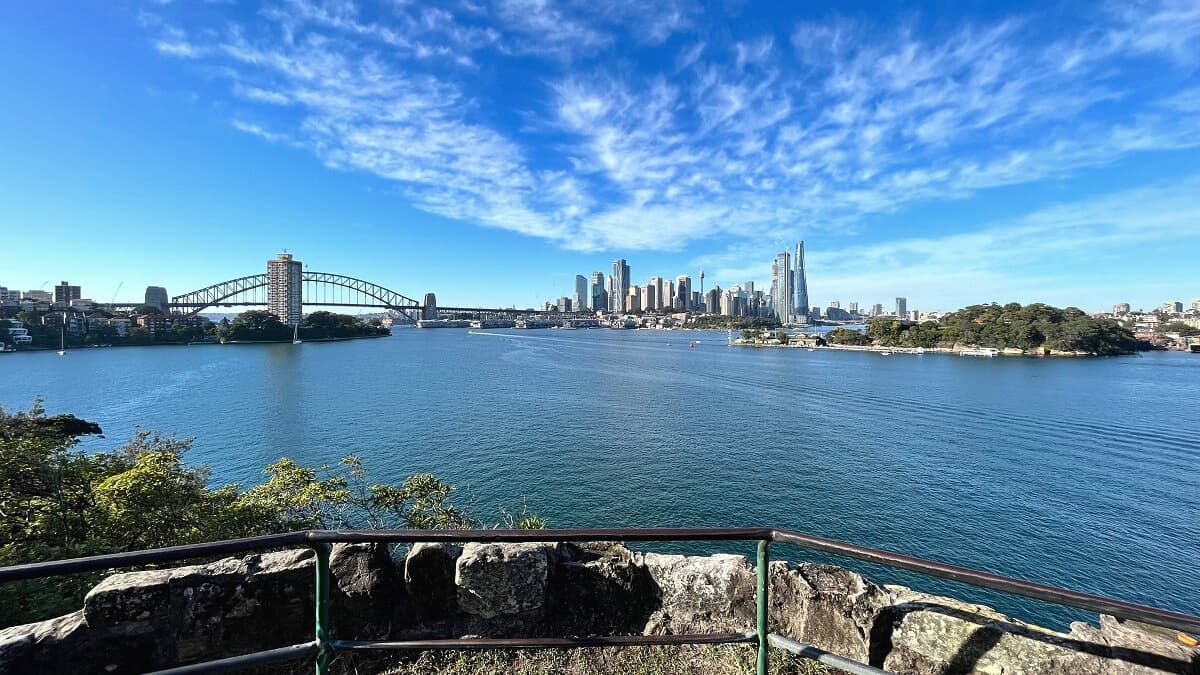
The walk takes in secluded beaches, beautiful parks, and picturesque bays, with panoramic views of the city and the Harbour to enjoy along the way.
Part of this walking trail is the Hermitage Foreshore Track, which runs between Bayview Hill Rd (just north of Rose Bay) to Nielsen Park in Vaucluse.
| Rose Bay to Watsons Bay | |
|---|---|
| Distance: | 8 km (one way) |
| Duration: | 3-4 hours (depending on stops) |
| Grade: | Easy / moderate |
| Dogs: | Not allowed on the trail |
How to Get There
There are various parking areas (paid and free) in Rose Bay, but these tend to fill up quickly on the weekends. Try free suburban street parking nearby as an alternative.
Otherwise, Sydney Ferries offers regular ferry services between Circular Quay, Rose Bay, and Watsons Bay. And honestly, travelling by ferry makes the day much more enjoyable.
If you decide to travel by car, you can park in Rose Bay or Watsons Bay, and then catch a ferry back to your starting point.
Travelling by bus is also an option. Rose Bay has several bus stops on New South Head Rd, with regular services to and from the city and Bondi Junction. Check the Transport NSW website for detailed travel information.
Rose Bay to Watsons Bay Track Notes
The walking track starts in Rose Bay, but you can also start the walk from Watsons Bay at the other end.
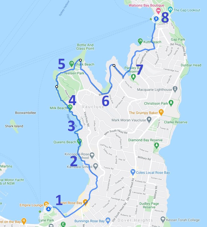
We are going to describe the walk starting from Rose Bay along the following highlights and landmarks:
- Rose Bay
- Hermitage Foreshore Walk
- Secluded Beaches
- Strickland House
- Nielsen Park and Shark Beach
- Vaucluse House and Gardens
- Parsley Bay Reserve
- Watsons Bay
Below is a map of the walk with those highlights marked.
If you would like a more detailed map to print out, grab a copy from the Woollahra Council website.
1. Rose Bay
The suburb of Rose Bay is a lovely place to hang out on a lazy Sunday afternoon.
There are plenty of activities to do, such as stand-up paddling, kayaking, swimming, tennis, or simply drinking a coffee at one of the cafes.
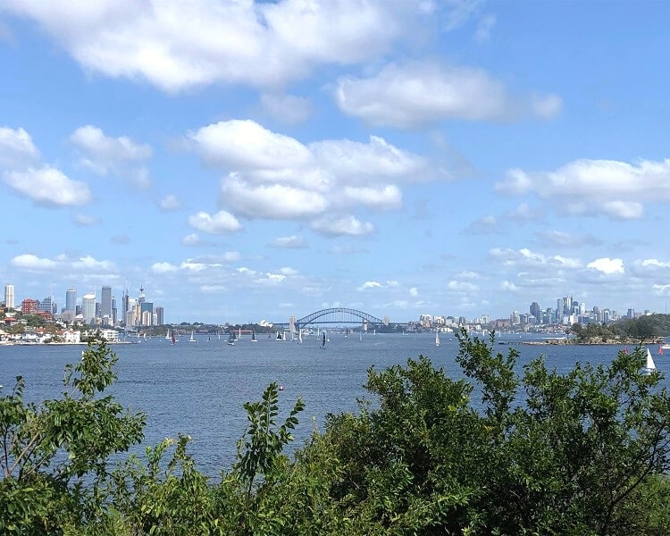
The best spot to start the walking trail to Watsons Bay is at the Rose Bay ferry wharf. From there, make your way to the north end of Rose Bay beach, past Lyne Park and Tingira Memorial Park.
At Dumaresq Reserve, find the steps that lead to New South Head Road. From there, take a left turn into Tivoli Avenue and left again into Bayview Hill Road.
2. Hermitage Foreshore Walk
You will soon see the sign for the start of the Hermitage Foreshore Walk.
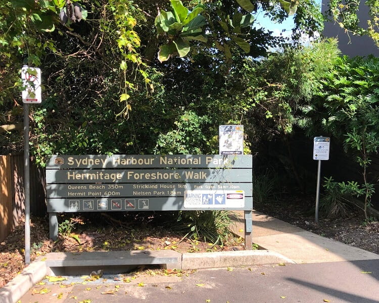
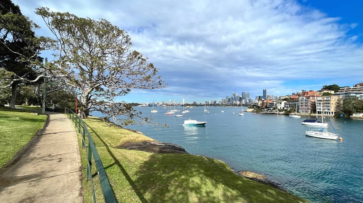
This is where the Rose Bay to Watsons Bay walk turns into a stunning coastal walk, with scenic bays, hidden beaches and great views of the Sydney Harbour to enjoy.
It’s a good reminder of how lucky we are to be able to enjoy this beautiful landscape so close to the city.
3. Secluded Beaches
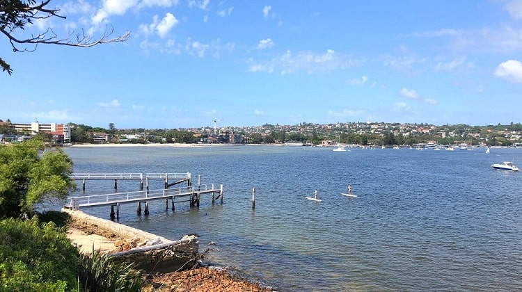
The first secluded beach along the track is Queens Beach.
Don’t be too surprised when there are no people at the beach; that’s how secluded it is, small and quietly tucked away from the main road.
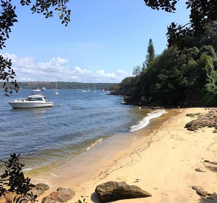
Keep following the trail towards the north, and Queens Beach is soon followed by Tingara Beach, Hermit Bay, and Milk Beach.
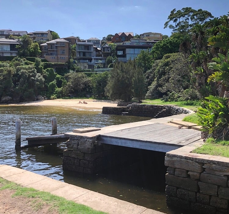
These beaches are so small and secluded that you will feel like you’ve ended up in some tropical paradise.
4. Strickland House
Strickland House is a heritage-listed house located in the suburb of Vaucluse. Designed and built in the 1850s, the house was the home of Sydney’s second mayor, John Hosking.
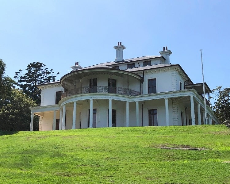
The grounds around Strickland house form an urban park, open seven days a week. The house itself is only open one day a year to the public during the National Trust Heritage Festival, or otherwise, you can book a guided tour through NSW National Parks.
From Strickland House, it’s only a short stroll to Nielsen Park, the perfect spot for a quick coffee break.
5. Nielsen Park and Shark Beach
Shark Beach, with Nielsen Park right behind the beach, marks the end of the Hermitage Foreshore walk.
This beach is a very popular weekend destination for families to go for a swim and to relax in the park.
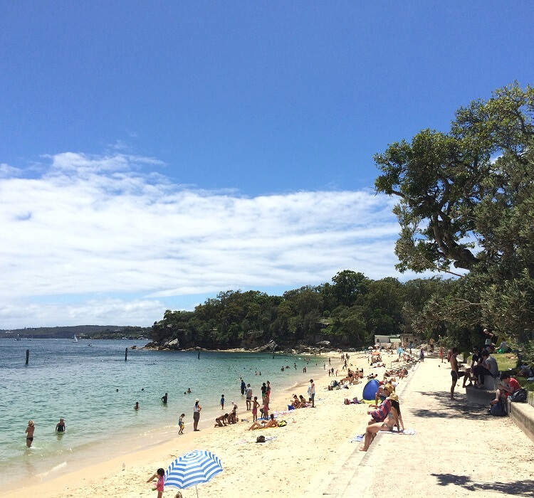
Finding a spot to park your car in the area on a warm Sunday afternoon can be a huge challenge, though.
The area is family-friendly, with calm waters, an enclosed swimming area, a shaded promenade, and many picnic areas.
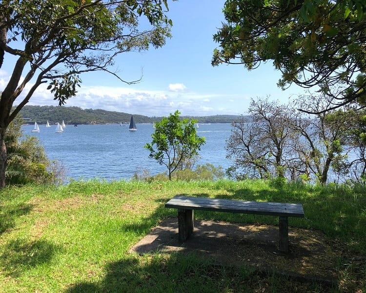
From there, you can continue along the track to Watsons Bay or do an extra loop walk to Bottle and Glass Point.
It’s only a short detour, but the views from up the hill are fantastic.
6. Vaucluse House and Gardens
Leaving Nielsen Park, follow Coolong Rd and Wentworth Rd around Vaucluse Bay.
If you have the time, it’s worth exploring Vaucluse House, a historic mansion built in the 19th century that became a museum in 1915 and still is today.
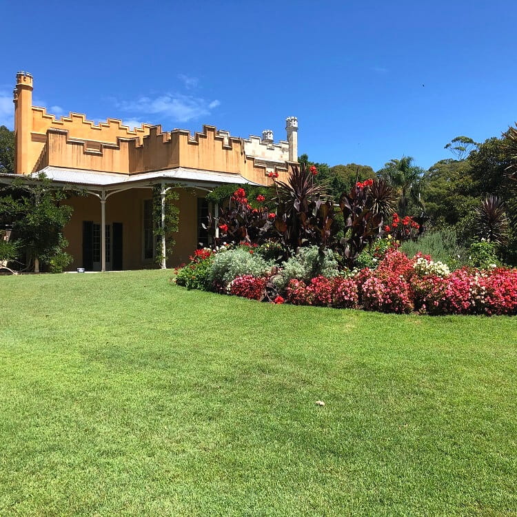
Wander around the grounds, have high tea, coffee or lunch, and enjoy this beautiful historic site. The gardens are so pretty that we have included Vaucluse House in our list of best gardens in Sydney.
From Vaucluse Bay, follow Wentworth Road and Fitzwilliam Road to the beautiful Parsley Bay Reserve.
7. Parsley Bay Reserve
The Parsley Bay reserve area is similar to Nielsen Park but smaller and less crowded, with an enclosed swimming area and quiet picnic facilities.
Swimming here on a warm day is a fantastic experience, with calm waters and idyllic surroundings.
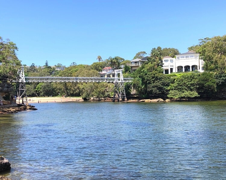
One of the highlights of Parsley Bay is the suspension bridge that is part of the Rose Bay to Watsons Bay walking trail.
Crossing this bridge is great fun, with lovely views on both sides. The bridge is accessible via a small path from Fitzwilliam Road.
8. Watsons Bay
From Parsley Bay, follow The Crescent, which leads to Watsons Bay.
A nice stop along the way is Kutti Beach, a “secret” small strip of sand that can be accessed via the sailing club on Wharf Road. Just don’t tell anyone.
From The Crescent, turn left into Hopetoun Ave, left again into Palmerston Street, and follow the path leading to Gibsons Beach. Not as small and secluded as Kutti Beach, Gibsons Beach is still a lovely spot for a quick swim before moving on to Watsons Bay.
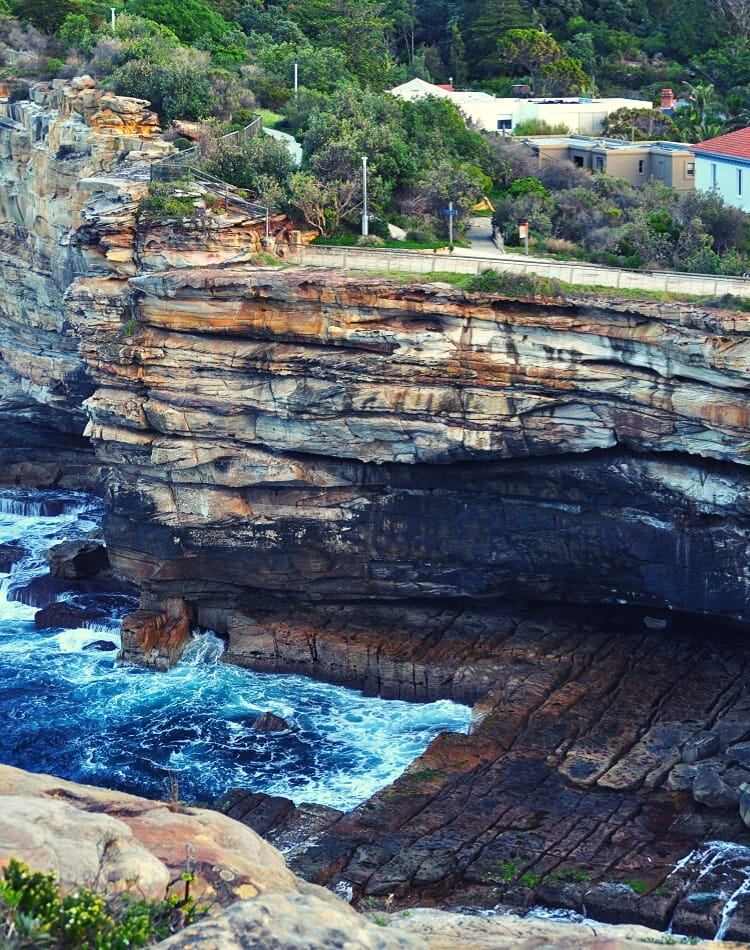
In Watsons Bay, enjoy a well-deserved lunch at one of the many cafes, rest up in Robertson Park, and soak up the views at The Gap.
If you feel like more hiking and exploring, go ahead and try the Watsons Bay Walk around South Head, one of the most popular walking trails in Sydney.
More Hiking Nearby
The walk from Rose Bay to Watsons Bay is quite long, but it’s a reasonably flat and relatively easy track. The views, secluded beaches, and parks make this walk one of Sydney’s best.
If you’d like to extend this walk, there are a few options:
- Rushcutters Bay to Rose Bay:
A scenic 5+ km walk from Rushcutters Bay to the Rose Bay ferry wharf. - Federation Cliff Walk:
A coastal walk from Watsons Bay to North Bondi, from where you can continue to Bondi Beach.
Is this walk wheelchair accessible?
Hi Robert, the track as a whole isn’t, but there are sections that are wheelchair accessible. It’s hard though to point out exactly where these sections are. The Hermitage Foreshore Walk, for example, has a paved section at the start, so it might be worth checking that out.
We walked from Rose Bay to Watson’s Bay today, Australia Day. It was quite warm, about 35 deg, but an enjoyable walk. Lots of families on all the beaches, making the most of a sparkling day. We followed the directions in this article and had no problems (thank you) but if you were relying only on the signage you could get lost. More signs and bigger signs needed! Highly recommend this walk.
Thanks Lynne, glad to hear you enjoyed this fantastic coastal walk. You’re right, signage isn’t the best, although it has gotten slightly better in recent times with the extra signs for the Bondi to Manly walk.
An outstanding walk this one. Who cares about signage as there is always someone to ask and to engage with, be they locals or fellow travellers. Adventure is what it’s about and trail maps and time constraints are simply rough guides and in my mind I’d rather be open to flexibility and discovery throughout the adventure.
Thanks so much, Graham, glad you enjoyed the hike between Rose Bay and Watsons Bay as much as we did!
My wife and I recently did this walk as part of a 165km, 9 day walk from La Perouse to Palm Beach along the coast and Harbour foreshore. We agree that this walk is poorly sign posted in places as you go from Watsons Bay to Rose Bay and trying to follow the above description in reverse didn’t always work. We found the walking maps provided by the Sydney Coastal Councils Group invaluable (for example they show that you can only walk along the foreshore between Rose Bay and Dumaresq Reserve at low tide). Some lovely sections of Harbour foreshore and secluded beaches along this walk but also some walking through quiet suburban back streets and the rather noisy and ugly New South Head Road if you do it at high tide.
It’s a great article, I didn’t have any issues to find the trail. Thank you very much for sharing the information.
As a Rose Bay local, I have to say the Rose Bay to Watsons Bay walk is definitely a favourite! Great article, thanks for sharing.
Really disappointed about the lack of signage for this walk.
We are 2 Seniors from the UK who love walking and wanted to get off the beaten track and enjoy your beautiful coastline. We are staying in Paddington and took the 380 bus to Mcquarrie lighthouse and followed the Coast route to Gap Bluff, the Southhead Heritage trail to Watson’s Bay, perfect to here. Then disaster, walked to the baths at end of Watson’s Bay then nothing, not a sign, notice, nothing. We ended up walking along the road to Rose Bay which was most unpleasant and despite asking many locals nobody seemed to have heard of the path (or didn’t want us to know about it).
We saw a sign for cycle route to Parsley Bay but no footpath or route sign anywhere and all we had to guide us was the red dotted line on the free map of Sydney. Needless to say we were very disappointed and wished we had caught the ferry at Watson’s Bay and not wasted a big chunk of our precious few days in Sydney.
Hi Patricia,
Sorry to hear you had issues finding the start of the walking trail to Rose Bay from Watsons Bay. You’re right, the signage there certainly isn’t the best. Especially starting from the Watsons Bay end it can be a bit confusing, because you need to go through some suburban streets until you get to The Crescent from where you can cross the suspension bridge at Parsley Bay. Hopefully the rest of your stay in Sydney worked out well for you.