Last updated: June 19, 2023
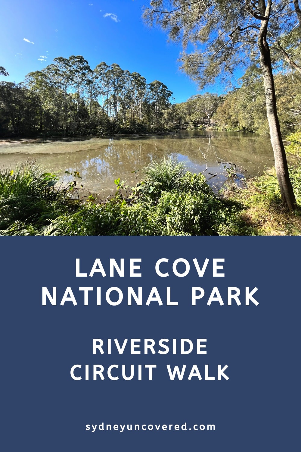
Located only 20 minutes northwest of the Sydney CBD, Lane Cove National Park is a large pocket of scenic bushland surrounding the banks of the Lane Cove River, which flows into Sydney Harbour.
A picturesque 10 km circuit walk along both sides of the river makes for an excellent way to explore the natural beauty of this national park.
Often considered as one of the best bush walks in Sydney, this walking track will not disappoint. Keep reading to find out more about the highlights!
Quick navigation:
| Lane Cove National Park Riverside Loop Walk | |
|---|---|
| Distance: | 10 km (circuit) |
| Duration: | 3 hours |
| Grade: | Moderate |
How to Get There
Since this is a loop walk, you can start from multiple locations.
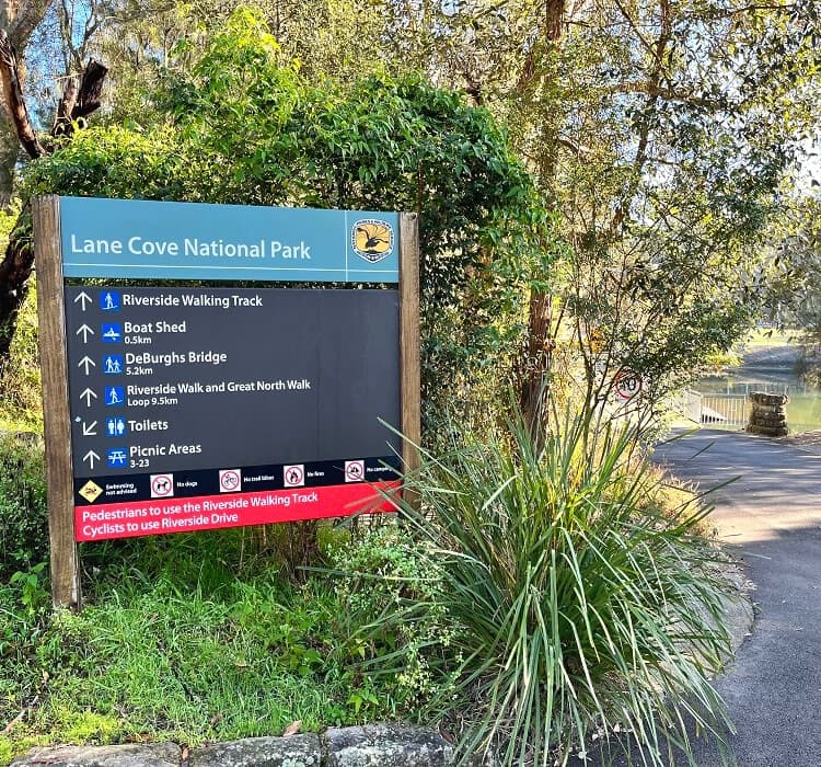
A good location to park your car and start this walking track is the Koonjeree Picnic Area in the eastern section of Lane Cove National Park in Chatswood West (see map location).
From the Pacific Highway in Chatswood, turn into Fullers Road. From there, turn right into Riverside Drive inside the national park, just after crossing Fullers Bridge. Entry to the park is $8 per vehicle for a whole day.
If you’re using public transport, the national park is accessible from North Ryde train station and by bus from Chatswood train station. Visit the NSW transport info website to help plan your trip.
About Lane Cove National Park
Popular with walkers, joggers, and cyclists, Sydney’s metropolitan Lane Cove National Park extends from Pennant Hills in the north to East Ryde in the south.
The main section of the National Park sits between the De Burghs Bridge on Ryde Road in Macquarie Park and Fullers Bridge in Chatswood West.
This central part is home to the Riverside Walking Track and a section of the Great North Walk that together form a moderately challenging yet pleasant 10 km circuit trail.
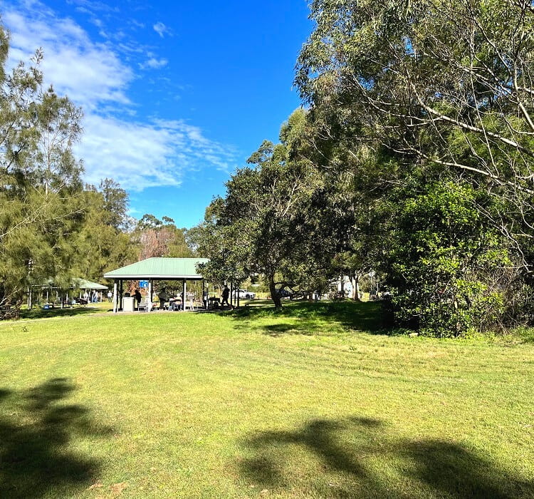
Several picnic areas, playgrounds, camping sites and cycle paths can also be found in this part of Lane Cove National Park.
Sydney’s strong population growth in the last few decades has put a lot of pressure on the park, which is now almost entirely surrounded by urban development.
One challenge is the water pollution and weed infestation due to stormwater run-off from houses, businesses, hospitals and schools in the catchment area. Hopefully the National Park as it is now can be preserved for future generations to enjoy.
Lane Cove National Park:
- Opening hours: 7 am to 7 pm daily.
- Park entry fees: $8 per vehicle per day.
- Things to do: hiking, cycling, camping, picnicking, photography, playgrounds, boat hire.
Lane Cove Riverside Walk Track Notes
The 10 km riverside circuit walk in Lane Cove National Park consists of two walking tracks:
- Great North Walk:
A moderately challenging walk, formerly known as the Lane Cove Valley Walk, along the east bank of the Lane Cove River. - Riverside Walking Track:
An easy, family-friendly walking track along the west bank of the river.
The two tracks connect at the Lane Cove Weir in the east and at the De Burghs Bridge on the other side (both marked with an X in below map).
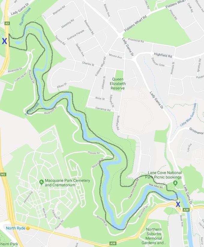
The Lane Cove National Park riverside circuit walk can be started either at the Lane Cove Weir or at the De Burghs Bridge.
However, the below track notes describe the circuit trail starting from the Lane Cove Weir and heading in a northwest direction.
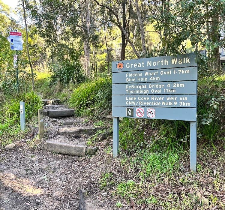
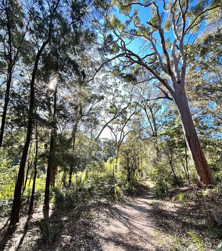
1. Great North Walk
The walking track that roughly follows the northern shoreline of the Lane Cove River is part of the iconic Great North Walk, a 250 km walking track between Sydney and Newcastle.
From the Koonjeree Picnic area, cross the Lane Cove Weir, and follow Max Allen Road for a short while until you see a big Great North Walk signpost.
At that sign, the track continues up the stairs and into the bush. From that point on, keep following the signs for Great North Walk, Blue Hole, and De Burghs Bridge.
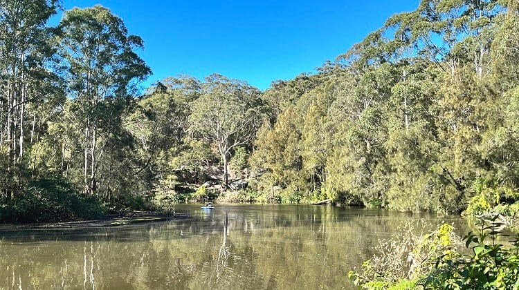
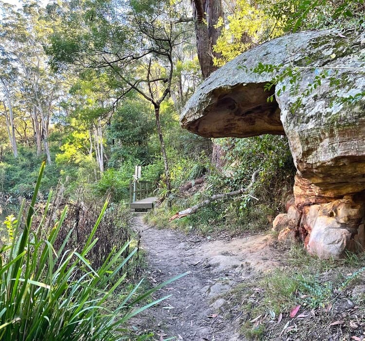
The rest of this track is an easy-to-follow but somewhat challenging bushwalk with several highlights along the way, such as sandstone caves and overhangs, mangroves, and picturesque Lane Cove River views.
The turning point of the circuit walk is at the Blue Hole, where you’ll need to do a bit of rock scrambling, before climbing out of the valley to walk across the De Burghs Bridge.
Crossing the De Burghs Bridge is a noisy experience and quite a contrast with the serenity of the bush, but luckily the mixed pedestrian/cycle lane on the bridge is only short.
At the other side of the bridge, head back down into the bush, and you will soon see a sign that marks the starting point of the Riverside walking track.
2. Riverside Walking Track
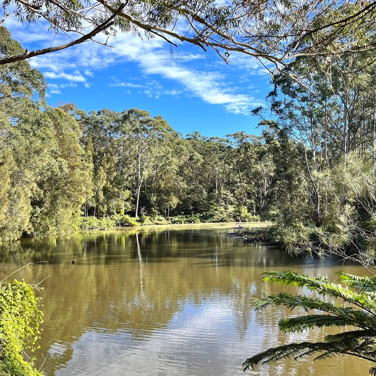
The Riverside walking track is less challenging than the valley walk on the other side of the river, with a path that is much more flat and easier to navigate.
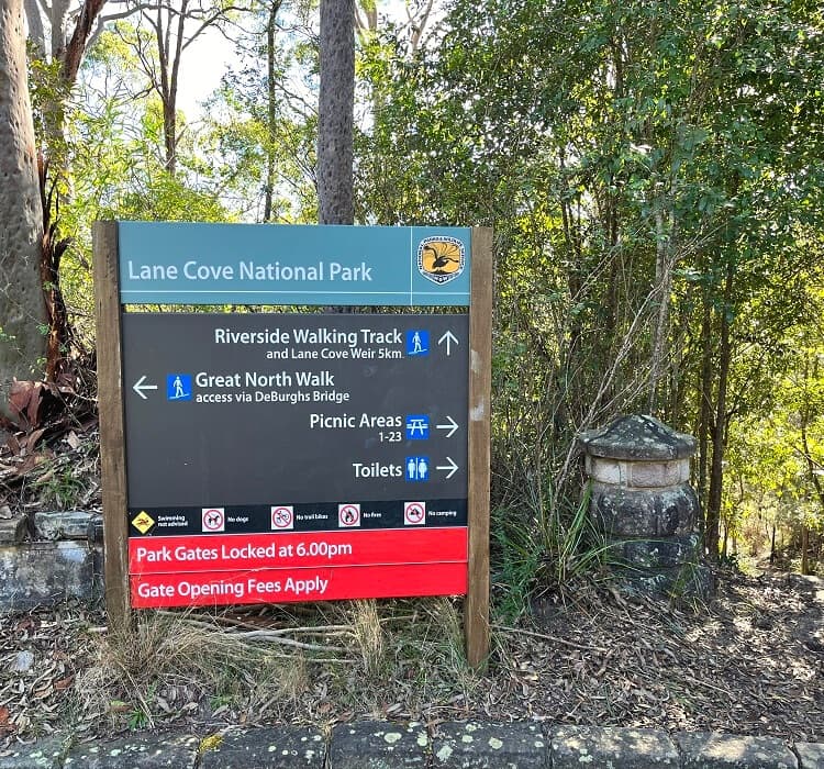
The path meanders through beautiful natural bushland and passes several family-friendly picnic areas with toilet facilities.
From northwest to southeast, the Riverside Walking Track passes the following picnic areas:
- Fern Valley picnic ground
- Korong picnic area
- Commandment Rock picnic area
- Blackbutt picnic area
- Cottonwood Glen picnic area
- Carter Creek picnic area
- Ironbarks picnic area
- Moola picnic area
- Illoura picnic area
- Koonjeree picnic area
Surrounded by urban development, the landscape in this part of Lane Cove National Park is very refreshing, with eucalypt forests, casuarina woodlands, and saltwater wetlands.
This area is also home to a great variety of different plants, animals, and birds, so keep an eye out for any wildlife you may encounter.
Look for local residents such as swamp wallabies, bush turkeys, and kookaburras, as well as eastern water dragons, cockatoos, and lorikeets.
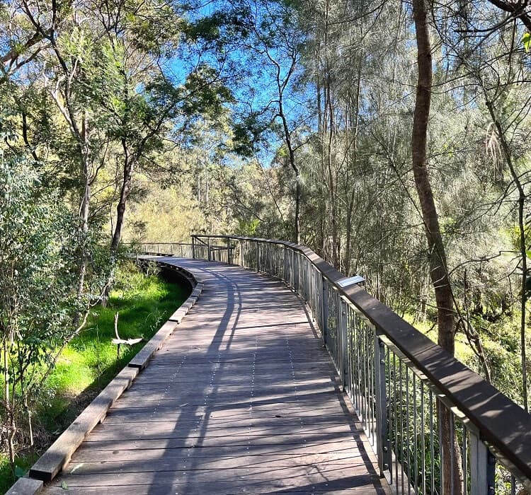
The last section of the Riverside Walking Track is on a comfortable boardwalk with a few benches and information boards, before arriving back at the Koonjeree picnic area.
A great place to walk! The directions were clear, great picnic areas, also a place where you could rent boats further down into the walk!
Thanks Ananya, it’s a great hike indeed, beautiful scenery.
I wish I had seen this website before I set off today.
The visitor guide map available at the information office is very poor (such as, for the Fiddens Wharf walk, it refers to Max Alan Drive which isn’t even shown on the map) and the distances noted are confusing as to which distances are single direction and which are return loops.
The NP leaflet refers to the Fiddens Wharf walk as an easy 3.5 km loop but in fact the signpost at the turnoff from the Great North Walk indicated a further 1.7 km and this is more than halfway along the section from the weir to De Burgh’s Bridge (which at the bridge end is listed as 4 km).
Also the tracks in many places seem unused for a long time and covered with leaves which became very slippery when it started to rain.
It should be noted The Great North Walk section is graded “medium difficulty” but this is obviously a hiker’s rating, not a day tripper’s rating. There is quite a bit of rock scrambling and some creek hopping involved where the track is not obvious until you get to the other side of the creek.
I enjoyed my walk in Lane Cove National Park but it was much more than I set out for.
Sounds like you had quite an adventure today, Karen. Thanks so much for sharing your experience with the rest of us. Happy to hear you still enjoyed the hike, despite the challenges!