Last updated: January 9, 2024
Not as well-known or popular as the Royal National Park or the Blue Mountains, Morton National Park in the Southern Highlands deserves a lot more attention.
Remote wilderness, scenic waterfalls, steep gorges, exciting bushwalking tracks, and panoramic lookout points, Morton National Park has something for everyone. A popular destination for birdwatchers and photographers, the park is a huge sanctuary for a great variety of wildlife. Bowerbirds, lyrebirds, eagles, falcons, and ground parrots are all happy residents of Morton National Park.
Various Aboriginal sites have been recorded in the area, the traditional country of the Yuin people, dating back more than 20,000 years. Some of the most popular sites in the park, such as Didthul (Pigeon House Mountain) and Fitzroy Falls, are of great significance to Aboriginal people.
We have listed eight fantastic hikes in Morton National Park to help you plan your next trip to this beautiful part of New South Wales.
Top 8 Morton National Park Walks:
| Walk | Distance | |
|---|---|---|
| 1 | Granite Falls Walk | 1 km (return) |
| 2 | Belmore Falls Walking Track | 1.5 km (return) |
| 3 | Badgerys Spur Walking Track | 3.5 km (return) |
| 4 | West Rim Walking Track at Fitzroy Falls | 3.5 km (return) |
| 5 | Pigeon House Mountain Walk | 5 km (return) |
| 6 | East Rim Walking Track at Fitzroy Falls | 7 km (return) |
| 7 | Mount Bushwalker Walking Track | 7 km (return) |
| 8 | Kangaroo River Walking Track | 7 km (return) |
Top 8 Morton National Park Walks
Morton National Park is situated around 170 km south of Sydney, and is easily accessible from Wollongong, Nowra, Canberra, and Moss Vale.
Here are eight of the best walks in Morton National Park, ranging from 1 to 7 km in distance. For each hike, we’ve included a link to the trailhead’s location.
1. Granite Falls Walk
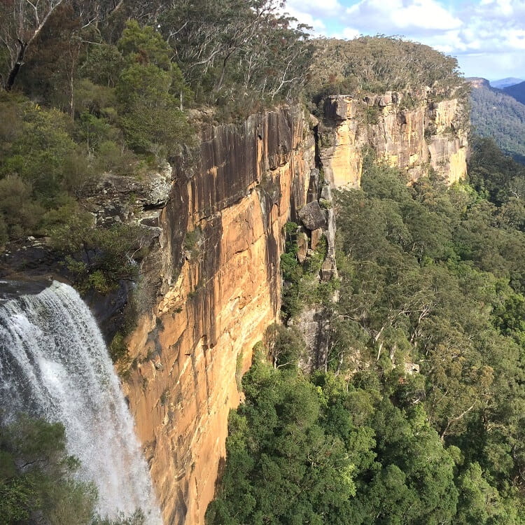
The short and easy Granite Falls walking trail south of Nowra guides hikers to a viewing platform with panoramic views of the 63m high waterfall and the valley below.
Constructed only a few years ago, the spectacular viewing platform is designed such that it hangs over the valley.
While the waterfall usually doesn’t carry an impressive amount of water, the panoramic views of the valley are very pretty.
| Granite Falls Walk | |
|---|---|
| Distance: | 1 km (return) |
| Time: | 0.5 hours |
| Grade: | Easy |
| Trailhead: | Google maps location |
2. Belmore Falls Walking Track
Belmore Falls is an impressive plunge waterfall with two drops on Barrengarry Creek. A short walking trail brings visitors to several lookout points with the best views of the waterfall and the valley.
Also included in this short walk is the Hindmarsh Lookout, which offers panoramic views of the upper Kangaroo Valley.
There is also an unofficial walking track that goes all the way down to the base of Belmore Falls. Do keep in mind though that this track is officially closed, and therefore, extreme care should be taken if you’re planning on undertaking this hike.
| Belmore Falls Walking Track | |
|---|---|
| Distance: | 1.5 km (return) |
| Time: | 1 hour |
| Grade: | Easy |
| Trailhead: | Google maps location |
3. Badgerys Spur Walking Track
Finishing on the banks of Shoalhaven River, the Badgerys Spur walking trail is a short but challenging descent through beautiful eucalyptus forests.
The track starts at the Badgerys Lookout car park near the small village of Tallong, not too far away from Goulburn.
To make this the perfect bushwalk adventure, go for a refreshing dip in the calm waters of the river and enjoy lunch in this unique and remote area.
| Badgerys Spur Walking Track | |
|---|---|
| Distance: | 3.5 km (return) |
| Time: | 3 hours |
| Grade: | Moderate / hard |
| Trailhead: | Google maps location |
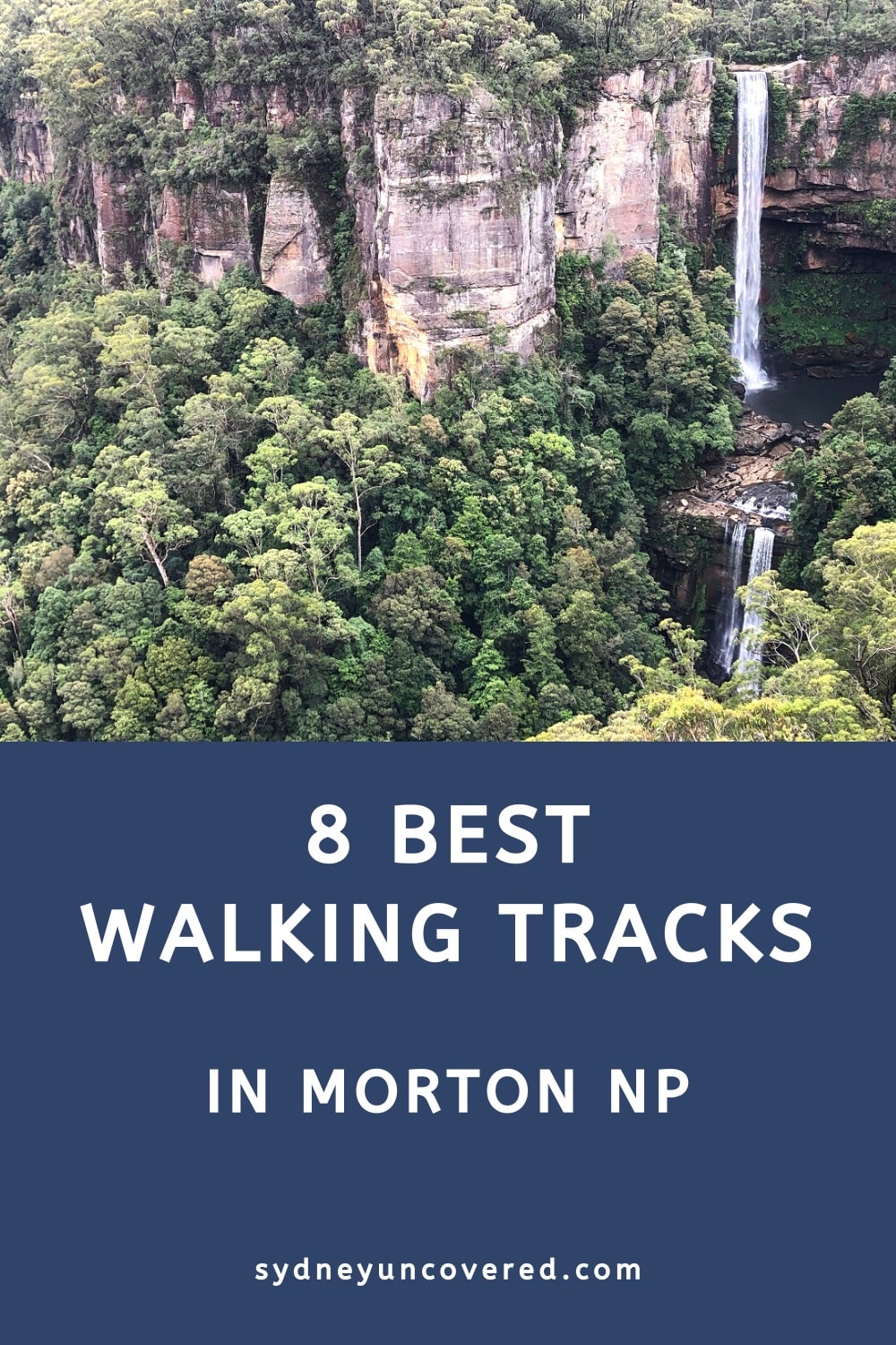
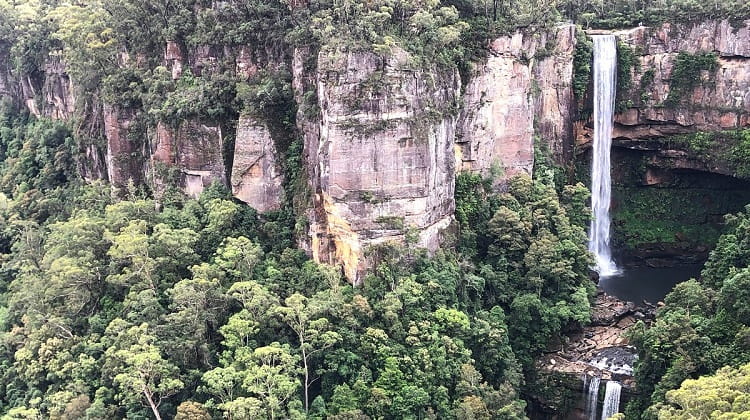
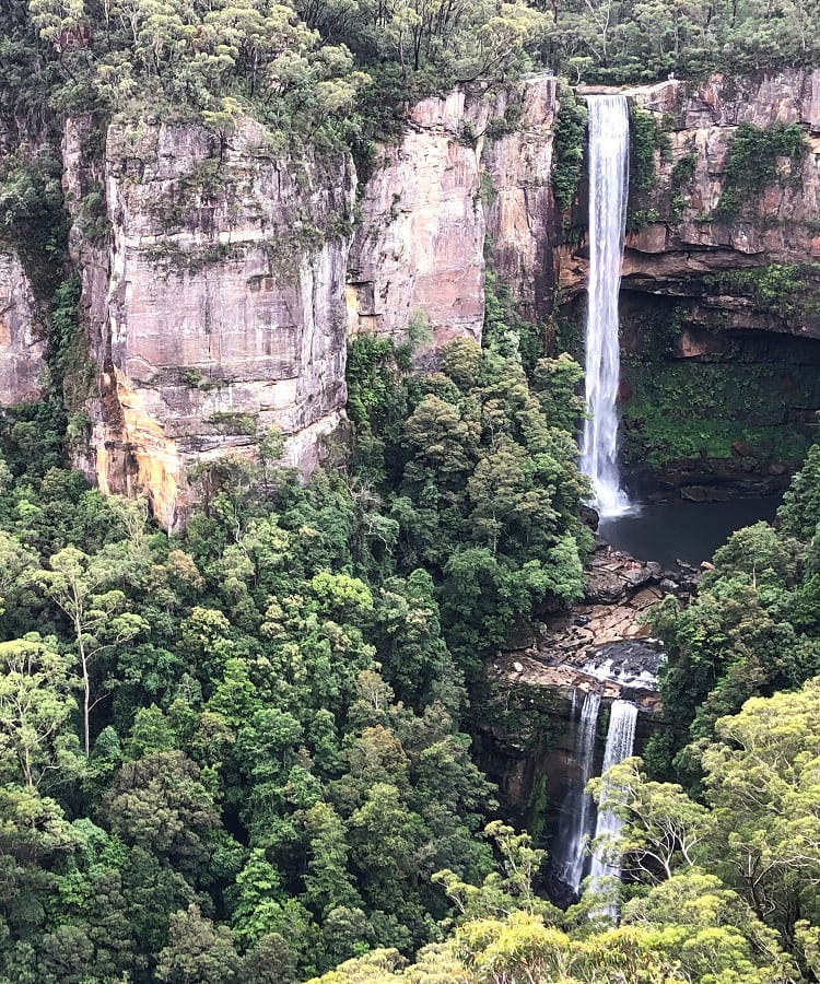
4. West Rim Walking Track at Fitzroy Falls
Fitzroy Falls is more than just a beautiful waterfall; it also serves as the starting point of several exciting bushwalks.
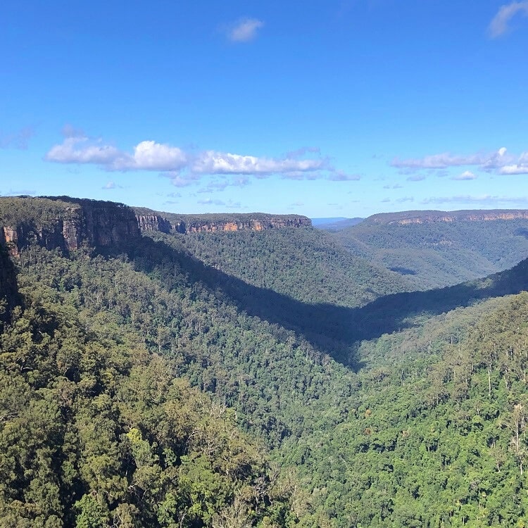
The West Rim walking track is a 4 km return walk through a scenery of pristine eucalypt forests, with amazing views of the Yarrunga Valley.
Several lookout points, such as the Twin Falls and Renown Lookout, make this an exciting outdoor adventure in Morton National Park.
The start of the West Rim walking track can be found at the Fitzroy Falls Lookout just past the Fitzroy Falls Visitor Centre .
| West Rim Walking Track | |
|---|---|
| Distance: | 3.5 km (return) |
| Time: | 2 hours |
| Grade: | Easy / moderate |
| Trailhead: | Google maps location |
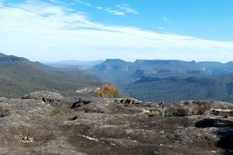
5. Pigeon House Mountain Walk
Characterised by its curiously shaped peak, the 720m high Pigeon House Mountain, otherwise known as Didthul, is situated in the southern part of Morton National Park, west of Milton and Ulladulla.
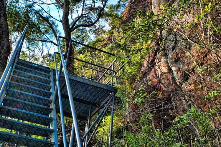
The 5 km return walking track to the summit is not long, but it does have some very steep climbs and ladders.
The panoramic views from the top over the Budawang Range, with its cliffs and gorges, make this a very rewarding hiking adventure.
| Pigeon House Mountain Walk | |
|---|---|
| Distance: | 5 km (return) |
| Time: | 3 hours |
| Grade: | Moderate / hard |
| Trailhead: | Google maps location |
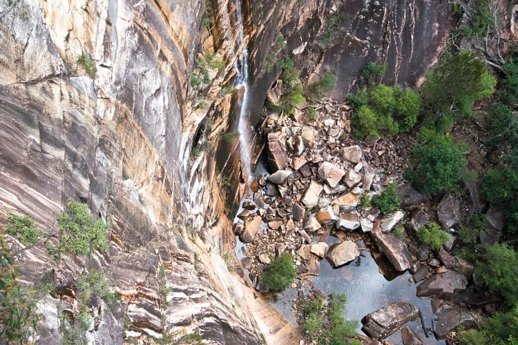
6. East Rim Walking Track at Fitzroy Falls
The second major bushwalk at Fitzroy Falls is the East Rim walking track, otherwise known as the Wildflower Walk. As the name suggests, the East Rim Track follows the eastern cliff line of the Yarrunga Valley.
This walking track is particularly interesting for true nature lovers and birdwatchers. Colourful flowers and singing birds greet you along the way as you hike through eucalyptus forests while taking in scenic valley views.
You can find the start of the track at the Fitzroy Falls visitor centre, right underneath the bridge where the boardwalk branches off to the east.
| East Rim Walking Track | |
|---|---|
| Distance: | 7 km (return) |
| Time: | 3 hours |
| Grade: | Moderate |
| Trailhead: | Google maps location |
7. Mount Bushwalker Walking Track
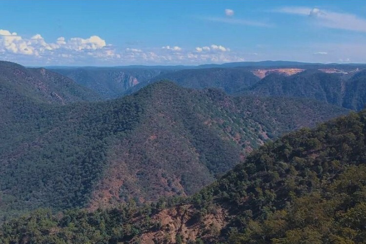
If hiking through the untouched and remote wilderness of the Budawang Range sounds exciting, the Mount Bushwalker walking track should be at the top of your bucket list.
The majestic scenery and incredible views of The Castle, The Shrouded Gods and the Clyde Gorge from the top of Mount Bushwalker have been described by many as some of the best you can get in New South Wales.
As tiny as the mountain itself is, the walking track has all the characteristics of the perfect bushwalk.
| Mount Bushwalker Walking Track | |
|---|---|
| Distance: | 7 km (return) |
| Time: | 3.5 hours |
| Grade: | Moderate / hard |
| Trailhead: | Google maps location |
8. Kangaroo River Walking Track
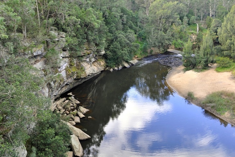
The picturesque Kangaroo River walking track runs from Tallowa Dam Road all the way down to Lake Yarungah, otherwise known as Kangaroo River.
The track winds its way through beautiful rainforest with interesting rock formations to an idyllic spot on the banks of the river, perfect for swimming, fishing, canoeing, and camping.
The water’s edge is also the perfect spot for a picnic in beautiful and quiet natural surroundings.
| Kangaroo River Walking Track | |
|---|---|
| Distance: | 7 km (return) |
| Time: | 3 hours |
| Grade: | Moderate / hard |
| Trailhead: | Google maps location |