Last updated: March 12, 2024
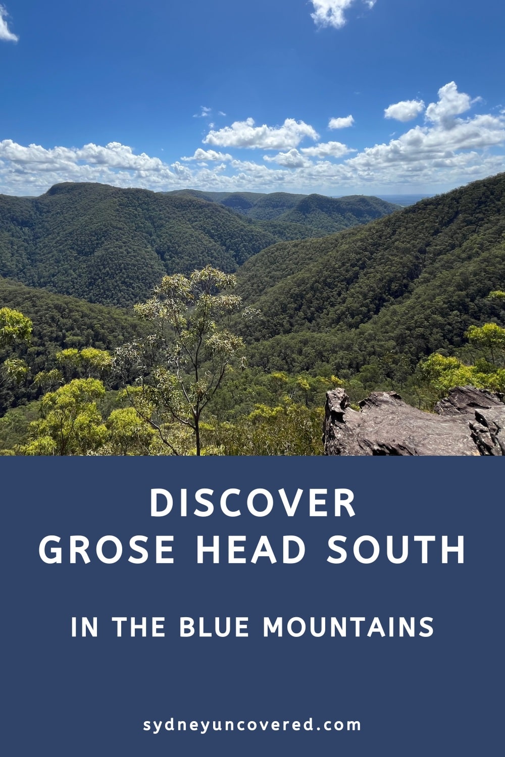
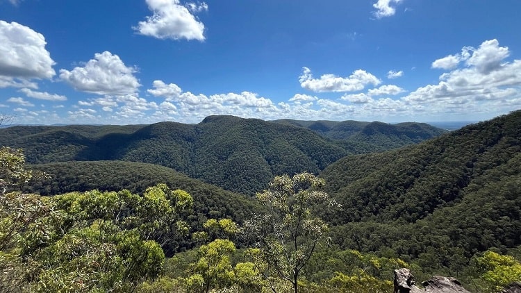
The Grose Head South Lookout is a remote viewing point in the Blue Mountains that offers beautiful views of the Lower Grose Valley.
This lookout can be accessed via two walking tracks that combined form a pleasant loop walk and a popular cycle trail in the Winmalee area.
| Grose Head South Lookout | |
|---|---|
| Distance: | 13 km (return/loop) |
| Time: | 2-3 hours |
| Grade: | Moderate (steep sections) |
| Dogs: | Not allowed |
How to Get There
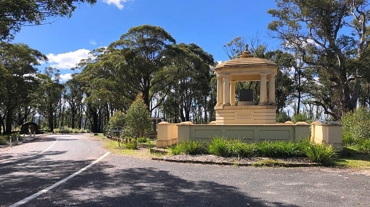
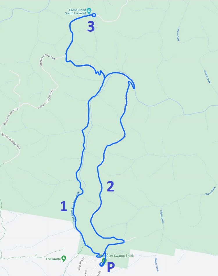
The best spot to start the walk to the Grose Head South Lookout is at the end of White Cross Road in Winmalee where you will see a small car parking area (see map location).
From there, you can choose between the Blue Gum Swamp Walk and the Shaws Ridge Trail to reach the lookout. We strongly recommend doing both walks and turning this adventure into a loop walk.
The Blue Gum Swamp Walk is slightly shorter than the Shaws Ridge Trail, but the entire loop is approximately 10 km long. The steep side trail to the Grose Head South Lookout is approximately 3 km return.
In other words, the total length to visit this lookout from Winmalee is 13 km, with the emphasis that the side trail to the lookout is very steep.
Map
Below is a map with the two walking tracks to the Grose Head South Lookout and the car parking area:
P: Car park
1: Blue Gum Swamp Walk
2: Shaws Ridge Trail
3: Grose Head South Lookout
Grose Head South Lookout
As mentioned, we recommend doing the loop walk so you can enjoy some variety in scenery. We also recommend going anti-clockwise, starting with the Shaws Ridge Trail and returning via the Blue Gum Swamp Walk.
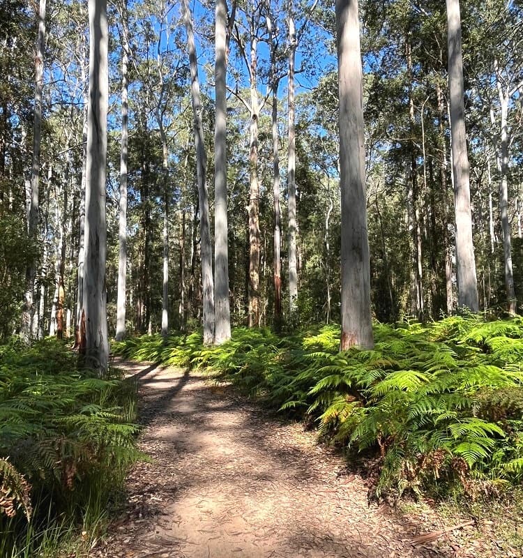
The Blue Gum Swamp Walk is the prettiest (and easiest) of the two walking trails, which is why most visitors prefer to do that walk on the return.
The Walk
The Blue Gum Swamp Walk and Shaws Ridge Trail loop is quite a popular walking trail, with local residents doing this loop walk regularly for exercise reasons.
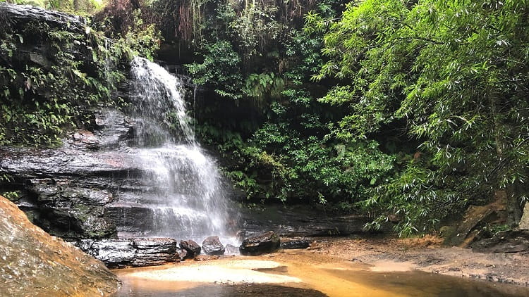
Most of the loop is on a fire trail, but the Blue Gum Swamp section navigates through a beautiful forest environment.
Halfway through the circuit walk, where the Blue Gum Swamp Walk evolves into the Shaws Ridge Trail or vice versa, you will see a signpost that says Grose Head South and Bees Nest Hill.
That is where the side trail to the Grose Head South Lookout starts. The walking trail to that lookout is called Bees Nest Hill Track.
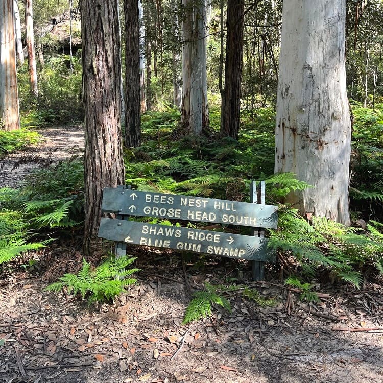
This side trail to the lookout is about 3 km long (return), and the first half of that trail is very steep, for which you will need to be prepared.
At the intersection with the Springwood Ridge Trail, turn right to get to the lookout. This last stretch is mostly flat and easy to do.
The Lookout
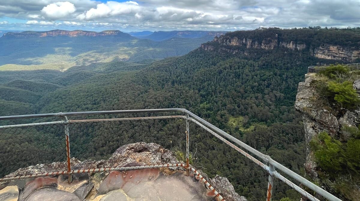
Towards the end of the walking trail, you will see a large clearing, with the lookout appearing on your left.
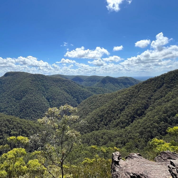
The Grose Head South Lookout is a large, unfenced rocky platform with fantastic views of the Lower Grose Valley, Springwood Creek, and the Grose River.
And with such incredible views, this lookout is also the perfect picnic spot!
Faulconbrdge Point Lookout.