Last updated: April 8, 2024
The steep walking track from Perrys Lookdown near Blackheath to the Blue Gum Forest in the Grose Valley is a challenging but rewarding bushwalking adventure.
The Acacia Flats camping ground is only 500m away from the forest, where you can set up your tent and stay overnight in beautiful surroundings.
In this article, we’ll share everything you need to know about this hike, its highlights, and how to get there.
| Perrys Lookdown to Blue Gum Forest | |
|---|---|
| Distance: | 5 km (return) |
| Duration: | 3-4 hours |
| Grade: | Hard (very steep) |
| Dogs: | Not allowed |
How to Get There
In Blackheath, drive into Hat Hill Road and follow the signs to Perrys Lookdown.
Hat Hill Road evolves into Perrys Lookdown Road. This road was sealed in 2014, so there is no need for a 4WD vehicle to drive there.
There is a small car park and a campground at the start of the walking track to Perrys Lookdown, Blue Gum Forest, and Acacia Flats.
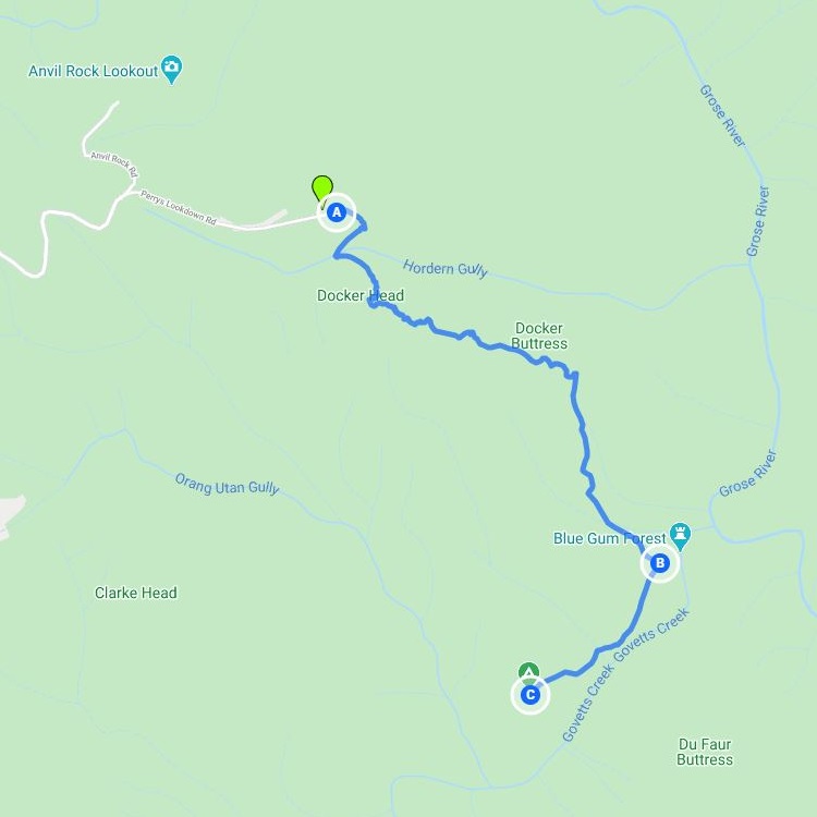
Map
The below map gives you an idea where this track is located, but click here for the exact location of the car park on Google Maps.
A: Perrys Lookdown
B: Blue Gum Forest
C: Acacia Flats Camping Ground
Perrys Lookdown to Blue Gum Forest
The walking track to the Blue Gum Forest starts at the “Perrys Lookdown Track” signpost next to the car park.
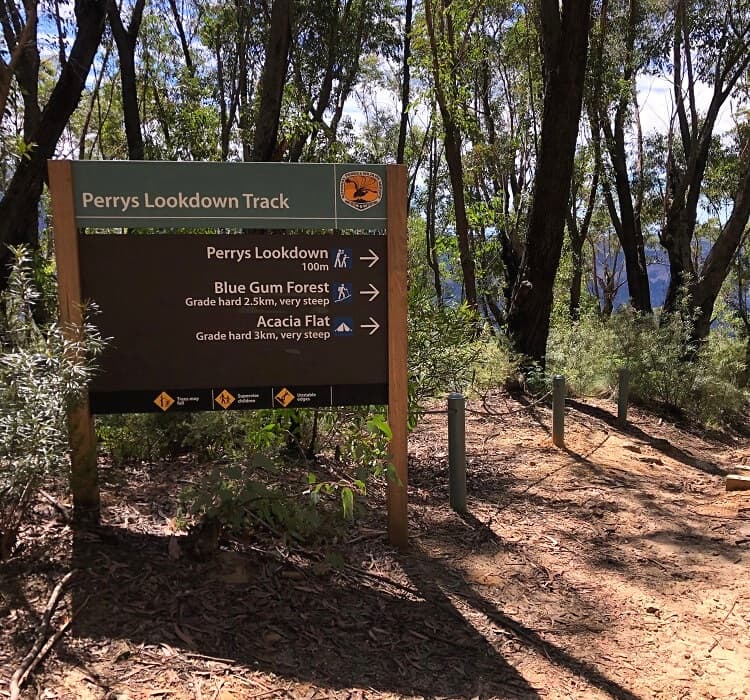
While this is certainly not a very long walking track, it is very steep, and you should allow at least 3-4 hours to complete the return walk.
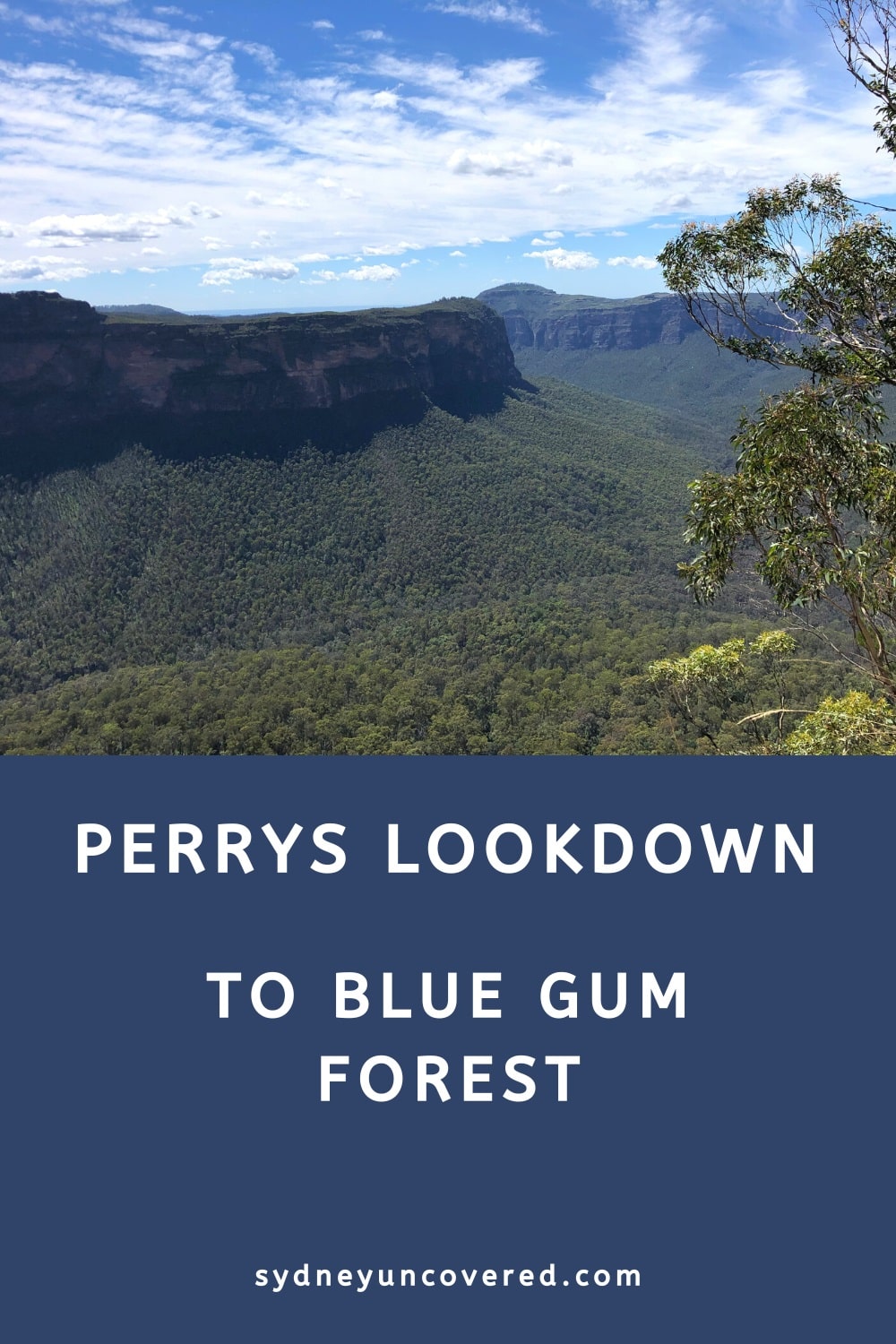
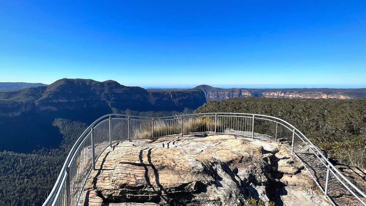
Perrys Lookdown
The first highlight is Perrys Lookdown, a lookout point offering panoramic views of the Grose Valley and the beautiful sandstone cliffs surrounding the valley.
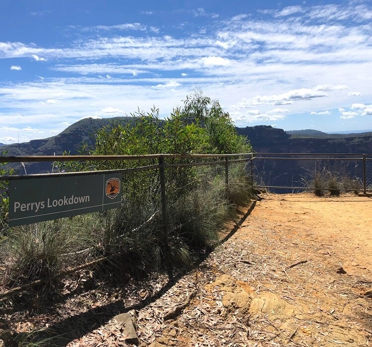
The views to the base of the valley will give you an idea of how far down the track will go to get to the Blue Gum Forest.
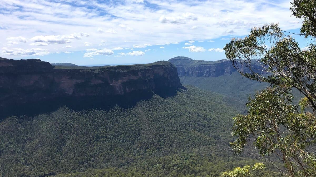
Dockers Lookout
Not too far away from Perrys Lookdown is the Dockers Lookout, which offers similar views, albeit from a slightly different angle.
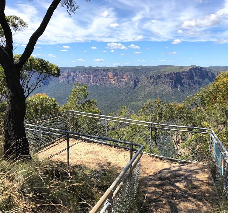
From the Dockers Lookout, you can actually see the first glimpses of the Blue Gum Forest at the bottom of the valley.
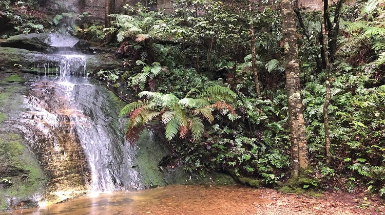
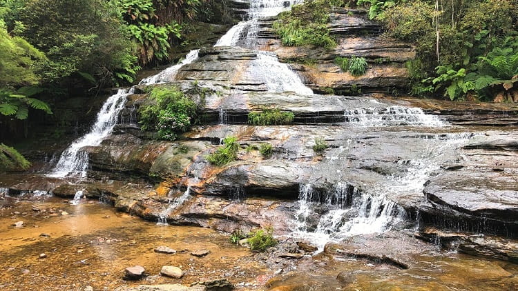
Blue Gum Forest
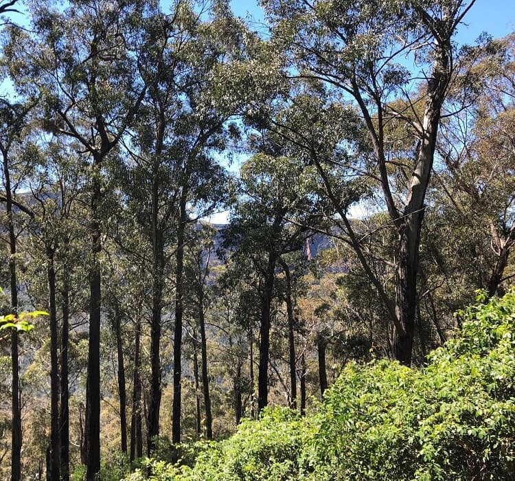
From the two lookouts, the track gradually zigzags its way down into the valley, heading towards the Blue Gum Forest.
Located at the intersection of the Grose River and Govetts Creek, the Blue Gum Forest is an impressive collection of majestic eucalyptus trees.
If it hadn’t been for the efforts of local bushwalkers, the Blue Gum Forest would have been axed in the 1930s.
A farmer by the name of Clarrie Hungerford managed to purchase a lease of the forest. His plan was to clear the gum trees for farming purposes.
Local bushwalkers became aware of his drastic plans and urged him to save the forest. Hungerford agreed to sell back the lease for 130 Australian Pounds, a considerable amount of money in those days.
The funds were eventually raised, Hungerford gave up the lease, and Blue Gum Forest was saved from destruction.
The government soon turned the area into a protected reserve named Blue Gum Forest. In 1962, Blue Gum Forest became officially part of the Blue Mountains National Park.
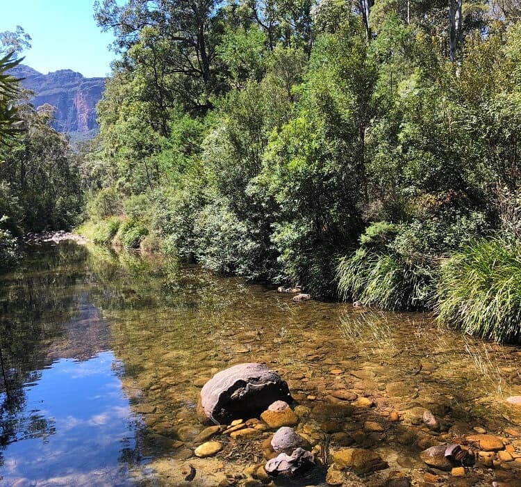
Acacia Flats Camping Ground
Located on the bottom of the Grose Valley, Acacia Flats is a beautiful camping ground surrounded by tall Acacias and Blue Gums.
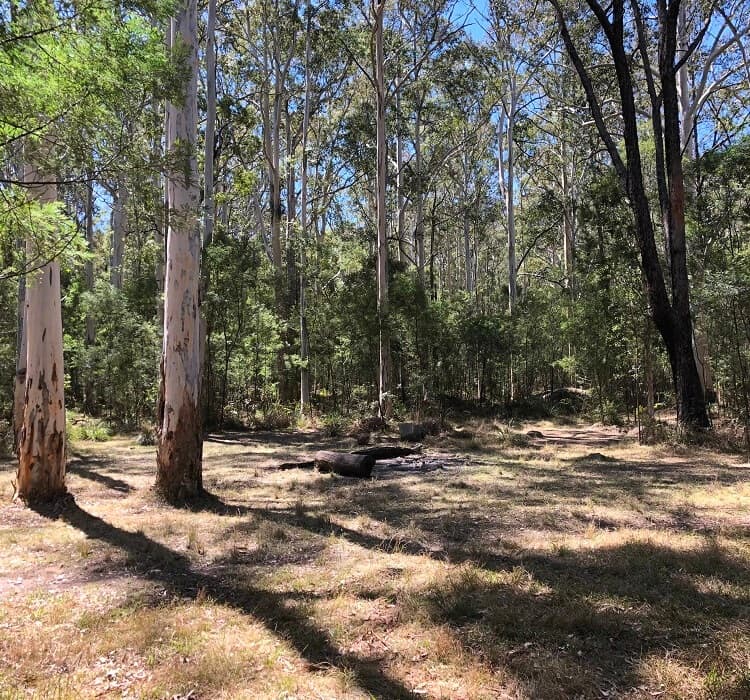
There are lots of flat sections in the area where campers can set up their tents for the night.
As can be expected, facilities are minimal, with one pit toilet and old tree logs to sit on. Water can be retrieved from Govetts Creek, which runs next to the camping ground.
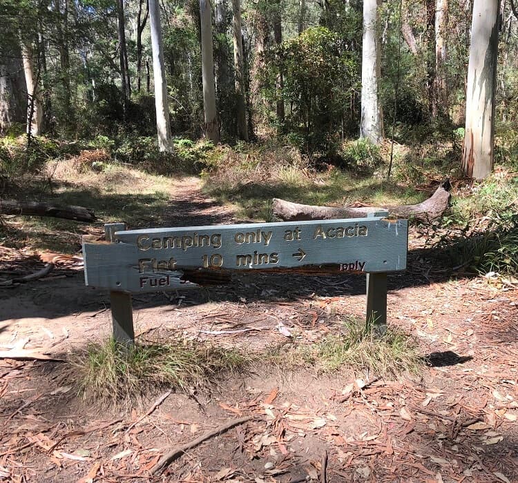
Blue Gum Forest and the camping ground are situated at an intersection where several walking tracks connect. This makes the camping ground the perfect base for bushwalking in the area.
More Hiking
From the camping ground, you can continue hiking to Lockleys Pylon and Du Faur Head going in a southeast direction.
You can also continue hiking to Evans Lookout via Junction Rock going in a southwest direction, or even all the way to Pierces Pass and Victoria Falls going northbound.
It’s fascinating how so many walks in the Blue Mountains are connected through the Grose Valley. Be mindful though that these hikes typically require some degree of bushwalking experience, as they can be quite challenging.