Last updated: April 16, 2024
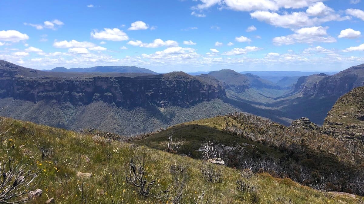
The Lockleys Pylon walking track is an exciting bushwalk in the Blue Mountains, offering scenic 360-degree views of the Grose Valley and beyond.
This part of the Blue Mountains is still relatively quiet and unspoiled, which makes the track to this unique landmark all the more enjoyable.
The extra stretch to Du Faur Head from Lockleys Pylon is worth the effort, with even more views to take in.
| Lockleys Pylon Walking Track | |
|---|---|
| Distance: | 7 km (return) |
| Duration: | 2-3 hours |
| Grade: | Moderate (steep sections, rough surface) |
| Dogs: | Not allowed |
How to Get There
The start of the Lockleys Pylon walking track is on Mount Hay Road, which you can access from Leura (see map location).
From the Great Western Highway, take the Leura exit and turn right at the roundabout crossing the overpass. Turn right into Britain Street, followed by a left turn into Mount Hay Road.
After about 10 km on this unsealed road, you will arrive at a small car park. If that car park is at capacity, you can try parking on the side of the road a bit further away.
A 4WD vehicle isn’t required to drive on Mount Hay Rd. However, after a period of rainfall, it’s recommended not to go there with a 2WD vehicle.
Public transport is not an option. With Leura’s train station about 15 km away and no buses heading there, travelling by car is the only feasible option.
Lockleys Pylon Track Notes
The Lockleys Pylon Track is approximately 7 km (return) and is moderately challenging. Anyone with a reasonable fitness level should easily be able to complete this fantastic hike.
The path overall is relatively easy to follow, and there is a bit of a steep climb at the end to get to the summit of Lockley Pylon. The extra stretch to Du Faur Head also requires a bit of climbing.
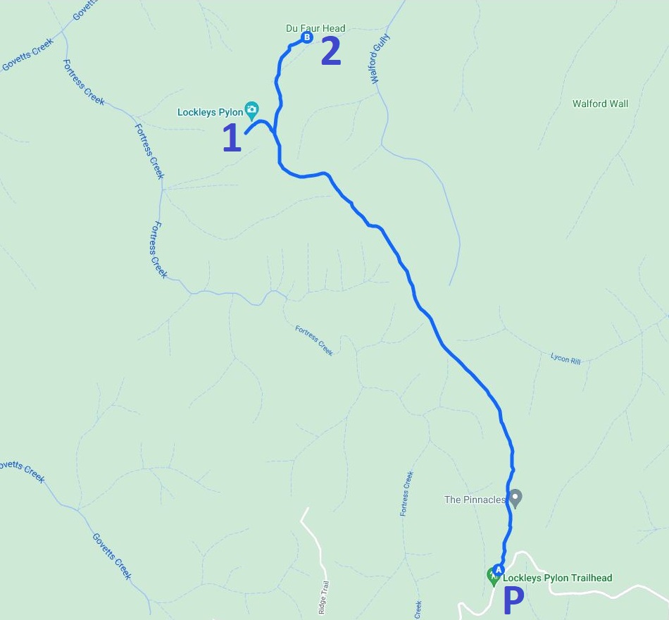
Below is a map of the walk:
P: Car park.
1: Lockleys Pylon.
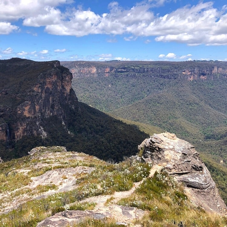
2: Du Faur Head.
The Pinnacles
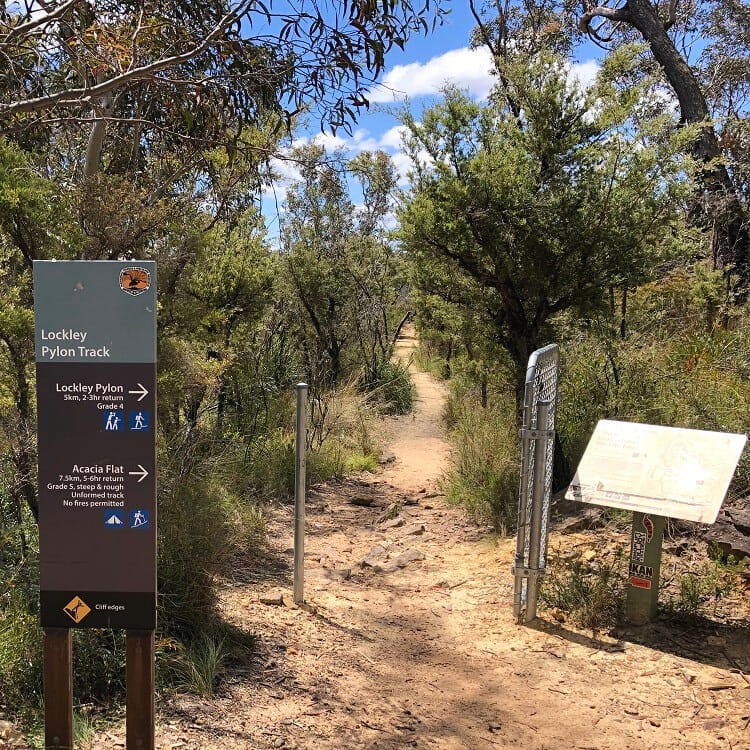
Once you’ve parked your car, it’s time to start hiking. Look for the signpost that marks the start of the trail.
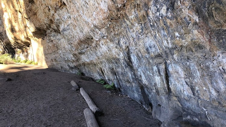
The first section of the walking track is uphill, heading towards a unique rock formation named The Pinnacles.
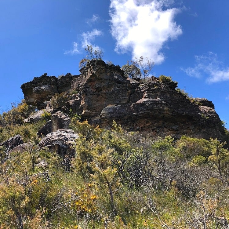
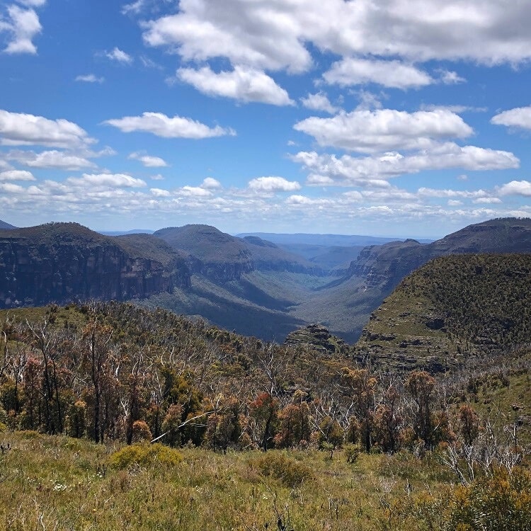
From the Pinnacles, the track continues through a beautiful landscape of heath vegetation, with scenic views of Fortress Ridge to the west to take in.
Keep an eye out for a short detour that leads to a lookout point with great views of Fortress Ridge and Fortress Creek in the valley below.
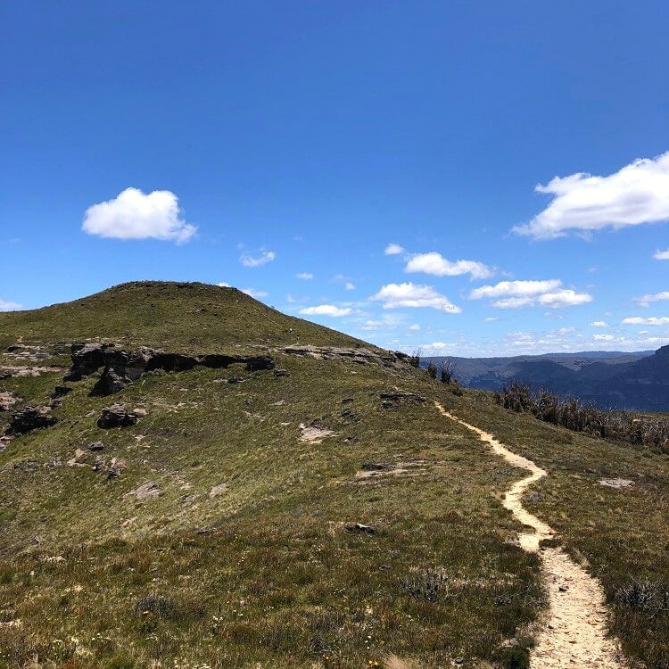
Lockleys Pylon
As the path continues, Lockleys Pylon slowly starts to appear in the distance while the panoramic views of the valleys and mountains on both sides of the track keep getting better.
Have a good look around and see if you can identify Mount Hay and Mount Banks in the distance.
Once you get to Lockleys Pylon, a set of stairs followed by a well-maintained path will get you to the summit of this very distinctive landmark.
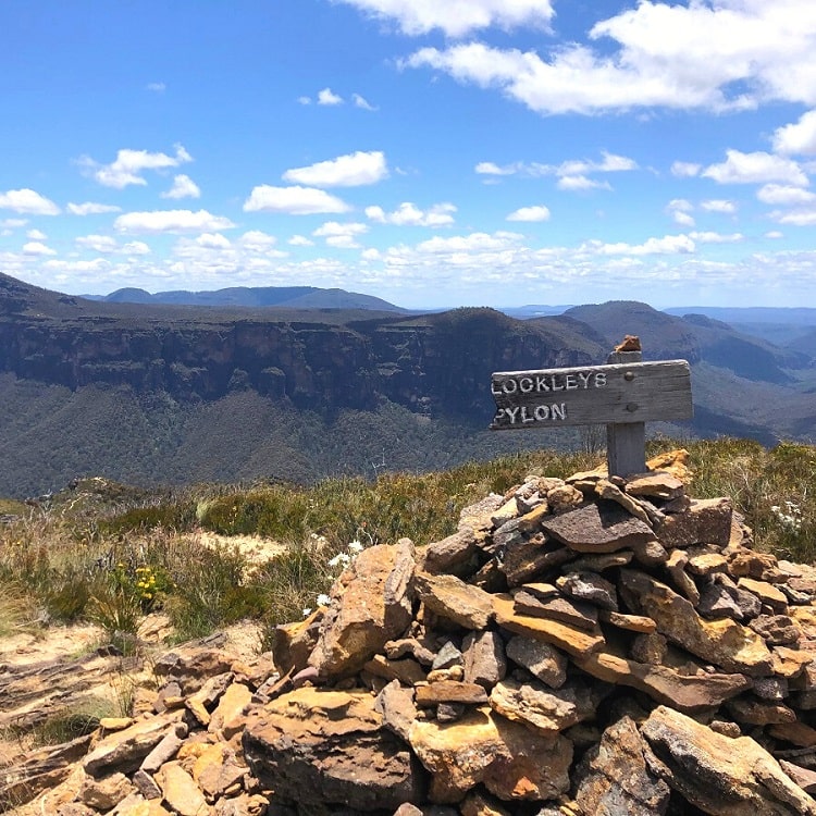
Lockleys Pylon was named after John Gilmour Lockley, a writer and journalist who supported conservation efforts to save the Blue Gum Forest from logging in the 1930s.
While it’s not all that far to the peak, there are some steep sections that can be a bit challenging.
Once at the top, you will notice several different paths you can choose from to head back down.
But before heading back, you will want to spend some time up there to take in the fantastic 360-degree views of one of the most beautiful parts of the Blue Mountains.
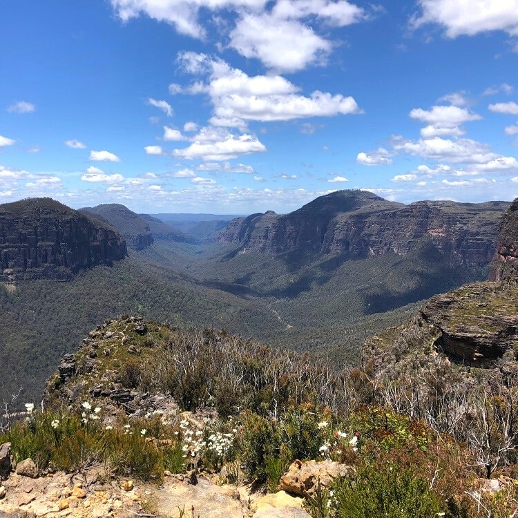
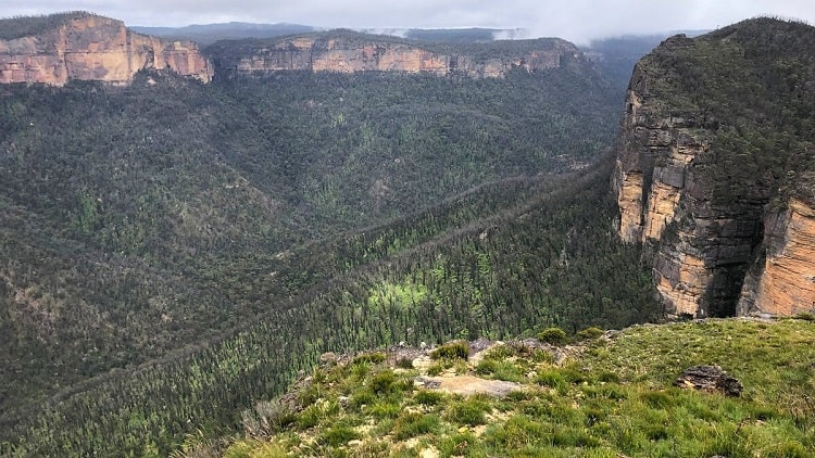
Du Faur Head
Once you’ve reached Lockleys Pylon, it’s worth continuing the walking track to Du Faur Head, a rock formation on the edge of the escarpment facing the Grose Valley.
From there, you can go even further and hike all the way to the Blue Gum Forest in the valley, but only do that if you’re well prepared with food and other supplies.
Allow for an extra hour of hiking and sightseeing if you plan to continue to Du Faur Head. It’s worth it, as the views are fantastic!
This walk is amazing, thanks for sharing. The road there is quite poor, but take it slow. I went on to Du Faur Head, 195 steps down, and back up! But the view was awesome to sit and have lunch.
Thanks Annette, you’re right, continuing on to Du Faur Head from Lockleys Pylon is definitely worth the effort!