Last updated: April 22, 2024
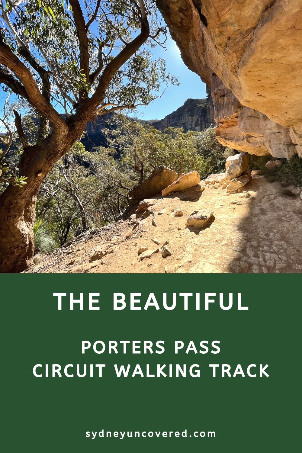
The Porters Pass circuit is a beautiful bushwalk in the Blackheath area of the Blue Mountains that involves waterfalls, valley views, creek crossings, rainforest gullies, and slot canyons.
This challenging hike combines four different walking trails and is among the best in the Greater Blue Mountains region. What’s great is that Porters Pass is far less trafficked than, for example, the Grand Canyon Walk.
In this article, we’ll tell you everything you need to know about this fantastic walk and its highlights, how to navigate the trail, and where to find the trailhead.
| Porters Pass Circuit | |
|---|---|
| Distance: | 5.5 km (loop) |
| Duration: | 3 hours (depending on stops) |
| Grade: | Moderate / hard |
| Dogs: | On a lead |
How to Get There
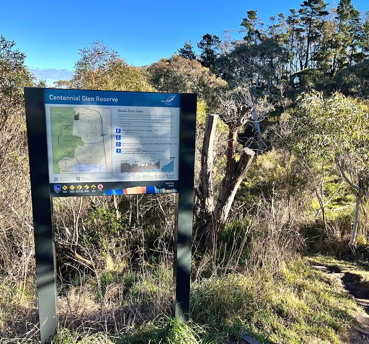
The Porters Pass Circuit has multiple entry points, but the best spot to start this adventure is at the end of Burton Road in Blackheath (see map location).
This spot is a short 3-minute drive from the Blackheath town centre via Station Street, Wombat Street, Kanimbla Road, and Burton Road.
Note that this is a residential street, so please park on the side of the road without blocking any driveways.
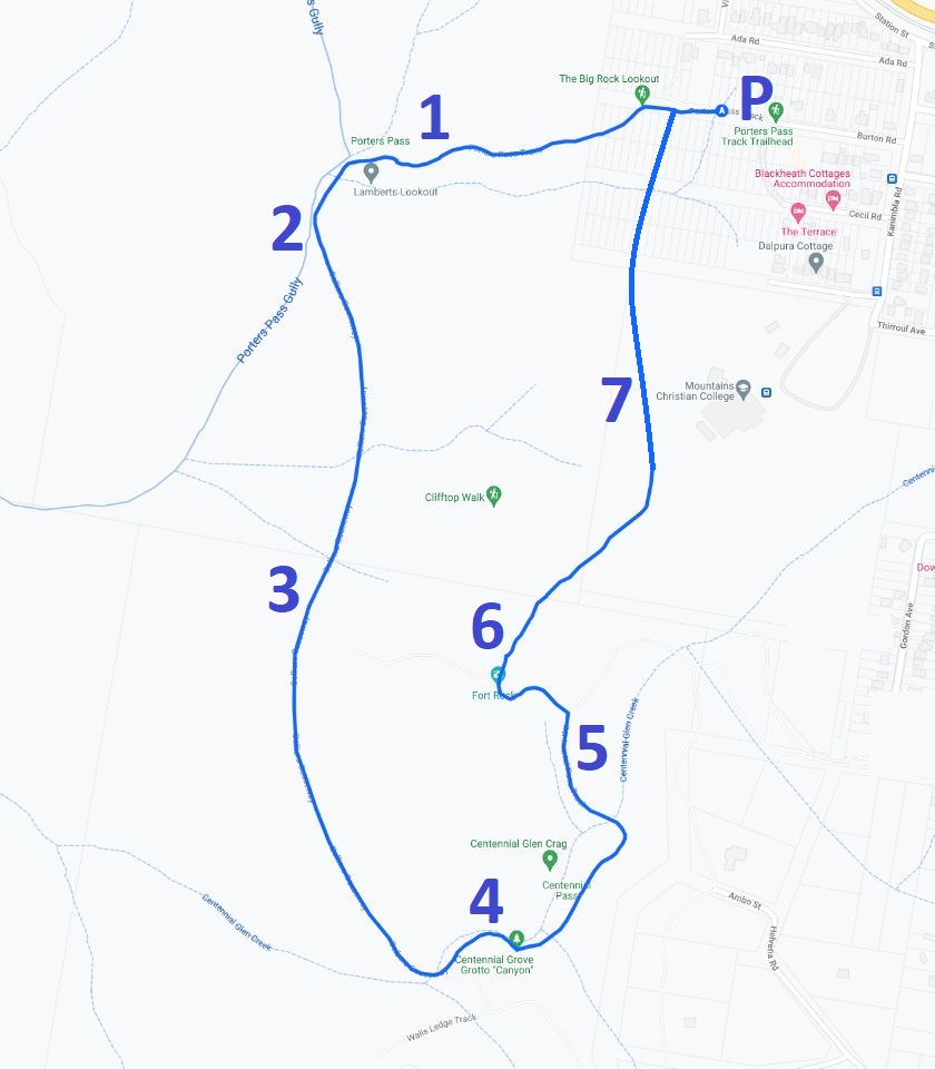
Map
Below is a map of the walk along the following highlights and sections:
- Lamberts Lookout
- Porters Pass Gully
- Colliers Causeway
- Centennial Grove Grotto Canyon
- Centennial Glen Pass
- Fort Rock
- Clifftop Walk
Porters Pass Track Notes
We classify the Porters Pass Circuit as a moderate to hard walking track. There are lots of steps and sections with rough surfaces to negotiate. Good hiking shoes are recommended, and a set of hiking poles might also be helpful.
The distance is approximately 5.5 km, and the path, overall, is easy to follow. However, there are multiple intersections where things can get a bit confusing, so it’s recommended to familiarise yourself with the route. The map above and track notes below will hopefully help with that.
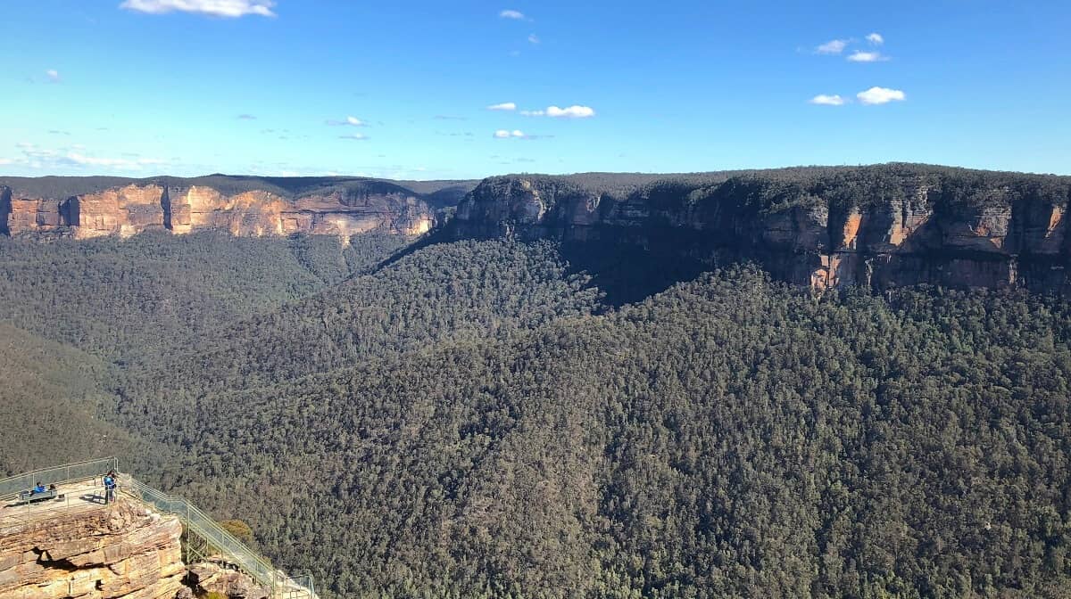
1. Lamberts Lookout
Once you’ve parked your car and put on your hiking boots, it’s time to start this Blue Mountains adventure. At the information board at the end of Burton Road, follow the walking path heading into the bush.
After about 600 metres, you will see a non-signposted path on your left, moments before a signpost that says “Porters Pass and Colliers Causeway”.
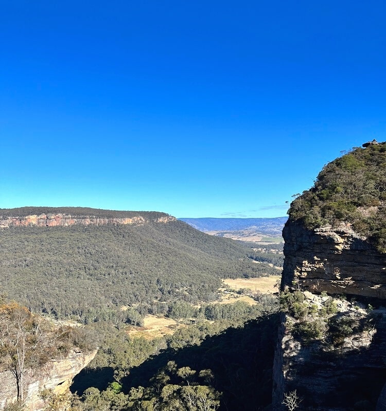
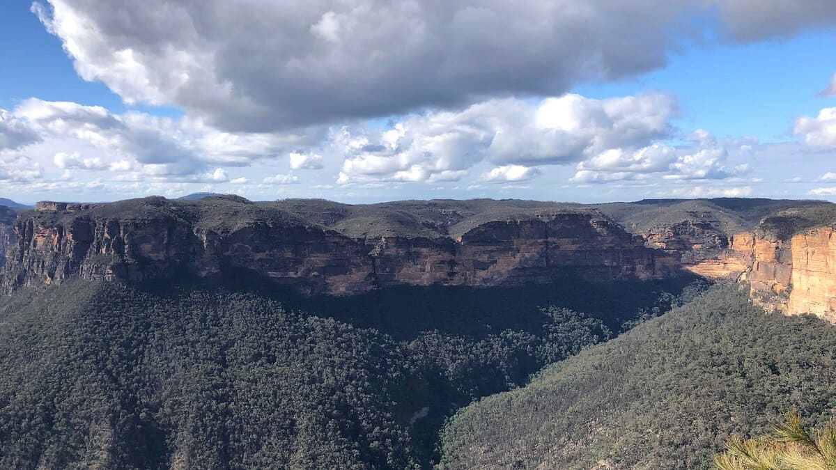
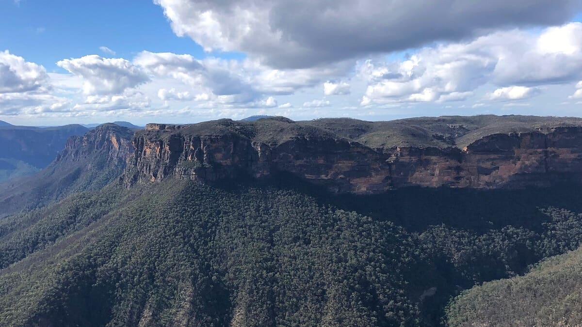
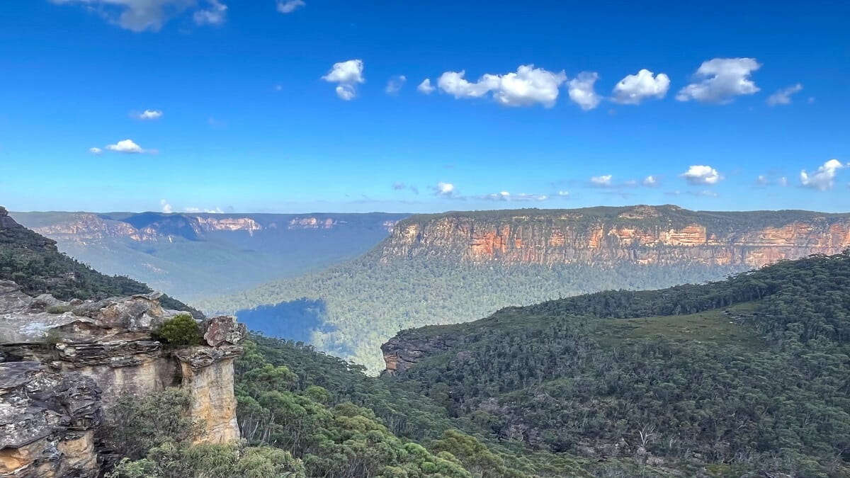
Follow that path on your left for a short detour to the Lamberts Lookout, a rocky outcrop from where you can enjoy fantastic views of a cliff wall and valley straight ahead.
Once you’ve finished admiring the views, retrace your steps to continue on the main trail towards Porters Pass and Colliers Causeway.
2. Porters Pass Gully
From this point, the trail goes downhill, with the scenery evolving from typical Blue Mountains bushland to a lush rainforest setting.
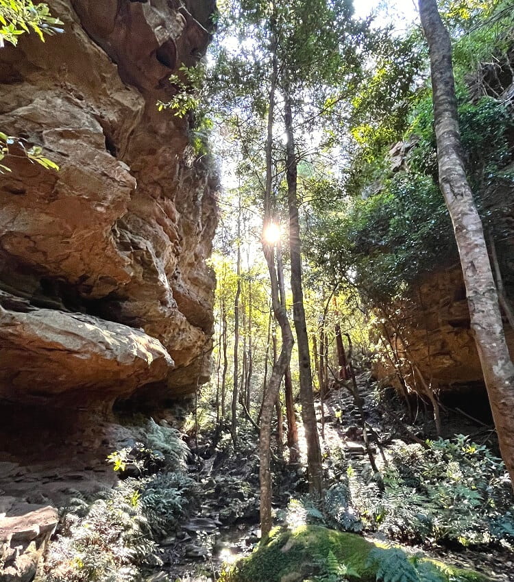
This is where the path for a short while follows the Porters Pass Gully, a creek that you’ll have to cross a few times.
The walking track also passes a small, unnamed waterfall with handrails on one side to help with crossing the gully creek safely.
3. Colliers Causeway
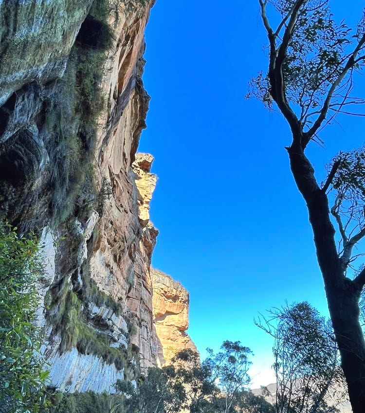
The Colliers Causeway is a beautiful section of the Porters Pass Circuit, where you’ll be hiking alongside the base of impressively high cliff walls.
The narrow path is a bit challenging along this stretch, but as long as you stay focused on your surroundings, it’s very manageable.
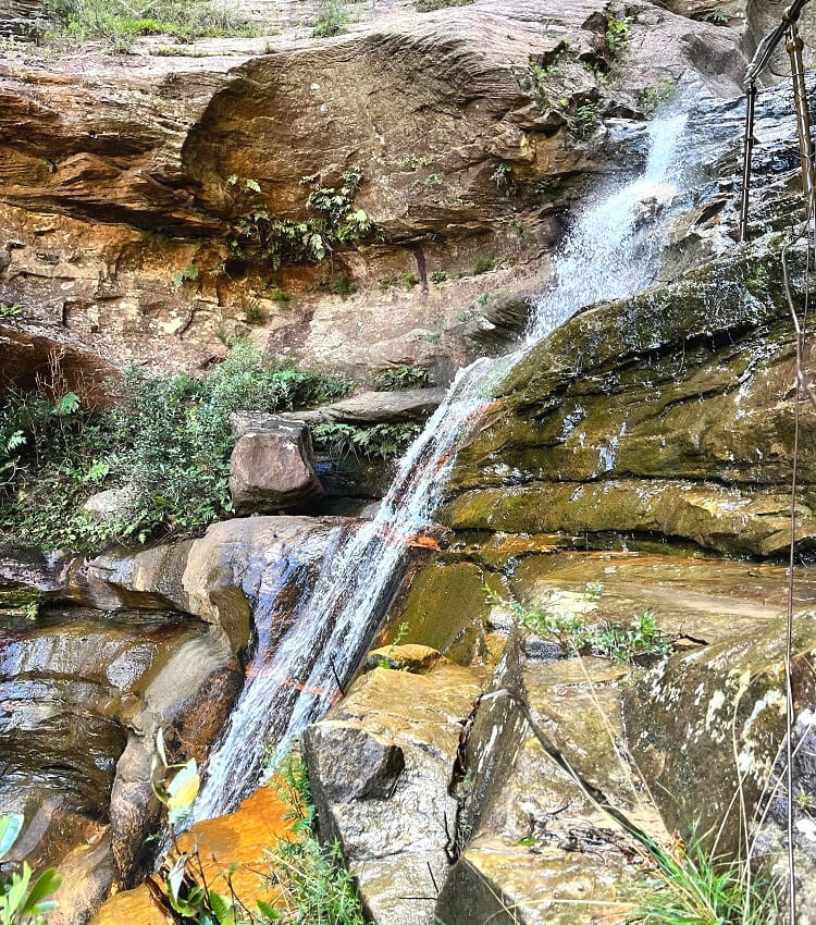
Towards the end of the Colliers Causeway section, the scenery again evolves into a rainforest setting, before arriving at a cascade waterfall.
This waterfall is, unofficially, also referred to as Slippery Dip Falls. It’s a beautiful waterfall, with the walking path ascending right next to it via a series of steps with handrails.
Soon after this waterfall, the path hits a junction with a signpost that says “Canyon” and “Centennial Glen”. Turn left at that signpost to visit the popular Centennial Grove Grotto Canyon.
4. Centennial Grove Grotto Canyon
The Centennial Grove Grotto Canyon is a slot canyon with a small waterfall at the end. This waterfall drops into a pool where you can take a quick dip if the weather is warm.
To get to that pool, you can walk through the water in the slot canyon or try to walk along a narrow elevated path under a rock overhang.
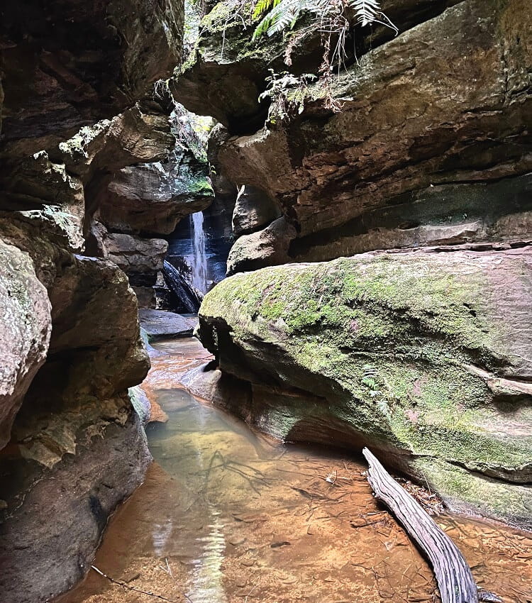
In the warmer summer months, the Centennial Grove Grotto Canyon is a lovely spot for a splash. It’s a beautiful and unique sight that has received a lot of attention on social media channels.
Once you’ve finished exploring Centennial Grove Grotto Canyon, retrace your steps to the junction and make your way up the steps to Centennial Glen.
For better swimming spots with more space to move around, read our list of swimming holes in the Blue Mountains, which includes Minnehaha Falls and Jellybean Pool.
5. Centennial Glen Pass
The trail soon arrives at two more intersections, where you’ll need to follow signs for “Centennial Glen exit Bundarra St” and “Fort Rock exit Bundarra St”.
Centennial Glen is a beautiful area where you’ll walk alongside impressive cliff walls. It’s a popular abseiling and climbing spot, so you may see a few abseilers at work.
This section also includes a stunning waterfall that is a bit hidden behind the trees, but the trail navigates behind the waterfall, and you won’t miss it.
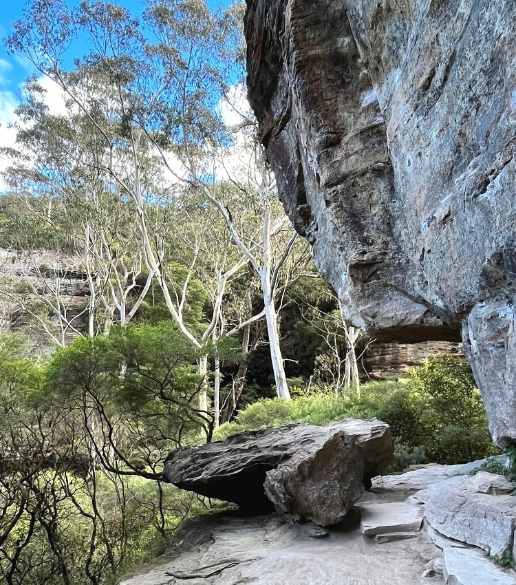
6. Fort Rock
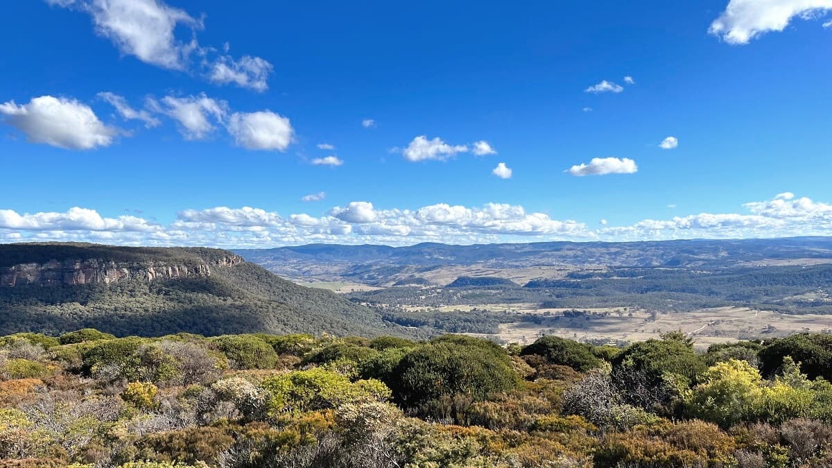
After this waterfall, the track goes uphill quite steeply before arriving at Fort Rock, a rocky outcrop that you can climb onto.
The district views from Fort Rock towards the valley and surrounding headlands are pretty spectacular.
Interestingly, you wouldn’t know about those great views unless you climbed onto the big rock. And this unassuming rock is easy to walk past and miss altogether!
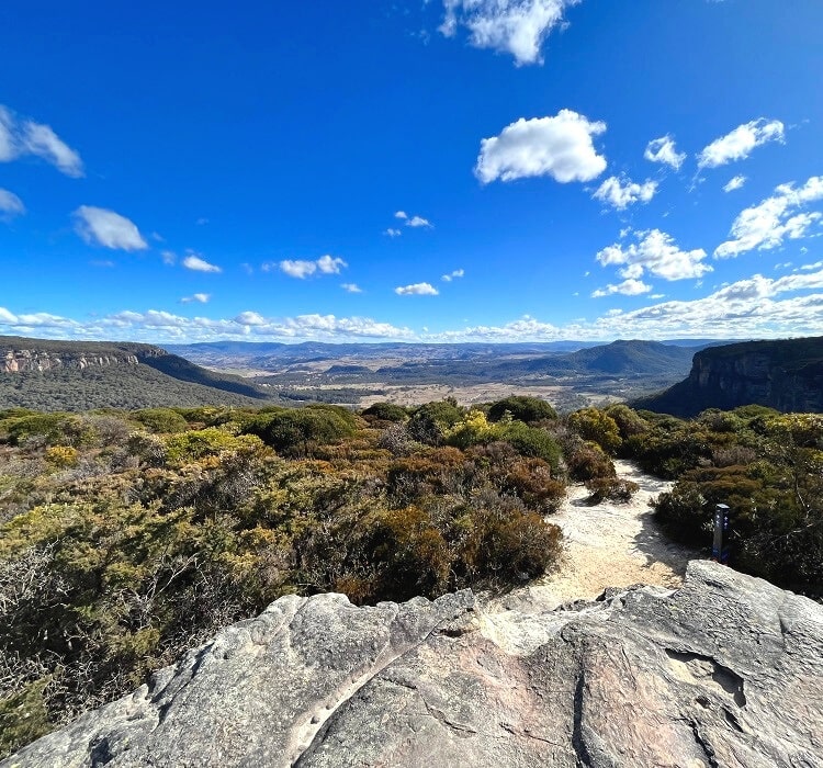
7. Clifftop Walk
The Clifftop Walk starts right after passing Fort Rock, and is a highly enjoyable walking trail.
This last stretch of the Porters Pass loop walk is a fantastic way to complete this hiking adventure, with wonderful views of the Kanimbla and Megalong Valley to take in.
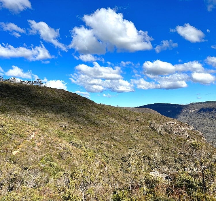
Towards the end of the Clifftop Walk, the path heads back into the bush, climbing to higher grounds where it meets the junction with the Porters Pass. From that junction, it’s only a short walk back to Burton Road.
We enjoyed the Porters Pass Circuit so much that we have it featured on our list of the best hikes in the Blue Mountains.