Last updated: January 25, 2024
This guide explores the seven best waterholes in the Blue Mountains where you can go for a quiet swim, including details on how to find them.
There is nothing quite like swimming in an idyllic natural waterhole in the Blue Mountains, ideally with a beautiful waterfall dropping into the pool. But going for a dip is not the only reason to visit these wild swimming holes. The exciting bushwalking trails to get to these spots are just as enjoyable.
The seven natural water holes below are ordered from east to west, starting with three spots in the Glenbrook area of the Blue Mountains.
Remember that swimming in the wild always comes with risk. As such, be aware of slippery surfaces, hidden submerged rocks in the water, and wildlife.
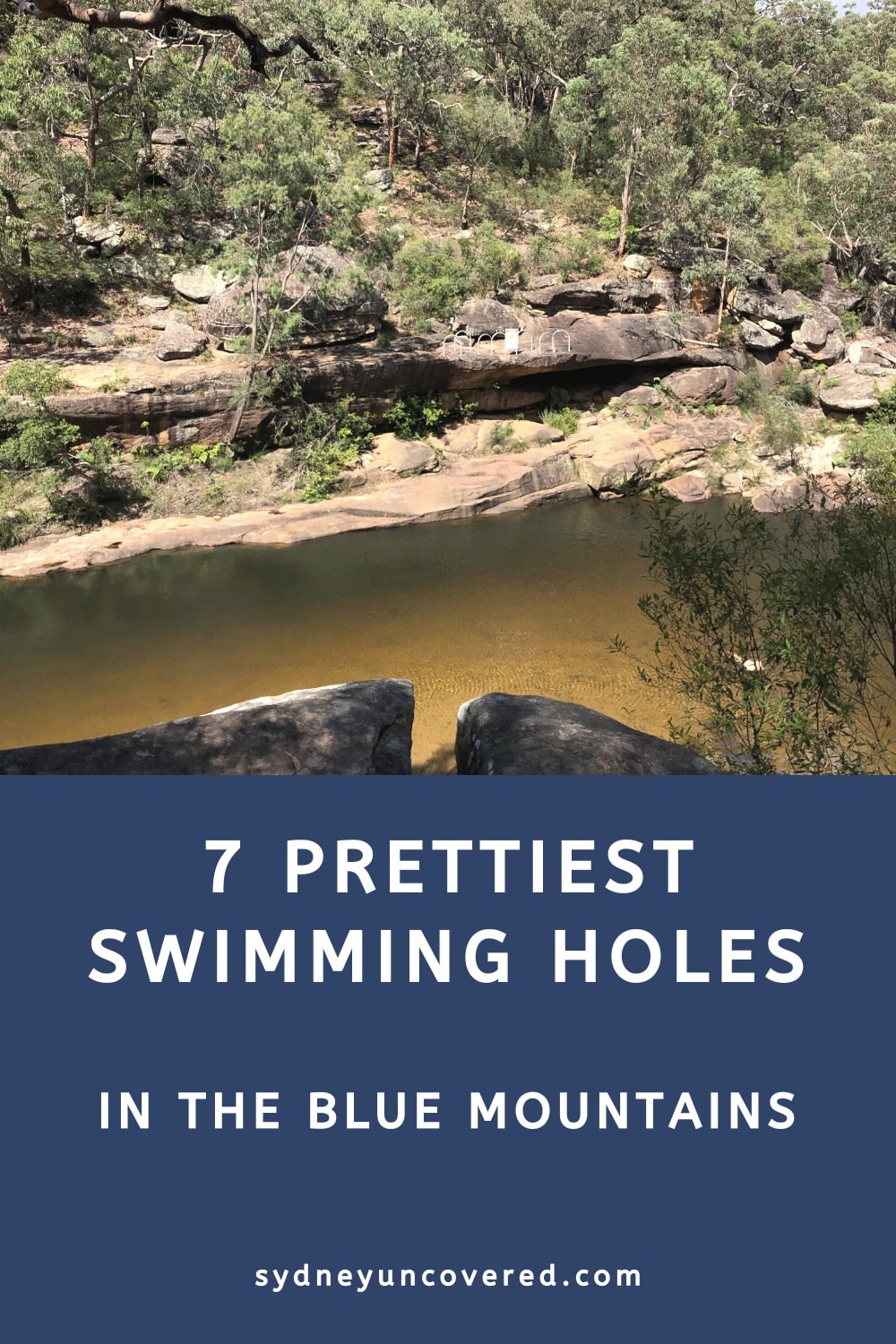
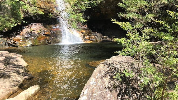
1. Jellybean Pool
Jellybean Pool in Glenbrook is perhaps the most popular swimming hole in the Blue Mountains, and for good reasons.
This natural waterhole on Glenbrook Creek looks stunning, it’s large, there is lots of space to move around, and it even has a small beach area. It’s also easy to drive to from Sydney and has two large car parks.
The downside is that Jellybean Pool can get very busy on the weekends, public holidays, and school holidays, especially when the weather is warm and sunny. The best way to avoid those crowds is to either go early in the morning or go on a weekday.
How to Get There
In Glenbrook, drive on Bruce Road until you see the entrance to the National Park, where you will see the first car park. From that car park, there is an easy 15-minute one-way walking trail to the pool.
However, if you drive a little further, on Jellybean Road, you will end up at the designated Jellybean Pool car park, from where it’s only a few steps down to the pool.
Please note that to park your car in this area of the Blue Mountains, you will need to pay the National Park parking fee at one of the ticket machines.
Find the trailhead to Jellybean Pool on Google Maps.
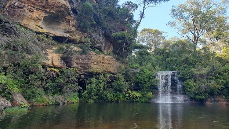
2. Blue Pool
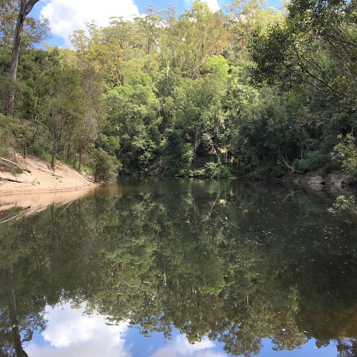
Blue Pool is located very close to Jellybean Pool but usually doesn’t attract the large crowd numbers that Jellybean Pool does.
While it may not have a sandy area, there is enough space on the rocky areas to settle in for the day. And because the pool is so big, there is plenty of space to go for an actual swim.
The walking trail to the pool from the car park is very short but is slightly more challenging than the stroll to Jellybean Pool, with a bit of mild rock scrambling to do as well. Once you see the pool, you will understand why it’s called Blue Pool. The water does indeed have this peculiar blue colour.
How to Get There
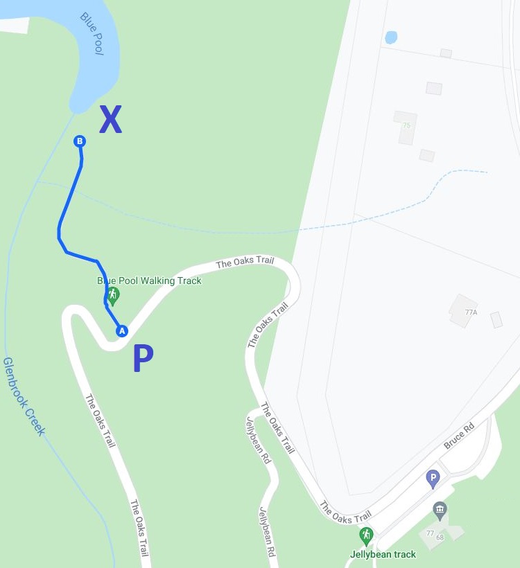
As mentioned, Blue Pool is not too far away from Jellybean Pool. From Bruce Road in Glenbrook, once you’ve entered the National Park, continue driving on The Oaks Trail until you see a designated car park for Blue Pool.
You can park on either side of the road, and usually, there is enough space. Once you’ve parked your car, look out for the start of the signposted walking trail to the pool.
Find the trailhead to Blue Pool on Google Maps.
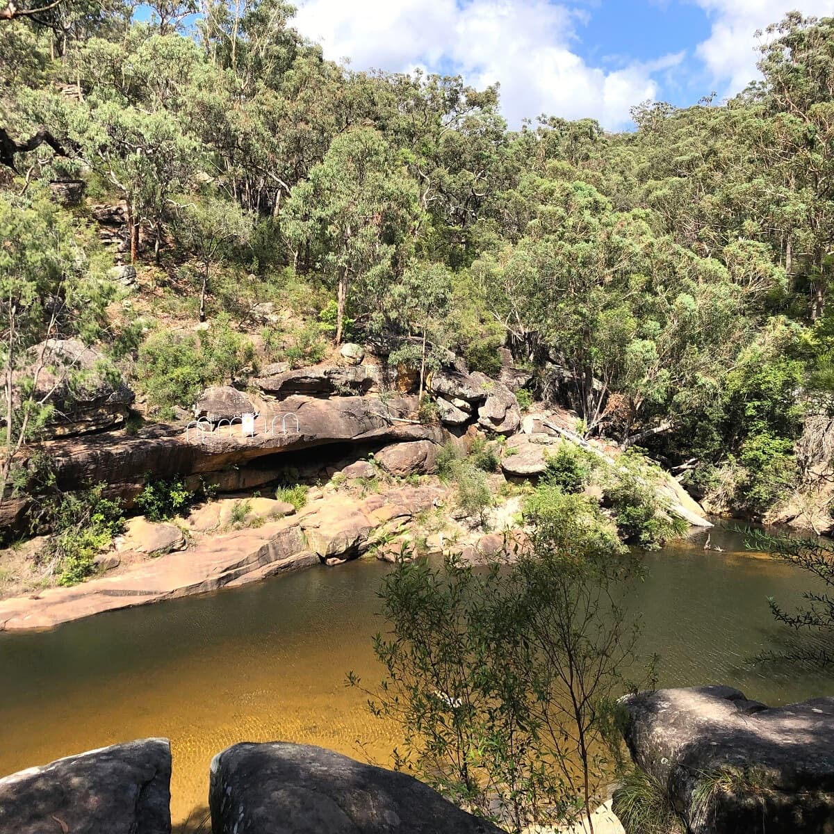
3. Glenbrook Gorge
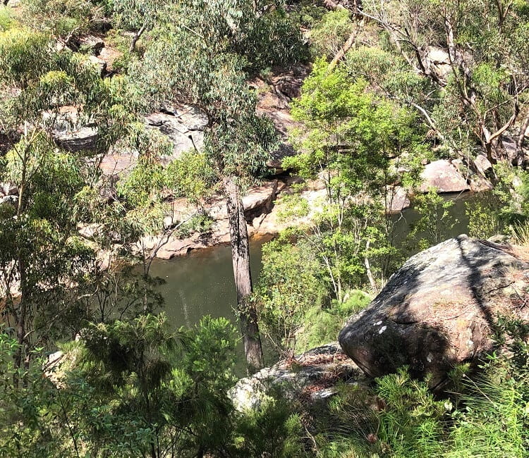
If you’re a bit more adventurous and don’t mind a bit of challenging bush walking, the Glenbrook Gorge Track might be for you. This track first makes a steep descent to Glenbrook Creek and then continues along the creek with a few natural swimming holes to explore.
The section from the car park to the creek is on a well-maintained path. But the track becomes much more challenging once it has reached the creek and isn’t always easy to follow. As such, we can only recommend this track if you’re comfortable navigating the bush and being in a somewhat remote area.
If you are bringing children with you, Jellybean Pool and Blue Pool are much better accessible and safer options.
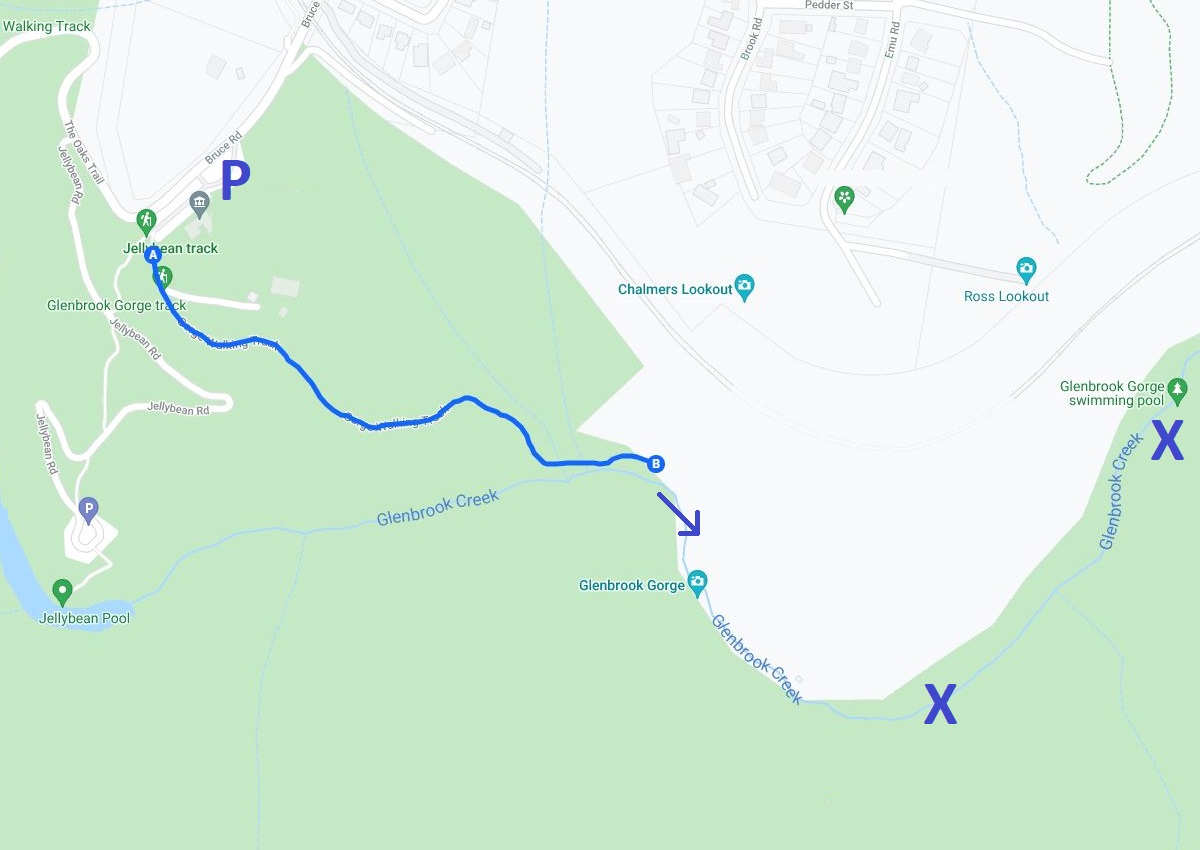
How to Get There
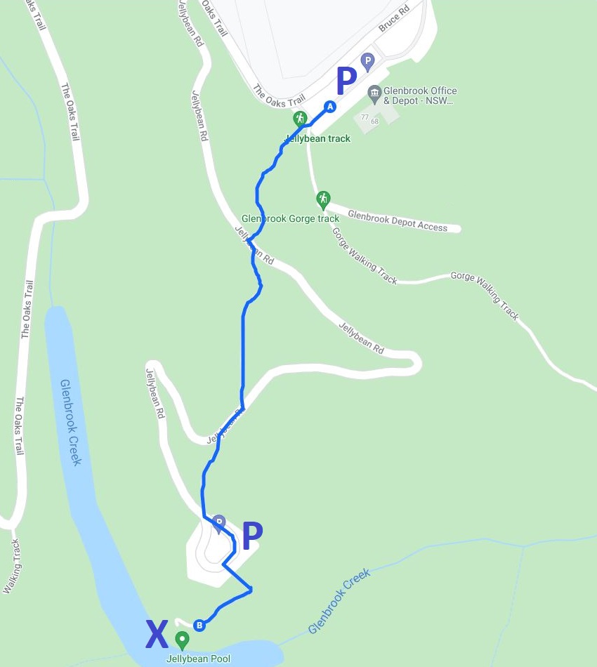
The Glenbrook Gorge Track starts from the same car park where the (longer) walk to the Jellybean Pool starts.
In the below map, the blue line indicates the walk from the car park to the creek. From there, continue hiking along the creek until you find a nice swimming hole. We have marked two decent pools with the letter X to give you a rough idea of their location.
Find the trailhead to Glenbrook Gorge on Google Maps.
4. Paradise Pool
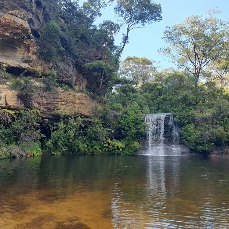
Another fantastic natural swimming spot in the Blue Mountains, one that has become more popular in recent times, is the Paradise Pool in Linden.
A relatively easy 1.5 km bushwalk will get you to Paradise Pool, a well-sized waterhole with a lovely waterfall. Because this spot has attracted more attention over the years, it can get quite busy during holidays and weekends.
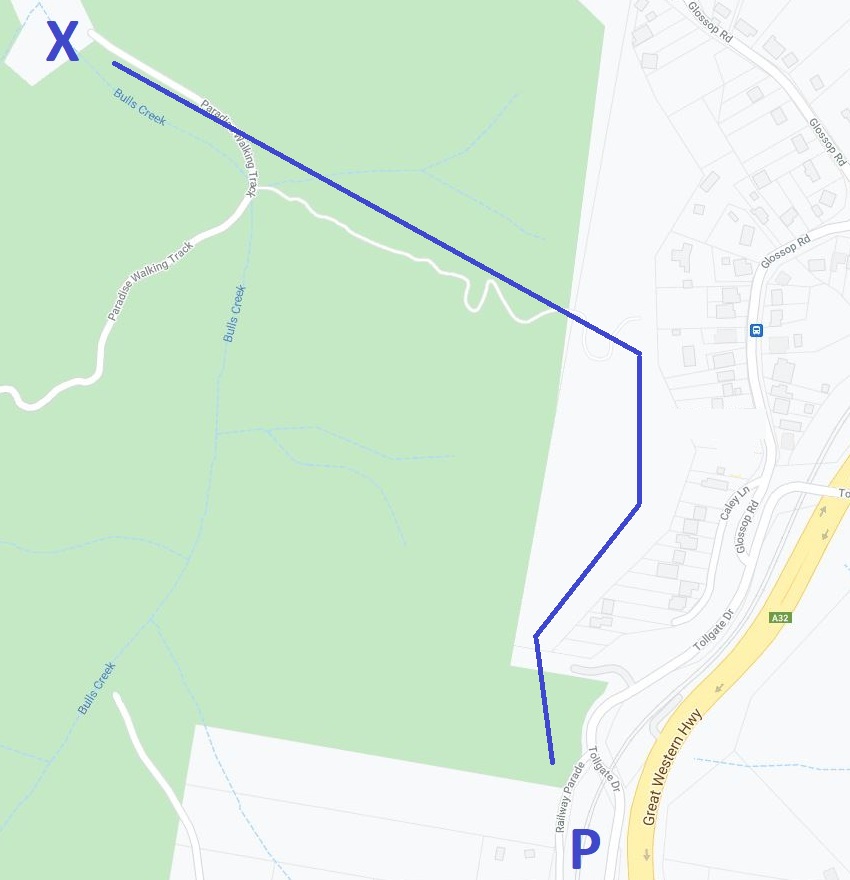
How to Get There
To get to the start of the walking trail to Paradise Pool, park your car on Railway Parade in Linden, just off Tollgate Drive.
In the map below, the car park is marked with the letter P. Once you’ve parked your car, follow the signage to find your way to the beautiful natural swimming hole that is Paradise Pool.
Find the trailhead to Paradise Pool on Google Maps.
5. Pool of Siloam
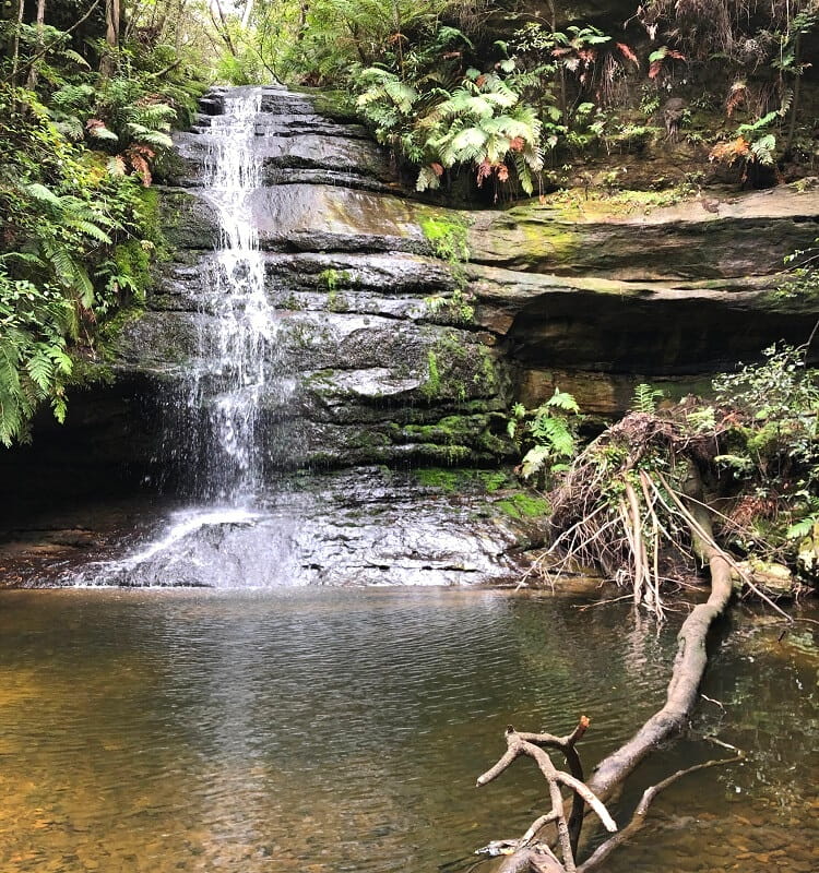
The Pool of Siloam in the Leura area of the Blue Mountains is the first natural waterhole on this list that is located just underneath a waterfall. Albeit a small waterfall, in this case.
The waterhole and waterfall are part of Gordon Creek, which eventually drops into Jamison Valley via Gordon Falls, a bit further away.
Admittedly, the Pool of Siloam is not the most suitable spot to swim, as it’s not very big or deep. But for young kids, this waterhole can be a great spot to have a good splash.
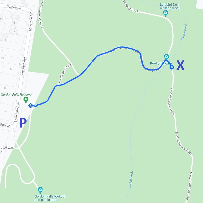
How to Get There
There are multiple ways to get to the Pool of Siloam, but the easiest and quickest way is from Gordon Falls Reserve on Lone Pine Avenue, where you will find a reasonably sized car park.
From there, look for the start of the Pool of Siloam walking trail, and in less than 20 minutes, you will be at this scenic spot in the Blue Mountains. It is pretty steep, but it’s certainly doable for children.
Find the trailhead to Pool of Siloam on Google Maps.
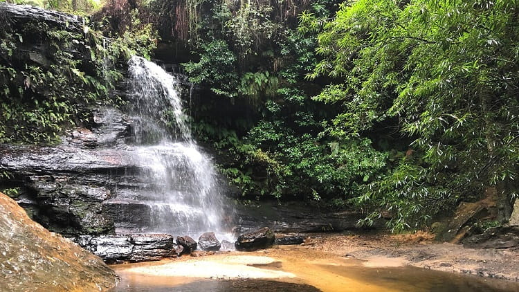
6. Minnehaha Falls
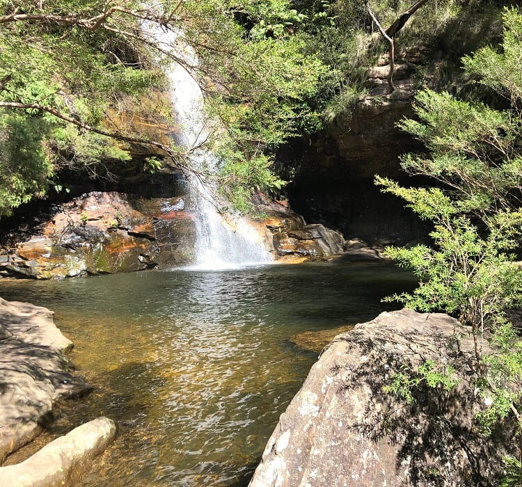
Minnehaha Falls is one of the prettiest waterfalls in the Blue Mountains, and it also offers one of the best natural swimming holes.
The pool may be small, but the waterfall and the scenic surroundings make swimming there a great experience on a warm day.
To get to this beautiful waterfall on Yosemite Creek in Katoomba, you will need to complete a 1.5 km bushwalk through lovely scenery, with a few staircases towards the end.
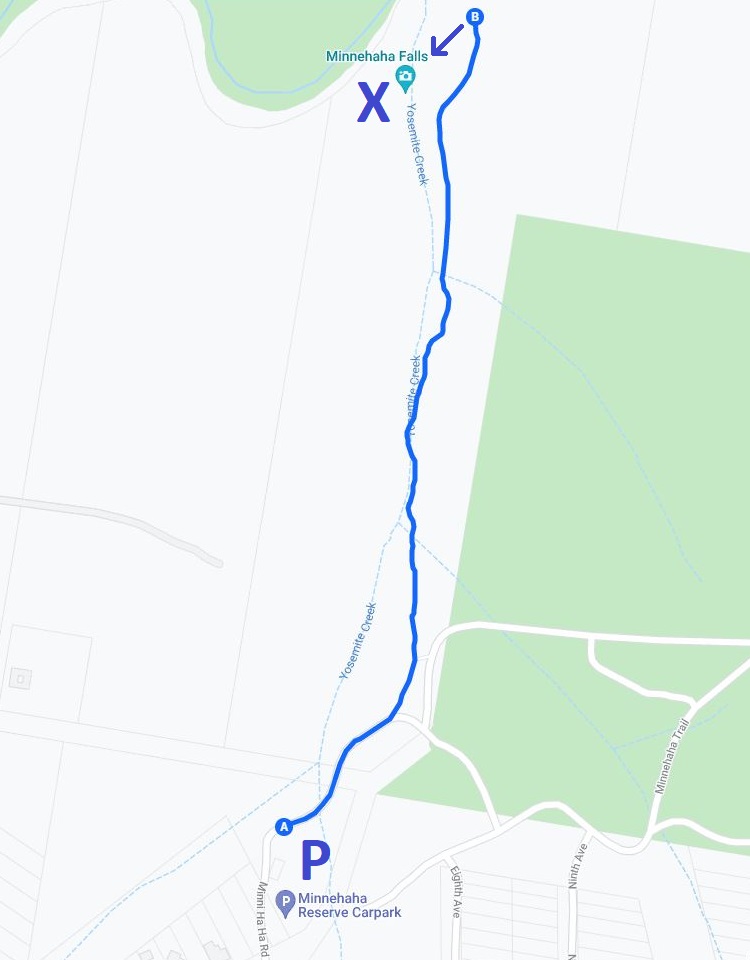
How to Get There
The car park at Minnehaha Falls Reserve is located at the end of Minni Ha Ha Road in North Katoomba. It’s a small car park, but there is plenty of street parking nearby if busy.
You can find the start of the walking trail next to the information board. From there, the trail follows Yosemite Creek until it arrives at the waterfall.
Find the trailhead to Minnehaha Falls on Google Maps.
7. Victoria Falls
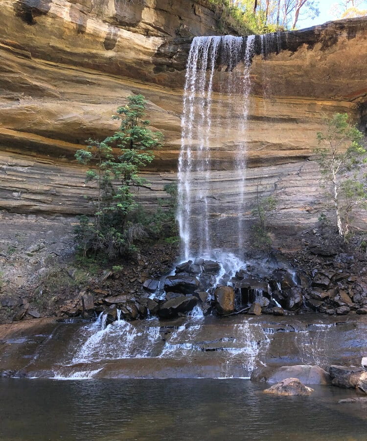
The challenging walking track down to Victoria Creek is only 4 km return, but it is very steep. The track zigzags its way down into the valley until you arrive at a junction where you need to turn left to visit Victoria Falls, an amazing waterfall with a beautiful waterhole at the base.
If you turn right at that junction, you’ll end up at Victoria Creek Cascades, a unique water spectacle that also has a small natural swimming hole where you can go for a quick dip.
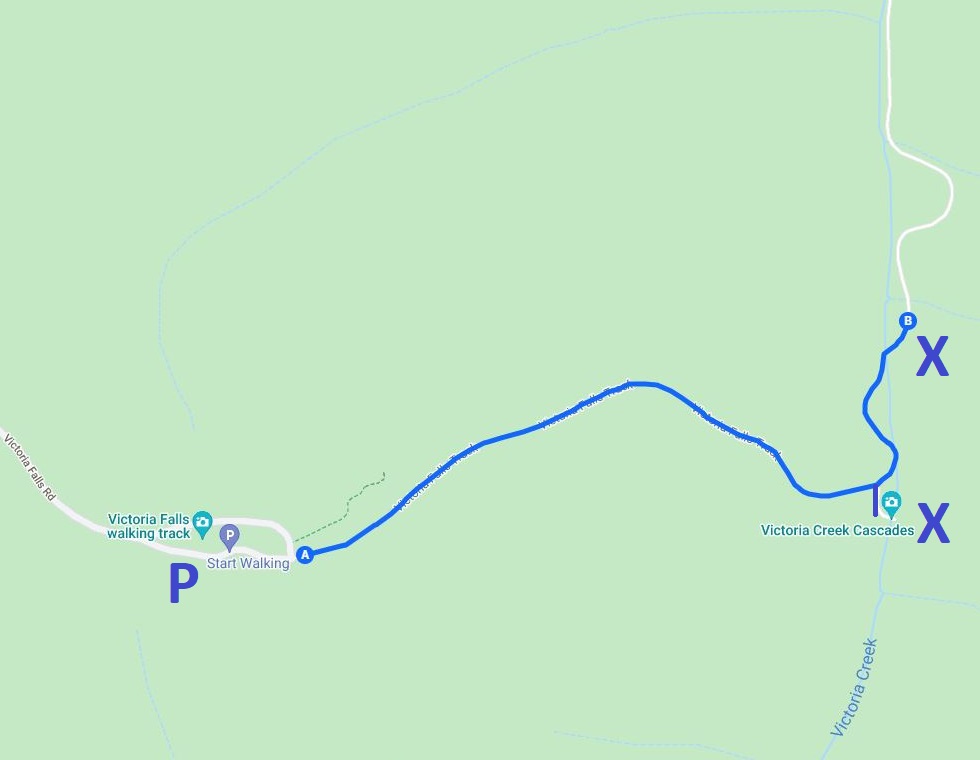
How to Get There
To find the start of the walking track, turn into Victoria Falls Road from the Great Western Highway. Stay on this unsealed road for about 5 km until you arrive at a small car park with a few picnic tables.
As mentioned, the walking track to Victoria Falls and Cascades is very steep, and you will need to be prepared for that. Make sure you bring a water bottle and proper hiking shoes.
Find the trailhead to Victoria Falls on Google Maps.
More Blue Mountains resources: