Last updated: March 2, 2024
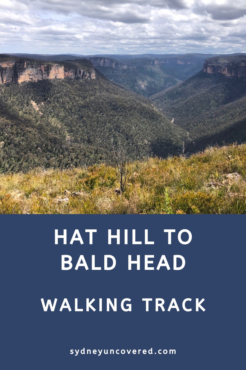
The 7 km return walking trail from Hat Hill to Bald Head meanders through pleasant bushland scenery before arriving at a panoramic vantage point.
The breathtaking views of the Grose Valley from Bald Head, along with nearby iconic landmarks, make the journey there truly rewarding.
In this article, we’ll share the stats, details, and highlights of this quiet yet beautiful spot in the Blue Mountains and how to get there.
| Hat Hill to Bald Head Walking Track | |
|---|---|
| Distance: | 7 km (return) |
| Duration: | 2.5 hours |
| Grade: | Moderate (some steep sections) |
| Dogs: | Not allowed |
How to Get There
The walk to Bald Head from Hat Hill is located in the Blackheath area of the Blue Mountains.
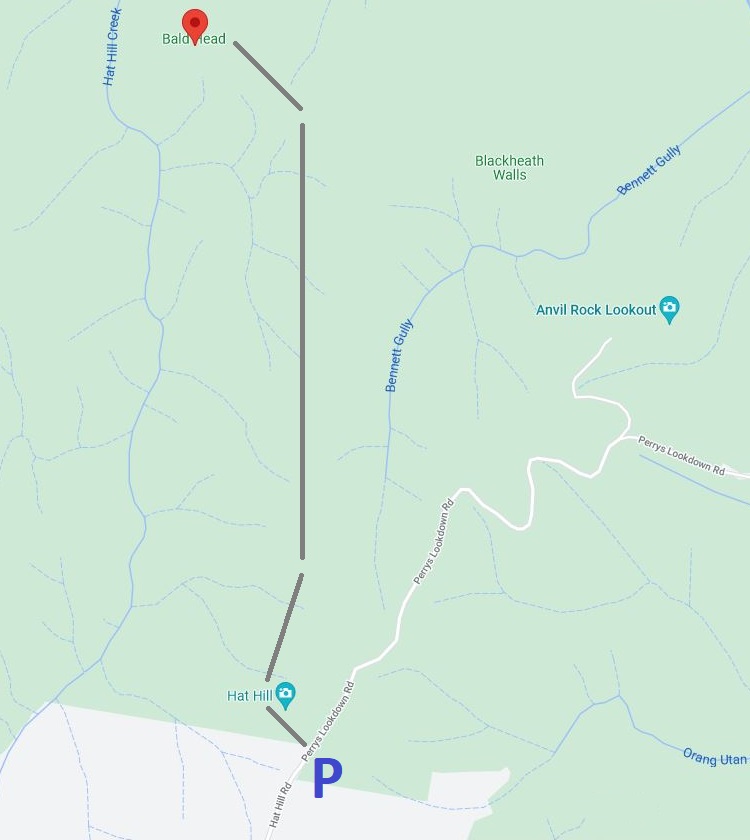
The start of the walk can be found at the end of Hat Hill Road where Perrys Lookdown Road begins (see map location).
On the eastern side of the road is a small parking area. Since this is not a well-known walk, you’re unlikely to have any issues parking your car there.
Here is a map of the walk:
Track Notes
This is a moderately challenging hike, with a few steep sections, but overall, anyone with a reasonable fitness level can complete this adventure without issues. Good hiking shoes and a full water bottle are strongly recommended.
It’s important to note that the walking track from Hat Hill to Bald Head is not officially signposted or marked. Although the path is relatively easy to follow, there are a few junctions where things may get a bit confusing.
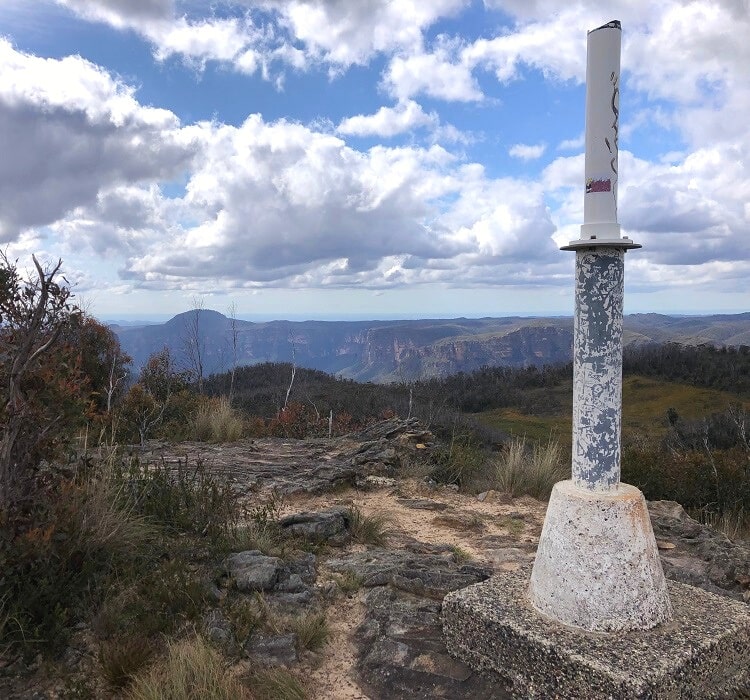
Hat Hill
Once you’ve parked your car, cross the road and start the hike next to the Blue Mountains National Park signpost.
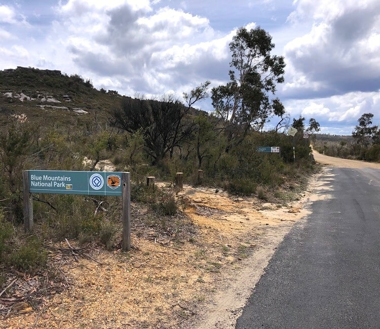
The trail goes uphill very soon, heading towards the summit of Hat Hill. It’s not a very steep climb, but the path itself can be a bit challenging.
From the summit of Hat Hill, the walking track continues through an open scenery with distant valley views on both sides of the path.
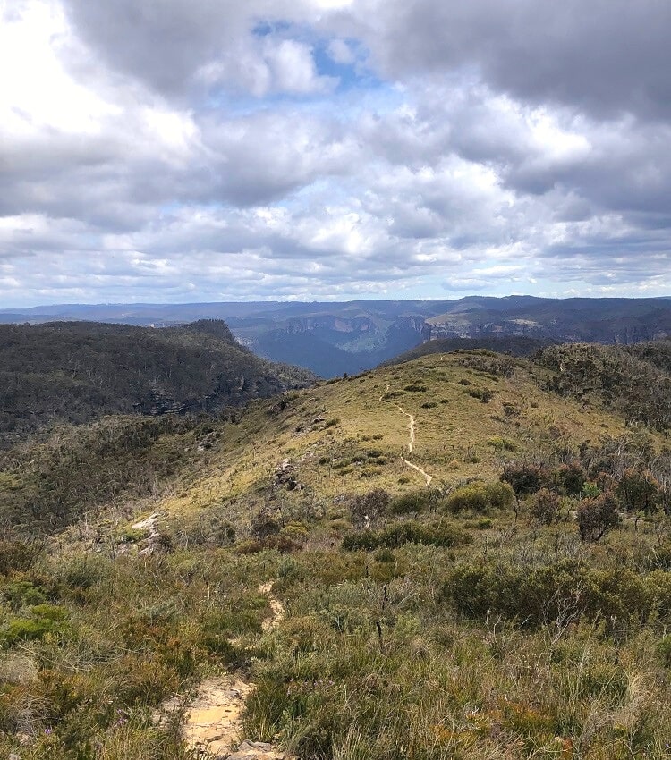
After a couple of kilometres, the landscape changes into thicker vegetation with more trees, which is a pleasant change in scenery.
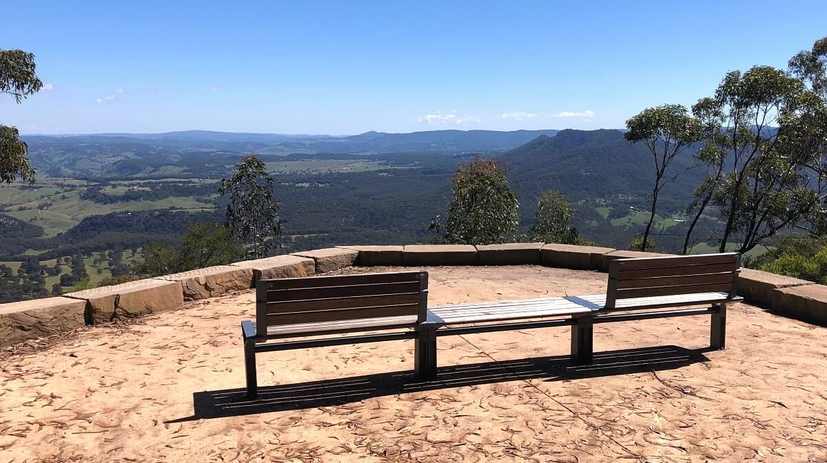
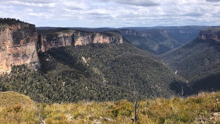
First Lookout
After approximately 3 km of hiking, the path leads to a rocky area from where you can catch the first glimpses of Bald Head and the Grose Valley.
The views from this lookout aren’t the best, but it’s a great spot to have a rest before starting the final stretch of the walk.
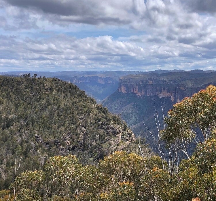
You might be forgiven for thinking that this spot is actually the end of the main walking track, but it isn’t!
To continue the walk to Bald Head, look for the path downhill on the eastern side of the rocky area. It’s not very obvious, but the path is definitely there.
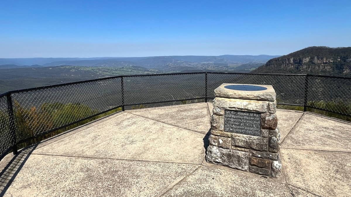
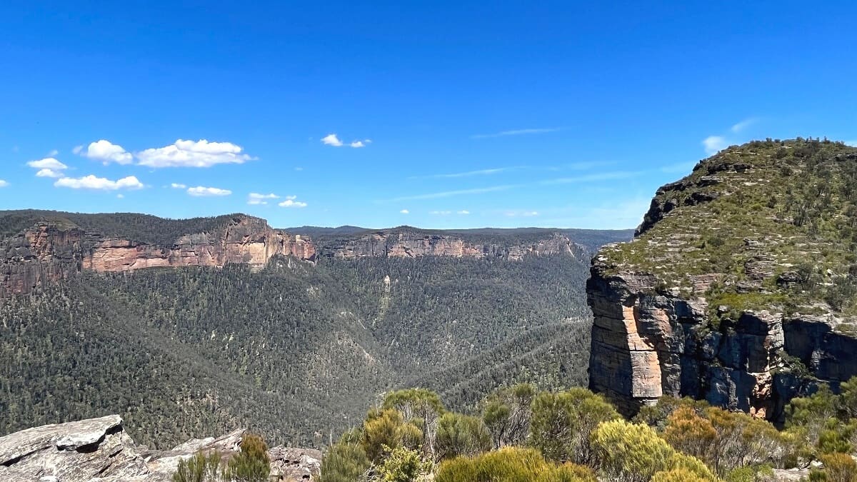
Bald Head
Although short, this final stretch of the walking track is the hardest, as it is quite a steep descent followed by a steep climb to get to the top of Bald Head.
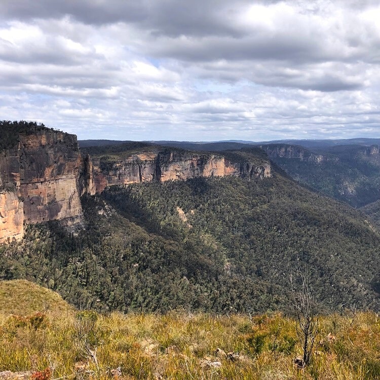
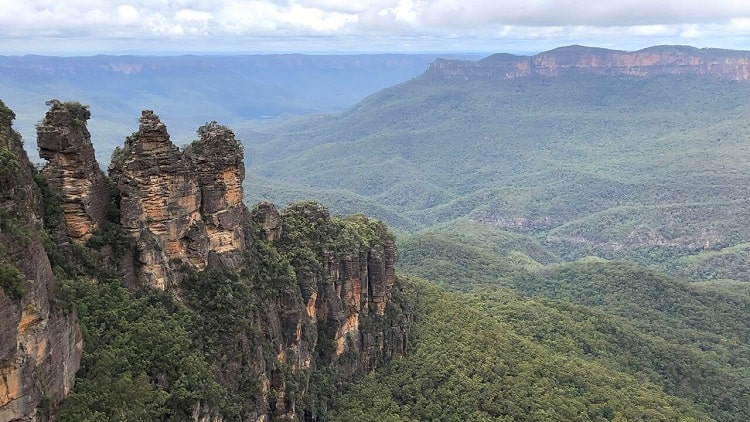
But once you reach Bald Head, you will be in awe of the fantastic views of the Grose Valley and beyond, including the beautiful cliff walls surrounding the valley and the various landmarks nearby.
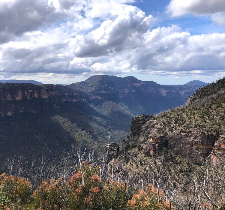
If you look closely, you may be able to identify the following landmarks:
- Hanging Rock (to the west).
- Walls Lookout (to the north).
- Mount Banks (to the east).
If you’ve enjoyed the walk from Hat Hill to Bald Head, you’ll also appreciate the walking tracks to the above three landmarks. They are quite similar and also offer fantastic views.