Last updated: February 11, 2024
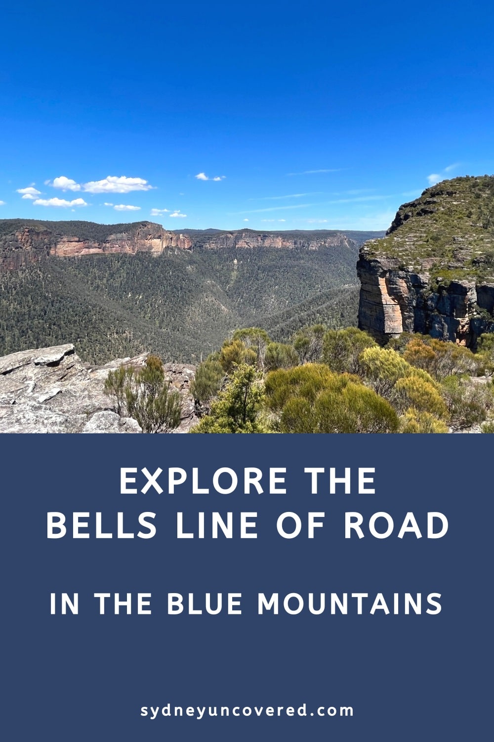
The northern part of the Blue Mountains, accessible via the historic Bells Line of Road, is home to fantastic walking tracks, beautiful sights, and interesting tourist attractions.
This area of the Blue Mountains is far less busy than the Wentworth Falls, Katoomba, Leura and Blackheath regions, even though there are many things to see and do.
In this guide, we are going to explore the Bells Line of Road in more detail and share a list of the seven best highlights.
About the Bells Line of Road
The Bells Line of Road runs between the North Richmond Bridge in the east and the Darling Causeway junction in the village of Bell in the west.
It’s a 59 km winding tourist drive that is a pleasant alternative to the Great Western Highway in the southern part of the Blue Mountains, with various interesting places to stop for a short break.
The area is well known for cider tasting and homemade apple pies, so you will find plenty of cafes, restaurants and breweries where you can indulge in all that local goodness.
History
The Bells Line of Road and the town of Bell are named after Archibald Bell Jr, an English-born Australian explorer and politician.
In 1823, when Bell was only 19 years of age, he crossed the Blue Mountains along the route that would later become the Bells Line of Road. However, it wasn’t until 1905 that Bells Line of Road was officially opened, along with the opening of the current North Richmond Bridge.
Major upgrade works in the 1940s meant that Bells Line of Road finally became a viable alternative to the Great Western Highway.
Map
The map below is a visualisation of the entire Bells Line of Road between the North Richmond Bridge and the Darling Causeway junction.
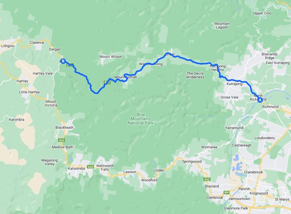
The Bells Line of Road passes through the following suburbs, villages, and localities, from east to west:
- North Richmond
- Kurmond
- Kurrajong
- Kurrajong Hills
- Kurrajong Heights
- Bilpin
- Berambing
- Mount Tomah
- Mount Wilson
- Bell
Top 7 Highlights
In geographical order, from east to west, here are seven great highlights to explore along the Bells Line of Road.
1. Cider tasting in Bilpin
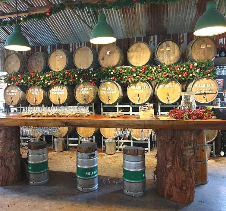
The town of Bilpin is perhaps the most popular village on the Bells Line of Road. Also known as the Land of the Mountain Apple, Bilpin is home to various fruit orchards and beautiful gardens.
This is also the area where you will find roadside stalls selling homemade produce and various eateries where you can try apple pie and other goodies.
But for most visitors, Bilpin is best known for its cider-tasting venues where you can try out delicious locally brewed ciders.
Find cider tasting in Bilpin at the Hillbilly Ciber Shed (see map) and at Bilpin Cider (see map).
2. Blue Mountains Botanic Garden
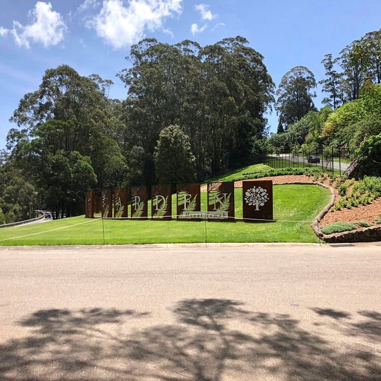
A visit to the Blue Mountains Botanic Garden is an absolute must when heading to the Bells Line of Road area of the Blue Mountains.
Located in Mount Tomah and managed by the Royal Botanic Gardens and Domain Trust, the Blue Mountains Botanic Garden is the only botanic garden in Australia located within a UNESCO World Heritage Area.
The park features 28 hectares of beautifully manicured gardens showcasing cool-climate plants from around the world.
It’s recommended to allocate at least one hour for a visit, although one could easily spend half a day wandering around and enjoying the unique scenery.
Read more about the Blue Mountains Botanic Garden.
3. The Mount Banks Summit Walk
Mount Banks is one of the more recognisable landmarks in the greater Blue Mountains region due to its characteristic rounded peak.
The hike to the summit of Mount Banks is also one of the best walks in the Blue Mountains, with fantastic scenery to enjoy from start to finish.
There are two trails going up to the summit, with one of them being an actual walking trail and the other a fire trail suitable for bicycles.
The Mount Banks summit walk starts at the Mount Banks picnic area, which can be accessed from the Bells Line of Road.
Read more about Mount Banks.
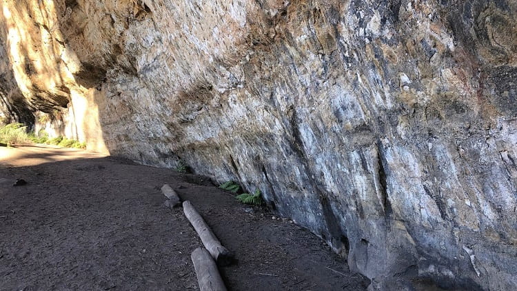
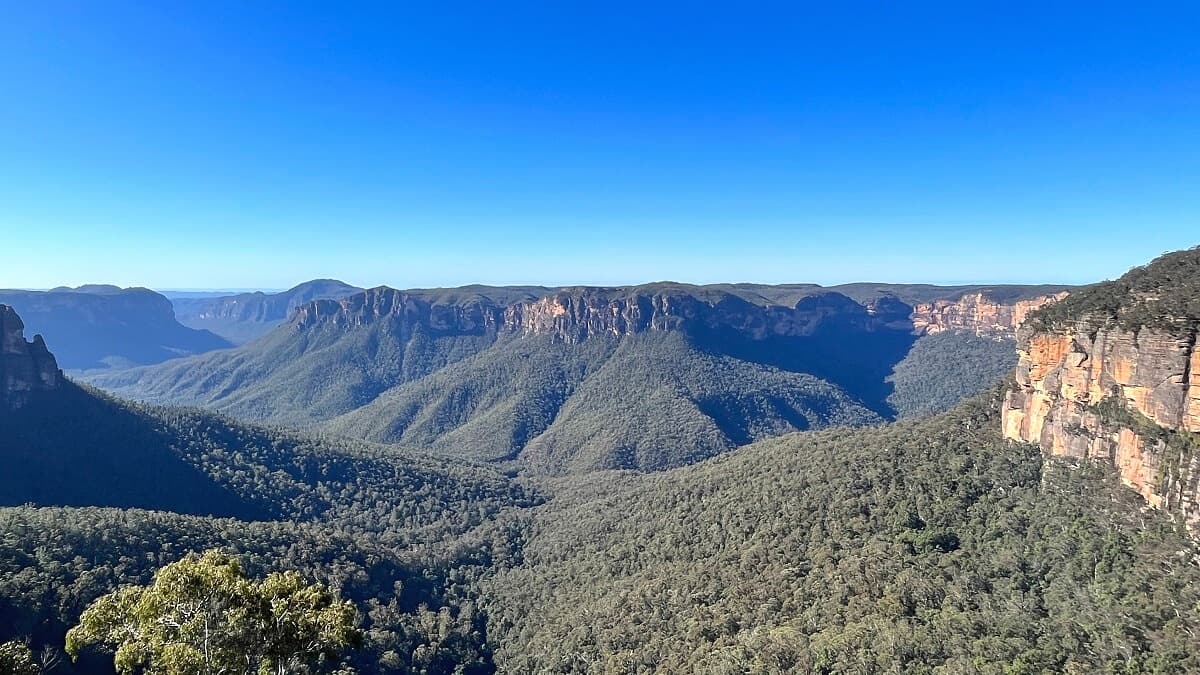
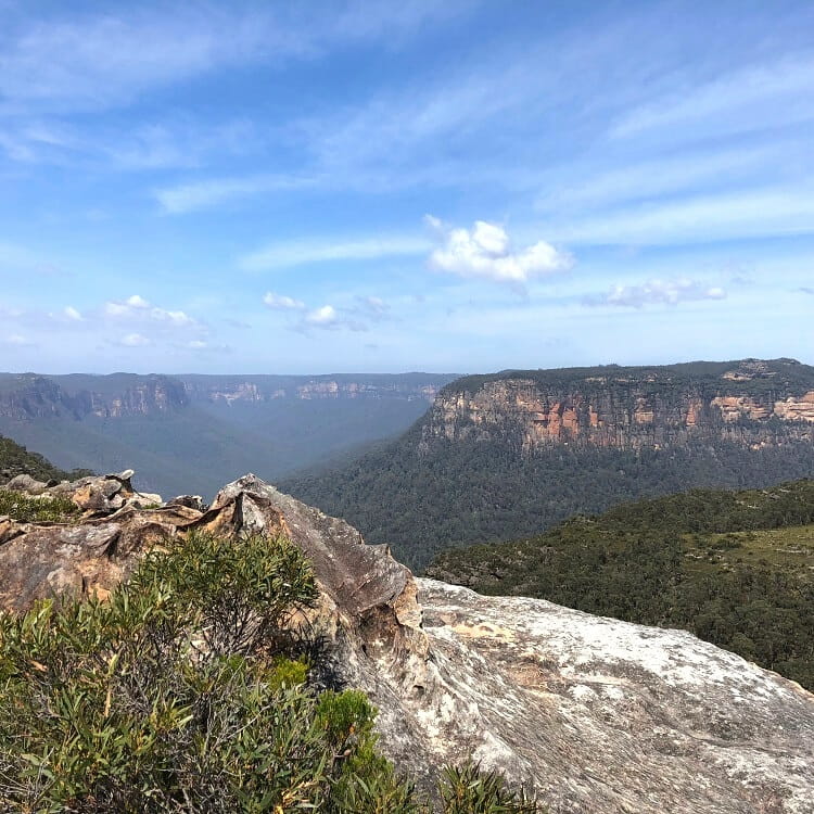
4. Walls Lookout
The walking track to Walls Lookout is similar to the Mount Banks summit walk, but the views are even better. The hike itself is also a lot easier because it’s not steep at all.
Walls Lookout is not a fenced lookout platform. Instead, it’s an area on top of a cliff that you can explore while enjoying the incredible views of the Grose Valley and its cliff walls.
The walking track to Walls Lookout starts on Bells Line of Road. Look for the “Pierces Pass Picnic Area” sign, where you must turn into Pierces Pass Road and park at the small parking area.
Read more about the Walls Lookout.
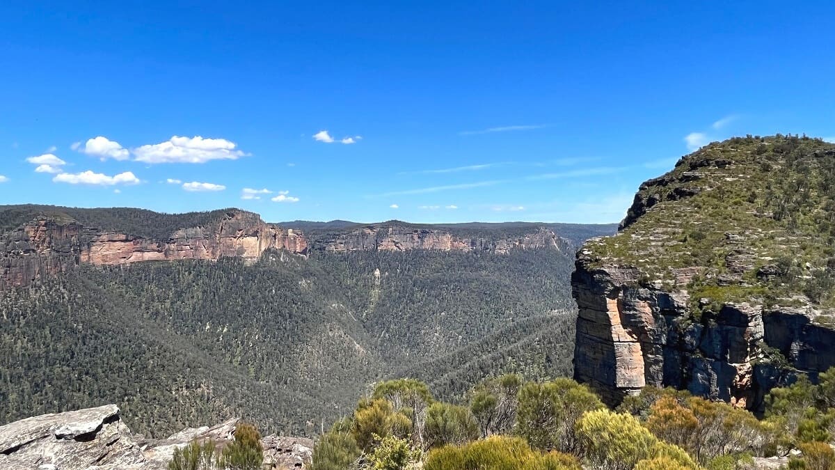
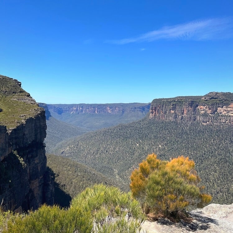
5. The Rigby Hill Walking Track
The Rigby Hill walking track is a scenic 1.2 km return trail that runs almost parallel to the walking track to Walls Lookout, with similar views to enjoy at the end of the trail.
This track is a fun, family-friendly walking trail suitable for all ages and fitness levels. Good hiking shoes are recommended, as the path can be rough in some parts.
This walk starts at the end of Pierces Pass Road (off Bells Line of Road), where you will find a parking area. This is a dirt road, but it can be conquered with a 2WD vehicle as long as care is taken.
Read more about the Rigby Hill Track.
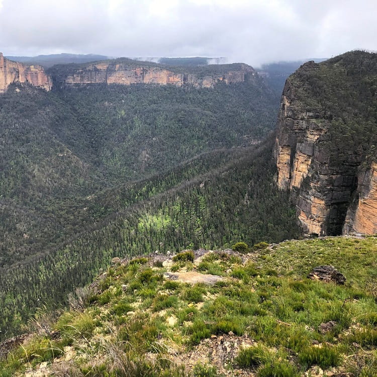
6. Pierces Pass
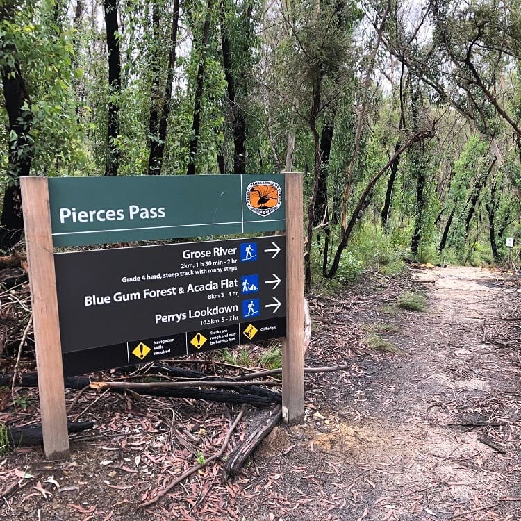
The Pierces Pass is one of the longer and more challenging walking tracks in the Blue Mountains, suitable for experienced bushwalkers.
This adventurous hike descends into the Grose Valley and continues to the Blue Gum Forest along the Grose River. It is, of course, also possible to do a shorter version of this hike by simply descending into the valley and heading back up after reaching the river.
The starting point of the Pierces Pass is in the very same spot as the start of the Rigby Hill walking track, at the end of Pierces Pass Road.
Read more about the Pierces Pass.
7. Dargan Arch
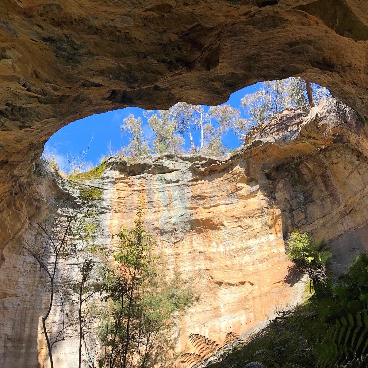
The Dargan Arch is a unique sandstone rock formation beautifully shaped like an actual arch. A short walking trail leads to this beautiful spot, where visitors can walk across the top of the arch and venture down to the bottom.
To find the start of the walking trail to Dargan Arch, turn into Sandham Road near the Bells Line of Road and Darling Causeway junction. Stay on that road for 3 km until you see a clearing on your right, just after the curve. That’s where you can park your car.
Note that while the 1.5 km return walk to Dargan Arch is relatively easy, the trail is not signposted, and the arch has no fencing.
Read more about the Dargan Arch.