Last updated: August 19, 2023
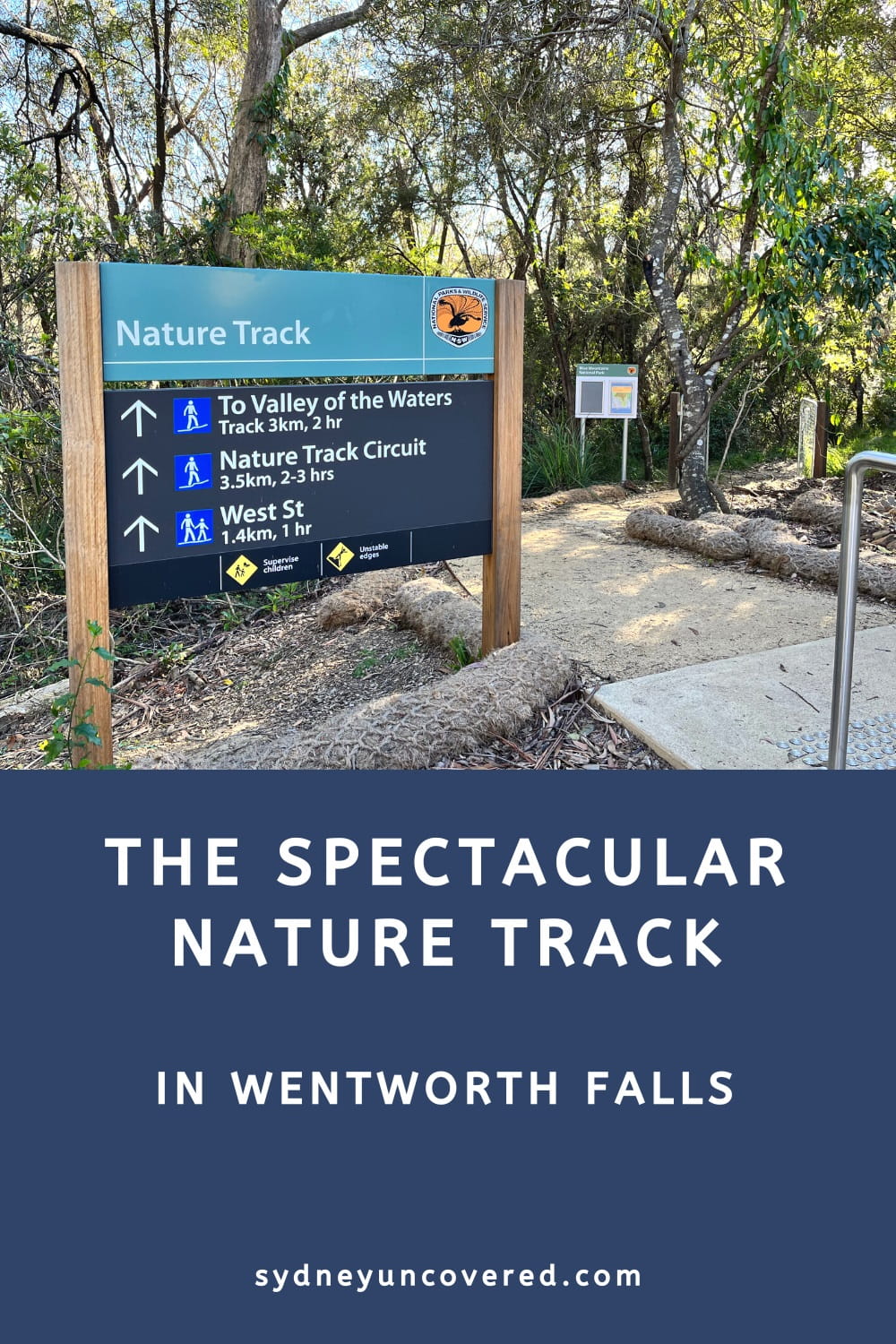
The short but scenic Nature Track in Wentworth Falls is a spectacular 3.5 km circuit trail that starts and ends at the old Conservation Hut.
This often ignored but highly enjoyable walking track follows the edge of an escarpment before descending to lower grounds, where it takes in a section of the Valley of the Waters.
Read on to find out more about this moderately challenging hike, its many highlights, and how best to get there.
| Nature Track | |
|---|---|
| Distance: | 3.5 km (circuit) |
| Time: | 1.5 hours |
| Grade: | Moderate (some steep sections) |
| Dogs: | Not allowed |
How to Get There
The Nature Track is a circuit trail that starts and ends at the Conservation Hut on Fletcher Street in Wentworth Falls (see map location).
By car:
From the Great Western Highway, turn into Falls Rd, followed by a right turn into Fletcher Street. The Conservation Hut is located at the end of Fletcher St.
The small parking area at the hut fills up quickly on the weekends. If it is full, you can try parking on one of the nearby suburban streets.
By public transport:
Catch a train to Wentworth Falls and walk to the Wentworth Falls picnic area from the train station.
From the picnic area, follow the Short Cut Track that leads directly to the Conservation Hut. If that’s a bit too much hiking, there are also local buses that service Fletcher Street.
Map:
Here is a map of the walk:
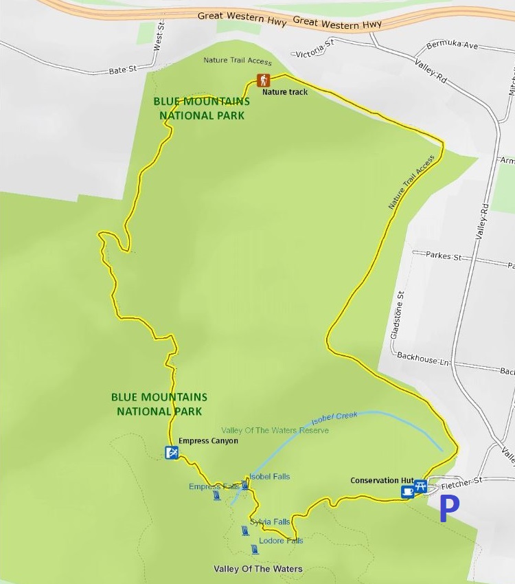
Nature Track
Opened in 1894, the Nature Track winds its way down into a section of the Valley of the Waters through various different habitats and ecosystems.
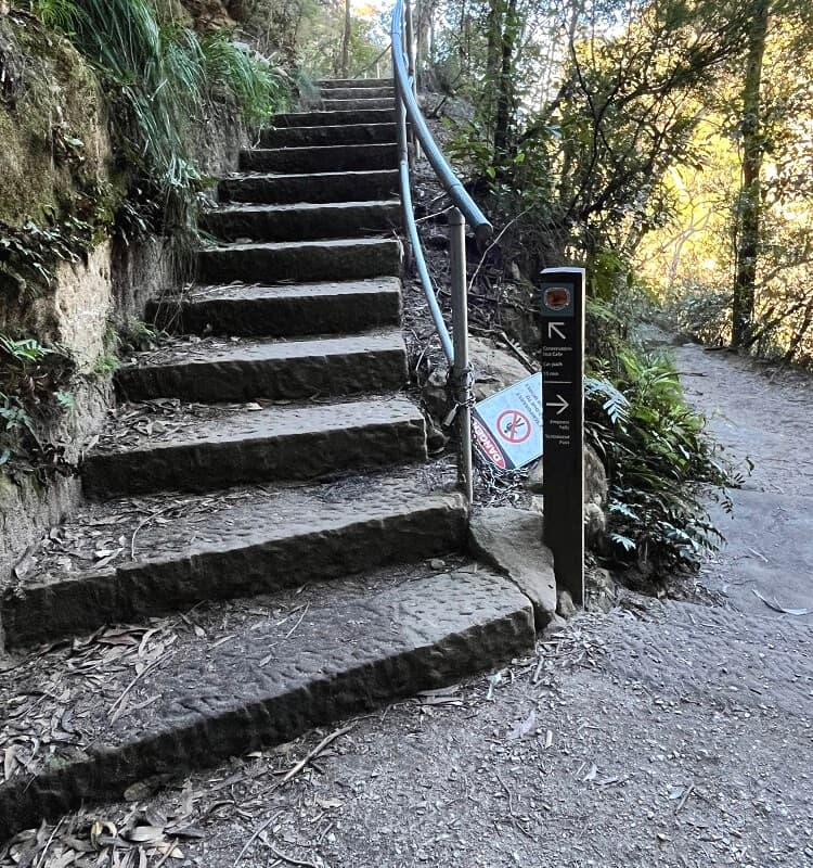
It’s a moderately challenging hike with lots of steps and some steep sections. Good hiking shoes are recommended, and on warm days, make sure to bring a bottle of water.
There are several numbered information boards along the way that help visitors get a better understanding of everything you can see in this beautiful part of Wentworth Falls.
1. Start of the Walk
While most walking tracks starting from the Conservation Hut head south towards Jamison Valley, the Nature Track goes in the other direction, northbound.
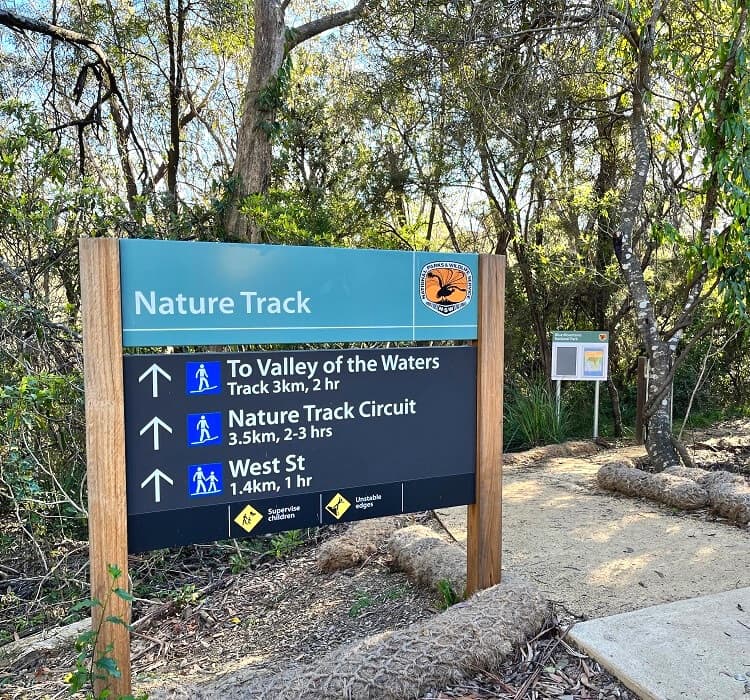
Look for the Nature Track signpost next to the car park to start this enjoyable hiking adventure.
The first section of the Nature Track runs parallel to Valley Rd until it makes a left turn towards West Street. This section isn’t particularly exciting, but it’s a good warmup for what’s to come.
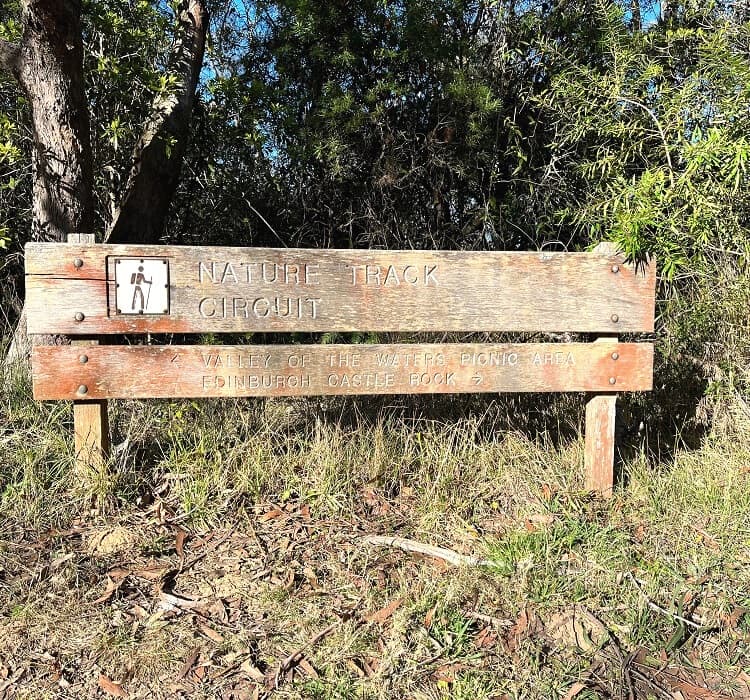
Just before it hits West Street, the path heads into the bush at an old signpost that mentions Nature Track Circuit and Edinburgh Castle Rock.
2. Edinburgh Castle Rock
The track continues along several sections with timber steps, metal stairs and small bridges before it hits an intersection with a little side trail to Edinburgh Castle Rock.
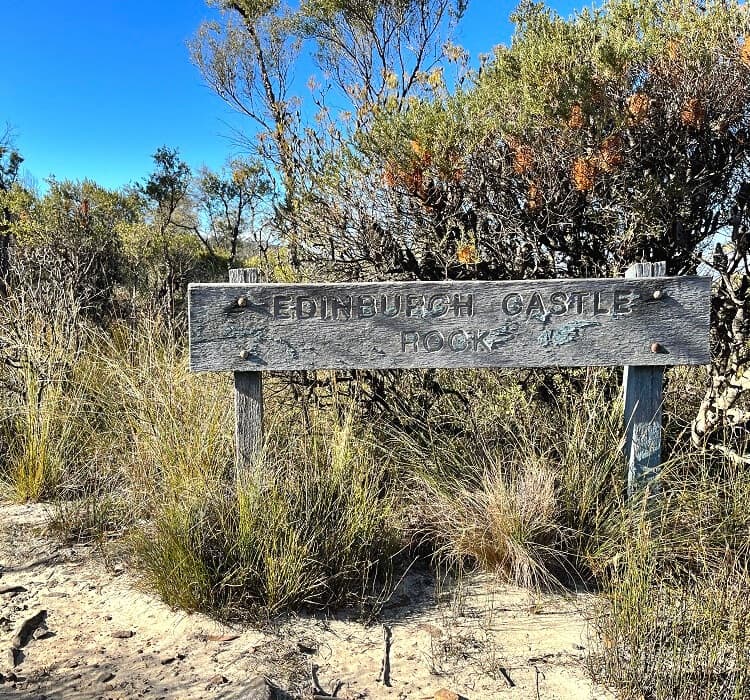
Known as an old Aboriginal cultural site, Edinburgh Castle Rock is an unfenced lookout point formed by a uniquely shaped rock formation.
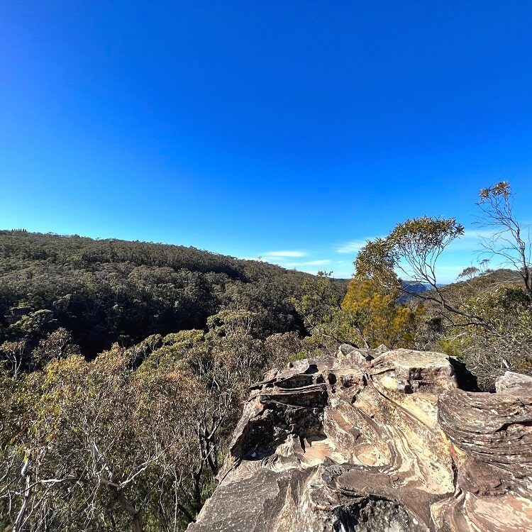
While not spectacular, the panoramic views of the valley and escarpments from this lookout are a good warm-up for what’s to come.
3. Lillians Glen
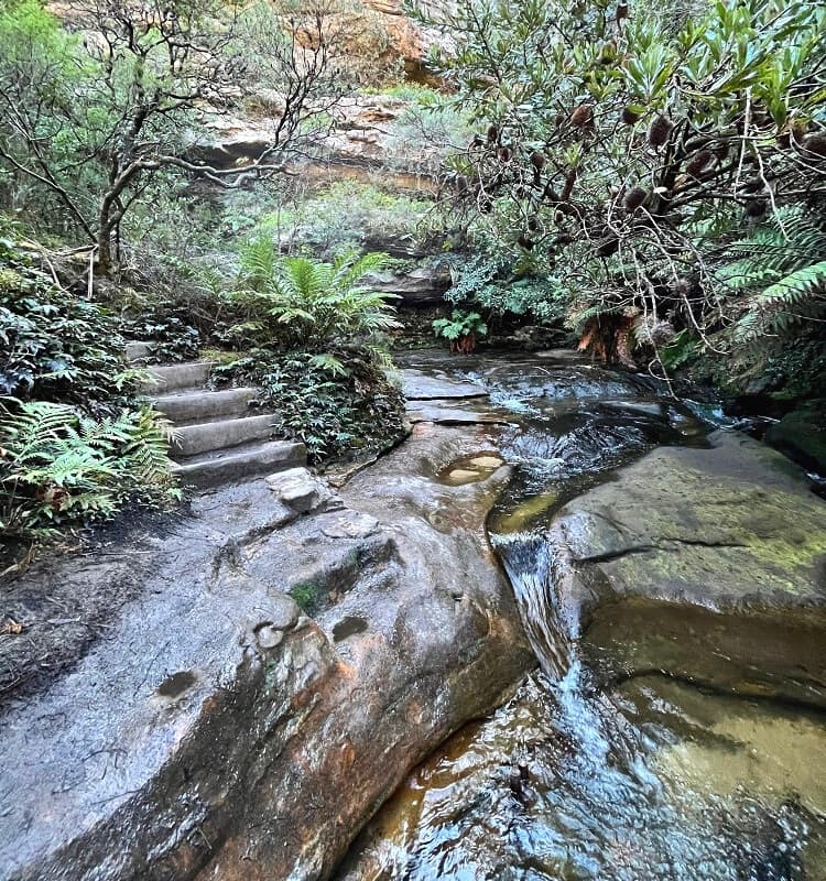
From the intersection, the Nature Track continues southbound towards Lillians Glen, past a few steep sections with several sandstone overhangs and rock walls.
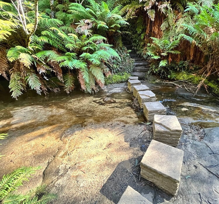
Lillians Glen is a picturesque section where the walking track crosses the Valley of the Waters Creek. A set of stepping stones makes it easier to cross this small water stream.
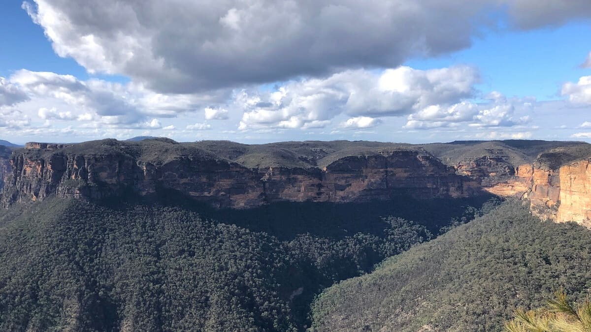
4. Empress Canyon
The track continues towards Empress Canyon, a very popular destination for canyoning and abseiling.
To do this canyoning adventure, which includes abseiling down Empress Falls, you can either head into the canyon with your own gear or you can join a commercial tour.
At Lillians Bridge (which connects with a track to Leura), the path continues uphill towards a few popular lookout points, leaving the canyon and valley behind.
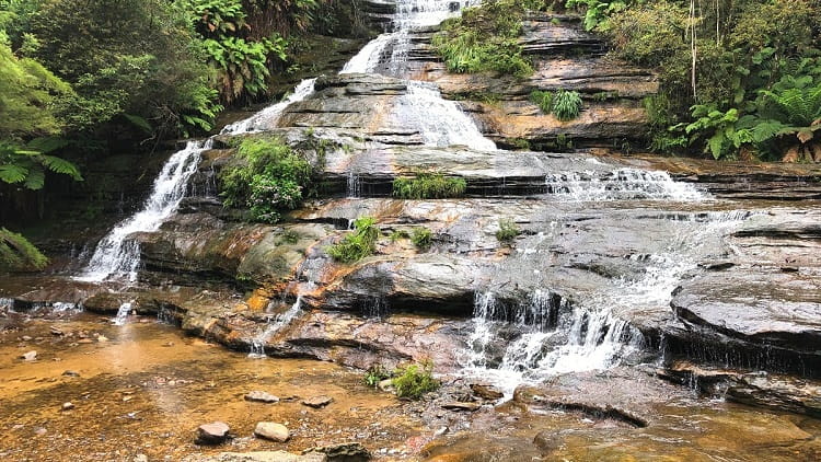
If you have the time and energy, you can extend the Nature Track by including the Valley of the Waters track, a fantastic walking trail along the Valley of the Waters creek, past Empress Falls, Sylvia Falls, and Lodore Falls.
To do that trail, keep walking straight ahead at the junction with the National Pass. But to continue the Nature Track, head up the stairs towards the Empress Lookout.
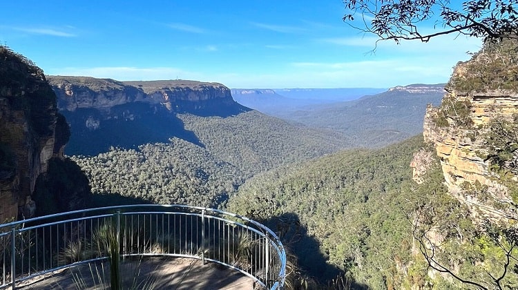
5. Empress Lookout
The reward for climbing up the various staircases is two fantastic lookout points that offer panoramic views of the Empress Canyon and the Jamison Valley.
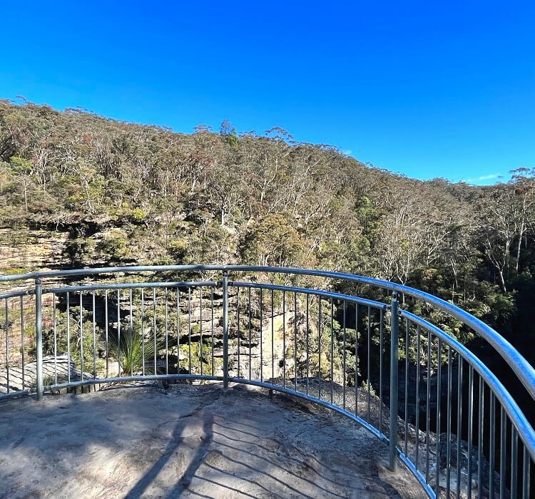
The fenced Empress Lookout is located on a sandstone overhang and offers views of the Empress Canyon and the Empress Falls waterfall, albeit obscured by the many trees surrounding the lookout.
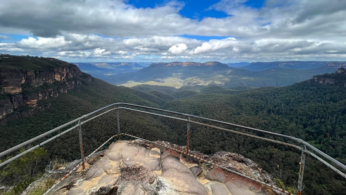
6. Queen Victoria Lookout
The next lookout point is only a short stroll further away. Queen Victoria Lookout offers breathtaking views of the Jamison Valley and its escarpments.
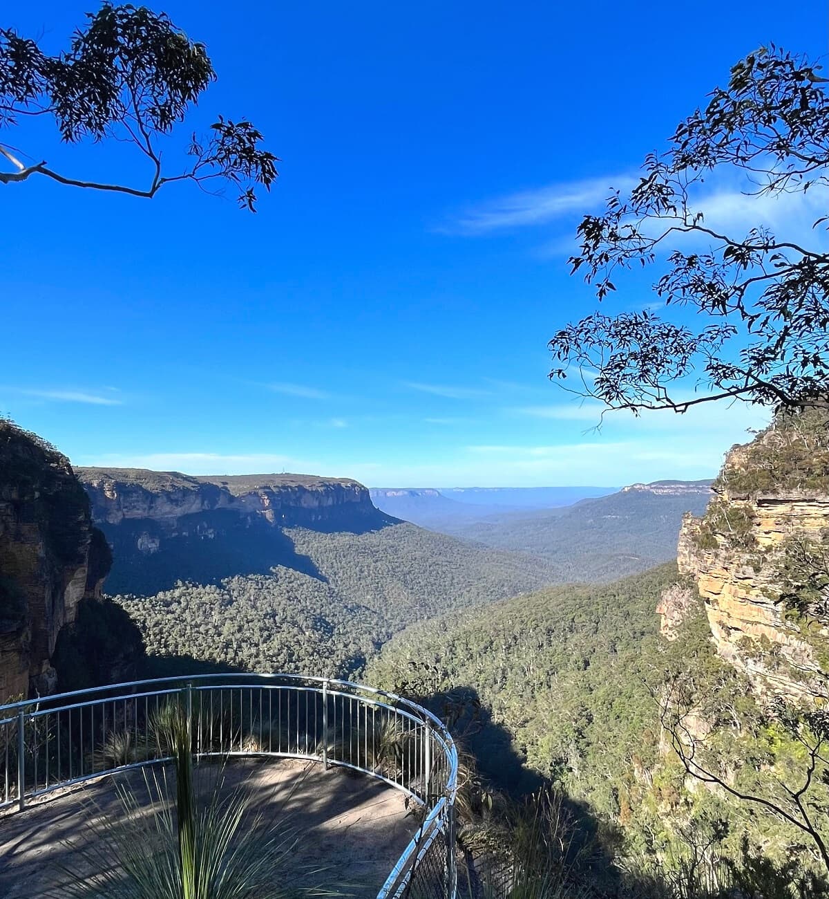
On a clear day, you may be able to identify Lincoln’s Rock, Mount Solitary, and Sublime Point in the distance.
From the Queen Victoria lookout point, it’s a short but steep final stretch back to the Conservation Hut and the car park.