Last updated: April 5, 2024
This guide shares the 25 best walks and hikes in Sydney, ranging from short and scenic coastal trails to adventurous bushwalking tracks.
Hiking in Sydney is the best way to fully enjoy and appreciate the sheer beauty of this great city. You can walk the beaches, the mountains, the bush, and of course the magnificent Sydney Harbour.
With Sydney’s near-perfect climate, you can go outside and conquer a scenic walking trail any time of year. And with so many different hikes to choose from, there will always be a new walking track to discover.
Below, we reveal our top 25 Sydney walks and hikes, ordered by distance.
Top 25 Sydney Walks:
| Walk | Distance | |
|---|---|---|
| 1 | America Bay Track | 2 km (return) |
| 2 | Barrenjoey Lighthouse Walk | 2.2 km (circuit) |
| 3 | Blue Gum Walk | 4 km (circuit) |
| 4 | Lake Parramatta Walk | 4.2 km (circuit) |
| 5 | Cape Baily Track | 6 km (return) |
| 6 | Giant Stairway to Furber Steps Loop | 6 km (circuit) |
| 7 | Resolute Beach Circuit Walk | 6 km (circuit) |
| 8 | Grand Canyon Walk | 6 km (circuit) |
| 9 | Taronga Zoo to Balmoral Beach Walk | 6.5 km (one way) |
| 10 | Prince Henry Cliff Walk | 7 km (one way) |
| 11 | Malabar Headland Circuit Walk | 7 km (circuit) |
| 12 | Manly Dam Circuit Walk | 7.3 km (circuit) |
| 13 | Fortress Ridge Trail | 7.5 km (return) |
| 14 | La Perouse Circuit Walk | 7.5 km (circuit) |
| 15 | Wattamolla to Eagle Rock Track | 8 km (return) |
| 16 | Rose Bay to Watsons Bay Walk | 8 km (one way) |
| 17 | Narrabeen Lagoon Trail | 8.4 km (circuit) |
| 18 | Manly North Head Circuit | 9.5 km (circuit) |
| 19 | Spit Bridge to Manly Walk | 10 km (one way) |
| 20 | Curra Moors Loop Track | 10 km (circuit) |
| 21 | Lane Cove Riverside Circuit | 10 km (circuit) |
| 22 | Sphinx Memorial to Bobbin Head Loop | 10 km (circuit) |
| 23 | Watsons Bay to Coogee Walk | 13 km (one way) |
| 24 | Cowan to Brooklyn via Jerusalem Bay | 13 km (one way) |
| 25 | Coast Track from Bundeena to Otford | 26 km (one way) |
1. America Bay Track
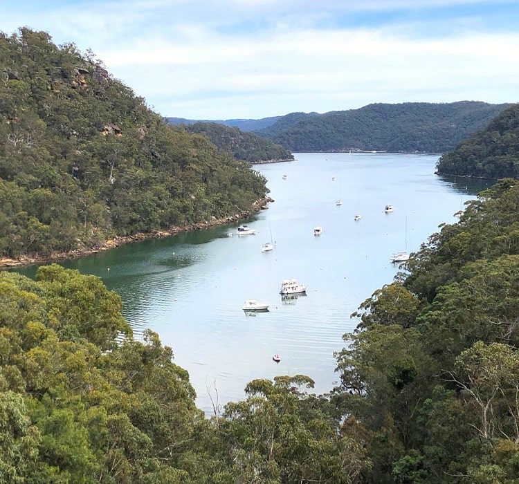
The exciting America Bay Track in the West Head and Basin precincts of Ku-ring-gai Chase National Park has all the characteristics of a classic Sydney bushwalk, with beautiful scenery to enjoy from start to finish.
The highlight of this easy 2 km return trail is the lookout at the end, which offers impressive views of America Bay.
But there is much more to enjoy before reaching this lookout, such as Aboriginal engravings, a couple of small waterfalls, a few creek crossings, and beautiful natural scenery.
More information: America Bay Track.
| Walk stats: | |
|---|---|
| Distance: | 2 km (return) |
| Duration: | 1 hour |
| Grade: | Easy |
2. Barrenjoey Lighthouse Walk
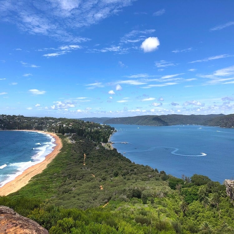
The hike up to the Barrenjoey Lighthouse is a popular walking trail in Barrenjoey Headland, the northernmost part of Palm Beach in Sydney’s Northern Beaches region.
Two walking tracks lead to the Barrenjoey Lighthouse up the hill, from where you can enjoy stunning ocean views. It’s recommended to do one trail to the top and do the other trail to return to the beach.
The views from the Barrenjoey Lighthouse are superb and stretch as far as Ku-ring-gai Chase National Park to the west, Broken Bay to the north, and Sydney’s coastline to the east.
More information: Barrenjoey Lighthouse Walk.
| Walk stats: | |
|---|---|
| Distance: | 2.2 km (circuit) |
| Duration: | 1.5 hours |
| Grade: | Easy / moderate |
3. Blue Gum Walk
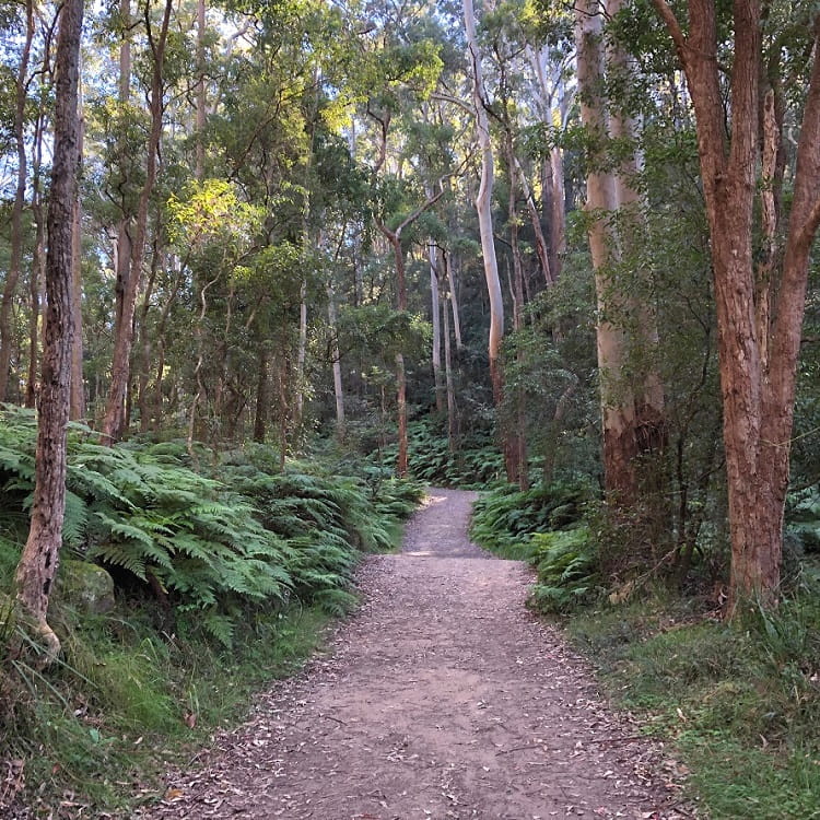
The Blue Gum Walk in Hornsby of Sydney explores various landscapes, from high gum trees and green ferns to creek crossings and valley views.
It is a moderately challenging, family-friendly walking track with various highlights and landmarks, such as the gum forest, the fishponds, and the forest of ferns.
The forest of ferns especially is a section with beautiful scenery, as the walking track meanders through a thriving forest of lush green ferns.
More information: Blue Gum Walk.
| Walk stats: | |
|---|---|
| Distance: | 4 km (circuit) |
| Duration: | 1.5 hours |
| Grade: | Moderate |
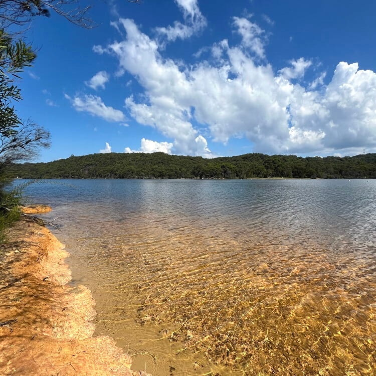
4. Lake Parramatta Walk
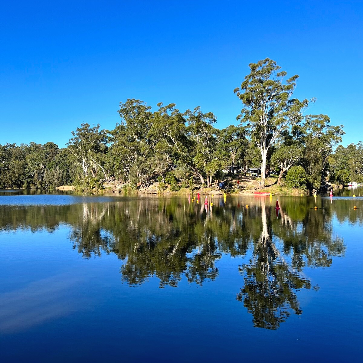
Lake Parramatta Reserve is home to a few walking trails, but the best one is the circuit walk around Lake Parramatta, a water reservoir formed by a decommissioned dam.
The lake was created as a result of the damming of Hunts Creek in 1856, and is now a recreational area with various marked bush walking trails, a picnic area, a cafe, and a swimming enclosure.
The Lake Parramatta Walk includes everything one would expect from a bushwalk, with fantastic scenery and great views to enjoy from start to finish.
More information: Lake Parramatta Walk.
| Walk stats: | |
|---|---|
| Distance: | 4.2 km (circuit) |
| Duration: | 2 hours |
| Grade: | Easy / moderate |
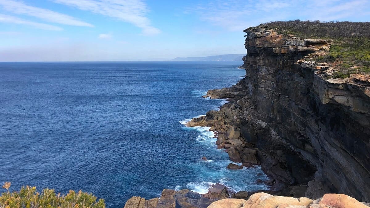
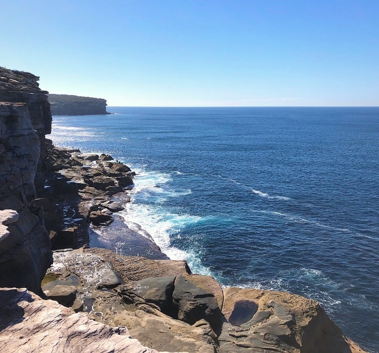
5. Cape Baily Track
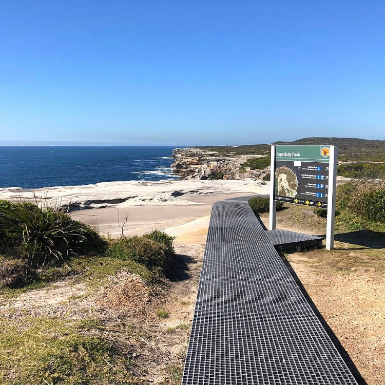
The Cape Baily Track is a scenic coastal hike in Kamay Botany Bay National Park between the Cape Solander Lookout and the Cape Baily Lighthouse.
This is a magnificent coastal walk with panoramic ocean views, high sandstone sea cliff walls, and a classic lighthouse to explore.
It doesn’t attract the big crowds that other popular hikes do, such as the Bondi to Coogee walk, even though the scenery is just as impressive.
More information: Cape Baily Track.
| Walk stats: | |
|---|---|
| Distance: | 6 km (return) |
| Duration: | 3 hours |
| Grade: | Easy |
6. Giant Stairway to Furber Steps Loop
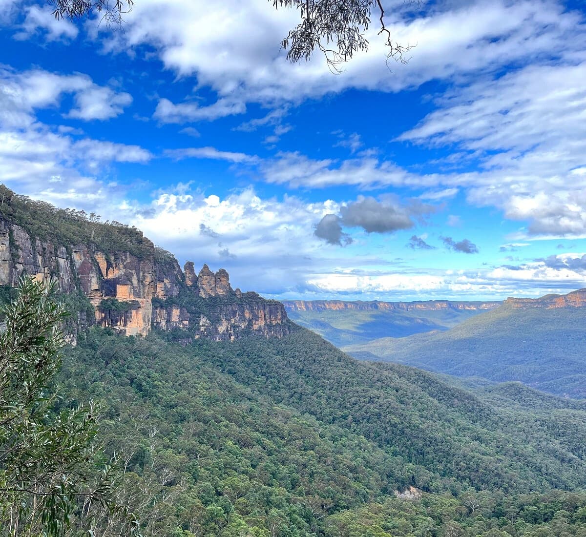
The Giant Stairway to Furber Steps Loop in the Katoomba area of the Blue Mountains is an energetic walk that includes two iconic staircases.
The historic Giant Stairway is located at the Three Sisters, and the Furber Steps is on the other side of the walk, close to Scenic World.
Climbing and descending these staircases is challenging but a great experience, with fantastic valley views to take in along the way.
More information: Giant Stairway to Furber Steps Loop.
| Walk stats: | |
|---|---|
| Distance: | 6 km (circuit) |
| Duration: | 3 hours |
| Grade: | Moderate |
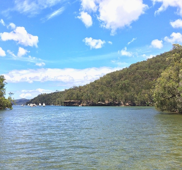
7. Resolute Beach Circuit Walk
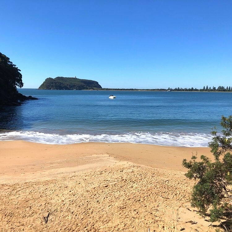
With amazing views of Pittwater and the Barrenjoey Headland, beautifully clear water, and hardly any tourists, Resolute Beach in Ku-ring-gai Chase National Park is a hidden gem.
The 6 km Resolute Beach Circuit Walk is an exciting bushwalk that brings visitors to Resolute Beach via the Resolute Picnic Ground.
The trail also includes the West Head Lookout, which offers breathtaking views of Pittwater, Broken Bay, Barrenjoey Headland, and Palm Beach.
More information: Resolute Beach Circuit Walk.
| Walk stats: | |
|---|---|
| Distance: | 6 km (circuit) |
| Duration: | 3 hours |
| Grade: | Moderate |
8. Grand Canyon Walk
By many considered the most impressive walking track in the Blue Mountains, the Grand Canyon Walk is a real bushwalking treat.
While the track has some very steep sections, anyone with a reasonable fitness level can complete the Grand Canyon Walk, as long as you bring sufficient water and perhaps a few snacks.
What’s great is that the cooler temperatures in the valley make this trail a pleasant adventure during the warmer summer months, too.
More information: Grand Canyon Walk.
| Walk stats: | |
|---|---|
| Distance: | 6 km (circuit) |
| Duration: | 3 hours |
| Grade: | Moderate / hard |
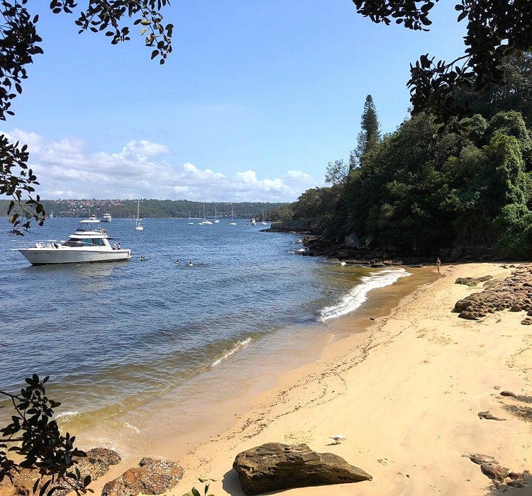
9. Taronga Zoo to Balmoral Beach Walk
One of the most enjoyable Sydney Harbour walking tracks is the trail from Taronga Zoo to Balmoral Beach.
This 6.5 km track navigates through a stunning landscape with secluded beaches, picturesque bays, impressive lookouts, and historical sites.
The best way to get to Taronga Zoo is by ferry from Circular Quay. This ferry trip across Sydney Harbour is a great experience and a nice warm-up for the walk.
More information: Taronga Zoo to Balmoral Beach Walk.
| Walk stats: | |
|---|---|
| Distance: | 6.5 km (one way) |
| Duration: | 2.5 hours |
| Grade: | Easy / moderate |
10. Prince Henry Cliff Walk
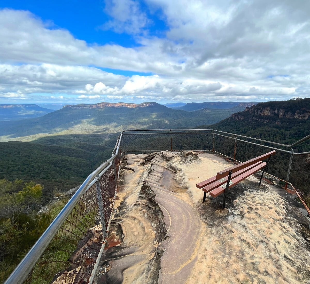
The Prince Henry Cliff Walk is an adventurous 7 km walking trail between Scenic World in Katoomba and Gordon Falls Lookout in Leura.
It follows the cliff edge overlooking Jamison Valley with many beautiful lookout points offering fantastic Blue Mountains views.
Some of the highlights of this walking track include Katoomba Falls, Katoomba Cascades, the Three Sisters, Leura Cascades, and Elysian Rock.
More information: Prince Henry Cliff Walk.
| Walk stats: | |
|---|---|
| Distance: | 7 km (one way) |
| Duration: | 3.5 hours |
| Grade: | Moderate |
11. Malabar Headland Circuit Walk
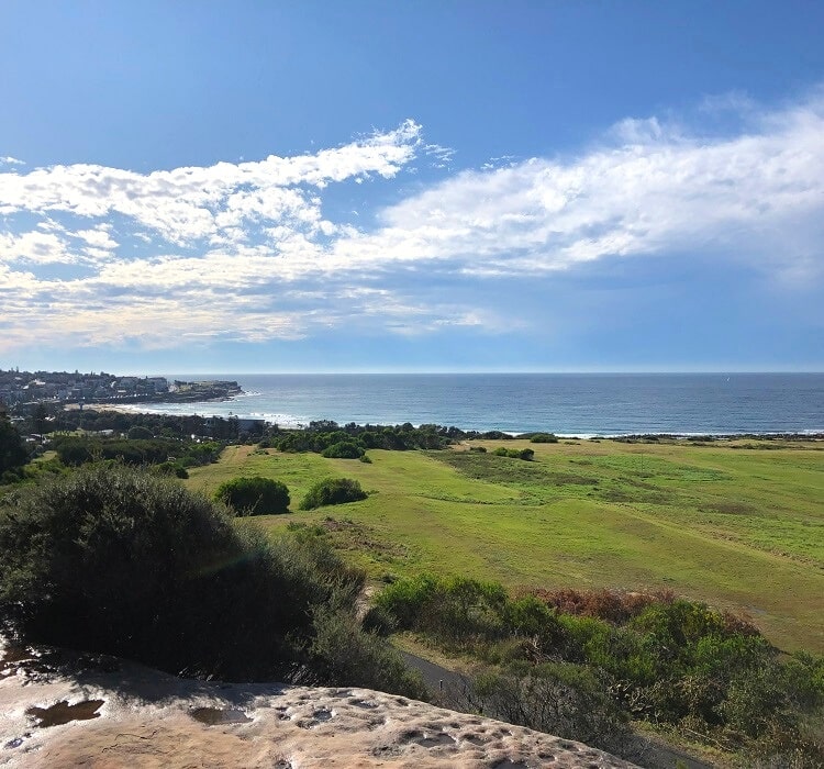
The 7 km circuit trail around the Malabar Headland National Park is one of Sydney’s newest hikes and has quickly evolved into one of the most popular walks in Sydney.
The circuit trail consists of the Boora Point walking track that follows the beautiful coastline of the headland, and the Western Escarpment walking track that meanders through scenic bushland.
It’s certainly not a challenging hike, but it does take a few hours to complete. And with Maroubra Beach just around the corner, there are plenty of options for a good feed after completing this hiking adventure.
More information: Malabar Headland Circuit Walk.
| Walk stats: | |
|---|---|
| Distance: | 7 km (circuit) |
| Duration: | 2 hours |
| Grade: | Easy / moderate |
12. Manly Dam Circuit Walk
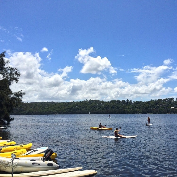
The hike around Manly Dam Lake is a beautiful 7.3 km circuit offering panoramic views of the lake and surrounding bushland.
Manly Dam Reserve is a popular recreational area with many activities in and around the lake, such as swimming, hiking, mountain biking, picnicking, and water skiing.
The hike itself is pretty long but not super challenging, although there are some sections that are a bit steep.
More information: Manly Dam Circuit Walk.
| Walk stats: | |
|---|---|
| Distance: | 7.3 km (circuit) |
| Duration: | 3 hours |
| Grade: | Moderate |
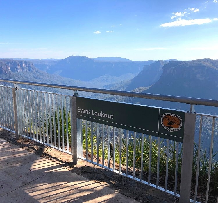
13. Fortress Ridge Trail
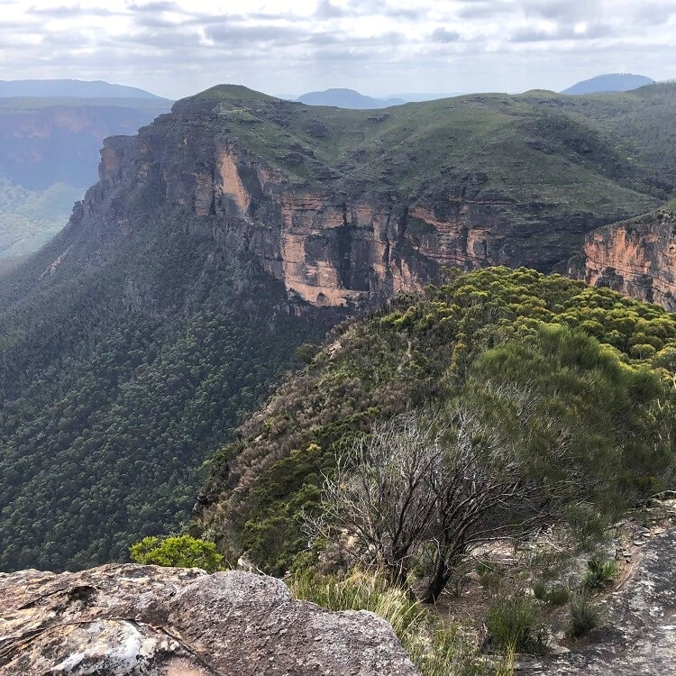
The Fortress Ridge Trail is a 7.5 km return hiking trail that leads to a panoramic viewing point with beautiful views of the Grose Valley.
The variation in the landscape and scenery makes this hike exciting and enjoyable, with the views at the end of the ridge as the big reward.
Upon your return, you have the option to do a second walk (to Fortress Rock), another lookout with scenic valley views but from a different angle.
More information: Fortress Ridge Trail.
| Walk stats: | |
|---|---|
| Distance: | 7.5 km (return) |
| Duration: | 3 hours |
| Grade: | Moderate |
14. La Perouse Circuit Walk
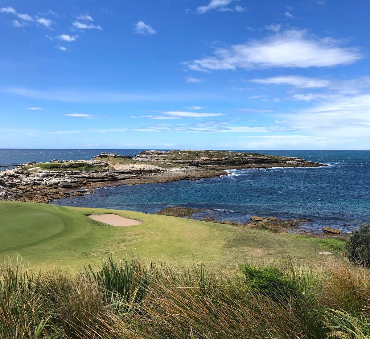
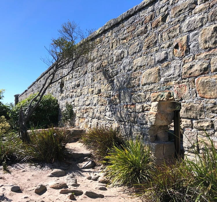
The La Perouse circuit walk is a mixed coastal and bushwalking track that takes in several highlights, landmarks, and historic sites.
Cape Banks, a rocky headland that can be accessed via a small footbridge, is the main highlight of this walk. The landscape on the headland feels quite raw and there are even remnants of a shipwreck to be discovered.
The circuit walk also takes in several beaches, such as Congwong Beach, Little Congwong Beach, and Cruwee Cove Beach, in addition to various lookouts.
More information: La Perouse Circuit Walk.
| Walk stats: | |
|---|---|
| Distance: | 7.5 km (circuit) |
| Duration: | 3 hours |
| Grade: | Easy / moderate |
15. Wattamolla to Eagle Rock Track
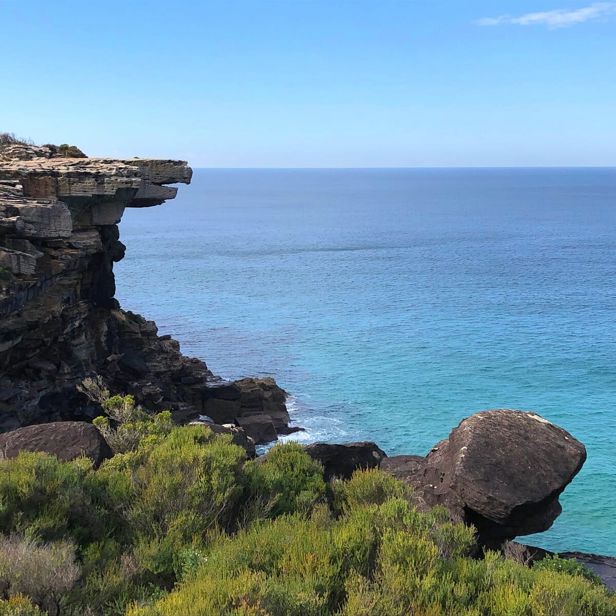
Eagle Rock is an iconic landmark in Royal National Park that strongly resembles an eagle’s beak. A beautiful coastal walk starting from Wattamolla Beach leads to this landmark.
But Eagle Rock is not the only unique sight you can explore at the end of this walking track. Next to Eagle Rock is Curracurrong Falls, a unique waterfall that flows directly into the ocean.
The walking track to get to these two sights is one of the best in Sydney and Royal National Park.
More information: Wattamolla to Eagle Rock Track.
| Walk stats: | |
|---|---|
| Distance: | 8 km (return) |
| Duration: | 3 hours |
| Grade: | Easy / moderate |
16. Rose Bay to Watsons Bay Walk
The trail between Rose Bay and Watsons Bay takes in secluded beaches, beautiful parks, and picturesque bays, with panoramic views of the city and the harbour to enjoy along the way.
The beauty of this walk is that you can park your car at Rose Bay or Watsons Bay and catch a ferry back to where you started. Ferry services frequently run between Watsons Bay and Rose Bay.
The popular (and shorter) Hermitage Foreshore Walk forms part of the Rose Bay to Watsons Bay Walk, and runs between Bayview Hill Rd and Nielsen Park in Vaucluse.
More information: Rose Bay to Watsons Bay Walk.
| Walk stats: | |
|---|---|
| Distance: | 8 km (one way) |
| Duration: | 3 hours |
| Grade: | Easy / moderate |
17. Narrabeen Lagoon Trail
The Narrabeen Lagoon Trail is a stunning 8.4 km circuit walk around Narrabeen Lakes on Sydney’s northern beaches.
Completed in February 2015, the Narrabeen Lagoon Trail is a popular destination for walkers, joggers, and cyclists, taking in the serenity of this idyllic lake surrounded by thriving bushland.
Narrabeen Lakes is also referred to as Narrabeen Lagoon because the lake is essentially a coastal lagoon, separated from the sea on the other side of Ocean Street.
More information: Narrabeen Lagoon Trail.
| Walk stats: | |
|---|---|
| Distance: | 8.4 km (circuit) |
| Duration: | 3 hours |
| Grade: | Easy / moderate |
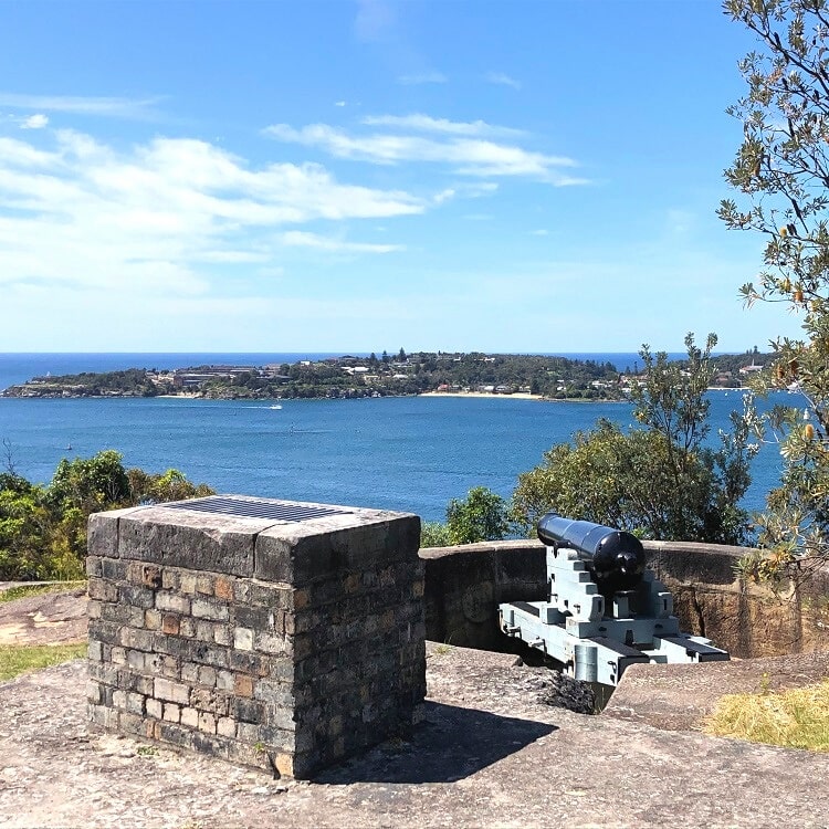
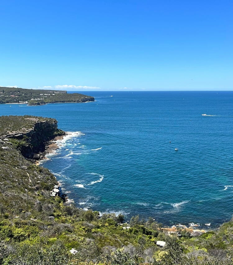
18. Manly North Head Circuit
The circuit hike on Manly’s North Head is the second part of the Manly Scenic Walkway, with the Spit to Manly Walk being the first section.
It’s one of the most fascinating hikes in Sydney because it offers a good mix of beautiful natural scenery, incredible coastal and Harbour views, secluded beaches, and a bit of history.
What’s great about the North Head Walk is that it starts and ends in beautiful Manly, so there will be plenty of options for great food and a cold drink after completing this hike.
More information: Manly North Head Circuit.
| Walk stats: | |
|---|---|
| Distance: | 9.5 km (circuit) |
| Duration: | 3 hours |
| Grade: | Moderate |
19. Spit Bridge to Manly Walk
The hike between the Spit Bridge and Manly Beach is one of the most popular and well-known walks in Sydney.
This beautiful 10 km coastal trail takes in secluded inner harbour beaches, thriving bushland, picturesque bays, and panoramic Sydney Harbour views.
For the best views along the track, head to the Crater Cove and Arabanoo lookout points at Dobroyd Head. These lookouts offer incredible views of Sydney Harbour, North Head, and South Head.
More information: Spit Bridge to Manly Walk.
| Walk stats: | |
|---|---|
| Distance: | 3 km (one way) |
| Duration: | 4 hours |
| Grade: | Moderate |
20. Curra Moors Loop Track
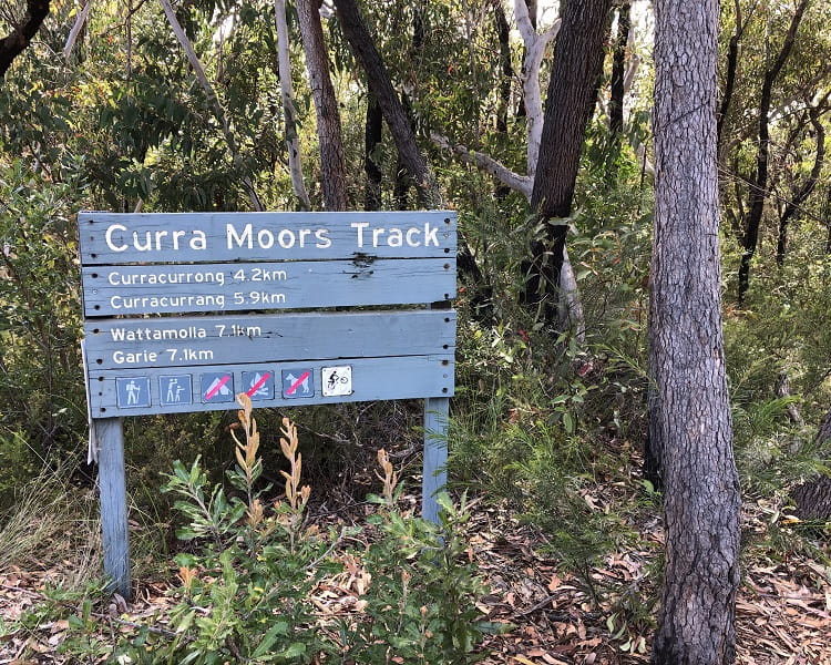
The Curra Moors Loop Track is a circuit walking trail that offers a welcome mix of bush and coastal walking.
The walk starts from Sir Bertram Stevens Drive and passes through a landscape of heath and low tree vegetation before it connects with the Coast Track close to Eagle Head Rock and Curracurrong Falls.
This walking track is approximately 10 km long and is reasonably challenging, but because it’s mostly flat, anyone with a reasonable fitness level can easily complete the walk.
More information: Curra Moors Loop Track.
| Walk stats: | |
|---|---|
| Distance: | 10 km (circuit) |
| Duration: | 3 hours |
| Grade: | Moderate |
21. Lane Cove Riverside Circuit
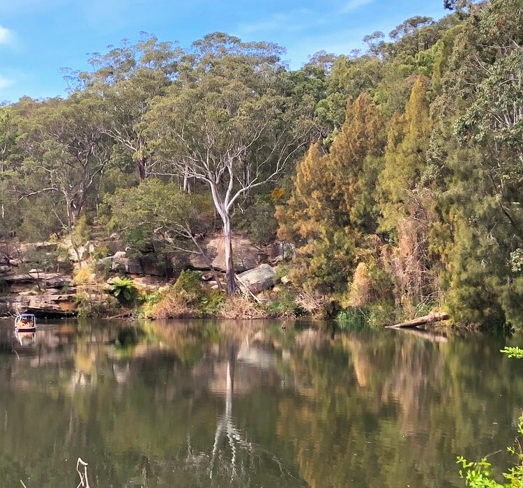
Lane Cove National Park is a large pocket of scenic bushland surrounding the banks of the Lane Cove River, which flows into Sydney Harbour.
A 10 km circuit walk along both sides of the river makes for an excellent way to explore the natural beauty of this national park.
This circuit walk combines the Riverside Walking Track and the Lane Cove Valley Walk, and is a moderately challenging bushwalking adventure.
More information: Lane Cove Riverside Circuit.
| Walk stats: | |
|---|---|
| Distance: | 10 km (circuit) |
| Duration: | 3 hours |
| Grade: | Moderate |
22. Sphinx Memorial to Bobbin Head Loop
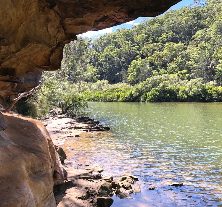
The 10 km Sphinx Memorial to Bobbin Head loop via the Warrimoo Track is a fantastic bushwalk in Ku-ring-gai Chase National Park.
One half of the loop (Warrimoo Track) follows the shoreline of Cowan Creek, while the other half (Bobbin Head trail) is mostly a fire trail through a forest of gum trees.
The best spot to start this hike is the Sphinx Memorial in North Turramurra, a unique sandstone monument built in the 1920s to commemorate those who died in service during WWI.
More information: Sphinx Memorial to Bobbin Head Loop.
| Walk stats: | |
|---|---|
| Distance: | 10 km (circuit) |
| Duration: | 3 hours |
| Grade: | Moderate |
23. Watsons Bay to Coogee Walk
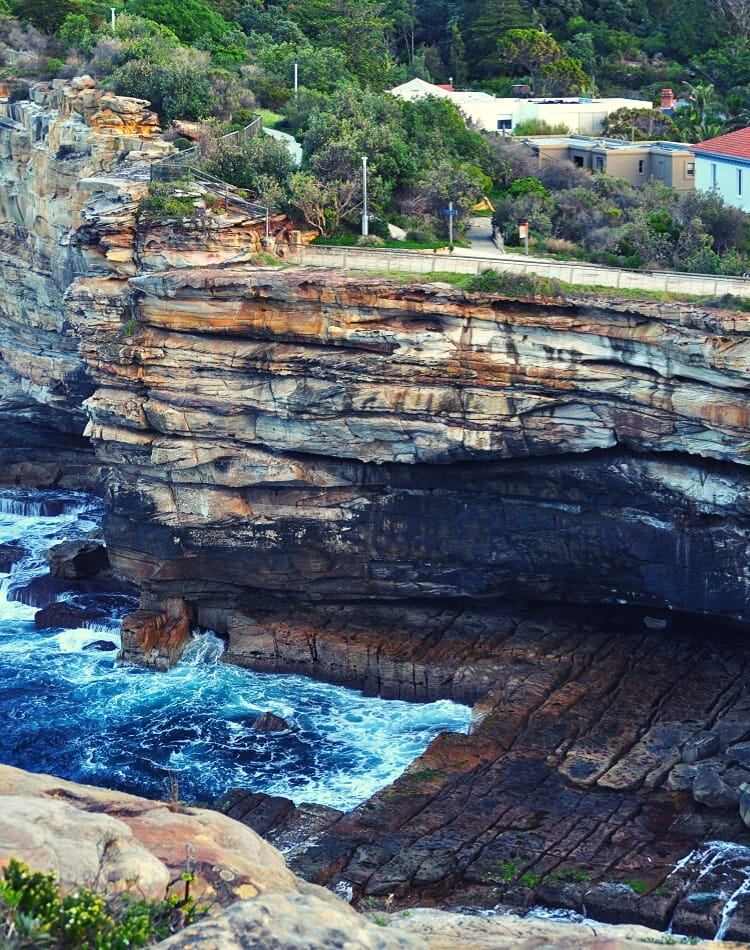
The 13 km coastal hike between Watsons Bay and Coogee Beach consists of two sections.
The first part is the walk between Watsons Bay and Bondi (also known as the Federation Cliff walking track), and the second part is the popular Bondi to Coogee walk.
These coastal walks are relatively easy, so combining the two makes for a fantastic coastal hike with excellent public transport options at both ends.
More information: Watsons Bay to Bondi and Bondi to Coogee.
| Walk stats: | |
|---|---|
| Distance: | 13 km (one way) |
| Duration: | 5 hours |
| Grade: | Moderate |
24. Cowan to Brooklyn via Jerusalem Bay
The challenging hike from Cowan to Brooklyn via Jerusalem Bay is a real bushwalking adventure, passing through beautiful bushland scenery.
One of the highlights along this walk is Jerusalem Bay, not too far away from the Cowan train station. It’s a pretty bay, part of Cowan Creek, that makes for a great swimming and picnic spot.
Both Cowan and Brooklyn have a train station on the same line, so you can start this walk at either end and catch the train back to where you started.
More information: Cowan to Jerusalem Bay.
| Walk stats: | |
|---|---|
| Distance: | 13 km (one way) |
| Duration: | 5 hours |
| Grade: | Hard |
25. Coast Track from Bundeena to Otford
The Coast Track between Bundeena and Otford in Royal National Park is a once-in-a-lifetime hiking experience. It is one of the most iconic coastal trails in New South Wales, but with 26 km, it does require preparation.
From scenic lookout points and waterfalls to natural swimming holes and isolated beaches, the Coast Track takes in all of the good things we would expect from an iconic coastal walk.
The Coast Track can be started from Bundeena in the north or Otford in the south of Royal National Park. Because of its distance, the best way to get there is by using public transport.
More information: Coast Track from Bundeena to Otford.
| Walk stats: | |
|---|---|
| Distance: | 26 km (one way) |
| Duration: | 1-2 days |
| Grade: | Hard |
Perhaps the most iconic hike in Sydney is the Bondi to Manly walk. This 80 km long walking track opened in 2019 and is an uninterrupted chain of several shorter coastal and bay hikes. It is possible to do it in one day, but most people choose to do this hike over multiple days.
So I like walking along the embankment. Sydney is a very beautiful city, I like to come there sometimes on weekends, I live nearby. I really like Narrabeen Lagoon Trail, it is very beautiful and calm there. Nice camping site, I enjoy spending time there with my family. Hope we can come there soon. I haven’t even heard of some of the hikes and places on this list, it’s interesting to visit them too. Thanks!
Thanks so much, glad you like this list. There are so many great hikes in Sydney, so it’s hard to pick the best ones, but hopefully the above 25 hikes are a good reflection of what Sydney has to offer.